
Saint-Sauveur-de-Pierrepont
| Saint-Sauveur-de-Pierrepont | ||
|---|---|---|
|
||
| region | Normandy | |
| Department | Some | |
| Arrondissement | Coutances | |
| Canton | Créances | |
| Community association | Communauté de communes Côte Ouest Center Manche | |
| Coordinates | 49 ° 20 ′ N , 1 ° 36 ′ W | |
| height | 7-42 m | |
| surface | 8.18 km 2 | |
| Residents | 128 (January 1, 2017) | |
| Population density | 16 inhabitants / km 2 | |
| Post Code | 50250 | |
| INSEE code | 50548 | |

Saint-Sauveur-de-Pierrepont is a French municipality with 128 inhabitants (at January 1, 2017) in the department of Manche in the region of Normandy . It belongs to the Arrondissement of Coutances and the canton of Créances .
Neighboring municipalities are Canville-la-Rocque in the northwest, Neuville-en-Beaumont in the north, Catteville in the northeast, Doville in the east, Saint-Nicolas-de-Pierrepont in the southeast, La Haye in the southwest and Port-Bail-sur-Mer with Denneville in the West.
Population development
| year | 1962 | 1968 | 1975 | 1982 | 1990 | 1999 | 2008 | 2015 |
|---|---|---|---|---|---|---|---|---|
| Residents | 210 | 186 | 121 | 143 | 134 | 133 | 132 | 138 |
Attractions
- Saint-Trinité church
- Church ruins, a monument historique since October 7, 1935

Saint-Trinité church

Destroyed church
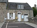
Mairie Saint-Sauveur-de-Pierrepont

.jpg)

Web links
Commons : Saint-Sauveur-de-Pierrepont - Collection of images, videos and audio files