Cerisy-la-Salle
| Cerisy-la-Salle | ||
|---|---|---|

|
|
|
| region | Normandy | |
| Department | Some | |
| Arrondissement | Coutances | |
| Canton | Quettreville-sur-Sienne | |
| Community association | Coutances Mer et Bocage | |
| Coordinates | 49 ° 2 ′ N , 1 ° 17 ′ W | |
| height | 58-169 m | |
| surface | 16.86 km 2 | |
| Residents | 1,043 (January 1, 2017) | |
| Population density | 62 inhabitants / km 2 | |
| Post Code | 50210 | |
| INSEE code | 50111 | |
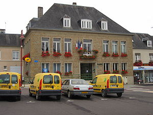
 Town hall (Mairie) of Cerisy-la-Salle |
||
Cerisy-la-Salle is a French commune with 1,043 inhabitants (as of January 1 2017) in the department of Manche in the region of Normandy . It belongs to the canton of Quettreville-sur-Sienne (until 2015: canton of Cerisy-la-Salle ) in the Arrondissement of Coutances . The inhabitants are called Cerisyais .
geography
Cerisy-la-Salle is 17 kilometers south-east of Saint-Lô in the Norman Bocage , a landscape criss-crossed with a large number of hedges that delimit agricultural fields. This is where the Terrette rises and the Soulles borders the community in the south. Neighboring municipalities are Cametours in the north, Carantilly in the north and northeast, Dangy in the east, Notre-Dame-de-Cenilly in the south and Montpinchon in the west.
Population development
| 1962 | 1968 | 1975 | 1982 | 1990 | 1999 | 2006 | 2013 |
|---|---|---|---|---|---|---|---|
| 1,074 | 1,031 | 966 | 912 | 1.004 | 937 | 1,033 | 1,037 |
| Source: Cassini and INSEE | |||||||
Culture and sights
- Menhir La Roche Bottin
- Saint-Pierre-et-Saint-Paul church from the 13th / 14th centuries century
- Cerisy Castle, built from 1605 to 1620, Monument historique , today Center culturel international, with the regular scientific meetings "Colloque de Cerisy"
Personalities
- Pierre-Marie Osouf (1829–1906), Archbishop of Tokyo
- Anne Heurgon-Desjardins (1899–1977), daughter of Paul Desjardins , founder of the Center culturel international , which will be continued
Web links
Commons : Cerisy-la-Salle - collection of images, videos and audio files


