List of squares and avenues in the old town of Regensburg
The list includes squares, special places, avenues and parks in Regensburg that are located in the area of the UNESCO World Heritage Site of Regensburg or that are close to this area.
Preliminary remarks
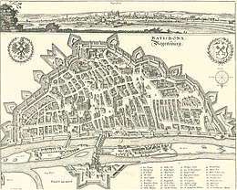
The area of the current old town of Regensburg, which belongs to the UNESCO World Heritage, extends in some places beyond the area of the former old town, which was surrounded by the medieval city wall on the southern bank of the Danube until 1860. The UNESCO World Heritage area also includes the small Bavarian town of Stadtamhof on the northern bank of the Danube, which did not belong to Regensburg until 1924, and thus also includes the area of the Danube flowing in the urban area with the two Danube islands Oberer Wöhrd and Unterer Wöhrd . The places in Stadtamhof were included.
From 1800, the former old town on the south bank of the Danube was surrounded by a mostly two-row tree- lined avenue, which was based on the then still existing city wall and ended in the west and east at the locations of the former west and east bastions, where parks were created. The largely preserved tree-lined avenue is now affected by traffic in three places (Platz der Einheit, Ernst-Reuter-Platz, Stobäus-Platz). Two of the three squares (Platz der Einheit, Stobäus-Platz) are just outside the UNESCO World Heritage area, but are still included.
Some of the squares and avenues included in the list are not marked with the names given here, or their names are not official and only in common use by the inhabitants.
Creation of the squares within the old town enclosed by the city wall
In the densely built-up old town of Regensburg with its mostly narrow streets and alleys, the squares that have emerged over the centuries are important structural elements that not only structure and shape the current appearance of the old town, but also the high quality of stay that has been increasingly and now largely traffic-calmed since 1990 Make out the old town. The first places were created in Roman times and took into account the network of paths and the location and dimensions of the buildings at that time within the walled Roman legionary camp of Castra Regina . The development of the places outside the Roman camp followed the course of the supply roads connected to the Roman camp via the four gates and used the undeveloped areas there. The areas in front of the western gate of the Roman camp, which were populated at an early stage, were included in the city area during the first city expansion in the early Middle Ages (9th century) through the construction of the Arnulfini city wall. After the demolition of the western Roman wall and the rebuilding of the Arnulfini city wall , which was built 500 m further to the west , the two forerunners of the still most important squares in the western old town, Haidplatz and the great Jakobshof (named after the Schottenkloster built in the 11th century) were built there St. Jakob), from which Arnulfsplatz and Bismarckplatz (Regensburg) developed.
These squares, which were created early, were not included in the urban area until the second city expansion in the late Middle Ages at the end of the 13th century. With the construction of the medieval city wall , the old town squares east of the old town were also included in the walled city area.
Creation of squares outside the old town enclosed by the city wall

The "Ernst Reuter-Platz" has a special position in terms of its location, its dimensions and its name. This square got its name after the Berlin mayor at the time after the Second World War at the time of the Berlin blockade . The dimensions of the square were initially limited to a small street and pedestrian area south of the large new buildings that were built there at the end of Maximilianstrasse after 1945. The memorial stone for Berlin created by Richard Triebe was also placed there in 1966 . Today the name "Ernst-Reuter-Platz" has expanded to include the area adjoining it to the south, right up to the train station, so that the name "Bahnhofsplatz" is largely dispensed with. The entire area of this large Ernst-Reuter-Platz was already closely connected in the Middle Ages with the nearby Peterstor as the important southern entrance to the city, but was not called "Petersplatz" because it was outside the city in front of the city wall , probably also because of name conflicts with another, small St. Peter's Square in the cathedral area and with the Regensburg Cathedral dedicated to St. Peter itself. However, buildings and facilities that arose on this site in front of the Peterstor were given the name "Peter". B. the Peterskirchlein , the monastery of St. Peter (Regensburg) or the Protestant "Petersfriedhof" established there in 1543, which existed until 1930 and was supplemented in 1804 by a Catholic "Petersfriedhof" to the south. After clearing the extensive and obstructive outer works that were in front of the city walls in the south and west that existed until 1860, Fürst-Anselm-Allee was laid out from 1796 . The avenue encompassed the entire southern old town and thus also the two cemeteries on today's Ernst Reuter-Platz. While the Catholic St. Peter's Cemetery had to give way to the construction of the new train station in 1892 , the Protestant St. Peter's Cemetery was initially retained, but was no longer used until it was finally closed after 1930. The entire area of today's "Ernst-Reuter-Platz" south of Maximilianstrasse, which was newly created in 1810, and its southern Maxtor up to the train station became an integral part of the park-like Fürst Anselm-Allee, which was created after 1800 and expanded by the newly created palace park , in 1809 with the Kepler Monument and other monuments and buildings such as the Theresens Ruh garden palace . However, despite these parks, the station had to be connected to the old town. This was done by extending Maximilianstrasse or, starting from Dachauplatz , by extending "Klarenangerstrasse", which became "D. Martin-Luther-Strasse".
List of places A, B
| Surname | Location | Explanations | description | Surroundings | image |
|---|---|---|---|---|---|
| Aegidienplatz | In the southwestern old town, south of the buildings of the former Dominican monastery . The square is used as an undesired east-west crossing of the old town | Named after the monastery church St. Aegid , today used as a retirement home | Former location of the Rehbach pencil factory on the adjacent site of today's parking lot of the government of the Upper Palatinate . | Marschallstrasse with buildings of the former Teutonic Order , used by the government of the Upper Palatinate. Beraiterweg, Adlergasse | |
| Albertus Magnus Square | In front of the west portal of the Dominican Church of St. Blasius Monastery, at the western end of Predigergasse, which, coming from the street "Am Ölberg", leads into Bismarckplatz . | The square is named after Albertus Magnus , who worked as a lecturer in the Dominican monastery for a short time after 1237. | The small, only 50 x 50 m square square is directly connected to the neighboring Bismarckplatz to the west. | Predigergasse runs parallel to the north. The Beraiterweg leads south to Aegidienplatz, only 100 m away . | |
| Albrecht Altdorfer Platz | The small square is an integral part of the south-eastern Domplatz and was placed without visible boundaries to the west of the Herzoghof and marked with a fountain created by Fritz Koenig . | The square is named after the Regensburg painter Albrecht Altdorfer . | A passage through the Herzogshof to the east leads directly to the old grain market | A narrow passage through the building leads south into Salzburger-Gasse, which connects Altdorferplatz with the south-facing "Am Frauenbergl" square | |
| Old grain market | 1 km north of the train station in the extension of Maximilianstrasse and Speichergasse in the central old town. |
Named after it was used as a grain market until 1825. Today it is used as a car park and as a weekly market. |
Edge development with monuments, such as Herzogshof collegiate church to the old chapel , Roman tower , Carmelite monastery collegiate church Niedermünster . |
Domplatz Speichergasse Pfluggasse Kapellengasse Niedermünstergasse |
|
| At the exhaustion | A freely accessible stone dam in the middle of the southern arm of the Danube, which crosses under the stone bridge . Good view of the old town from the dam, but the dam towards the Dnau is not secured by bars. | The 20 m wide and 600 m long stone dam connects the two Danube islands Oberer Wöhrd and Unterer Wöhrd within walking distance | The dam was built around 1380 and secured with rammed wooden pillars. The dam served as the location for many water-powered mills until the end of the 18th century. | The dam is not directly connected to roads. It can be reached on foot from the west via Müllerstrasse. The dam can be reached from the east via the Iron Bridge and Proskestrasse. | |
| At the royal court | A hidden, angled street at the southern end of the old town, which widens like a square to the south, where the Roman wall and the medieval city wall had their south-east curves. Remains of the rounded walls, excavated after 1945, are visible there. | The name Königshof goes back to a royal farm yard located there in the early Middle Ages and / or to the Bavarian King Ludwig II , as the initiator of the construction of the neighboring Maximilianstraße to the west , after which the Königsstraße was named. | The southern square-like extension with information boards is the starting point for a city tour, which follows the course of the former Roman wall. The next section of the Roman wall is located 300 m north in the basement of the attic | The angled street connects to Maximilianstrasse in the west and continues on Grasgasse. The southern square-like extension is bordered to the south and east by D.-Martin-Luther-Strasse. | |
| At the Frauenbergl | A place on slightly elevated ground south of the building of the former Dompost, whose building separates the place from the Domplatz . separate | The name of the square is derived from a still preserved image of the Virgin that stood in the former St. Kilian's Chapel. | The lane, which has been expanded into a square, connects Neupfarrplatz with Domplatz and the Alter Kornmarkt in a short walking distance | Pfauen-Gasse and Salzburger-Gasse connect the square to the surrounding streets and squares. | |
| At the Peter Gate | Square-like extension of Petersweg coming from the east after the bridge over the former moat. There the Petersweg branches off, which leads to the parking garage and ends at Emmeramsplatz. | The square takes its name from the important southern Peter Gate, which is heavily fortified with three towers, and hardly any remains of the buildings have survived. This was also the location of the south gate of the Roman legion camp Castra Regina . | The Peterstor was badly damaged during the battle of Regensburg . The ruins of the gate towers were not finally removed until 1875. Remains of the Roman wall and the city wall can be found in neighboring houses. | From the Peterstor the Fröhliche Türkenstraße leads into the old town on a direct way north to the Domplatz 500 m away . | |
| At the beginning | Located on the southern bank of the Danube, separated from the stone bridge by the Amberger Salzstadel to the east and bounded to the west by a building erected in the 16th century, which was created after a medieval harbor basin was filled in. | The name of the square comes from the Middle High German "Wit" for log and "found" for "harvest, find" and indicates the use of the square as a wood storage area. In the Middle Ages, there was a harbor basin protected from the current, which was connected by a canal to the square at the historic Wurstkuchel . | The name Am Wiedfang also applies to the narrow lane that runs parallel to the banks of the Danube behind the former city wall and leads eastwards, ending at the former fish market in Goldenen-Bären-Straße. | To the south of the square runs the Goldene-Bären-Strasse, which runs as an extension of Keplerstrasse to the east and crosses the old town as Thundorferstrasse and an important bus route. | |
| Arnulfsplatz | Located in the west of the old town, at the end of the east-west thoroughfare that crosses the old town, which begins at the Ostentor and ends as Ludwigstraße at Arnulfsplatz with the now-preserved clock tower Neue Uhr . | The name of the square goes back to the Bavarian Duke Arnulf I , the builder of the Arnulfinische city wall. In front of the wall a large square was formed, from which the Arnulfsplatz emerged, which was initially called "Unterer Jakobsplatz". That corresponded to the "Upper Jakobsplatz" as the forerunner of the later Bismarckplatz. | The square is the end of an urban east-west street, has always been heavily loaded with traffic and is still used by many local bus routes today. The southern peripheral development is characterized by the theater building | Ludwigstrasse, Weißgerbergraben, for a nice opportunity, Rote Löwen Strasse, Kreuzgasse, Schottenstrasse |
|
| Augustinerplatz | The square at the southern end of the angled Augustinergasse is called Augustinerplatz, which branches off from Oberen Bachgasse to the east and then runs south. The square connects there to the Rote Sternen-Gasse. | The square and the alley are named after the former Augustinian monastery located to the north , whose church and monastery building used to occupy the entire space between Neupfarrplatz , Oberer Bachgasse and Pfarrergasse. The monastery was dissolved in 1810 and the church and building were largely demolished. | Today the square is so remote in the middle of the densely built-up old town that it has no design significance and is only important for the residents and their parking spaces. | Surrounding streets: Pfarrergasse and Rote Sternen-Gasse. The former monastery grounds were sold in 1830, the church and most of the monastery buildings demolished and replaced with new buildings. | Former Augustinian monastery, today Augustiner restaurant, multi-wing, three-storey hipped roof building, around 1700. |
| Bismarckplatz | Located in the west of the old town and at the end of the Gesänderstrasse , which begins at Neupfarrplatz and which has always flowed into Bismarckplatz without a gate. | Original name of the square: "Oberer Jakobsplatz" after the neighboring St. Jakob monastery . After the division of the large Jakobsplatz in 1804 by the theater building, the square south of the theater was called "Theaterplatz". In 1885 the square was named after Chancellor Otto von Bismarck . | The almost traffic-free, but connected by underground car park and bus routes, is a popular meeting place for the young population with its infrastructure and palace-like perimeter buildings ( Regensburg Theater , Presidential Palace ), two fountains and lots of seats. | Gesänderstrasse, Schottenstrasse, Jakobsstrasse, Beraiterweg | |
| Brunnleite | The Lederergasse running in the west of the old town, only separated from the Danube by the parallel Hölzländestrasse, widens like a square at the eastern end to the so-called Brunnleite | The name was already used in 1007 and describes a water source or a flood of water in the Danube and the terrain sloping towards the Danube | Edge development of the square from 1600 used by the city variably as a poor house and work house, old people's home, orphanage, prison. After 1810 location of the Bavarian military hospital. | Lederergasse, Weintinger-Gasse, Fidelgasse, Portnergasse | |
| Place name | Text location | Text explanation | Text description | Text roads | image |
| Place name | Text location | Text explanation | Text description | Text street | image |
List of places D, E
| Surname | Location | Explanations | description | Surroundings | image |
|---|---|---|---|---|---|
|
Dachauplatz Oldest name: "Klarenanger", after the St. Clara Poor Clare Monastery built at the beginning of the 13th century . Modern names after the Minorite monastery was used as a barracks: "Kasernenplatz", "Parade ground", "Moltkeplatz" |
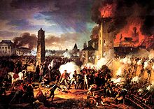
The square is located in the south-east of the old town and is part of the busy south-north road that begins in the south on the A3 motorway as "Galgenbergstraße", connects the clinic , the university and the train station to the old town and to the iron bridge over the Danube ends at the Museum of Bavarian History . | The square has had his name since 1945 when three people were executed here by National Socialists at the end of the war. A memorial reminds of this. | Meeting point for many bus routes. Market hall and multi-storey car park at the site of the former Clarisse monastery, which was completely destroyed in the battle of Regensburg in 1809 . In the basement there is an exhibition on the wall of the Roman legionary camp. | D. Martin-Luther-Straße, Minorite Monastery . The square was in 1873 at the confluence of Drei Kronen-Gasse where the stone founding document of the Roman legion camp Castra Regina was found , shown in the city museum on the east side of the square. |
|
|
Domplatz A distinction is made between the approximately 200 m long southern Domplatz, which includes the small Albrecht Altdorfer Platz in the east, and the small western Domplatz with a view of the cathedral towers. |
The Domplatz is located in the center of the Altstand, approx. 600 m north of the train station and can be reached from there via Maximilianstraße , but also via other streets running parallel to the west. The Domplatz was a center of local traffic until 1990 and was used as a parking lot. Today the square is traffic-calmed and is only approached by the electric city bus. | The southern cathedral square was significantly widened at the end of the 19th century. The historic southern development was lost and the equestrian statue for King Ludwig I was erected. The historical western development ( Heuporthaus , former residence for Prince Primate Karl Theodor von Dalberg ) was largely preserved. From there to the south, Residenzstrasse leads to the neighboring Neupfarrplatz . | The southern cathedral square connects to the east at the church of Ortisei with an archway between the Römerturm and the Herzogshof to the old grain market . Going north from the western Domplatz, you can reach the Danube, which is only 300 m away, via the adjacent "Krauterermarkt" and the "Weisse Hahnen-Gasse" | Stone bridge . There is also the Salzstadel with the World Heritage visitor center and the square with the historic Wurstkuchl , from which the Danube area can be easily walked to the east or west. | |
|
Danube area up to the 19th century. Term for the landing stages of ships and barges that could be safely loaded and unloaded there. (Wine, wood, salt fields). After the Danube ports were built, the lands retained their names, but were used differently. Today the "Lände" are attractive places and paths on the south bank of the Danube that are connected by foot. |
The lands run for about 3 km in the area of the old town on the south bank of the Danube. The lands begin in the west at the Herzogspark and go east of the Nibelungen Bridge , outside the world heritage area, into the area of the port area . | To the east of the Stone Bridge , which can be crossed on foot, to the Iron Bridge , the Danube area is used as a landing stage for excursion boats and museum ships . Cruise ships moor only east of the Iron Bridge. The area above the Danube area, which is heavily used for tourism and which is raised to street level by a bank wall and expanded like a square, is called here "Marc-Aurel-Ufer". |
The Danube area east of the Iron Bridge was structurally changed significantly in 2015 when the museum was built . Until the end of the Second World War, the Danube area was used as a port area with tracks for the port railway. It was now needed to supply the cruise ships. Remains of the railway tracks can still be found in front of the Nibelungen Bridge at the height of King handy villa where an old crane system is preserved. |
The Danube area has always been part of the city fortifications with gates and defense towers, of which the so-called anatomy tower is still preserved. In the narrower area of the densely built-up old town, there were special names for individual sections of the Danube area that are still in use today, such as B. "Holzlände" and "Weinlände". The Danube area can be reached in many places from adjacent streets, is continuously accessible and - in some places a bit tedious and dangerous - can also be traveled by bike. | |
|
Danube Market New Danube Market since 2019 : A small square north of the Museum of Bavarian History on a level that is elevated due to the risk of flooding, well above the Danube area. |
By 2019 |
Old Danube Market Dimensions: approx. 250 m. from the Iron Bridge in the east to the Österreicher Stadel at Schattenhofergasse in the west. The square was used as a large car park and as a location for department stores, a sausage factory and the weekly market. For the background to the development see: Development of the old Danube market and its history |
New Danube Market It is not planned, as it was originally planned, to operate a weekly market again on the new Danube Market because no parking spaces can be set up there. |
The new Danube market connects to "St. Georgenplatz" in the west. There, at the eastern end of the street "Unter den Schwibbögen", the north-east curve of the Roman wall of Castra Regina is visible. The former "Hunnenplatz", east of "Georgenplatz" at the west end of "Ostengasse", was built over after two houses were demolished when the museum was built. | |
|
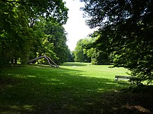
Dörnbergpark Created 1804–1806 on behalf of a Jewish banker as a small 2 hectare park near a suburban villa 500 m south of the city wall, which ran along Bismarckplatz . |
The park and villa were acquired by Ernst Friedrich von Dörnberg in 1832 . The villa was converted into today's Dörnbergpalais , the park expanded to 7 hectares and designed as an English landscape park in 1864 with 1400 trees . | Some of the existing park structures date from the time of the park: Swiss House / Rosarium, Society House, Gardener's House and Greenhouse. | The park has been open to the public since 1938, is managed by a foundation and maintained by the City Garden Authority. In 1947 the palace, buildings and park were placed under monument protection. | Today the park has dimensions of 380 m × 280 m and is enclosed by the streets Kumpfmühlerstraße, Augustenstraße, Wittelsbacherstraße, Hoppe / Dech Bettenerstraße |
|
|
Dultplatz Until 1875, the Regensburg Dult took place on squares in the old town of Regensburg (Neupfarrplatz, Residenzstrasse). At the suggestion of Mayor Stobäus , the Dult in Regensburg was discontinued in 1875. |
The neighboring Bavarian town of Stadtamhof took the opportunity and after 1875 made its main street and the area of the flood basin "Protzenweiher" available as a Dultplatz, where the Rhine Main Danube Canal runs today . | After construction of the canal began, the Dultplatz had to be relocated. Today's Dultplatz is located in the far northeast away from the old town and just outside the World Heritage area. | The new location is well suited as a Dultplatz, because it is located far away from buildings on a site between the northern arm of the Danube and the canal, adjacent to parking lots. | Dultplatz is almost 2 km away on foot from the train station. To reach Dultplatz, you have to cross the entire old town from the south and cross both the main arm of the Danube and its north arm on Pfaffensteiner Steg. From the north, starting from Frankenstrasse, the canal must be crossed on the Oberpfalzbrücke. |
|
|
Emmeramsplatz Named after the Holy Emmeram of Regensburg . His grave is located in the neighboring St. Emmeram monastery church to the south , which, like St. Emmeram Castle , is accessible from here. |
The square is located in the south-western area of the old town and is the western end of St.Petersweg, which follows the course of the former city wall up to here, which turned sharply south here. Emmeramsplatz is surrounded by narrow buildings on all sides and would be a dead end for cars if the narrow Marschallstrasse did not offer a passage west to the Aegidienplatz . | The place, which could be supplied with water from the Vitusbach , was used as a cattle trough in the Middle Ages and for a fire water pond during World War II. A planted roundabout with trees and the monument to Bishop Johann Michael Sailer , which was erected in 1868 by King Ludwig I , had to give way . The memorial was put up again in 2014, but without a flower ring in the middle of parked cars |
In order to take the character of a dead end from the square, there were early plans to create breakthroughs for streets by demolishing houses to the west of the square, with which the Kumpfmühlerstrasse running in the west was to be connected to the Domplatz in the center of the old town. The plans were not finally abandoned until 1970. | The western and northern development of the square is used by the government of the Upper Palatinate. From the east over St. Petersweg, Emmeramsplatz is part of a car crossing the old town, which also puts a strain on Marschallstraße and Aegidienplatz. From the west, Emmeramsplatz can only be reached via the narrow one-way street "Eck zum Vaulschink". From the north, the "Grünes Gässchen" pedestrian alley ends at Emmeramsplatz. |
|
|
Ernst Reuter Platz. Named after the mayor of Berlin, Ernst Reuter . Officially, "Ernst Reuter Platz" is limited to the small northern area of the large overall site, which extends on both sides of Maximilianstrasse to Bahnhofstrasse as a bypass of the old town. The northern small Ernst-Reuter-Platz consists of a narrow pedestrian area with a fountain and a wider street area where the Berlin monument created by Richard Triebe is barely recognizable on a traffic island . |
The population calls the large total area of about 300 m from north to south and 200 m from east to west Ernst-Reuter-Platz. The large "Ernst-Reuter-Platz" ends in the west at the fence of the Turn-und-Taxis-Fürstenpark, which unfortunately is not freely accessible. From west to east the large "Ernst-Reuter" square is crossed by Albertstrasse, the eastern section of which is used as the center of bus traffic. In the east, the large Ernst-Reuter-Platz ends at D. Martin-Luther- and Galgenberg-Straße. | Surrounded by the train station and many busy streets, the large Ernst-Reuter-Platz, which is part of the listed Fürst-Anselm-Allee , has the character of a large traffic hub. At the same time, the square was also a location for local supply shops and offices in a high-rise designed by the architect Werner Wirsing , which also housed a student residence. These buildings were demolished in 2020 because a new type of transport hub for buses and the planned light rail system is to be built here. |
Even if the northern square was attractive after 1945 because of its favorable location for the construction of the then modern, innovative high-rise buildings , which today impaired the ensemble of Fürst-Anselm-Allee, the square with its historical past remains as a cemetery and as a location for the Peter church with its monuments and tree component of the listed Fürst-Anselm-Allee, but exposed to traffic because of its exposed location requirements. |
In 2018, the previously undiscovered former Jewish cemetery was searched for in the southwest area of the square, but could not be found. Neighboring streets: Bahnhofsstr., Luitpoldstr., Hemauerstr., D. Martin-Luther-Str., Petersweg, Albertstr. | |
| Place name | Text location | Text explanation | Text description | Text environment | image |
| Place name | Text location | Text explanation | Text description | Text environment | image |
List of places F, G
| Surname | Location | Explanations | description | Surroundings | image |
|---|---|---|---|---|---|
|
Fish market A fish market in Regensburg has been attested since 1256 |
The fish market is located at the western end of the Golden Bear Street, which widens like a square to the south. As an extension of Thundorferstrasse, Goldene Bärenstrasse, only separated from the Danube by the bank development, is part of the west-east road that crosses the old town. | The meat store was built in 1525 on the north side of the street, diagonally across from the fish market on the Danube. In 1529 the square was paved for use as a meat and fish market and equipped with scoop fountains and stone sales benches on the fish market area . The meat store was demolished in 1888 and replaced by a new building, which at that time housed a bathing establishment (Ottobad) |
The sale at the fish market took place until the market was closed in 1980 using the structural relics. The fountain and stone bench are still there today at the site of the former fish market | The fish market can be reached from the old town from the town hall, which is only 100 m south of the city, via the Kohlenmarkt, Zieroldsplatz and Fischgässel. | |
|
Franziskanerplatz The square takes its name from the former Franciscan monastery , the remaining buildings of which were demolished in 1891. |
The Franziskanerplatz is located in the western part of the Regensburg district Stadtamhof and is part of a 3 km long street with the three streets "Am Gries", "Andreasstraße" and "Pfaffensteinerweg". The street begins in the east at Regen , crosses the place parallel to the northern arm of the Danube and ends in the west at Dultplatz. | When crossing the town from east to west, you first cross the Katharinenspital area and then the Franziskanerplatz. The level of the square is so low that it used to be often flooded during floods. Today the square can be protected by a mobile flood wall. |
The monastery that gave the place its name was hastily dissolved in 1802 in the course of secularization . The buildings were used as a prison, badly damaged in the course of the Battle of Regensburg in 1809 and demolished in 1891. The State Land Surveying Office is now located in the new building that was built in 1893. |
If you head north across Herzog Heinrich-Str. leaves, one reaches the former flood basin of the Danube with the European Canal on the street "Am Protzenweiher" . | |
|
Fürst-Anselm-Allee The construction of the avenue was initiated by its namesake Prince Karl Anselm von Thurn und Taxis , who also financed the construction of the avenue between 1779 and 1781. |
The avenue begins in the west on the banks of the Danube at Herzogspark , the location of the former western bastion. The avenue follows the course of the then still preserved city wall and ends in the east at the villa park belonging to the royal villa , the location of the former east bastion. | The avenue was laid out in front of the city wall, which was still in existence at the time, on the site of the previously dilapidated outworks , the remains of which had to be removed. | The course of the avenue, whose tree population was supplemented by Prince Karl Theodor von Dalberg in the following years , reflects the course of the former city wall and today corresponds to the course of the border of the world cultural heritage in the old town south of the Danube. | The castle park of Schloss St. Emmeram can be seen as part of the avenue, but it is not accessible. The Ernst Reuter-Platz area is also part of the avenue, but has always been and will be used differently in a variety of ways. | |
|
Gutenbergplatz Named after Johannes Gutenberg |
A small, tree-lined square to the south adjoins the traffic-calmed Gesandersstrasse, which is narrowly built on both sides and connects Neupfarrplatz with Bismarckplatz. | Via the confluence with Deischgasse, Gutenbergplatz ensures that € mmeranplatz and the traffic-free streets in the southern old town are within walking distance to Gesandersstraße and thus also to the northern old town. | To the east, the square adjoins the buildings of the former snuff factory of the Bernard brothers . Today there are restaurants there that use Gutenbergplatz for popular outdoor seating. | The use of the space as a parking lot is limited to residents, in favor of a large bicycle parking lot. The Trinity Church is only 100 m to the west . |
List of places H, J
| Surname | Location | Explanations | description | Surroundings | image |
|---|---|---|---|---|---|
|
Haidplatz The name of the square goes back to the Old High German name Heida for a wildly overgrown piece of land. |
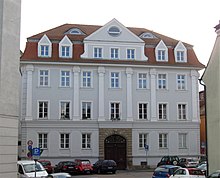
The square is part of the east-west street that crosses the old town from the Ostentor to the Arnulfsplatz with the Ruozanburgtor , the so-called "New Clock", which is no longer there . |
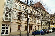
Since the Middle Ages, the square has been important as a place for tournaments, meetings and events. Until 1990 the place was misused as a parking lot. | The perimeter development of the square includes the Gothic house castles Goldenes Kreuz , Neue Waag and the Arch , as well as the classical Thon-Dittmer-Palais and on the south side buildings of the Bruderhausstiftung , | Rathausplatz is only 50 m to the east. The Danube can be reached north via Weingasse. The Neupfarrplatz can be reached via the "Rote Hahnengasse". The "Krebsgasse" leads south to the Dreieinigkeitskirche . |

Haidplatz View from the west of the Neue Waag castle (2014).
|
|
Herrenplatz The name of the square goes back to the "councilors" as the city government and refers to the city's own property. |
Herrenplatz in the far west of the old town is at the end of "Holzländestrasse", which turns into the cul-de-sac "Hundsumkehr", which ends 100 m further at the walls of the Prebrunnturm, which is only accessible from the Herzogspark . | The Herrenplatz, only separated from the Danube by the Holzlände, is the largest undeveloped space in the western suburb and in the Baroque period offered space for equestrian games such as quadrille riding and ring piercing, which were popular at the time . Even today the place is a recreation and playground overgrown with trees. | There were city-owned facilities on the square, e. B. Warehouses for wood and malt and mills powered by horse power. When Bavarian troops occupied Regensburg during the War of the Spanish Succession , Herrenplatz and Nonnenplatz were needed as camps for 2,000 soldiers. |
In addition to the Holzlände, three alleys end at Herrenplatz, which cross the old craftsmen's quarter: Lederergasse, Gerbergasse and Wollnahmergasse. Access to the neighboring Herzogspark can be found at the Württembergisches Palais Am Singrün, or at the end of the Holzlände at Westendstrasse. | |
|
Herzogspark The name of the park goes back to Duchess Marie Sophie von Württemberg, who used the Württemberg Palace , which belongs to the park, as a residence after 1843 |
The park is located in the far west of the old town directly on the Danube, forms the north-western tip of the world heritage area and is the western end of Fürst-Anselm-Allee , which encompasses the entire old town to the south |
The park was created on the site of the Prebrunn Bastion after the Princely Thurn & Taxis Council Friedrich von Müller acquired the bastion site from the then sovereign Karl Theodor von Dalberg in 1804 . | The Prebrunnbastei was destroyed in the course of the fighting for Regensburg in the Thirty Years War. In 1656 the bastion was rebuilt with a new defensive tower and significantly enlarged in the form that still characterizes the Herzogspark today. | Friedrich von Müller had the Württemberg Palace built on the neighboring property to the south. From the Herzogspark to the south, the streets "Dalbergstrasse extended by Dr. Johann Maier-Str. And the Stahlzwingerweg lead to the city park just 400 m away to the west of the" Platz der Einheit " | |
| Woodland Former 500 m long municipal storage area for wood delivered on the Danube. |
The street space on the southern bank of the Danube used as a wood storage area was between Herrenplatz and Weißgerbergraben. | The camp site was guarded because of many wood thieves. Access through the city wall was through the "wooden gate" at the Weißgerbergraben. | The demand for wood was high because until Mayor Oskar von Stobäus took office in 1865, wood was also used to generate gas . |
Today the Holzlände is a residential street. It opens up the south-facing, closely built-up residential area via lanes branching off to the south up to the Herzogspark. | |
|
Hunnenplatz The name is probably not based on the execution of commanders of the Huns after the battle on the Lechfeld , but rather on the old designation "Hennen" or "Hühnerplatz". |
The space that is no longer available today was at the western end of Ostengasse, which expanded like a square towards the Danube. The Kalmünzergasse, coming from the south, ended in the square. | After severe damage to the old buildings on Hunnenplatz and Kalmünzergasse in World War II, the Kolping House was built there in 1954 as a brutal cross bar. Several of the damaged houses had to give way in order to enable the required by-pass of the new building on both sides. |
Except for one house, the remaining building was demolished in 1964 for the construction of the newly planned Bayerwaldbrücke as a new Danube bridge. The "Danube Market" was created as a result of the demolition measures . The last house on Hunnenplatz was demolished for the construction of the south entrance to the new museum. |
In the area around Hunnenplatz there were other squares (St. Georgen-Platz, Schwanen-Platz) that were structurally upgraded after 2019. |
|
|
Jakobsplatz (Jakobshof) Historical name for the former large square, between the western Arnulfini city wall and the Schottenkloster St. Jakob, built around 1100 (see also St. Jakob ). |
The monastery was 100 m west of the city in front of the Arnulfini city wall, which ran north from there to the Danube 500 m away. Originally, the space between the monastery and the Arnulfin city wall was called "weir in front of the castle". |
When the monastery was incorporated into the urban space around 1300 after the construction of the medieval city wall and the demolition of the Arnulfini city wall, there was still a space between the monastery and the urban development, for which the name "Großer Jakobsplatz" became established. From this square arose after 1803, separated by the new building of the theater , the Arnulfsplatz and the Bismarckplatz | In 1803, after the division of Jakobsplatz, it made sense to transfer the name to the square directly north in front of the St. Jakob monastery. A wide space was created there in 1813 after the Jakobstorturm complex , which was severely hindering traffic, was demolished , but was then not designated as a square. Today Jakobsstraße runs there. | The neighboring square in front of the former Jakobstor, which was part of Fürst-Anselm-Allee, was also not renamed. He kept the name "Wittelsbacherplatz". During the Nazi era, this square was named after the late Gauleiter Hans Schemm . After 1945 current names were chosen, first "Platz der Republik" then "Platz der Einheit". | |
|
Jesuitenplatz The name of the square goes back to the Jesuit monastery St. Paul, which was founded in 1588 in the abandoned Benedictine monastery in Mittelmünster . |
Jesuitenplatz is located between Fröhliche-Türken-Strasse in the east, Obermünsterstrasse in the north and the parking garage on St.-Peters-Weg in the south. | The square was created in April 1809 when the buildings of the Jesuit monastery were destroyed during the battle of Regensburg . |
After the new car park was built in 2014, Jesuitenplatz, which was used as a location for discos for years, is also in a phase of redesign and re-use. | Just 100 meters west from the Obermünster road is located Reich Obermünster with the upper Cathedral Square. |
List of places K, L
| Surname | Location | Explanations | description | Surroundings | image |
|---|---|---|---|---|---|
|
Kassiansplatz (also Cassians-Hof). The name of the square can be traced back to a St. Kassian's Church (Caßianskirche), which was mentioned as early as 885. In the 16th century, the square was also called Häfermarkt because clay vessels (harbors) were sold there. |
Kassiansplatz has always been closely connected to the larger Neupfarrplatz, only 50 m to the north- west . The path across Kassiansplatz continues southwest over "Vier-Eimer-Gasse" to "Vier-Eimer-Platz". |
At the beginning of the 1970s, numerous old town houses at the southeast end of Neupfarrplatz at the transition to Kassiansplatz and also the old town houses on the edge of Kassiansplatz (e.g. Augsburger Hof) were demolished to create a "modern" environment for a planned large department store . | The central building of the square is the collegiate parish church of St. Kassian . It is the second oldest church in Regensburg and only 20 m south of the new department store building from the 1970s. | Malergasse leads south from Kassiansplatz to Obermünsterplatz . Via the "Schwarze-Bären-Straße" and the Kapellen-Gasse to the northeast, you reach the old grain market after 200 m . | |
|
Coal market The name of the square goes back to the charcoal trade that has been documented since 1740. The older name was simply "market" according to the market tower that was built there in 1374 and was a trademark of the city. It burned down in 1706 and was canceled. |
The coal market in the center of the old town at the western end of Goliathstrasse, near the Goliathhaus , goes west into Rathausplatz and south into Zieroldsplatz, which ends at the Fischmarkt, where Keplerstrasse begins. | In Roman times the carbon market was the site of the North-East rounding the wall of the Roman legion camp Castra Regina , then the course of the branching off from the carbon market to the south Wahlenstraße | In the post-war period, the coal market developed into a parking lot. Only after 1985 did the redesign of the succession of the Kohlenmark, Rathausplatz and Haidplatz become a pedestrian zone. The granite fountain inaugurated in 1985 on the coal market became a visible sign of development. Surrounded by four linden trees, it is a popular meeting place. | The coal market and its surroundings are characterized by the many heavily frequented streets that flow into it. The view of the east facade of the old town hall and the town hall tower also increases the quality of stay. | |
|
Krauterer Markt The name of the square is based on its use as a point of sale for the vegetables grown by city farmers in the east of the city (from Tann-Straße, formerly "Krauterer Gasse"). Sauerkraut was still sold here until the 1980s. |
The Krauterer Markt connects directly to the north with the small western Domplatz in front of the west facade of the cathedral, slopes down towards the Danube to the north and ends after 200 m on the street "Unter den Schwibbögen", "Goliathstraße", which runs across from east to west. | There were different legal relationships on the square. The eastern half of the square following the cathedral up to the bishop's court belonged to the bishop's church area. Only the western half, where the city's eagle fountain was built, could be used by the city of Regensburg as a market area and for the development of the edge with large town houses. | In 1907 the sloping Krauterermark was tiered with a terrace on the west side and trees were planted. | The Krauterermarkt is connected via the narrow streets "Kramgasse" and "Watmarkt" (with the Baumburger Tower ) and the Gängeviertel so that at the end you reach "Wahlenstraße" and the "Kohlenmarkt" at the town hall. | |
|
Leonhardplatz The name of the square is derived from the St. Leonhard church located there , which - built around 1130 - is considered to be the oldest hall church in Bavaria. |
Leonhardplatz is located in the western west of Regenburg, surrounded by Weitoldstrasse and Lederergasse and other, in some cases very narrow, network-like lanes. |
The entrance to the neighboring Herzogspark and the Württemberg Palace , which houses the East Bavarian Natural History Museum , is quickly accessible via Weitoldstrasse . | Of the Romanesque hall church of St. Leonhard, which has an extensive building history, only the nave has been preserved. | The Danube and Holzländestrasse, which connect to the city center, are 200 m to the north. Herrenplatz is 200 m to the west and can be reached via Gerbergasse |
List of places M, N
| Surname | Location | Explanations | description | Surroundings | image |
|---|---|---|---|---|---|
|
Marc-Aurel-Ufer Originally the name for a 400 m long bank section of the Thundorferstraße redesigned in 1990 between the Salzstadel in the west and the Iron Bridge in the east. The tree-planted section of the bank was designed in 1990 as an elevated bank promenade supported by a stone wall. The promenade runs on the northern bank of the Danube, above the paved riverside path of the Donaulände where the excursion boats and the ships of the Maritime Museum can moor. The riverside path can be reached via exits. |
The former city wall ran parallel to the bank retaining wall, but approx. 10 m further south on the current Thundorferstrasse carriageway. This street ran within the city wall and was called "Am Krahncher Tor" at the Salzstadel, after the crane for loading and unloading ships that was on a city wall tower there. At the western end of the Salzstadel, the city wall formed the back wall of the historic Wurstkuchl | With a view of the Salzstadel and the historic Wurstkuchl, the Stone Bridge and museum ships, the Marc-Aurel-Ufer is a tourist center in Regensburg, which can be reached by the important bus routes from east and west. As a compromise solution to a controversy that has been ongoing since Mayor Christa Meier (1990–1996), motorized car traffic can only be used in east-west direction (as of 2020). | On the Marc-Aurel-Ufer there are also the landing stages for boat trips to the Walhalla and the Danube Gorge near Weltenburg . There is also a very informative bronze model of the city of Regensburg at the time of the Middle Ages. |
The World Heritage visitor center is located in the Salzstadel. Three short narrow streets lead south to the 100 meters distant street "Unter den Arches" in the Porta praetoriabefindet .The most westerly of the three lanes, the "white cocks alley" crosses the Krauterer market to the cathedral, whose towers and from Marc-Aurel-Ufer are visible from. After the completion of the Museum of Bavarian History east of the Iron Bridge in 2019, the newly designed bank area of the Danube - the former Danube Market - will also be referred to as Marc-Aurel-Ufer. |
|
|
Neupfarrplatz The name of the square goes back to the first use of the Neupfarrkirche . The church was planned as a Catholic pilgrimage church after the destruction of the Jewish quarter in 1519 , but was then used for the first time as a Protestant parish church in 1542 after the city of Regensburg had accepted the Reformation. |
The Neupfarrplatz is located in the center of Regensburg's old town. As the former location of the Regensburg Jewish quarter , the entire square was used by the buildings and alleys of the Jews. The synagogue was located in the southwest of the square. A few wider and several narrow streets connected the quarter with the streets and squares of the city via gates and doors. | During excavations between 1995 and 1997, the remains of Jewish houses and an air raid shelter bunker were archaeologically recorded. The location of the former old synagogue was also localized and marked by a floor plan by the sculptor Dani Karavan . The church of the Augustinian monastery , built at the end of the 13th century and demolished in 1838, was located south of the synagogue outside the Jewish quarter |
After the Second World War, Gesandersstrasse in a west-east direction and the subsequent Neupfarrplatz were used by bus traffic, while the northern area of the square became a car parking area. This made the square attractive for the construction of a department store and after 1960 extensive demolition work was carried out on the entire old perimeter development of the place. After the new building measures that followed, the impression of the square had completely changed. |
In the 1990s, the square was traffic-calmed and redesigned and is now again a popular square with market stalls, which is also used for the Christmas market and events. Of the former perimeter buildings, only the Löschenkohl palace remained on the south side and the facade of the city guard on the east side . The traders and shopkeepers' quarter north of the square is attractive and can be reached via T trader alley. Kassiansplatz is located to the southeast. |
|
|
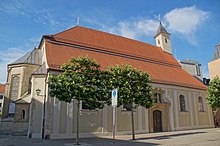
Nonnenplatz The name of the square means the nuns of the neighboring Dominican convent of the Holy Cross . This women's monastery was founded in 1233 and still exists today, in contrast to the Dominican men's monastery , which was dissolved after 1806, whose church at Albertus Magnus Platz, adjacent to Bismarckplatz , still exists. |
Nonnenplatz is a square-like extended street that is enclosed by "Weitoldstraße" in the north, by the buildings and gardens of the Dominican convent, by the subsequent "Stahlzwingerweg" in the south and by the street "Am Judenstein" in the east. |
The Dominican convent, which gave the place its name, was not dissolved during the course of secularization, because the nuns were supposed to take over the girls' schooling on behalf of the ruling prince Karl Theodor von Dalberg . | The classicist, palais-like hipped roof house at Nonnenplatz 8 was built around 1805 by Emanuel Herigoyen for the owner of the nearby, former porcelain factory "Am Singrün". | The neighboring street "Am Judenstein" has had its name since 1644 after a Jewish tombstone from 1374, which comes from the Jewish cemetery that was destroyed in 1519 and which today stands at the northeast corner of the school building of the Kreuzschule. |
List of places O, P
| Surname | Location | Explanations | description | Surroundings | image |
|---|---|---|---|---|---|
|
Obermünsterplatz | The name of the square goes back to the Reichsstift Obermünster , which was founded in the 9th century and dissolved in 1810 in the course of secularization . |
The square gives the southwestern part of the city its name, is separated from Obermünsterstrasse, which runs north of the square, and can be reached from there. | During the 2nd World War the collegiate church and parts of the collegiate buildings were destroyed. The tower of the church was preserved. The square limits the buildings used by Catholic institutions to the north. | The entire space is used as a parking lot. The ruins of the Obermünster collegiate church can be reached from the square, but only rarely accessible. | The Emmeramsplatz, only 200 m to the west, can be reached via Obermünsterstrasse and Obere Bachgasse. | |
|
Ostenallee Name for the eastern section of Fürst-Anselm-Allee |
Ostenallee is separated from Fürst-Anselm-Allee by Ernst-Reuter-Platz and the equally busy D-Martin-Luther-Straße. | The Ostenallee runs parallel to Von-der-Tann-Strasse and Gabelsbergerstrasse and ends at Villapark at Ostentor near the Royal Villa | The Ostenallee is the location of several monuments | The Ostenallee forms the eastern limit of the world heritage area. The Stobäusplatz as a neighboring, heavily used traffic hub is only 200 m to the east. |
|
|
Platz der Einheit The square got its current name at the time of the division of Germany after 1949. After World War II, the square was initially called "Platz der Republik". In the time of National Socialism, the old name "Wittelsbacherplatz" was changed to " Hans Schemm- Platz", the former Gauleiter of the Bavarian East Markets. |
Unity Square is located in front of the Jakobstor , the western city gate, the redesigned bridge gates of which have been preserved. A forerunner of the square was the Lindenpark , created in 1511 , which in the 30th year. War destroyed, but then reforested. Today is the place that was built in the 19th century. as part of Fürst-Anselm-Allee was planted with further trees, outside the world heritage area and has lost the tree population except for the edge areas due to traffic loads, but also as a result of construction work north of the gate towers. | The Platz der Einheit is a traffic turntable in the west of the city with theprüfungigerstraße as the arterial road to the western suburbs . The northern and southern feeder roads (Dr.-Johann-Maier-Strasse and Wittelsbacherstrasse ) have largely retained their old trees. |
After the creation of the city park around 1520 and after the construction of cemeteries, today's Unity Square and the Jakobstor became important stations and meeting points for the population of Regensburg on walks, excursions and events with pageants or competitions. Sports shooting ranges and inns were built here |
The Ostdeutsche Galerie art forum is located just north of the square on Dr.-Johann-Maier-Strasse. | |
|
Prebrunallee Name of the western section of Fürst-Anselm-Allee , which starts at the Platz der Einheit with the streets Stahlzwingerweg and Dr. Johann Maier-Straße accompanies you to the Herzogspark on the Danube. |
The name of the avenue can be traced back to the former suburb of Prebrunn, outside the city of Regensburg . The place was settled by fishermen and craftsmen who operated pottery and brick kilns and who were dependent on close relationships with Regensburg. | When the rapid access to Regensburg on the banks of the Danube was cut off due to the construction of the Prebrunnbastei , the route to the Jakobstor, on which the Prebrunnalle runs today, was of great importance as a transport route. At the northern end of the Stahlzwingerweg, where the city wall ran, a separate wall passage with a bridge over the city moat was created for small traders , the so-called "Prebrunner Türl" |
A large part of the development on Prebrunnallee was created around the turn of the 19th and 20th centuries in the style of late classicism , neo- baroque or neo-renaissance . | In continuation of Wittelsbacherstraße, Prebrunnallee forms the western boundary of the World Heritage area and leads from the Platz der Einheit at Jakobstor to the Herzogspark and the Württembergisches Palais Palais, which houses the East Bavarian Natural History Museum . |
List of places R, S
| Surname | Location | Explanations | description | Surroundings | image |
|---|---|---|---|---|---|
|
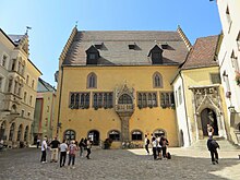
Rathausplatz Meant is the square in front of the Old Town Hall in the center of the old town. The New Town Hall, built around 1935, is located in the western old town on Dachauplatz and has only one large inner courtyard. |
The town hall square in front of the old town hall, which is bordered by the east and south facades of the old town hall, is part of the east-west street running south of the square, which is called "Neue-Waag-Gasse" here and the coal market with the Haidplatz connects. With dimensions of approx. 50 m × 50 m, the town hall square is quite small. | A narrow lane in the north leads through an archway that connects the two wings of the town hall to a free area behind the town hall, which was created in the 1950s after the demolition of the then densely built-up area. The narrow lane is called "Zum Roten Herzfleck" after the former inn "Zum Roten Herzen", which was renovated in 2000 and is now used by the city. The path to the north continues to "Keplerstrasse" on the Danube. | The following are clearly visible from the town hall square: 1. the entrance portal to the Reichsaal, with the figures "Schutz" and "Trutz" as the guards, 2. the late Gothic emperor's bay window , 3. the 15th-century bay window attached to the left of the portal building , iron bars angled at the ends, the city dimensions : the city shoe, the city cubit and the city fathom. |
That the city hall south facing, built in 1300 Dollinger house with the open-to-street Dollinger Hall was demolished 1889th Casts of the sculptures in the ballroom for the Dollinger saga were rescued and ended up in a room in the baroque town hall on Zieroldsplatz, which is adjacent to the town hall square to the east. | |
|
Schopperplatz The name of the square is based on the job title for the so-called "Schopper". These were craftsmen who had the task of waterproofing the joints between the planks of ships' barges, which was called "schoppen". |
Schopperplatz is located on the Danube island of Oberer Wöhrd , which can be reached from the old town via the Stone Bridge or the Eiserner Steg as an extension of the Weißbergergraben. On the Upper Wöhrd, Schopperplatz is located south of the northern branch of the Danube, south of Lieblstrasse at the western end of Badstrasse |
Schopperplatz is the location of the RT-Halle, the former hall of the Regensburg gymnastics club , which is now used as a municipal multi-purpose hall. To the west of Schopperplatz there is a sports field and the municipal outdoor pool as well as the so-called Inselpark. | Schopperplatz is a popular residential area that can only be reached by car from the north via the Oberpfalzbrücke ( European Canal ) and the Pfaffensteiner Steg (northern arm of the Danube). | The Stadtamhof district is within walking distance to the east. The Regensburg canal barrage with the Danube crossing is 500 m to the west and Dultplatz 500 m to the east. | |
|
Schwanenplatz The name of the square goes back to the former inn "Zum Silbernen Schwan", which was operated until 1820 in Kalmünzergasse in house no. 6, which continues north from the square. The inn was demolished in 1965. |
After the construction of the Kolping House, which took up the entire width of the street like a block, many houses in the Kalmünzergasse, which was formerly built on both sides, were demolished in 1965 to enable access roads in the east to Ostengasse and in the west via Kolpingstrasse to St. Georgenplatz. | With the construction of the Kolping House and the subsequent demolition of the houses on Kalmünzergasse, some of which were also damaged by bombs, Schwanenplatz lost its original integration into the development and was used as a parking lot for years. The opening of the Museum of Bavarian History (2018) changed the framework. |
In future, the previous south-north car route via Dachauplatz , Kolpingstrasse, St. Georgenplatz and Eiserne Brücke will only be used by buses and the planned tram. Therefore, Schwanenplatz and the surrounding area were redesigned in 2018. | In the south, Schwanenplatz is separated from the Minorite Church, the church of the former Minorite monastery, by Bertholdstraße . The cultural center of the city of Regensburg is located in Bertholdstrasse in a medieval granary, the so-called empty bag . | |
|
St GeorgenPlatz The name of the square can be traced back to the former Romanesque chapel of St. Georg and Afra, which is adjacent to the square to the west. Window openings of the chapel have been visible in the exposed east wall of the house at Unter den Schwibbögen No. 8 since they were accidentally uncovered in 1905 together with the rounding of the Roman wall that was also exposed there after a house was demolished. |
The difference in level between places in the upper old town ( Alter Kornmarkt , Domplatz) becomes clear when you have to descend a staircase at the end of Erhardigasse to get to Georgenplatz. There at the eastern end of the alley "Unter den Schwibbögen" was formerly the Gate tower of the Arnulfini city wall , which was demolished with the construction of the medieval city wall after 1300 to a clock tower and in 1868. |
If you follow the curve of the Roman wall to the west into the alley "Unter den Schwibbögen", you will come to Porta Prätoria after 100 m . If you follow the curve of the Roman wall to the south, you follow the Roman wall along "Kolpingstrasse", pass under the choir of the abandoned parish church of St. Peter and Paul of the Niedermünster Abbey, which towers above the Roman wall, and meet a 65 m long section in the basement of the Dachauplatz car park the Roman wall, which is presented there with information. |
The course is located just south of the Marc-Aurel-Ufer on Thundorferstraße. the various landing stages on the Danube can be reached quickly. | Although St. Georgenplatz is the starting point for visiting the neighboring Museum of Bavarian History, it cannot be used as a car park. The square is to be opened up by the future city railway, which will cross both arms of the Danube from here to the north over the Iron Bridge and the Nibelungen Bridge . | |
| St. Catherine's Square | Text location | Text explanation | Text description | Text environment | image |
| Stobaeus Square | Text location | Text explanation | Text description | Text environment | image |
List of places V, W, Z
| Surname | Location | Explanations | description | Surroundings | image |
|---|---|---|---|---|---|
| Four buckets of space | Text location | Text explanation | Text description | Text environment | image |
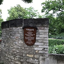
| Villa park | Text location | Text explanation | Text description | Text environment | |
| Watmarkt | Text location | Text explanation | Text description | Text environment | |
| Vineyards | Text location | Text explanation | Text description | Text environment | image |
| Wurstkuchelplatz | Text location | Text explanation | Text description | Text environment | |
| Zieroldsplatz | Text location | Text explanation | Text description | Text environment | |
| Surname | Text location | Text explanation | Text description | Text environment | image |
Individual evidence
- ↑ Dr. Werner Chrobak: The Thon - Dittmer - Palais . In: City of Regensburg, Kulturreferat (Hrsg.): Kulturführer . tape 25 . Regensburg 2019, ISBN 978-3-943222-55-5 .
- ^ Karl Bauer: Regensburg Art, Culture and Everyday History . 6th edition. MZ-Buchverlag in H. Gietl Verlag & Publication Service GmbH, Regenstauf 2014, ISBN 978-3-86646-300-4 , p. 557 .
- ^ A b Karl Bauer: Regensburg Art, Culture and Everyday History . 6th edition. MZ-Buchverlag in H. Gietl Verlag & Publication Service GmbH, Regenstauf 2014, ISBN 978-3-86646-300-4 , p. 67.797 ff .
- ^ Karl Bauer: Regensburg Art, Culture and Everyday History . 6th edition. MZ-Buchverlag in H. Gietl Verlag & Publication Service GmbH, Regenstauf 2014, ISBN 978-3-86646-300-4 , p. 451.455 .
- ^ Matthias Freitag: Regensburg street names . Mittelbayerische Verlagsgesellschaft mbH, Regensburg 1997, ISBN 3-931904-05-9 , p. 23 .
- ^ Karl Bauer: Regensburg Art, Culture and Everyday History . 6th edition. MZ-Buchverlag in H. Gietl Verlag & Publication Service GmbH, Regenstauf 2014, ISBN 978-3-86646-300-4 , p. 35 f .
- ^ Karl Bauer: Regensburg Art, Culture and Everyday History . 6th edition. MZ-Buchverlag in H. Gietl Verlag & Publication Service GmbH, Regenstauf 2014, ISBN 978-3-86646-300-4 , p. 119 .
- ^ A b Karl Bauer: Regensburg Art, Culture and Everyday History . 6th edition. MZ-Buchverlag in H. Gietl Verlag & Publication Service GmbH, Regenstauf 2014, ISBN 978-3-86646-300-4 , p. 20 .
- ^ Karl Bauer: Regensburg Art, Culture and Everyday History . 6th edition. MZ-Buchverlag in H. Gietl Verlag & Publication Service GmbH, Regenstauf 2014, ISBN 978-3-86646-300-4 , p. 424 .
- ^ Karl Bauer: Regensburg Art, Culture and Everyday History . 6th edition. MZ-Buchverlag in H. Gietl Verlag & Publication Service GmbH, Regenstauf 2014, ISBN 978-3-86646-300-4 , p. 404 .
- ↑ Harald Gieß: Forty years of urban redevelopment in Regensburg . Ed .: City of Regensburg planning and construction department. Erhardi Druck GmbH, Regensburg 1995, ISBN 3-925753-45-1 , p. 97 .
- ^ A b Karl Bauer: Regensburg Art, Culture and Everyday History . 6th edition. MZ-Buchverlag in H. Gietl Verlag & Publication Service GmbH, Regenstauf 2014, ISBN 978-3-86646-300-4 , p. 232 .
- ^ Karl Bauer: Regensburg Art, Culture and Everyday History . 6th edition. MZ-Buchverlag in H. Gietl Verlag & Publication Service GmbH, Regenstauf 2014, ISBN 978-3-86646-300-4 , p. 715 f .
- ↑ Richard Strobel: The Fürst-Anselm-Allee . In: Imperial City and Perpetual Reichstag (1663–1806), Thurn and Taxis Studies. Vol. 20, Verlag Michael Lassleben, Kallmünz 2001, ISBN 3-7847-1522-2 , pp. 155-163
- ^ Karl Bauer: Regensburg Art, Culture and Everyday History . 6th edition. MZ-Buchverlag in H. Gietl Verlag & Publication Service GmbH, Regenstauf 2014, ISBN 978-3-86646-300-4 , p. 427 f .
- ^ Karl Bauer: Regensburg Art, Culture and Everyday History . 6th edition. MZ-Buchverlag in H. Gietl Verlag & Publication Service GmbH, Regenstauf 2014, ISBN 978-3-86646-300-4 , p. 432 f .
- ^ Karl Bauer: Regensburg Art, Culture and Everyday History . 6th edition. MZ-Buchverlag in H. Gietl Verlag & Publication Service GmbH, Regenstauf 2014, ISBN 978-3-86646-300-4 , p. 423 .
- ^ Karl Bauer: Regensburg Art, Culture and Everyday History . 6th edition. MZ-Buchverlag in H. Gietl Verlag & Publication Service GmbH, Regenstauf 2014, ISBN 978-3-86646-300-4 , p. 400 .
- ^ Matthias Freitag: Regensburg street names . Mittelbayerische Verlagsgesellschaft mbH, Regensburg 1997, ISBN 3-931904-05-9 , p. 72 .
- ^ Matthias Freitag: Regensburg street names . Mittelbayerische Verlagsgesellschaft mbH, Regensburg 1997, ISBN 3-931904-05-9 , p. 45 .
- ^ Matthias Freitag: Regensburg street names . Mittelbayerische Verlagsgesellschaft mbH, Regensburg 1997, ISBN 3-931904-05-9 , p. 104 f .
- ^ Karl Bauer: Regensburg Art, Culture and Everyday History . 6th edition. MZ-Buchverlag in H. Gietl Verlag & Publication Service GmbH, Regenstauf 2014, ISBN 978-3-86646-300-4 , p. 103 .
- ^ Karl Bauer: Regensburg Art, Culture and Everyday History . 6th edition. MZ-Buchverlag in H. Gietl Verlag & Publication Service GmbH, Regenstauf 2014, ISBN 978-3-86646-300-4 , p. 260 ff .
- ^ Karl Bauer: Regensburg Art, Culture and Everyday History . 6th edition. MZ-Buchverlag in H. Gietl Verlag & Publication Service GmbH, Regenstauf 2014, ISBN 978-3-86646-300-4 , p. 75 f .
- ^ Karl Bauer: Regensburg Art, Culture and Everyday History . 6th edition. MZ-Buchverlag in H. Gietl Verlag & Publication Service GmbH, Regenstauf 2014, ISBN 978-3-86646-300-4 , p. 210 .
- ^ A b Karl Bauer: Regensburg Art, Culture and Everyday History . 6th edition. MZ-Buchverlag in H. Gietl Verlag & Publication Service GmbH, Regenstauf 2014, ISBN 978-3-86646-300-4 , p. 443-445 .
- ^ Karl Bauer: Regensburg Art, Culture and Everyday History . 6th edition. MZ-Buchverlag in H. Gietl Verlag & Publication Service GmbH, Regenstauf 2014, ISBN 978-3-86646-300-4 , p. 441 .
- ^ Matthias Freitag: Regensburg street names . Mittelbayerische Verlagsgesellschaft mbH, Regensburg 1997, ISBN 3-931904-05-9 , p. 100 .
-
^ A b Karl Bauer: Regensburg Art, Culture and Everyday History . 6th edition. MZ-Buchverlag in H. Gietl Verlag & Publication Service GmbH, Regenstauf 2014, ISBN 978-3-86646-300-4 , p. 290 . Reference error: Invalid tag. The name "Bauer" has been defined several times with different content.
<ref> - ^ Matthias Freitag: Regensburg street names . Mittelbayerische Verlagsgesellschaft mbH, Regensburg 1997, ISBN 3-931904-05-9 , p. 111 .
- ^ Karl Bauer: Regensburg Art, Culture and Everyday History . 6th edition. MZ-Buchverlag in H. Gietl Verlag & Publication Service GmbH, Regenstauf 2014, ISBN 978-3-86646-300-4 , p. 286-295 .
- ^ Karl Bauer: Regensburg Art, Culture and Everyday History . 6th edition. MZ-Buchverlag in H. Gietl Verlag & Publication Service GmbH, Regenstauf 2014, ISBN 978-3-86646-300-4 , p. 390 f .
- ^ Karl Bauer: Regensburg Art, Culture and Everyday History . 6th edition. MZ-Buchverlag in H. Gietl Verlag & Publication Service GmbH, Regenstauf 2014, ISBN 978-3-86646-300-4 , p. 96, 208 f .
