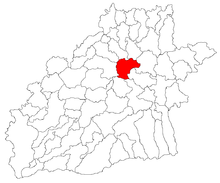
Mihăileni (Sibiu)
|
Mihăileni Schaldorf Sálfalva |
||||
|
||||
| Basic data | ||||
|---|---|---|---|---|
| State : |
|
|||
| Historical region : | Transylvania | |||
| Circle : | Sibiu | |||
| Coordinates : | 45 ° 59 ′ N , 24 ° 21 ′ E | |||
| Time zone : | EET ( UTC +2) | |||
| Height : | 399 m | |||
| Area : | 77.4 km² | |||
| Residents : | 1,036 (October 20, 2011) | |||
| Population density : | 13 inhabitants per km² | |||
| Postal code : | 557155 | |||
| Telephone code : | (+40) 02 69 | |||
| License plate : | SB | |||
| Structure and administration (as of 2016) | ||||
| Community type : | local community | |||
| Structure : | Mihăileni, Metiș , Moardăș , Răvășel , Șalcău | |||
| Mayor : | Ioan Șchiau ( PSD ) | |||
| Postal address : | Str. Principală, no. 165 loc. Mihăileni, jud. Sibiu, RO-557155 |
|||
| Website : | ||||
Mihăileni [ ˈmihəilenʲ ] (outdated Șaldorf , Șoale ; German Schaldorf , Hungarian Sálfalva ) is a municipality in the Sibiu County , in Transylvania , Romania .
Geographical location
The municipality of Mihăileni is located in the Transylvanian Basin , in the Harbach Highlands in the center of the Sibiu district. At the brook Șoala - a right tributary of the Vişa ( Weißbach ) - and the county road ( drum județean ) DJ 141A, the place is 30 kilometers southeast of the small town of Copşa Mică ( Kleinkopisch ); the district capital Sibiu ( Hermannstadt ) is about 50 kilometers to the southwest.
history
The place Mihăileni was first mentioned in 1382.
After the revolution of 1848 , the protesting spokesmen were forced to withdraw their requests, as was the cleric I. Lebu here in Mihăileni .
At the end of the 19th century, Schaldorf belonged to the Marktschelken district in what was then Sibiu County and had about 480 inhabitants.
population
The population of the municipality developed as follows:
| census | Ethnic composition | |||||||
|---|---|---|---|---|---|---|---|---|
| year | population | Romanians | Hungary | German | other | |||
| 1850 | 2,389 | 1,146 | 87 | 1.014 | 142 | |||
| 1941 | 3,100 | 1,661 | 61 | 1,341 | 37 | |||
| 1956 | 2,990 | 1,902 | 15th | 1,015 | 58 | |||
| 1977 | 1,806 | 1,025 | 4th | 704 | 73 | |||
| 1992 | 1,035 | 757 | 1 | 76 | 201 | |||
| 2002 | 1,062 | 809 | 7th | 31 | 215 | |||
| 2011 | 1,036 | 742 | 3 | 22nd | 269 (243 Roma) | |||
Since 1850 the highest number of inhabitants and at the same time that of the Romanian Germans in 1941 was determined in the area of today's municipality. The highest number of Romanians was counted in 1956, that of Roma in 2011 and that of Magyars (106) in 1890. Furthermore, a Slovak was registered in 1890 and a Serb in 1992 . Most of the Romanian Germans were registered in the incorporated villages of Metiș ( Martinsdorf ) - from 1850 to 1941 about 83% - and also in Moardăș ( Mardisch ) and Răvășel ( Rosch ).
Attractions
- In the incorporated village of Metiș, the Protestant church, built in the 15th century and renovated in the 19th (inaugurated in 1863), is a listed building.
- In the incorporated village of Moardăș the evangelical fortified church, built in the 14th century, is a listed building. Only parts of the curtain wall can be seen today. The bell tower collapsed in 1880, so that a round tower standing in the northeast of the fortified church served as a bell tower for a while. In 1913 and 1959 the church was extensively renovated.
Web links
Individual evidence
- ↑ 2011 census in Romania ( MS Excel ; 1.3 MB)
- ^ Dictionary of the localities in Transylvania
- ↑ Heinz Heltmann, Gustav Servatius (Ed.): Travel Guide Siebenbürgen. Kraft, Würzburg 1993, ISBN 3-8083-2019-2 .
- ^ The novels of the Austrian monarchy , printed by Karl Gerold & Sohn, third booklet, Vienna 1851, p. 78
- ^ EA Bielz: Handbuch der Landeskunde Siebenbürgens , Hermannstadt 1857, S. 413. Online in the Bayerische Staatsbibliothek.
- ↑ Census, last updated November 4, 2008 (Hungarian; PDF; 1.1 MB)
- ↑ Information on Martinsdorf at sevenbuerger.de
- ↑ a b List of historical monuments of the Romanian Ministry of Culture, updated 2010 (Romanian; PDF; 7.10 MB)
- ↑ Information on Mardisch at sevenbuerger.de


