
Miyako (Iwate)
| Miyako-shi 宮 古 市 |
|||
|---|---|---|---|
|
|||
| Geographical location in Japan | |||
| Region : | Tōhoku | ||
| Prefecture : | Iwate | ||
| Coordinates : | 39 ° 38 ' N , 141 ° 57' E | ||
| Basic data | |||
| Surface: | 1,259.15 km² | ||
| Residents : | 52,471 (October 1, 2019) |
||
| Population density : | 42 inhabitants per km² | ||
| Community key : | 03202-6 | ||
| Symbols | |||
| Flag / coat of arms: |
 |
||
| town hall | |||
| Address : |
Miyako City Hall 2 - 1 , Shinkawa-chō Miyako -shi Iwate 027-8501 |
||
| Website URL: | http://www.city.miyako.iwate.jp/ | ||
| Location of Miyakos in Iwate Prefecture | |||
 |
|||

Miyako ( Japanese 宮 古 市 , -shi ) is a city in the east of Iwate Prefecture in Japan .
geography


Miyako is east of Morioka and north of Kamaishi on the Pacific Ocean . The town lies at the northern end of the Riasküstengebietes the Sanriku Coast .
Taro area
The Tarō area in the northern part of the city of Miyako is a fishing town on the Pacific Ocean, in which urban areas are distributed around the fishing port Tarō. The city of Tarō is located in a bay that opens to the east and is bounded by steep hills, into which two rivers from the north (長 内 川) and west (River Tarō / 田 代 川) flow. Relatively small settlements, such as the Settai and Koborinai districts, are scattered across the coastal area into the mountainous region. Fishing is the most important industry.
Miyako area
Miyako Bay, which is close to the Sanriku fishing grounds and has both a rocky Rias coastline and a sandy beach at the mouth of the Hei River, offers rich and diverse fish resources. The bay is naturally a good harbor, protected from the rough seas of the Pacific Ocean by the Omoe Peninsula.
Omoe area
The Omoe Peninsula (重 茂 半島 Omoe-hantō) protrudes from the Sanriku coast into the Pacific Ocean. It harbors the rich fishing grounds of Sanriku, where the warm Japan Current coming from the east meets the cold Kuril Current (Oyashio) coming from the north .
The Omoe area has a diverse natural environment with lakes and mountains. From Mount Gassan (月 山) the whole bay of Miyako can be seen. While most of the peninsula consists of mountains and forest, many people live in the hinterland of the fishing ports and nearby hills, such as Omoetate, Omoesato, Otobe, Aneyoshi, Chikei and Ishihama. The peninsula is the for Ria typical -Küsten deep inlets and towering cliffs lined. The local main road of the area, which connects the settlements and connects the settlements, begins in Akamae and follows the course of the coast with its winding up and down hills.
history
The city of Miyako was built in 1941 by the merger of several municipalities from among Shimo-Hei: the city of Miyako ( 宮古町 Miyako- machi ) and villages ( - mura ) Yamaguchi, sentoku and Sokei with time together 33,000 inhabitants. In the great Shōwa territorial reform in 1955, the villages of Sakiyama, Tsugaruishi, Omoe and Hanawa were incorporated into Miyako.
Due to the merger (technically: re-establishment) on June 6, 2005 with the small town of Tarō ( 田 老 町 , - chō ) and the village of Niisato ( 新 里 村 ) of the Shimohei district , Miyako had 61,000 inhabitants on 697 km² (2005). With the incorporation of the village of Kawai in 2010, the area of the city grew to over 1000 km² and includes the Hei River along its entire length.
Taro area
Fishing is the main industry in Tarō area. The beach fish ( beach fishing ) of abalone and sea urchins , as well as the cultivation of cultivated wakame seaweed and Konbu -Tang flourish. After the salmon disappeared from the Tarō River due to water pollution by the Tarō Mine, the salmon could be successfully brought back into the Tarō River, so that the Tarō and Tsugaruishi rivers have again taken first place in salmon fishing on the island of Honshū .
Miyako area
The Miyako port in Nanbu became the most prosperous city of the Morioka fiefdom ( han ) with a governorship established in the Edo period . The Miyako area continued to develop as a fishing and trading city after the Meiji Restoration.
After the Shōwa-Sanriku earthquake and -Tsunami in 1933 , Miyako experienced a strong development spurt, a copper refinery and a lime production plant were founded as part of national policy and the Yamada line of the Japanese State Railways was put into operation.
When the Fujiwara Wharf (藤原 ふ 頭) was built after the Second World War , a port for the shipping of materials was formed, as companies in the wood industry, mainly active in the plywood sector, were established in the hinterland of the port. After recruiting in the field of metal foundry and other companies, they now form the main industry in the area together with the fishing and construction timber industries.
The city of Miyako was considered to be the central city on the Rikuchu Coast in Iwate Prefecture. Urban and industrial infrastructure development has been carried out in the Miyako area. The area acts as the center of the extended Miyako settlement region.
The Miyako area can be divided into several central urban areas with a cluster of commercial establishments clustered around JR and Sanriku Railway stations :
- the Atago (愛 宕), Tsukiji (築 地) and Koganji (光 岸 地) neighborhoods, on the streets of which there are offices of financial institutions and electrical and communications companies
- the Kuwagasaki neighborhood (鍬 ヶ 崎), which is home to a fish market, a number of fish processing plants, and the Jōdogahama viewpoint (浄土 ヶ 浜)
- the Sakiyama (崎 山) district, which is home to picturesque places such as Shiofukiana (潮 吹 穴) and Anegasaki (姉 ケ 崎) and tourist facilities such as Nakanohama Campground
- the Fujiwara (藤原) district, which is home to port facilities and logistics facilities
- the Sokei district (磯 鶏), where the Civic Culture Hall, the prefectural junior college Iwate Kenritsu Daigaku Miyako Tanki Daigakubu (岩手 県 立 大学 宮 古 短期 大学 部, Iwate Prefectural University, Miyako College ), a commercial college (宮 宮 県高等学校, Iwate Prefectural Miyako Commercial Senior High School ) and a fishing high school (岩手 県 立 宮 古 水産 高等学校, Iwate prefectural Miyako Fischerise High school )
- the Takahama (高 浜) and Kanehama (金 浜) neighborhoods, which are residential areas on the Sanriku Coastal Road
- the Tsugaruishi (津 軽 石) and Akamae (赤 前) neighborhoods, which are home to a number of companies that deal with electronic components
- the Horinai and Hirahama neighborhoods, which are fishing villages
Omoe area
In terms of fish stocks and other fishery resources such as wakame kelp, other kelp , sea urchins, abalones, and salmon, the area has the highest catches and quality on the Sanriku Coast.
Earthquake and tsunami disasters

The prefecture administrations carry out hazard mapping to determine hazard data such as the expected height and extent of the flooding, which in turn is used by the municipalities to create hazard maps on which not only the expected hazard, but also information such as evacuation routes and Evacuation locations are indicated.
| Disaster event | Completely destroyed houses | Death toll | source |
|---|---|---|---|
| Meiji 1896 (earthquake and tsunami) | 832 | 3010 | |
| Shōwa 1933 (earthquake and tsunami) | 589 | 127 | |
| Chile 1960 (earthquake and tsunami) | 99 | 0 | |
| Tōhoku 2011 (earthquake and tsunami) | 3669 | 514 | |
| Note: The death toll for the 2011 Tōhoku disaster is calculated from the total number of dead and missing in the 153rd FDMA damage report of March 8, 2016, minus the figures for catastrophe-related deaths determined by the Reconstruction Agency (RA). | |||
Tōhoku disaster 2011
On March 11, 2011, Miyako was shaken by the Tōhoku earthquake , which on the Japanese seismic intensity scale was rated “strong 5” for the Moichi area and “weak 5” for the areas of Satsuki-cho, Kuwagasaki, Nagasawa, Taro, Kawai and Kadoma-Tashiro reached.
Extent of flooding and damage
The Tōhoku earthquake triggered a several meter high tsunami, the highest wave of which hit Miyako on March 11, 2011 at 3:26 p.m. The tsunami reached a height of over 8.5 m, according to an analysis of records at tsunami observation points, which were found again at a later date. Based on tsunami tracks at tsunami observation sites, a tsunami height of 7.3 m was estimated (published by the Morioka Meteorological Office on April 5, 2011). Tsunami heights of 37.9 m (according to the Earthquake Research Institute, University of Tokyo) in Tarō-Koborinai and 40.5 m (according to The 2011 Tohoku Earthquake Tsunami Joint Survey Group, TTJS) were determined.
Around 4,500 houses were destroyed or damaged in the 2011 disaster in Miyako. The number of completely destroyed residential buildings is put at 2,677. At least two multi-story reinforced concrete buildings were overturned by the tsunami in Miyako.
Victim
The Fire and Disaster Management Agency (FDMA) reported 475 dead and 94 missing in its 157th FDMA damage report of March 7, 2018.
Measured against the total population of Miyako, which was given as 59,430 in the 2010 census, the death rate from the 2011 disaster was 1.0% if all dead and missing persons recorded in the 157th FDMA damage report of March 7, 2018 are taken into account or 0.86% if the victims registered in the 153rd FDMA damage report of March 8, 2016 (474 dead and 94 missing) minus the catastrophe-related deaths reported by the Reconstruction Agency (RA) are taken into account, resulting in a 514 dead and missing results. With the same database, but based solely on the floodplain area of the tsunami in Miyako, which covered an area of 10 km 2 , the casualty rate was 2.80%.
According to a summary published on September 1, 2014 by the city of Miyako, which assumed 517 deaths, 64% of the fatalities were 60 years of age or older: 24.4% (126 people) were between 70 and 79 years old, 23.6% (122 people) between 60 and 69 and 16.1% (83 people) between 80 and 89. Divided according to their place of residence, 181 of the 517 fatalities (35.0%) came from the Tarō district, 68 people (13.2%) ) from the Miyako district, 65 people (12.6%) from the Sokei district, 57 people each (11.0%) from the Kuwagasaki and Tsugaruishi districts and 48 people (9.3%) from the Omoe district.
| Area in Miyako | Fatalities | Residents | Tsunami | Distance to the next evacuation site [m] | ||
|---|---|---|---|---|---|---|
| Rate [%] | number | Max. Flooding height [m] | Arrival time [min.] | |||
| Taro | 3.25 | 140 | 4,302 | 8.23 | 31 | 329 |
| Tsugaruishi | 0.86 | 30th | 3,492 | 5.79 | 40 | 319 |
| Kanehama | 3.90 | 26th | 666 | 11.44 | 40 | 639 |
| Omoe | 7.25 | 24 | 331 | 4.31 | 72 | 649 |
| Minato | 0.66 | 1 | 151 | 7.91 | 28 | 302 |
| Koganji | 5.37 | 11 | 205 | 6.49 | 72 | 415 |
| Fujiwara | 0.51 | 5 | 987 | 9.23 | 72 | 384 |
| Chinatsu | 1.18 | 2 | 170 | 2.86 | 35 | 256 |
| Source: Total population according to Statistics Bureau (統計局) and Director-General for Policy Planning (政策 統 括 官), 2010 census; Fatalities according to fire and disaster management agency (消防 庁 = Fire and Disaster Management Agency, FDMA); Maximum flood height and arrival time of the tsunami according to The 2011 Tohoku Earthquake and Tsunami Joint Survey Group ; Distance to the nearest evacuation site from the place of residence according to the evacuation site data from the Cabinet Secretariat Civil Protection Portal Site ( http://www.kokuminhogo.go.jp/en/pc-index_e.html ) of the Cabinet Secretariat (内閣 官 房) and the aerial photographs and maps from Geospatial Information Authority of Japan (GSI) from the Tsunami Damage Mapping Team, Association of Japanese Geographers. | ||||||
Taro area
Historical tsunami experiences and countermeasures in the Tarō area

"2011": tsunami track from 2011 at the Icehouse of the Japan Fisheries cooperative (14.8 m).
"1896": white marking of the tsunami height of 1896 on a cliff (14.6 m)
"1933": white marking of the tsunami height of 1933 on a cliff (10 m, measured at a slightly different location; at this point were 7.0 and 6 , 4 m).


Right: The eastern parts of the new seawalls suffered damage. (Photo: November 9, 2011)

The city of Tarō (now a district of Miyako) is also known as the “Tsunami Tarō” for having suffered devastating damage from tsunamis several times in the past, such as the Keichō tsunami 1611 , Meiji tsunami 1896 and Shōwa tsunami 1933.
For the Meiji tsunami in Tarō in 1896, a height of 15 m or 33 m (according to S. Yamana, 1896), a death rate of 83% (1,867 of the 2,248 inhabitants) and a rate of destroyed houses of 100% were given. According to other sources, it flooded 285 houses in Taro, killing 1,447 people there.
For the Shōwa tsunami in Tarō in 1933 a height of 4 to 10 m, a casualty rate of 32% (911 of the population) and a rate of destroyed houses of 63% were given. According to other sources, it flooded all 503 houses in Taro and killed 889 or 900 of the 2,950 villagers.
The history of Tarō is shaped by the fight against tsunamis.
- Relocation
While in some places in Japan affected by the tsunami in 2011 a high percentage of the population settled in the immediate vicinity of the dikes, Tarō was an example of the areas where the residential areas were located on relatively safe elevated terrain. In Tarō, after previous tsunamis, many residents had moved to higher altitudes.
Land reorganization began in urban areas after the Shōwa-Sanriku earthquake and tsunami of 1933. After the Shōwa tsunami in 1933, Tarō had considered following the recommendation of the central government to relocate the entire settlement to higher terrain, but no suitable site was found that met the important conditions such as a clear view of the fishing port and the ability to see the houses Orientate south. The concentration of economic activity in the coastal village of Tarō on the coast made the search for suitable resettlement sites problematic. Since Tarō was a large village and there was not enough high ground available for all 500 houses, the search for a relocation site was abandoned and the village decided to build a dike around the residential area from its own resources.
- Dyke construction
A year after the tsunami of 1933, the dyke construction, which lasted over three decades, began in 1934 with borrowed funds. The central government and the prefectural government approved the construction project after a year of construction as a public disaster control measure and covered the rest of the costs. Two coastal dikes were completed in 1958 with a height of 10 m. They had a total length of 1.4 km and were intended to protect the city by allowing the tsunami to flow along both sides of the levees. The dikes were able to protect the city successfully and completely during the Chile tsunami in 1960 (with a maximum height of 3.5 m) without causing any deaths.
After the Chile tsunami of 1960, the city had another dike of the same size built with two more 10 m high dyke sections in the 1970s to accommodate the growing population in the protected area and to be prepared for larger tsunamis. In 1979 the dyke system was expanded to two lanes and remained efficient. The dyke construction was thus completed.
The largest of the dykes now had a total length of 2.4 km and a height of 7 m (or 10.65 m, measured at mean sea level). It was 25 m wide at its base and 3 m wide at its top. According to other sources, the total length of the dikes was 10 km. The district looked almost as if it were enclosed by the 10 m high coastal dikes, which the government and the media called the "Great Wall" in reference to the Great Wall of China . The top of the dike was so wide that residents jogged on it , went for walks or rode bicycles.
In contrast to the levees in many other places on the Japanese coast, which were designed to protect the land from high tides or typhoons , these levees in Tarō were intended to act as tsunami barriers and were designed for the 1933 tsunami. These seawalls designed for tsunamis with a height of 10 meters dominated the landscape of Tarō and with their older wall and the two newer sections formed four urban areas connected by tsunami gates. Tarō became known worldwide for its long tsunam oak.
- Further tsunami countermeasures
In addition, the people of Tarō worked on both the hardware and the software side for disaster control, created wireless communication systems for disaster control and tsunami evacuation routes, passed on tsunami experiences and finally called themselves the "City of Tsunami Disaster Preparedness" in 2003 out.
Tōhoku disaster in 2011 in the Tarō area
Extent of flooding and damage in the Tarō area
Despite the efforts as the “city of disaster risk reduction” and the construction of the 10 m high and 2.4 km long coastal dams, the tsunami of 2011 in Tarō flooded and destroyed the large two-line coastal dykes. The first and third dykes were overflowed and the second destroyed. The tsunami destroyed the eastern part of the new dike. The concrete blocks of the newest section of the wall were almost all overturned, and only a few supporting pillars and blocks around the gates remained as the only parts of this seawall section. The tsunami tore blocks and other debris from these structures more than 100 m inland.
The breakwaters at the entrance to the bay were also badly damaged. The river's lock gates remained undamaged.
The two dykes (the newer and the older) were - seen from above - crossed in an X-shape, which meant that the tsunami had accumulated and increased in the middle of the dyke stretch. While the coastal dykes of Tarō are rated as ineffective for the Tōhoku tsunami from one side, another side claims that they have reduced the damage to a certain extent. The role of these coastal structures is therefore a controversial subject. Their effectiveness against lower tsunamis of the past was undisputed.

A tsunami flood height of 16.6 m in urban areas and a tsunami run-up height of 20.72 m were recorded. The mean of the measurements of the flood height and the run-up height carried out by The 2011 Tohoku Earthquake Tsunami Joint Survey Group 2011 was 21.47 m. Other information found tsunami heights (flood and run-up heights) between 12 and 19 m. The 2011 tsunami in Tarō was higher than the tsunami of 1933. Whether it was also higher than the tsunami of 1896 is not clear. A comparison of the 2011 tsunami damage to an icehouse of the Japan Fisheries Cooperative (漁業 協同 組合, ジ ェ イ エ フ) in the fishing port of Tarō, which was badly damaged by the 2011 tsunami, showing a tsunami height of 15 m, with the white markings of the tsunami heights of 1896 and 1933 on one behind The cliff above the Icehouse show that the 2011 tsunami was similar in height to the 1896 tsunami. In addition to the Icehouse of the Japan Fisheries Cooperative , tsunami traces were also found at Tarō Kanko Hotels in 2011 , which indicate an inundation height of 14.8 m. In the western residential area a run-up height of 11.8 m was measured, in the eastern residential area a run-up height of 19.0 m. Based on tsunami tracks on a school building, the inundation height is 12.6 m. In Tarō-Mukaishinden near the Koborinai fishing port in the city of Miyako, tsunami traces such as debris and the lack of leaves measured a run-up height of 37.8 m. Three firefighters who instructed fishermen to evacuate were killed on a hill about 30 m high.
The tsunami overflowing the levees destroyed urban areas, caused flooding in all flat areas and washed away all buildings in the areas from O-hira to the Osanaifort River.
The tsunami crossed every section of the seawalls, penetrated inland, and carried away wooden dwellings. Most of the timber-framed buildings were washed away from their foundations even behind the oldest seawalls (inland). Considerable amounts of debris washed up in this area and remained trapped behind the seawalls when the water receded. Most of the houses were damaged by the tsunami. Almost all houses and fishing facilities were washed away or completely destroyed. Only a few reinforced concrete buildings withstood his strength.
In front of the tsunami sea walls (along the quay) only two buildings remained, which were a reinforced concrete building with considerable tsunami damage on the lower four floors and a steel frame building.

a: Flood heights (triangles) and run-up heights (circles) in Tategamori (I69), Nohara (I70), Aozari (I71-72) and Tanaka (I73)
b: Tsunami damage to the breakwater and (background) to to the 3rd floor (14.8 m) at a hotel in Nohara (野 原)

Between the new and the old part of the Seawall, the settlement was completely destroyed. At the time of a field survey at the end of May 2011, there were only two buildings left there. The first building was a structure whose reinforced concrete storey remained standing, while the other storeys, built as wooden structures, were washed away. The second building was a steel-framed hotel:
The tsunami penetrated to the fourth floor of the six-story (according to other information: seven-story) Tarō Kanko Hotel (た ろ う 観 光 ホ テ ル), which was built in 1986 at a distance of 200 m from the coast in Tarō-Nohara (野 原). The tsunami completely destroyed the first and second storey apart from the bare metal support structure and completely removed the cladding. Tsunami damage in the hotel reached a height of 14.8 m (3rd floor, according to other information: 4th floor). All hotel guests and hotel employees were able to get to safety from the tsunami. In October 2013, the city made the decision that the Tarō-Kanko-Hotel should be preserved as a tsunami memorial as the first disaster ruin in Iwate Prefecture with funding from the national government. In March 2014, the city acquired the hotel and land and decided to keep the building in its condition. Parts of the fourth floor and the higher floors will be left almost in the same condition as after the disaster. The ruined hotel is intended to remind visitors of the power of a tsunami with its warped metal support frame and the destroyed elevators and stairs. In order to get into the hotel building, visitors should climb the external stairs of the building to the fifth floor to get an impression of how high the tsunami can reach. The fifth and sixth floors are used as a data room and event location, where visitors can watch a video of the tsunami on March 11, 2011, filmed by the hotel owner himself. The renovated hotel opened to the public as an educational facility for disaster risk reduction on April 1, 2016. Kataribe (storytellers) offer visitors talks about the disaster that are intended to pass on valuable lessons to future generations.
Forest fires broke out in Aozari, Wano, Otobe and near the Kumano Shrine in Ariya and were finally extinguished on March 16, 2011.
Important facilities such as the Taro fish market, the Taro daycare center, the National Health Insurance Clinic in Taro and the branch of the Miyako fire station in Taro were completely destroyed. The first and second floors of the fishing cooperative building in Tarō were completely destroyed, but were later renovated again.
In the Settai district, the abalone breeding center at the Settai fishing port was completely destroyed. The flood gate on the Settai coast was destroyed and carried upstream in the Settai River. The Shimosettai Bridge was washed away.
Sacrifice in the Taro area
The 2011 tsunami killed 5% of the population in Tarō (an estimated 181 or 200 of the approximately 4,400 inhabitants). A total of 141 bodies were found in the Tarō area, identified by a doctor who had been the only district doctor in the area since 2007 and who had survived the tsunami, in almost all cases within a few days, although the doctor's clinic as well as the The only dental clinic in town was completely flooded and almost all medical and dental documentation was destroyed. According to other information, Tarō had a total population of 4,876 inhabitants, of which 3,000 (62%) had their residence in the area flooded by the tsunami.
According to a summary published on September 1, 2014 by the city of Miyako, which assumed 517 fatalities (dead and missing persons declared dead) for the entire city of Miyako, the total number of people killed in the disaster in the Tarō area was 181 people. Of these, 136 people who were registered in the city of Miyako on March 11, 2011, had been killed by a cause directly related to the earthquake and tsunami (such as drowning , pneumonia, etc.) (in the statistics as "Deaths with certificate" while the death of 45 people was declared in the absence of the corpse. Using mortal remains or DNA fingerprinting , the number of these 45 people was subsequently reduced to 41 missing people who had been declared dead.
Evacuation in the Taro area
Over 1300 people evacuated due to the devastating tsunami damage.
The events in Tarō are considered to be a testimony to the vulnerability of tsunami warning systems in the event of power outages caused by local earthquakes. Shortly after the acoustic transmission of tsunami warnings began in Tarō, it had already been terminated by a power failure.
The Japan Meteorological Agency (JMA) issued a tsunami warning about three minutes after the earthquake occurred, but this alarm was based on an underestimated magnitude of 7.9, which led to an underestimation of the expected tsunami wave heights on the Japanese coasts. The release of the information that the expected tsunami would only have a height of 3 m is said to have resulted in no evacuations in Tarō. In the public perception, the city was protected by its tsunami defense structures during a tsunami of this height. Survivors have reported that the presence of the seawalls may have made vulnerable coastal populations a deceptive sense of security. Part of the population of Taro waited for the arrival of the tsunami and the flooding of the tsunami barriers, instead of going to higher ground beforehand. After the natural and formal warning signs, some residents of Taro waited in the city for family members outside of the city to return home to evacuate with them. This not only led to the delay for the respective person in Tarō, but also encouraged those outside to drive into the danger zone, which led to some unnecessary deaths during the flooding.
Miyako area
Historical tsunami experiences in the Miyako area
In the Tsukiji district, land was reclaimed after the Meiji Restoration. In 1937 the Desaki quay was completed.
The Takahama and Kanehama neighborhoods had already suffered severe damage during the Chile tsunami of 1960.
2011 Tōhoku disaster in the Miyako area
Extent of flooding and damage in the Miyako area
.jpg)

Central urban areas suffered significant damage from the tsunami. The tsunami flooded Desaki quay and overcame the levees in Tsukiji and Shinkawa-cho. It flooded the town hall up to the second floor and tore away six girders of the railway bridge that crosses the river Hei on the JR Yamada line. The tsunami spread from Mukai-machi and Odori to Motomachi, Aramachi, Kurota-machi and Suehiro-cho. He agitated fishing boats on Chuo-dori shopping street. The shopping streets in Motomachi and Suehiro-cho were also flooded to a flood height of 1.5 m and littered with vehicles and debris.
Homes in the Tsukiji neighborhood were washed away. Buildings like the Bank of Iwate or Tōhoku Denryoku survived the tsunami, but most of them had their first floor flooded. In the Atago neighborhood, houses on National Road 45, which was blocked by rubble, were completely destroyed and over half of the buildings in the neighborhood were flooded.
Since there was no dike to protect against the tsunami in the Kuwagasaki district, flat areas were almost completely destroyed. The tsunamis that destroyed the fish market on the quayside of the fishing port and the facilities associated with seafood processing met the tsunamis that flowed over the ridge of Tokonohama at Takonohama-cho (蛸 の 浜 町). The Jōdogahama tourist boat that had been in the dock for maintenance work washed up in Minato-machi.
In the Sakiyama neighborhood, the flood gate on Onatsupe Beach was destroyed, flooding over half the community and completely destroying the Miyako Farming Fishery Center . The Nakanohama campsite in Sakiyama, located near the coast, was washed away or badly damaged by the more than 15 m high tsunami. It is believed that the tsunami in Nakanohama reached a height of up to 21 meters above sea level. The ruins of the campsite in the national park were preserved as the Tsunami Memorial Park Nakanohama and opened to the public on May 24, 2014 as the first surviving disaster ruins. The campsite's public toilets and field kitchen have been preserved in the state they were in after the disaster. The memorial park aims to convey the importance of evacuation to higher ground in the event of a tsunami. The wharf at the Yado fishing port was destroyed and almost the entire Hideshima neighborhood was flooded.
In the Fujiwara district, the flood gate in front of the Nakaya shipyard was destroyed. The tsunami overcame the levee at Fujiwara Wharf, penetrated inland, crossed National Road 45, and built the JR Yamada Line. Seafood processing facilities and homes near National Route 45 or closer to the sea have suffered significant damage.
In the Sokei district, plywood factories and transport and storage facilities between the dike and the coast suffered severe damage, as did the North Sanriku Forestry Office and the Miyako Civic Culture Hall . The tsunami crossed JR Sokei Train Station and advanced to Sokei-Nishi and Wamura, which it inundated. Along the Yagisawa River, the tsunami reached the plywood factories and Miyako Fisheries High School , which it flooded. The Rias port was completely destroyed.
In the Takahama and Kanehama districts, National Road 45 was blocked by debris, cutting off the community from the outside world in vehicle traffic. In Takahama, the tsunami overcame the dam on which National Road 45 ran, flooded the area, caused great damage along the bus route and completely destroyed the Takahama Community Center . In the Kanehama district, the dike was damaged over a length of around 30 m and, as a result, apartments in the lowlands were almost completely destroyed.
In the Tsugaruishi neighborhood, the tsunami passed the flood gate, advanced upstream in the Tsugaruishi River, and flooded the Inari Bridge. In the Norinowaki district, almost all of the houses were washed away and a train on the Yamada line was thrown off the track near the Tsugaruishi station about a kilometer from the coast. The Tsugaruishi Branch Office and Tsugaruishi Public Hall were completely destroyed. In Motomachi, houses were completely destroyed or flooded with a height of 1.5 m above the ground. The tsunamis advancing upstream in the Tsugaruishi River entered the Neisawa River and damaged the Shin-machi-shimo neighborhood. In the Akamae neighborhood, the tsunami advancing from the north flooded the sports park and continued to move south.
The Kamagasawa neighborhood was almost completely flooded. The Koborinai, Horinai and Shirahama neighborhoods were more than half flooded. Soil subsidence has meant that the Omoe Peninsula Line has since been submerged under seawater during high tide and storm surge, which made construction work necessary to raise the ground level.
Victims in the Miyako area
Of the 517 fatalities in the entire city of Miyako, according to a summary published on September 1, 2014 by the city of Miyako, 68 came from the Miyako district, including 25 from Mukai-machi, 11 each from Tsukiji and Koganji, 7 from Shinkawa-cho, 5 from Yamaguchi, 2 each from Odori and Kurota-machi and one each from Tateai-cho, Nishi-machi, Hokuda, Atago and Miyazono.
65 of 517 fatalities came from the Sokei district, 28 of them from Kanehama, 8 from Sokei, 6 from Fujiwara, 5 each from Yagisawa and Takahama, 4 each from Koyamada and Kanbayashi, 2 each from Wamura and Fujinokawa and one from Kanan.
57 of 517 fatalities came from the Kuwagasaki district, 20 of them from Kuwagasaki, 18 from Takonohama-cho, 6 from Yamane-cho, 5 from Kumano-cho, 4 from Hitachihamacho and one each from Nakasatodanchi, Hikage-cho, Minato-machi and Hinode-cho.
Another 57 of the 517 fatalities came from the Tsugaruishi district, including 31 from Tsugaruishi and 26 from Akamae.
Of the 517 fatalities, 22 came from the Sakiyama district, including 18 from Sakikuwagasaki and 3 from Sakiyama.
Twelve of the 517 fatalities came from the Sentoku district, five of them from Nagane, three from Chikanai and one each from Nishigaoka, Ota, Kanpana and Itaya.
6 of the 517 fatalities came from the Hanawa district, including 3 from Nagasawa and one each from Takusari, Matsuyama and Roki.
One of the 517 fatalities came from the Niisato (Kariya) district.
Omoe area
Historical tsunami experiences and countermeasures in the Omoe area

The four- foot- high monument of the great tsunami of 1933 in the village of Aneyoshi, which admonishes residents not to settle below its height.The engraved inscriptions include the name (above in the picture) of the stone memorial (大 津 浪 記念 碑) also the request (left in the picture): Do not build a house below this point! (此処 よ り 下 に 家 を 建 て る な)
Because the Omoe area faces the open ocean, it suffered severe damage during the tsunamis triggered by the Meiji and Shōwa earthquakes. Aneyoshi is one of the villages that were relocated due to the disasters caused by the Meiji tsunami in 1896 and the Shōwa tsunami of 1933. After almost the entire population of the place was wiped out in the two tsunamis, the people built a tsunami memorial and relocated on a hill. The people of this community moved to higher ground individually.
The village gained great fame through its stone memorial. It exhorts people not to settle below its height. The stone memorial was built after the Shōwa tsunami in 1933 (according to other information: after the tsunami of 1896) at a height of 60 m above sea level (20 m higher than the level of the 1933 tsunami) in the Omoe-Aneyoshi area of Miyako and bears engraved inscriptions with lessons learned from the Shōwa-Sanriku earthquake of 1933. The population is warned by the engraved inscriptions (for example 此処 よ り 下 に 家 を 建 e る な: Do not build a house below this point! ) Also for the distant future never to build houses below the memorial because the tsunamis of 1896 and 1933 this place reached and only 2 or 4 people would have survived the destruction of the villages.
2011 Tōhoku disaster in the Omoe area
Extent of flooding and damage in the Omoe area
The tsunami hit all fishing ports facing Miyako Bay on the western side of the Omoe Peninsula such as Shirahama, Uranosawa and Oikiri, as well as those facing the open ocean such as Tatehama, Uiso, Aramaki, Omoe (重 茂), Otobe, Aneyoshi, Chikei, Ishihama and Kawashiro and destroyed levees and seawalls. The transshipment point as well as the cooling systems, fish processing plants and production facilities for salmon and abalone were completely destroyed. Across the city, 2,629 fishing boats were damaged.
Most of the houses in Otobesato and Omoesato were washed away. The Mukaiwatari Bridge in Omoesato collapsed, cutting off Aneyoshi, Chikei and Ishihama from the surrounding area. The tsunami entered Chikei and flooded half the community in Ishihama. The Chikei primary school was flooded to the second floor.

In Omoe (Uiso), where the tsunami left tsunami tracks on the first floor of the Uiso elementary school, which is over 20 m high, inundation heights of around 24.5 m and run-up heights of up to 27.0 m were measured.
The 2011 tsunami in Aneyoshi reached a height of 40.5 m (according to other information: the highest tsunami flood height of 38.9 m), one of the highest values of the Tōhoku tsunami 2011 and destroyed the seawall and the fishing port behind it. However, he did not reach the stone memorial and there was no damage to the village itself. Aneyoshi was the only resettlement village in Miyako that did not suffer any damage. Thanks to the stone memorial erected decades earlier on the hill, none of the residents had built their homes near the water, and no houses were washed away. The four- foot- high tsunami stone memorial stands on the only street in the small village, which lies in a narrow valley leading to the sea. Villagers took the ascending and winding path leading to the tsunami memorial in Aneyoshi district of Miyako City to safety from the tsunami on March 11, 2011, where the tsunami halted 70 meters from the stone memorial.
The fact that houses that were built on higher ground than the memorial were not damaged by the Tōhoku tsunami in 2011 is viewed by the Japanese government as evidence that the transmission of lessons from past disasters is an important means of To keep disaster losses too low.
Sacrifice in the Omoe area
Of the 517 fatalities in the entire city of Miyako, according to a summary published on September 1, 2014 by the city of Miyako, 48 were from the Omoe district, 44 of them from Omoe and 4 from Otobe. 20 of these fatalities remained missing at the time, 19 in Omoe and one in Otobe.
Attractions
- Jōdo Beach (浄土 ヶ 浜, Jōdogahama )
- Gallery: Sights and viewpoints

Sannō-iwa (三 王岩) in Tarō

Jōdogahama in Kuwagasaki, access point to the former Rikuchū Kaigan National Park . The name (beach of the pure land) is said to go back to the Buddhist monk Reikyo, who praised the country as heavenly in the 17th century.
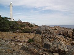
The Todogasaki Stone Monument and Todogasaki Lighthouse at Cape Todo on the Omoe Peninsula. Known as the eastern end of Honshu Island .


traffic
- Train:
- Street:
- Sanriku-Jūkan Highway
- National road 45,106,340
economy
Miyako has been a fishing port since the Edo period . The main catches are salmon and Pacific jackfish (Cololabis saira) . Various companies for wood and food processing as well as for electrical appliance manufacture are located in the city.
Town twinning
Sister cities of Miyako are Kuroishi , Hachimantai , the municipality of Tarama in the district of Miyako , as well as the Chinese city of Yantai ( 煙台 auf ) and La Trinidad in the Philippines abroad .
Sons and daughters
- Tarcisio Isao Kikuchi (* 1958), Roman Catholic religious, Archbishop of Tokyo
Web links
- 岩手県地震·津波シミュレーション及び被害想定調査(Overview of Earthquake / Tsunami simulation and loss forecast for Iwate):岩手県津波浸水予測図(宮古市) その1 , その2 (Part 1 and Part 2 of the tsunami Inundationsprognose - Iwate prefecture diagram for Miyako city), www2.pref.iwate.jp (Iwate prefecture). 岩手 県 津 波 浸水 予 測 図 (田 老 町) (Iwate prefecture tsunami inundation forecast diagram for Tarōf), www2. iwate.jp (Iwate Prefecture). A print version with further information is available as: 岩手 県 地震 ・ 津 波 シ ミ ュ レ ー シ ョ ン 及 び 被害 想 定 調査 に 関 す る 報告 書 (概要 版) ( Memento from June 28, 2018 on WebCite ) (PDF) (岩手ww2.pref.iwate ) (PDF), w 岩手ww2.pref.iwate ), November 2004 (revised: February 2006).
- The tsunami hazard maps are based on three tsunami simulations (1st historical Meiji-Sanriku tsunami, 2nd historical Showa-Sanriku tsunami and 3rd predicted Miyagi-Oki earthquake tsunami) with their tsunami flood information. The maps of the Kokudo Chiriin (国土 地理 院, Geographical Survey Institute = GSI) are created on a scale of 1: 25000 and are intended for printing in A3 paper format . The damage prediction study was carried out by Iwate Prefecture in 2003 and 2004.
- 10 万分 1 浸水 範 囲 概況 図 , 国土 地理 院 ( Kokudo Chiriin , Geospatial Information Authority of Japan, formerly: Geographical Survey Institute = GSI), www.gsi.go.jp: 地理 院 ホ ー ム> 防災 関 連> 平 成 23 年 (2011年) 東北 地方 太平洋 沖 地震 に 関 す る 情報 提供> 10 万分 1 浸水 範 囲 概況 図:
- The GSI published here a map with Miyako ( 浸水範囲概況図6 ) on which the 2011 flooded areas are drawn on the basis of reports of aerial photographs and satellite images from the Tōhoku tsunami, as far as was possible.
Individual evidence
- ↑ a b c d e f g h i j k l m n o p q r s t u v w x y z aa ab ac ad ae af ag ah ai aj ak al am an ao ap aq ar as at au av aw ax ay az ba bb bc bd be bf bg bh bi bj bk bl bm bn bo bp bq br bs bt bu bv bw bx Miyako City Great East Japan Earthquake and Tsunami Records Editorial Committee: The Great East Japan Earthquake and Tsunami Records of Miyako City - Vol. 1, History of Tsunami (Summary Version) - English Edition ( Memento from August 20, 2018 on WebCite ) (PDF), Miyako City Iwate Prefecture, March 15, 2015 (Japanese original version: September 1, 2014).
- ↑ a b c d e f g h i j k l m Stuart Fraser, Alison Raby, Antonios Pomonis, Katsuichiro Goda, Siau Chen Chian, Joshua Macabuag, Mark Offord, Keiko Saito, Peter Sammonds: Tsunami damage to coastal defences and buildings in the March 11th 2011 Mw9.0 Great East Japan earthquake and tsunami . In: Bulletin of Earthquake Engineering . tape 11 , 2013, p. 205-239 , doi : 10.1007 / s10518-012-9348-9 . (Published online March 27, 2012).
- ↑ 三 陸 海岸 . NHK , accessed September 30, 2009 (Japanese).
- ↑ 庁 舎 の あ ゆ み ( chōsha no ayumi , “History of the Office Building”). 宮 古 市 Miyako-shi , July 29, 2014, accessed October 18, 2019 (Japanese).
- ↑ Junko Sagara, Keiko Saito: Risk Assessment and Hazard Mapping . In: Federica Ranghieri, Mikio Ishiwatari (Ed.): Learning from Megadisasters - Lessons from the Great East Japan Earthquake . World Bank Publications, Washington, DC 2014, ISBN 978-1-4648-0153-2 , Chapter 25, pp. 223–231 , doi : 10.1596 / 978-1-4648-0153-2 ( work accessible online on Google Books [accessed on April 3, 2018]). , here: p. 229, Map 25.6: "An example of a tsunami hazard map, Miyako City, Iwate Prefecture" ("Source: Miyako City") License: Creative Commons Attribution CC BY 3.0 IGO.
- ↑ a b c d e f Tadashi Nakasu, Yuichi Ono, Wiraporn Pothisiri: Why did Rikuzentakata have a high death toll in the 2011 Great East Japan Earthquake and Tsunami disaster? Finding the devastating disaster's root causes . In: International Journal of Disaster Risk Reduction . tape 27 , 2018, p. 21-36 , doi : 10.1016 / j.ijdrr.2017.08.001 . (Published online August 15, 2017). With reference to: Tadashi Nakasu, Yuichi Ono, Wiraporn Pothisiri: Forensic investigation of the 2011 Great East Japan Earthquake and Tsunami disaster: a case study of Rikuzentakata , Disaster Prevention and Management, 26 (3) (2017), pp. 298-313 , doi: 10.1108 / DPM-10-2016-0213 .
- ↑ 東 日本 大 震災 図 説 集 . (No longer available online.) In: mainichi.jp. Mainichi Shimbun- sha, May 20, 2011, archived from the original on June 19, 2011 ; Retrieved June 19, 2011 (Japanese, overview of reported dead, missing and evacuated).
- ↑ a b c 平 成 23 年 (2011 年) 東北 地方 太平洋 沖 地震 (東 日本 大 震災) に つ い て (第 157 報) ( Memento from March 18, 2018 on WebCite ) ( PDF ( Memento from March 18, 2018 on WebCite )),総 務 省 消防 庁 (Fire and Disaster Management Agency), March 7, 2018.
- ↑ a b c d e f g h i j k l m n o p q r s t u v Anawat Suppasri, Nobuo Shuto, Fumihiko Imamura, Shunichi Koshimura, Erick Mas, Ahmet Cevdet Yalciner: Lessons Learned from the 2011 Great East Japan Tsunami: Performance of Tsunami Countermeasures, Coastal Buildings, and Tsunami Evacuation in Japan . In: Pure and Applied Geophysics . tape 170 , no. 6-8 , 2013, pp. 993-1018 , doi : 10.1007 / s00024-012-0511-7 . (Published online July 7, 2012).
- ↑ 平 成 22 年 国 勢 調査 - 人口 等 基本 集 計 結果 - (岩手 県 , 宮城 県 及 び 福島 県) ( Memento from March 24, 2018 on WebCite ) (PDF, Japanese), stat.go.jp (Statistics Japan - Statistics Bureau , Ministry of Internal Affairs and communication), 2010 Census, Summary of Results for Iwate, Miyagi and Fukushima Prefectures, URL: http://www.stat.go.jp/data/kokusei/2010/index.html .
- ↑ Tadashi Nakasu, Yuichi Ono, Wiraporn Pothisiri: Why did Rikuzentakata have a high death toll in the 2011 Great East Japan Earthquake and Tsunami disaster? Finding the devastating disaster's root causes . In: International Journal of Disaster Risk Reduction . tape 27 , 2018, p. 21-36 , doi : 10.1016 / j.ijdrr.2017.08.001 . (Published online on August 15, 2017), here p. 22, table 2.
- ↑ 平 成 23 年 (2011 年) 東北 地方 太平洋 沖 地震 (東 日本 大 震災) に つ い て (第 153 報) ( Memento of March 10, 2016 on WebCite ) , 総 務 省 消防 庁 (Fire and Disaster Management Agency), 153rd report, March 8, 2016.
- ↑ Nam Yi Yun, Masanori Hamada: Evacuation Behavior and Fatality Rate during the 2011 Tohoku-Oki Earthquake and Tsunami . In: Earthquake Spectra . tape 31 , no. 3 , August 2015, p. 1237-1265 , doi : 10.1193 / 082013EQS234M . , here table 2.
- ↑ Yoshinobu Tsuji, Kenji Satake, Takeo Ishibe, Tomoya Harada, Akihito Nishiyama, Satoshi Kusumoto: Tsunami Heights along the Pacific Coast of Northern Honshu Recorded from the 2011 Tohoku . In: Pure and Applied Geophysics . tape 171 , no. 12 , 2014, p. 3183-3215 , doi : 10.1007 / s00024-014-0779-x . (Published online March 19, 2014). License: Creative Commons Attribution 4.0 International (CC BY 4.0). Here: p. 3209, Figure 17.
- ↑ a b c d e f g h i j k l m n o p q Nobuo Mimura, Kazuya Yasuhara, Seiki Kawagoe, Hiromune Yokoki, So Kazama: Damage from the Great East Japan Earthquake and Tsunami - A quick report . In: Mitigation and Adaptation Strategies for Global Change . tape 16 , no. 7 , 2011, p. 803-818 , doi : 10.1007 / s11027-011-9304-z . (Published online May 21, 2011).
- ↑ a b c d e f g R. Omira, MA Baptista, F. Leone, L. Matias, S. Mellas, B. Zourarah, JM Miranda, F. Carrilho, J.-P. Cherel: Performance of coastal sea-defense infrastructure at El Jadida (Morocco) against tsunami threat: lessons learned from the Japanese 11 March 2011 tsunami . In: Natural Hazards and Earth System Sciences . tape 13 , 2013, p. 1779–1794 , doi : 10.5194 / nhess-13-1779-2013 . (Published July 12, 2013). License: Creative Commons Attribution 3.0 Unported (CC BY 3.0).
- ↑ Anawat Suppasri, Nobuo Shuto, Fumihiko Imamura, Shunichi Koshimura, Erick Mas, Ahmet Cevdet Yalciner: Lessons Learned from the 2011 Great East Japan Tsunami: Performance of Tsunami Countermeasures, Coastal Buildings, and Tsunami Evacuation in Japan . In: Pure and Applied Geophysics . tape 170 , no. 6-8 , 2013, pp. 993-1018 , doi : 10.1007 / s00024-012-0511-7 . (Published online on July 7, 2012), here: p. 999, Figure 7. License: Creative Commons Attribution 2.0 Generic (CC BY 2.0).
- ↑ Alison Raby, Joshua Macabuag, Antonios Pomonis, Sean Wilkinson, Tiziana Rossetto: Implications of the 2011 Great East Japan Tsunami on sea defense design . In: International Journal of Disaster Risk Reduction . tape 14 , no. 4 , December 2015, p. 332-346 , doi : 10.1016 / j.ijdrr.2015.08.009 . (Published online September 14, 2015). Published under a Creative Commons License (CC BY 4.0: http://creativecommons.org/licenses/by/4.0/ ).
- ↑ a b c d e f g h i j Structural Measures Against Tsunamis . In: Federica Ranghieri, Mikio Ishiwatari (Ed.): Learning from Megadisasters - Lessons from the Great East Japan Earthquake . World Bank Publications, Washington, DC 2014, ISBN 978-1-4648-0153-2 , Chapter 1, pp. 25–32 , doi : 10.1596 / 978-1-4648-0153-2 ( work accessible online on Google Books [accessed on April 3, 2018]). , License: Creative Commons Attribution CC BY 3.0 IGO.
- ↑ a b c d e f g h i j Yoshinobu Tsuji, Kenji Satake, Takeo Ishibe, Tomoya Harada, Akihito Nishiyama, Satoshi Kusumoto: Tsunami Heights along the Pacific Coast of Northern Honshu Recorded from the 2011 Tohoku . In: Pure and Applied Geophysics . tape 171 , no. 12 , 2014, p. 3183-3215 , doi : 10.1007 / s00024-014-0779-x . (Published online March 19, 2014).
- ↑ a b c d e f g h i j k l m n Urban Planning, Land Use Regulations, and Relocation . In: Federica Ranghieri, Mikio Ishiwatari (Ed.): Learning from Megadisasters - Lessons from the Great East Japan Earthquake . World Bank Publications, Washington, DC 2014, ISBN 978-1-4648-0153-2 , Chapter 12, pp. 109–115 , doi : 10.1596 / 978-1-4648-0153-2 ( work accessible online on Google Books [accessed April 3, 2018]). , License: Creative Commons Attribution CC BY 3.0 IGO.
- ↑ Stephanie Chang et al .: The March 11, 2011, Great East Japan (Tohoku) Earthquake and Tsunami: Societal Dimensions . In: EERI Special Earthquake Report . August 2011, p. 1-23 . Earthquake Engineering Research Institute (EERI).
- ↑ Overview: Lessons from the Great East Japan Earthquake . In: Federica Ranghieri, Mikio Ishiwatari (Ed.): Learning from Megadisasters - Lessons from the Great East Japan Earthquake . World Bank Publications, Washington, DC 2014, ISBN 978-1-4648-0153-2 , Chapter 17, pp. 1–21 , doi : 10.1596 / 978-1-4648-0153-2 ( work accessible online on Google Books [accessed April 3, 2018]). , License: Creative Commons Attribution CC BY 3.0 IGO.
- ↑ a b c d e f g h Pradyumna P. Karan: Tamil Nadu and Tohoku: The Two Tsunamis . In: Pradyumna P. Karan, Unryu Suganuma (Ed.): Japan after 3/11: Global Perspectives on the Earthquake, Tsunami, and Fukushima Meltdown . University Press of Kentucky, 2016, ISBN 978-0-8131-6730-5 , chap. 23 , p. 447–461 , doi : 10.1007 / 978-3-319-56742-6_7 ( in Karan & Suganuma partly accessible online on Google Books ).
- ↑ Yoshinobu Tsuji, Kenji Satake, Takeo Ishibe, Tomoya Harada, Akihito Nishiyama, Satoshi Kusumoto: Tsunami Heights along the Pacific Coast of Northern Honshu Recorded from the 2011 Tohoku . In: Pure and Applied Geophysics . tape 171 , no. 12 , 2014, p. 3183-3215 , doi : 10.1007 / s00024-014-0779-x . (Published online March 19, 2014). License: Creative Commons Attribution 4.0 International (CC BY 4.0). Here: p. 3188, Figure 5.
- ↑ a b c Yoshinobu Tsuji, Kenji Satake, Takeo Ishibe, Tomoya Harada, Akihito Nishiyama, Satoshi Kusumoto: Tsunami Heights along the Pacific Coast of Northern Honshu Recorded from the 2011 Tohoku . In: Pure and Applied Geophysics . tape 171 , no. 12 , 2014, p. 3183-3215 , doi : 10.1007 / s00024-014-0779-x . (Published online March 19, 2014). License: Creative Commons Attribution 4.0 International (CC BY 4.0). Here: p. 3189, Figure 6.
- ↑ a b c d e f Hiroshi Suzuki: Maintaining remnants of disaster for future . In: japantimes.co.jp . March 11, 2016. Retrieved August 24, 2018.
- ↑ a b c d e f g h i j k l m n Isao Hayashi: Materializing Memories of Disasters: Individual Experiences in Conflict Concerning Disaster Remains in the Affected Regions of the Great East Japan Earthquake and Tsunami . In: Bulletin of the National Museum of Ethnology [ 国立 民族 学 博物館 研究 報告 ] . tape 41 , no. 4 , March 30, 2017, p. 337-391 , doi : 10.15021 / 00008472 .
- ↑ a b c Hitoshi Kuroda, Kazuo Inoue, Shin Takayama, Tadashi Ishii: A Victim of the Great East Japan Earthquake Identified with the Preserved Medical Samples of Her Deceased Mother . In: Tohoku J. Exp. Med. Band 242 , no. 3 , 2017, p. 247-249 .
- ^ S. Fraser, GS Leonard, I. Matsuo, H. Murakami: Tsunami Evacuation: Lessons from the Great East Japan Earthquake and Tsunami of March 11th 2011 . In: GNS Science Report 2012/17 . Institute of Geological and Nuclear Sciences Limited, 2012, ISBN 978-0-478-19897-3 , ISSN 1177-2425 , 2.0, pp. I-VIII + 1–81 ( massey.ac.nz [PDF; accessed on June 29, 2018]). ; here: p. 3.
- ^ S. Fraser, GS Leonard, I. Matsuo, H. Murakami: Tsunami Evacuation: Lessons from the Great East Japan Earthquake and Tsunami of March 11th 2011 . In: GNS Science Report 2012/17 . Institute of Geological and Nuclear Sciences Limited, 2012, ISBN 978-0-478-19897-3 , ISSN 1177-2425 , 2.0, pp. I-VIII + 1–81 ( massey.ac.nz [PDF; accessed on June 29, 2018]). ; here: p. 29.
- ^ A b S. Fraser, GS Leonard, I. Matsuo, H. Murakami: Tsunami Evacuation: Lessons from the Great East Japan Earthquake and Tsunami of March 11th 2011 . In: GNS Science Report 2012/17 . Institute of Geological and Nuclear Sciences Limited, 2012, ISBN 978-0-478-19897-3 , ISSN 1177-2425 , 2.0, pp. I-VIII + 1–81 ( massey.ac.nz [PDF; accessed on June 29, 2018]). ; here: p. 31.
- ↑ Soichiro Shimamura, Fumihiko Imamura, Ikuo Abe: Damage to the Railway System along the Coast Due to the 2011 Tohoku Earthquake Tsunami . In: Journal of Natural Disaster Science . tape 34 , no. 1 , 2012, p. 105-113 , doi : 10.2328 / jnds.34.105 .
- ↑ a b c d Tsunami Warnings, Written in Stone ( Memento from May 20, 2018 on WebCite ) , nytimes.com, April 20, 2011, by Martin Fackler.
- ↑ a b c d e f White Paper - Disaster Management in Japan 2015 (PDF, approx. 222 pages), http://www.bousai.go.jp/ (Cabinet Office, Japan / 内閣 府), Disaster Management in Japan, 2015, here: page 68.
- ↑ Director General for Disaster management, Cabinet Office, Government of Japan: Index , http://www.bousai.go.jp/ (Cabinet Office Japan / 内閣 府), Disaster Management in Japan: 日本 の 災害 対 策 Disaster Management in Japan - Mar. 2015 (PDF, 49 pages), Cabinet Office Japan (内閣 府), March 2015, here: page 41, fig. "岩手 県 宮 古 市 姉 吉 地区 の 石碑 写真 提供 : 宮 古 市 教育 委員会 - Tsunami warning stone tablet in Aneyoshi, Miyako city, Miyagi Prefecture ", access via website:" White paper on Disaster Management ".
- ↑ a b c 平 成 27 年 版 防災 白 書 , Cabinet Office, Government of Japan (内閣 府), 防災 情報 の ペ ー ジ. Text: 平 成 27 年 版 防災 白 書 【本文 目次】 , here: 平 成 27 年 版 防災 白 書 | 第 1 部 第 1 章 第 1 節 1-5 災害 教訓 の 伝 承 , 平 成 27 年 版 防災 白 書 | 県 碑 津 津 津 | 県 津 津 津宮 古 市 重 茂 姉 吉 地区) . Illustrations: 平 成 27 年 版 防災 白 書 【図 表 目次】 .
- ↑ a b c d e f g Maki Norio: Long-Term Recovery from the 2011 Great East Japan Earthquake and Tsunami Disaster . In: V. Santiago-Fandiño, YA Kontar, Y. Kaneda (Ed.): Post-Tsunami Hazard - Reconstruction and Restoration (= Advances in Natural and Technological Hazards Research (NTHR, volume 44) ). Springer, 2015, ISBN 978-3-319-10201-6 , ISSN 1878-9897 , chap. 1 , p. 1-13 , doi : 10.1007 / 978-3-319-10202-3 . (Published online 23 September 2014).
- ↑ a b c d Evacuation . In: Federica Ranghieri, Mikio Ishiwatari (Ed.): Learning from Megadisasters - Lessons from the Great East Japan Earthquake . World Bank Publications, Washington, DC 2014, ISBN 978-1-4648-0153-2 , Chapter 11, pp. 99-108 , doi : 10.1596 / 978-1-4648-0153-2 ( work accessible online on Google Books [accessed April 3, 2018]). , License: Creative Commons Attribution CC BY 3.0 IGO.
- ↑ Yoshinobu Tsuji, Kenji Satake, Takeo Ishibe, Tomoya Harada, Akihito Nishiyama, Satoshi Kusumoto: Tsunami Heights along the Pacific Coast of Northern Honshu Recorded from the 2011 Tohoku . In: Pure and Applied Geophysics . tape 171 , no. 12 , 2014, p. 3183-3215 , doi : 10.1007 / s00024-014-0779-x . (Published online March 19, 2014). License: Creative Commons Attribution 4.0 International (CC BY 4.0). Here: p. 3189, Figure 7.
- ↑ Bitter Legacy, Injured Coast ( August 21, 2018 memento on WebCite ) , nytimes.com, March 19, 2011, by Ian Jared Miller (Op-Ed Contributor).
Remarks
- ↑ As a run-up height (English: run-up height ) is here the height of the country to which the tsunami has penetrated, respectively. (Source: Miyako City Great East Japan Earthquake and Tsunami Records Editorial Committee: The Great East Japan Earthquake and Tsunami Records of Miyako City - Vol. 1, History of Tsunami (Summary Version) - English Edition ( Memento from August 20, 2018 on WebCite ) (PDF), Miyako City Iwate Prefecture, March 15, 2015 (Japanese original version: September 1, 2014).)
Independent cities ( shi ): Hachimantai | Hanamaki | Ichinoseki | Kamaishi | Kitakami | Kuji | Miyako | Morioka (administrative headquarters) | Ninohe | Ōfunato | Ōshū | Rikuzentakata | Takizawa | Tono
Isawa-gun : Kanegasaki | Iwate-gun : Iwate | Kuzumaki | Shizukuishi | Kamihei-gun : Ōtsuchi | Kesen-gun : Sumita | Kunohe-gun : Karumai | Kunohe | Noda | Hirono | Ninohe-gun : Ichinohe | Nishiiwai-gun : Hiraizumi | Shimohei-gun : Fudai | Iwaizumi | Tanohata | Yamada | Shiwa-gun : Shiwa | Yahaba | Waga-gun : Nishiwaga