
Rikuzentakata
| Rikuzentakata-shi 陸 前 高田 市 |
|||
|---|---|---|---|
|
|||
| Geographical location in Japan | |||
| Region : | Tōhoku | ||
| Prefecture : | Iwate | ||
| Coordinates : | 39 ° 1 ' N , 141 ° 38' E | ||
| Basic data | |||
| Surface: | 232.27 km² | ||
| Residents : | 18,500 (October 1, 2019) |
||
| Population density : | 80 inhabitants per km² | ||
| Community key : | 03210-7 | ||
| Symbols | |||
| Flag / coat of arms: |
 |
||
| Tree : | Crescent fir | ||
| Flower : | camellia | ||
| Bird : | Common gull | ||
| town hall | |||
| Address : |
Rikuzentakata City Hall 110 Aza Tatenooki, Takata-chō Rikuzentakata -shi Iwate 029-2292 |
||
| Website URL: | www.city.rikuzentakata.iwate.jp | ||
| Location Rikuzentakatas in Iwate Prefecture | |||
 |
|||

Rikuzentakata ( Japanese 陸 前 高田 市 , - shi ) is a city in Iwate Prefecture on Honshū , the main island of Japan .
geography

Rikuzentakata is a municipality in the southeast of the Ria coast in Iwate Prefecture, which borders Ōfunato to the north and Miyagi Prefecture with the municipality of Kesennuma to the south . It is located on the east coast of the Tōhoku region at the end of a 3 km wide bay at the mouth of the Kesen River .
Rikuzentakata is located south of Morioka and north of Sendai on the Pacific Ocean and represents an unusual environment for the Ria coast of the Sanriku area . The geometry is similar to the Sendai plain, but the bathymetry takes place off the coast of Rikuzentakata, between the Karakuwa - and the Hirota Peninsula is located, sudden jumps, so that tsunamis can be amplified.
In recent history (since 1945) there have been two significant changes in the coastline of Rikuzentakata: in 1960 by the Chile tsunami and in 2011 by the Tōhoku tsunami . After the Chile tsunami in 1960 penetrated the coastal forest Takata-Matsubara inland, it had divided the Takata-Matsubara forest on its return flow and created an erosion area with a width of 240 m and a maximum depth of 5 m. Until the Tōhoku earthquake of March 11, 2011, the brackish water lake Furukawa-numa ( 古 川 沼 ) lay near the coast , but its separating sandbank was washed away by the tsunami triggered by the earthquake and the lake thus became part of the coastal waters. This coastal retreat through erosion or subsidence also created a series of 9 main islands that were thus separated from the mainland.
history
The part of the name Rikuzen refers to the province of Rikuzen , which was here during the Meiji period .
In 1933 the railway came to the mountainous area of Takata.
In 1955, Rikuzentakata received city status by merging the former cities of Takata , Kesen , Hirota and Otomo and the villages of Yonesaki , Yahagi , Takekoma and Yokota . The Takata and Kesen areas became commercial and industrial centers. The development of the Takata area took place after the 1960s. After the Chile earthquake in 1960, the downtown Takata area experienced rapid development. Takata's population growth and the resulting expansion of the downtown Takata area reflected the social conditions of the time. While the total population of Rikuzentakata decreased by 21% between 1980 and 2010 and the population of Kesen decreased by 14% from 3,818 to 3,287 between 1995 and 2010, the population in the Takata area increased by 19% from 6,461 to 7,711 between 1950 and 2005.
After the main road had previously led through the mountain region, National Road 45 was opened in 2009 as a Takata bypass , which follows the coastline. The economic and administrative centers then moved to the coastal region. At the time of the 2010 census, the city had a population of 23,300 people, with a geographic area of 232 km². The population density was 100 inhabitants per km² and thus higher than in Miyako (47 / km²) and Kamaishi (90 / km²), two other larger cities on the Sanriku-Ria coast.
The most important industrial area of the city - similar to other coastal communities along the Sanriku Ria coast - is the fishing industry, especially in Kesen, Hirota, Otomo and Yonezaki. Shellfish such as oysters and scallops are raised in Rikuzentakata . In particular, before the Tōhoku earthquake in 2011, the population lived off oyster farming (40 million yen sales in 2010) and the location as a scenic attraction. Before it was destroyed by the natural disaster of March 11, 2011, Rikuzentakata was a well-known tourist destination . With its historic wooden houses and shrines, it was considered one of the most beautiful places in Japan. Much of the city had stood for more than a century. The Takata Matsubara Park (高田 松原) was declared by the Japanese Ministry of the Environment in 1927 as a "place of scenic beauty" (名勝) of the Shōwa period . Takata Beach was known for its beauty and was one of the most famous white beaches with pine forest before the 2011 tsunami.
Earthquake and tsunami disasters
Over the past 150 years, the coast of Rikuzentakata has been hit by tsunami disasters several times: the Meiji tsunami in 1896 , the Shōwa tsunami in 1933 , the Chile tsunami in 1960 and the Tōhoku tsunami in 2011.
| Disaster event | Completely destroyed houses | Death toll | source |
|---|---|---|---|
| Meiji 1896 (earthquake and tsunami) | 245 | 818 | |
| Shōwa 1933 (earthquake and tsunami) | 242 | 106 | |
| Chile 1960 (earthquake and tsunami) | 148 | 8th | |
| Tōhoku 2011 (earthquake and tsunami) | 3159 | 1763 | |
| Note: The death toll for the 2011 Tōhoku disaster is calculated from the total number of dead and missing in the 153rd FDMA damage report of March 8, 2016, minus the figures for catastrophe-related deaths determined by the Reconstruction Agency (RA). | |||
Historical tsunami experiences and countermeasures

red : predicted flood plains based on the union of three types of earthquakes: the historical Meiji-Sanriku-oki and Shōwa-Sanriku-oki and the hypothetical Miyagi-oki
black numbers : flood or run-up heights [m ] March 11, 2011
blue : floodplains on 11 March 2011
column charts : population (left) and dead (right) for ages 0-15 (below), 16-64 (center) and ≥65 (top)
Kesen had suffered considerable damage during the Meiji Tunami in 1896 and the Shōwa-Sanriku earthquake tsunami in 1933.
After the Shōwa-Sanriku earthquake tsunami in 1933, national and local governments promoted tsunami disaster control measures. Due to the limited technical and economic possibilities, among other things, the focus was not on expanding the infrastructure, but on saving human lives through evacuation and resettlement, such as the relocation of Kesen. In the Kesen area, the village of Osabe, which was most severely damaged by the Meiji Tunami and the Showa Tsunami, was relocated to higher ground after the Shōwa tsunami.
The Chile tsunami was 3–4 m high, streamed up the Kesen-gawa River and penetrated inland through the relatively barren area of Takata-Matsubara . After the Chile tsunami in 1960, disaster control policy began using the opportunities offered by Japan's rapid economic growth to expand infrastructure and develop a warning system. As a result of this rapid economic progress, the tsunami protection project was initiated together with other national projects for land improvement. The first seawall with a height of 3 m TP has now been erected between the beach and the forest to protect the foreshore and stabilize the coastline. Takata Beach was then restored as a bathing beach.
Although downtown Takata had a potentially high risk of tsunamis from the experience of past tsunamis, the population in the Takata area had grown rapidly. For example, as a result of the local government's urban planning project to promote economy and social welfare, a town hall, high school and a second seawall with a height of 5.5 m TP were built. This seawall, built in 1966, was aligned with the height of the Chile tsunami (4-5 m), which it exceeded by one meter. It was built between the forest and the Furukawa-numa marshland, and was intended to protect the low and inland areas - especially in the Takata area - from the tsunami, which in turn accelerated the development of the area.
This seawall completely protected the area during the 1968 tsunami , with the Iwate Prefecture government reporting that the tsunami had made residents feel safe. The designated evacuation sites that were later to be affected by the tsunami in 2011 were also in this area, for which tsunami hazard maps before the tsunami of 2011 predicted flooding, but only at a height of 0.5 to 1.0 meters .
In 1972, the construction of groynes and breakwaters began on Takata Beach to protect the foreshore and stabilize the coastline. In April 1988 Takata Beach was specified as a coastal community zone (CCZ) development area and coastal projects were carried out along with other projects such as park projects. Between 1990 and 2001, three underwater breakwaters were built in order to protect the landscape.
| Tsunami event | Tsunami height [m] | Completely destroyed houses | Death toll | ||||||||||||
|---|---|---|---|---|---|---|---|---|---|---|---|---|---|---|---|
| Takata | Kesen | Hirota | Otomo | Yonezaki | Takata | Kesen | Hirota | Otomo | Yonezaki | Takata | Kesen | Hirota | Otomo | Yonezaki | |
| Meiji tsunami 1896 | - | 3.45 | 32.6 | 9.2 | 4.21 | 1 | 37 | 146 | 65 | 18th | 19th | 42 | 570 | 203 | 11 |
| Shōwa tsunami 1933 | - | 3.85 | 28.87 | 7.70 | 3.00 | 14th | 127 | 130 | 49 | 98 | 3 | 32 | 23 | 52 | 35 |
| Chile tsunami 1960 | 1.0 | 5.2 | 3.8 | 6.75 | 5.40 | 26th | 20th | 0 | 66 | 42 | 3 | 1 | 0 | 3 | 0 |
| Tōhoku tsunami 2011 | 15.8 | 18.1 | 204 | 1081 | 1101 | 634 | 937 | 1173 | 260 | 59 | 62 | 113 | |||


- Coastal forests - Takata-Matsubara
In the centuries preceding the 2011 tsunami, coastal forests were planted on the Sanriku coast . The Japanese black pine (Pinus thunbergii) trees were planted along extensive areas of the eastern Tōhoku coastline to stabilize the sandy substrate and keep salt spray away. The first pines were planted around 400 years ago in the Sendai Plain along the Teizan-bori Canal, which runs parallel to the coast. In the 17th century, a wealthy merchant began planting pine trees in the inhospitable coastal areas to protect the agricultural areas from strong winds and salt water. Another merchant had started planting in the 18th century. The local communities expanded the forests, preserved them for around 350 years and held annual festivals in memory of the two merchants. In addition, these coastal forests had developed into a tourist attraction, which annually attracted a number of possibly a million people for swimming and nature experience. The area inland from the Teizan-boro Canal was originally low-lying marshland that had been filled in and planted with pine trees. Both the roots of P. thunbergii and P. densiflora ( Japanese red pine ), which under natural circumstances prefer to thrive deep into dry soils, could not penetrate the heavy marshy soil downwards, so that they were forced to spread outwards . This reduced the stability of the trees and their ability to withstand the tsunami forces. By the tsunami triggered by the Tōhoku earthquake on March 11, 2011, these forests should finally be destroyed. The tsunami flooded a total of 3,660 hectares of coastal forest, of which 1,072 hectares a third suffered over 75% damage. The largest damage occurred in the Miyagi Prefecture with 750 hectares.
Rikuzentakata, which before the tsunami of March 11, 2011 had the natural sandy beach with the 70,000-80,000 pine trees that formed the 20 hectare, 2 km long and 200 meter wide coastal forest Takatamatsubara (高田 松原) as part of the coastal protection plan , is one such example of the loss of its regulatory forest. The pines should provide protection from both storm surges and tsunamis. In reliance on these pines and the sandy beach as a natural buffer, the coastline of Rikuzentakata was protected by an onshore breakwater, which was relatively low (5 m) compared to other regions . The pines on the coast had protected the houses in Rikuzentakata well against the Shōwa-Sanriku tsunami of 1933 and the Chile tsunami of 1960. A similar role of natural protection by trees had also been reported in other events and from other regions such as the Nihonkai-Chubu earthquake and tsunami in the 1980s and had been discussed extensively in Japan for various regions.
Tōhoku disaster 2011


.jpg)


Extent of flooding and damage
Even in the Tōhoku disaster of 2011, the coastal forests and dunes were able to fulfill their intended role relatively well in areas with lower tsunami heights, such as in Ibaraki and Aomori . But in the Sanriku region the tsunami impact was too strong, so that the coastal forests here did not significantly reduce the tsunami damage. The trees in Rikuzentakata were fully developed with trunk diameters of 25 to 40 cm. In Rikuzentakata, this natural protection was completely destroyed and washed away by the almost 20 m high tsunami, with the exception of a single pine tree on the 1.7 km to 2 km long sandy beach. Not only did the forest fail to protect the city, it also exacerbated the effects of the tsunami as the pines that were swept along destroyed many buildings.
Due to the local geometric and bathymetric conditions of the coast, the tsunami in Rikuzentakata was intensified. The average flood height was around 13 m and the maximum run-up height was over 20 m, almost twice as high as in the Sendai plain. According to other information, the tsunami wave height was over 15 m and the highest incidence height was around 39 m. The second seawall, coastal forest, and the eastward portion of the first seawall were damaged between 3:20 pm and 3:37 pm, while the first seawall was damaged after 3:37 pm, causing significant erosion. In contrast, part of the western coast, where the second seawall was partially preserved, was not eroded. Over 100 meters of the shoreline was lost due to the interaction of subsidence and erosion caused by the tsunami.
In addition, the tsunami penetrated over 5 km from the river mouth upstream into the river Kesen, which acted as an important channel - like a “tsunami expressway” - for the tsunami to spread inland. The tsunami waves flooded the river dikes in the middle and upper reaches. As a result, the tsunami caused damage several kilometers from the coast - even out of sight. The Kesen, which was lower than the surrounding area and had less surface roughness , enabled the tsunami to flood some areas in relation to the coastline from the side or from behind, instead of - or instead of just - from the coast. Since these areas, in which the tsunami took place in a kind of pincer attack from both the coast and the river, were several kilometers from the coast, such flooding came as a surprise for the people there. There was considerable erosion and widening of the Kesen. The average width of the active river channel widened from 79 to 88 m. Along the 4.8 km long Kesen river, all trees on the banks were uprooted and carried away or knocked over by the tsunami. Along the Kesen, 0.29 km² and along the Kesen and its tributary 0.34 km² were lost. The tsunami destroyed both small and large forest areas, the largest with an area of 51,000 m² and located at a distance of 3 to 3.8 km from the river mouth. The high extent of the destruction of floodplain forest far inland was due to the fact that the tsunami flow was partly channeled inside the river bank with lower ground friction and thus lost less of its energy than outside the river.
Rikuzentakata was one of the hardest hit and devastated areas by the tsunami. Every area in Rikuzentakata was affected by the tsunami, including downtown Takata. The tsunami had a flood height of 15.8 m and flooded an area of 13 square kilometers and 43 percent of the area in the residential areas. 71.8% of the 23,243 inhabitants of Rikuzentakata lived in the flooded area. According to other information, 80% of the urban area, i.e. H. about 5000 households, have been flooded. The number of completely destroyed residential buildings is put at 3807. This destroyed most of the houses, while some reinforced concrete buildings held up. Two multi-storey reinforced concrete buildings were overturned by the tsunami in Rikuzentakata. One of the two hospitals and seven of the city's nine clinics were damaged by the tsunami. Like Ōtsuchi, Yamada, and Nodazu, Rikuzentakata belonged to the cities of Iwate Prefecture, where most of the medical facilities lost their functionality.
The fact that structural damage was particularly high, particularly in buildings, can be attributed to the fact that most of the buildings in the area were made of wood and only some of the larger buildings were made of concrete, as can be seen in the videos that were available online. Although the building regulations in Japan were very strict due to the extremely high risk of natural disasters, the buildings in this area were primarily designed to withstand earthquakes and not tsunami pollution. Accordingly, the damage to buildings caused by the earthquake itself was minor, but the tsunami resulted in greater damage, since wooden, earthquake-proof houses are not suitable for withstanding a tsunami. In general, three types of buildings were common in Japan: wooden structures (typically traditional buildings and one- or two-story residential buildings), metal structures (newer residential and commercial buildings), and reinforced concrete buildings (RC and SRC buildings). Some buildings also featured a mix of construction styles, with the traditional wood structure often being overlaid with a metallic structure to reinforce the buildings or to extend the life of aging buildings. The outer walls, hung on the wooden or metallic structures, were traditionally light and could consist of wooden boards, compressed wooden panels, aluminum or plastic panels. Light cladding such as plasterboard, plaster of paris traditionally sprayed onto bamboo strips and the well-known light wood and paper walls ( called Fusuma in a movable form ) were also found in the houses and were usually anchored to a concrete ceiling or to concrete walls. In buildings of less than three stories, which made up the majority of buildings in Rikuzentakata, the connections between these structures and the foundations were made either in strands of metal less than 2 cm in diameter or in screws that could not withstand upward or sideways forces and loads . The light structures in Rikuzentakata proved to be ill-suited to the vertical loads and upward forces generated by the tsunami waves. The two building types of wooden and metal structures, which are supposed to withstand earthquakes due to their low weight, were completely destroyed up to a distance of 3.5 km from the coast. Their light weight increased the ability to swim and the light walls offered little resistance to the force of the tsunami waves. The buildings that withstood the tsunami in this area were therefore usually concrete, but some concrete buildings also fell victim to the tsunami due to erosion at their base.
The greatest destruction of buildings took place in the low-relief lowlands up to a distance of 3 km from the coastline. The buildings were destroyed regardless of the density of their surroundings, the orientation of the houses and, in the case of most buildings (namely wood and metal structures), also their construction. The buildings of the city council and the sports centers as well as some of the school buildings survived the tsunami from the structure. As a result, the barycenter of the buildings of Rikuzentakata was moved from a distance of 1400 m to 2400 m from the coast, which also changed the spatial distribution of the building density.

The central areas of Rikuzentakata were completely flooded and around 560,000 objects were in four cultural institutions - the City Museum Rikuzentakata (陸 前 高田 市立 博物館) with 230,000 objects, the Umi to Kai no Museum (Sea and Shell Museum) with 110,000 objects, the city library and the facility for the storage of excavated cultural goods - were kept or exhibited were scattered. According to Kumagai Masaru, the only museum curator in the city to survive the tsunami, all four facilities had been completely flooded. Among their objects were also fishing gear from Rikuzentakata, which is registered as a Tangible Cultural Property of Japan . Many of the objects had been washed away, damaged or soiled. Rescue and preservation of the objects could only with some delay (about 20 days) are picked up and accelerated, since which Self-Defense Forces (Self Defense Forces, SDF) end of April 2011 involved in the transport. Since never before in Japan had so much cultural property been damaged in a single such catastrophic event and no existing procedure could be followed, help was sought from the Committee for the Rescue of Cultural Property, which was run by the Japanese government organization Bunka-chō (Agency for Cultural Affairs, ACA) in Response to the disaster had been established. Around 460,000 objects were finally rescued through the ACA project “Kulturgutrettung”, in which curators and other representatives from museums nationwide were involved (up to March 2012 4,900 experts). The ACA cultural rescue program also included zoological and botanical specimens in natural history museums. Experts restored the stuffed specimen of a 9.7 meter long black whale ( genus Berardius ) - the largest exhibit of its kind in Japan - from the Maritime Museum in Rikuzentakata and transported it to the National Museum of Natural Sciences in Tokyo with the help of the SDF .
The tsunami also destroyed the city's famous oyster farms .
evacuation


According to a study (Sagara 2011), the statistical numbers among the victims in Rikuzentakata show the importance of an immediate evacuation for the chances of survival. Accordingly, out of 33 people who left Rikuzentakata immediately evacuating only one person died, while of 147 people who did not leave Rikuzentakata immediately evacuating 42 died. The medical staff and the patients, together 164 people, escaped to the roof of the hospital.
In Rikuzentakata, over half of the evacuation shelters (not to be confused with evacuation centers), to which people are to be evacuated immediately after an earthquake, were flooded by the tsunami.
The sports hall, designated as an evacuation center, and the Central Community Center connected to it in Takata (Sunahata / 砂 畑) were hit and completely destroyed by the tsunami, which reached to the ceiling of the second floor (up to 18 m high). Due to its designation as the primary evacuation shelter in an area of Rikuzentakata with little relief, many citizens (more than 80 people) had fled to the municipal sports hall Rikuzentakata and stayed there, most of whom were victims of the tsunami and only three were flooded by the sports hall survived the tsunami. The demolition of the building began in October 2012, but a few days earlier a message from two daughters to their mother who had died in the tsunami, which had remained on the wall of the Central Community Center, was preserved and remains in the former Oide primary school, where the museum carries out the conservation work for cultural property.
The tsunami was higher than the roof of the city hall, which was destroyed. The city hall of Rikuzentakata (陸 前 高田 市民 会館) opposite the town hall of Rikuzentakata (陸 前 高田 市 役 所) was a designated evacuation building, into which around 70 to 80 people - staff and citizens - were evacuated, but according to eyewitnesses only 10 survived should have. In addition to the location of Rikuzentakata, the distribution of the main infrastructure in the lowlands, such as the town hall and schools, which served as refuge during natural disasters, also increased the city's vulnerability to the tsunami.


With a height of 19 m, the tsunami reached the height of the fifth floor in many parts of the city center and destroyed all buildings in this area except for two large reinforced concrete structures: the seven- story Capital Hotel and the adjacent tsunami evacuation building. This concrete building erected on the beach in Rikuzentakata, which was built as a vertical evacuation protection, enabled three (according to other information: five) people to survive the tsunami on the top level of the building. The tsunami evacuation building features a unique design, with outside stairs leading to a series of concrete seating platforms. The building survived the tsunami, although the water level reached on March 11, 2011 exceeded that for which the building was designed and only the top two or three rows of seats remained above the water level and offered protection from the tsunami. The former service station Takata-Matsubara Tapic 45 (旧道の駅高田松原(タピック45)), which was constructed in 1991 on the National Road 45 in the district Takata, was after the disaster of 2011, in addition to the Youth and Rikuzentakata Kesen Junior High School to the four buildings damaged by the disaster that were to be preserved in Rikuzentakata. The building is considered representative, as it is direct and permanent evidence of the almost 15 meter high tsunami, which reached 13.7 m (according to other information: TP 14.5 m) to just below the top of the building, and the Saved the lives of three people evacuated from the building.
At the time of the earthquake, media reports said that all 86 students and teachers from Rikuzentakata Kesen Junior High School (陸 前 高田 市立 気 仙 中 学校) were in the middle school gymnasium practicing songs for the graduation ceremony that was scheduled for the following week. Before five minutes were up, they evacuated to a parking lot at the school. After observing that the water on the coast had withdrawn almost completely from the shore, they decided to evacuate to higher ground and all survived the disaster. The three-story school building was later preserved as a relic of the Tohoku disaster. A plaque with the tsunami flood level of 14.2 m was placed on the roof of the building, indicating that the roof of the school building was flooded by the tsunami.
Victim
In addition to the intensification of the tsunami waves due to the topographical conditions, the concentration of settlement on the low-lying and narrow coastal plain in Rikuzentakata also contributed to the high level of damage and mortality. The fire and disaster control authority (FDMA) reported in its 124th damage report from May 19, 1492 dead and 699 missing. The number of deaths increased to 1604 by the 157th FDMA damage report, while 202 people were still missing.
The percentage of victims was, depending on the data, between 7.6 or more than 10% of the total population, which in the 2010 census was 23,300. A calculation that subtracts the numbers of catastrophic deaths determined by the Reconstruction Agency (RA) from the total number of dead and missing in the 153rd FDMA damage report of March 8, 2016, comes to an absolute number of victims for Rikuzentakata (deaths and missing persons) of 1,763, to a casualty rate in the community population of 7.57% and to a casualty rate in the tsunami-flooded area of 10.59%. Rikuzentakata had the highest absolute number of victims as well as the highest victim rate in the flooded area of the entire Sanriku Ria coast.
The city lost 68 of the 295 municipal employees on its entire staff. Together, victims and refugees made up 80% of the total population of Rikuzentakata.
| Area in Rikuzentakata | Fatalities | Residents | Tsunami | Distance to the next evacuation site [m] | ||
|---|---|---|---|---|---|---|
| Rate [%] | number | Max. Flooding height [m] | Arrival time [min.] | |||
| Takata (高田 町) | 13.57 | 1,037 | 7,641 | 16.31 | 39 | 1,169 |
| Kesen (気 仙 町) | 6.42 | 211 | 3,287 | 13.27 | 39 | 929 |
| Yonezaki (米 崎 町) | 3.12 | 86 | 2,754 | 13.88 | 40 | 433 |
| Otomo (小 友 町) | 2.72 | 52 | 1.911 | 13.51 | 41 | 752 |
| Hirota (広 田 町) | 1.13 | 40 | 3,532 | 12.81 | 39 | 463 |
| Takekoma (竹 駒 町) | 3.33 | 40 | 1,203 | 11.61 | 39 | 304 |
| Yahagi (矢 作 町) | 1.25 | 21st | 1,677 | 9.91 | 39 | 320 |
| Source: Total population according to Statistics Bureau (統計局) and Director-General for Policy Planning (政策 統 括 官), 2010 census; Fatalities according to fire and disaster management agency (消防 庁 = Fire and Disaster Management Agency, FDMA); Maximum flood height and arrival time of the tsunami according to The 2011 Tohoku Earthquake and Tsunami Joint Survey Group ; Distance to the nearest evacuation site from the place of residence according to the evacuation site data from the Cabinet Secretariat Civil Protection Portal Site ( http://www.kokuminhogo.go.jp/en/pc-index_e.html ) of the Cabinet Secretariat (内閣 官 房) and the aerial photographs and maps from Geospatial Information Authority of Japan (GSI) from the Tsunami Damage Mapping Team, Association of Japanese Geographers. | ||||||
reconstruction
Nagoya , one of the largest cities in central Japan, took on the city of Rikuzentakata as one of the places hardest hit by the disaster in order to support the Tōhoku region after the disaster. As of March 2012, Nagoya posted 144 officials to Rikuzentakata for a maximum term of one year. Nagoya sent in a wide variety of experts such as city planners, healthcare professionals, and statisticians. As of March 2014, 13 officials from Nagoya were still working in Rikuzentakata, which over time hired more and more staff itself and regained independence.
According to media reports, the reconstruction in Rikuzentakata, where several thousand survivors lived in makeshift shelters even after years, was hampered by bureaucratic obstacles and by a lack of space on higher ground and far away from the coast, as in other affected communities.
In December 2011, the city of Rikuzentakata drafted the base reconstruction plan for the time after the Tōhoku disaster, which was based on the base reconstruction policy formulated in 2011. In March 2015, the reconstruction plan was revised taking into account the progress made so far and the changed social and economic situation. The basic reconstruction plan includes a strategy to fully restore Takata Matsubara Forest and Takata Beach to their pre-tsunami levels. The city of Rikuzentakata was selected as the site for the construction of the Tsunami Reconstruction Memorial Park. In June 2014, the Tōhoku Regional Office, the Ministry of Land, Infrastructure, Transport and Tourism , Iwate Prefecture, and Rikuzentakata City published the basic concept for the Takata-Matsubara Tsunami Memorial Park , according to which the park includes the forest and the beach becomes.


As a “wonder pine ” ( 奇跡 の 松 , kiseki no matsu ), “tree (or: pine) of hope”, “pine tree of guts ” or “the pine” ( ipponmatsu ) the only one that remained standing was 27 m high 250 year old pine tree has become a very important and well known symbol of reconstruction. It was celebrated as a national symbol of perseverance in poems and songs, appeared like a memorial to the victims and encouraged people to rebuild through their survival. Since its roots were exposed to the high salt content of the seawater after the disaster of 2011 and died, the tree was declared dead in anticipation of its almost certain death and removed in September 2012. Experts then artificially preserved the tree in an upright appearance similar to its original condition until the beginning of June 2013 by inserting a metal frame into the trunk and adding replica branches, twigs and leaves made of synthetic resin. The city of Rikuzentakata decided to keep the synthetically treated pine as a symbol of reconstruction for future generations. The high cost of preservation to be borne by the city sparked controversial discussions. The city had responded to criticism of the planned restoration costs expressed on the Internet by collecting over 150 million yen through donations from Japan and overseas. In June 2013, the restored tree was returned to its original location in Takatamatsubara and was to be illuminated every night as a sign of respect for the victims of the disaster . City Mayor Futoshi Toba, whose wife was killed in the tsunami, said at the inauguration ceremony that the miraculous jaws gave the survivors strength and hope to go on living. The preserved “wonder pine” should form the heart of the decided disaster control and memorial park, to which the area closest to the coast and completely destroyed by the tsunami had been designated. The synthetically preserved tree has since become a popular tourist destination.
In 2013, the Takata Coast began to be rebuilt to restore the land area hit by the 2011 tsunami and the protective walls. The coast had not recovered at this point. Since the topography of the coast off Rikuzentakata had been constant before the tsunami of 2011, a natural restoration of the eroded sections, for example via sedimentation by the Kesen-gawa River, was not expected within the desired time frame under the existing climate. Without artificial sand pre-washing, a recovery of the beaches within 50 years was not to be expected. A committee was established that discussed the sand filling of Takata Beach in several meetings in 2014 and 2015 and decided that the beach along the first protective wall over a length of 1.75 km and a width of 30 to 60 m with a gradient of 1/20 to 1/10 and a grain size of over 0.26 mm should be heaped up. The flushing of the sand planned for 2017 was to be divided into three areas by two groynes, the middle of which was intended as a bathing beach. Since Takata Beach was one of the most famous white beaches with pine forest before the tsunami, the color and grain size of the sand played an important role. After considering sand deposits in five locations in Hokkaido, Aomori, Miyagi, Ibaraki and Chiba as possible sources for the landfill, the committee selected the one from Taiwa City with a grain size based on its similarities to the natural sand of Takata Beach of 0.51 mm.


In March 2014, the general contractor Shimizu Corporation built a 3 km long conveyor belt system in the coastal area of Rikuzentakata near the “Wunderkiefer” at a cost of 12 billion yen , which transports 40,000 tons of earth and gravel down from the adjacent hills every day to a To create the foundation for raising the lower coastal area by around 10 meters. The conveyor belt system is connected to a hill via a temporary bridge over the Kesen River known as the “Bridge of Hope”, on which the construction of a housing estate on elevated terrain has started. The construction of the conveyor belt system was also intended to shorten the period originally estimated by the city for the reconstruction work from nine to two years. According to City Mayor Futoshi Toba, the conveyor belt system gave tsunami survivors hope to return to their old homes and has since been attracting sightseeing visitors. The 118.2 billion yen project, mainly financed by the Japanese central government, to build construction areas over 12 meters high by backing up thousands of tons of soil from higher ground was intended to create a 124.2 hectare area in the coastal area which the city planned to build a new inner city. Among the many construction projects on artificially raised areas in Japanese coastal cities, that of Rikuzentakata was the largest. At the same time, concerns arose as to whether the rebuilt cities of the Tōhoku region would regain their population, not just since the catastrophe of 2011, with rapidly aging and shrinking populations would achieve earlier vitality.
To reduce the risk of damage from future tsunamis, the city also started building two 1.8 km long protective walls, one of which is 3 meters high and the second is 12.5 m high.
traffic
- Train:
sons and daughters of the town
- Naoya Hatakeyama (* 1958), art photographer
Neighboring cities and communities
- Iwate Prefecture
- Miyagi Prefecture
Picture gallery
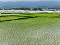
Rice fields in Yonezaki District (June 2, 2007)

Fumonji Temple (普 門寺) of the Sōtō sect in the Yonezaki district (November 2, 2014)

The former brackish lake Furukawa-numa (December 3, 2009)
.jpg)


swell
- ↑ a b c d e f g h i j k l m n o p q r s t u Tadashi Nakasu, Yuichi Ono, Wiraporn Pothisiri: Why did Rikuzentakata have a high death toll in the 2011 Great East Japan Earthquake and Tsunami disaster? Finding the devastating disaster's root causes . In: International Journal of Disaster Risk Reduction . tape 27 , 2018, p. 21-36 , doi : 10.1016 / j.ijdrr.2017.08.001 . (Published online August 15, 2017).
- ↑ a b c d e f g h i j k l m n o p q r s Christopher Gomez, Patrick Wassmer, Claire Kain, Marie De Villiers, Kelli Campbell, Stephen Ward, Arash Moghaddam: GIS Evaluation of the Impacts on the Built and the 'Natural' Environment of the 11 March 2011 Tsunami in Rikuzentakata, Iwate Prefecture, Japan ( Memento from July 25, 2018 on WebCite ) , HAL Id: hal-00655023 ( https://hal.archives-ouvertes.fr/hal -00655023 ), version 1, December 25, 2011.
- ↑ a b c d e f g h i j k l m n Nobuhito Mori, Daniel T. Cox, Tomohiro Yasuda, Hajime Mase: Overview of the 2011 Tohoku Earthquake Tsunami Damage and Its Relation to Coastal Protection along the Sanriku Coast . In: Earthquake Spectra . tape 29 , S1, 2013, pp. 127-143 , doi : 10.1193 / 1.4000118 .
- ↑ a b c d e f g h i j k Keiko Udo, Yuriko Takeda, Hitoshi Tanaka: Coastal Morphology Change Before and After 2011 Off the Pacific Coast of Tohoku Earthquake Tsunami at Rikuzen-Takata Coast . In: Coastal Engineering Journal . tape 58 , no. 4 , 2016, p. 1640016-1-1640016-16 , doi : 10.1142 / S0578563416400167 . (Published online January 10, 2018).
- ↑ 岩手 県 に お け る 被 災 状況 と 復興 へ の 取 組 . (PDF) 岩手 県 別 添 資料 1-2 平 成 23 年 東北 地方 太平洋 沖 地震 及 び 津 波 災害 に 関 関 す る 被害 状況 及 び 技術 的 な 考察 【状況 写真】 . Cabinet Secretariat , p. 4 , accessed on April 27, 2013 (before and after picture of Furukawa-numa).
- ↑ a b c Museum works to deodorize disaster-damaged documents ( Memento from August 11, 2018 on WebCite ) , annx.asianews.network (The Japan News (Japan)), March 9, 2017.
- ↑ a b The Boy on the Bike ( Memento from April 8, 2018 on WebCite ) (English; 25:06 min.), Abc.net.au (ABC Australia), May 31, 2011. The video from ABC Australia from June 2011 (Reporter: Mark Willacy) is also available as: Rebuilding After The Most Expensive Natural Disaster In History (2011) , YouTube, published on August 4, 2016 by the Journeyman Pictures YouTube channel .
- ↑ a b c d e f Akemi Ishigaki, Hikari Higashi, Takako Sakamoto, Shigeki Shibahara: The Great East-Japan Earthquake and Devastating Tsunami: An Update and Lessons from the Past Great Earthquakes in Japan since 1923 . In: The Tohoku Journal of Experimental Medicine . tape 229 , no. 4 , 2013, p. 287-299 , doi : 10.1620 / tjem.229.287 . (Published online April 13, 2013).
- ↑ a b c d e f Tadashi Nakasu, Yuichi Ono, Wiraporn Pothisiri: Why did Rikuzentakata have a high death toll in the 2011 Great East Japan Earthquake and Tsunami disaster? Finding the devastating disaster's root causes . In: International Journal of Disaster Risk Reduction . tape 27 , 2018, p. 21-36 , doi : 10.1016 / j.ijdrr.2017.08.001 . (Published online August 15, 2017). With reference to: Tadashi Nakasu, Yuichi Ono, Wiraporn Pothisiri: Forensic investigation of the 2011 Great East Japan Earthquake and Tsunami disaster: a case study of Rikuzentakata , Disaster Prevention and Management, 26 (3) (2017), pp. 298-313 , DOI: 10.1108 / DPM-10-2016-0213 .
- ↑ M. Ando, M. Ishida, Y. Hayashi, C. Mizuki, Y. Nishikawa, Y. Tu: Interviewing insights regarding the fatalities inflicted by the 2011 Great East Japan Earthquake . In: Nat. Hazards Earth Syst. Sci. tape 13 , September 6, 2017, p. 2173-2187 , doi : 10.5194 / nhess-13-2173-2013 . , License: Creative Commons Attribution 3.0 Unported (CC BY 3.0); here: 2179, Fig.2e) ("Takada, Rikuzen-Takada") and Fig. 2f) ("Hirota, Rikuzen-Takada").
- ↑ Tadashi Nakasu, Yuichi Ono, Wiraporn Pothisiri: Why did Rikuzentakata have a high death toll in the 2011 Great East Japan Earthquake and Tsunami disaster? Finding the devastating disaster's root causes . In: International Journal of Disaster Risk Reduction . tape 27 , 2018, p. 21-36 , doi : 10.1016 / j.ijdrr.2017.08.001 . (Published online August 15, 2017). Here p. 26, 28, Table 4 "Past tsunamis impacts and countermeasures in Rikuzentakata".
- ↑ Anawat Suppasri, Nobuo Shuto, Fumihiko Imamura, Shunichi Koshimura, Erick Mas, Ahmet Cevdet Yalciner: Lessons Learned from the 2011 Great East Japan Tsunami: Performance of Tsunami Countermeasures, Coastal Buildings, and Tsunami Evacuation in Japan . In: Pure and Applied Geophysics . tape 170 , no. 6-8 , 2013, pp. 993-1018 , doi : 10.1007 / s00024-012-0511-7 . (Published online on July 7, 2012), here: p. 1002, Figure 12. License: Creative Commons Attribution 2.0 Generic (CC BY 2.0).
- ↑ a b c d Shunichi Koshimura, Nobuo Shuto: Response to the 2011 Great East Japan Earthquake and Tsunami disaster . In: Philosophical Transactions of The Royal Society A Mathematical Physical and Engineering Sciences . tape 373 , no. 2053 , 2015, p. 20140373 , doi : 10.1098 / rsta.2014.0373 . (Published online September 21, 2015).
- ↑ a b c d e Keitarou Hara: Damage to Coastal Vegetation Due to the 2011 Tsunami in Northeast Japan and Subsequent Restoration Process: Analyzes Using Remotely Sensed Data . In: Global Environmental Research . tape 18 , 2014, p. 27-34 .
- ^ A b Rajib Shaw, Yusuke Noguchi, Mikio Ishiwatari: Green Belts and Coastal Risk Management . In: Federica Ranghieri, Mikio Ishiwatari (Ed.): Learning from Megadisasters - Lessons from the Great East Japan Earthquake . World Bank Publications, Washington, DC 2014, ISBN 978-1-4648-0153-2 , Chapter 13, pp. 117–121 , doi : 10.1596 / 978-1-4648-0153-2 ( work accessible online on Google Books [accessed April 3, 2018]). , License: Creative Commons Attribution CC BY 3.0 IGO.
- ↑ a b c d e Anawat Suppasri, Nobuo Shuto, Fumihiko Imamura, Shunichi Koshimura, Erick Mas, Ahmet Cevdet Yalciner: Lessons Learned from the 2011 Great East Japan Tsunami: Performance of Tsunami Countermeasures, Coastal Buildings, and Tsunami Evacuation in Japan . In: Pure and Applied Geophysics . tape 170 , no. 6-8 , 2013, pp. 993-1018 , doi : 10.1007 / s00024-012-0511-7 . (Published online July 7, 2012).
- ↑ a b c d e f g h Lori Dengler, Megumi Sugimoto: Learning from Earthquakes - The Japan Tohoku Tsunami of March 11, 2011 . In: EERI Special Earthquake Report . November 2011, p. 1-15 . , Earthquake Engineering Research Institute (EERI).
- ↑ a b c d e f Nobuo Mimura, Kazuya Yasuhara, Seiki Kawagoe, Hiromune Yokoki, So Kazama: Damage from the Great East Japan Earthquake and Tsunami - A quick report . In: Mitigation and Adaptation Strategies for Global Change . tape 16 , no. 7 , 2011, p. 803-818 , doi : 10.1007 / s11027-011-9304-z . (Published online May 21, 2011).
- ↑ a b Shinichi Omama, Yoshihiro Inoue, Hiroyuki Fujiwara, Tomohiko Mase: First aid stations and patient demand in tsunami-affected areas of Iwate Prefecture following the Great East Japan Earthquake . In: International Journal of Disaster Risk Reduction . tape 31 , 2018, p. 435-440 , doi : 10.1016 / j.ijdrr.2018.06.005 . (First available online on June 12, 2018). License: Creative Commons Attribution-NonCommercial-NoDerivatives 4.0 International (CC BY-NC-ND 4.0).
- ↑ 陸 前 高田 5000 世 帯 が 水 没 . In: NHK News. March 12, 2010, archived from the original on March 15, 2011 ; Retrieved March 12, 2010 (Japanese).
- ^ Number of dead, missing rises to 1,400. In: Daily Yomiuri Online. Yomiuri Shimbun- sha, March 13, 2011, archived from the original on December 8, 2012 ; accessed on August 12, 2016 .
- ↑ Consequences of the mega-quake: death bays, shifted land. In: Spiegel Online. March 18, 2011, Retrieved March 18, 2011 (before-and-after picture by Rikuzentakata).
- ↑ a b c 平 成 23 年 (2011 年) 東北 地方 太平洋 沖 地震 (東 日本 大 震災) に つ い て (第 157 報) ( Memento from March 18, 2018 on WebCite ) ( PDF ( Memento from March 18, 2018 on WebCite )),総 務 省 消防 庁 (Fire and Disaster Management Agency), 157th report, March 7, 2018.
- ↑ a b c Analysis of the 2011 Tohoku tsunami ( Memento from July 25, 2018 on WebCite ) , ngi.no, project report for the NGI ( Norwegian Geotechnical Institute ) on the project: GBV - Sårbarhetsanalyser og risikohåndtering , document no .: 20081430- 00-11-R, December 31, 2011, by Bjørn Kalsnes (Project Manager), Gunilla Kaiser, Carl B. Harbitz.
- ^ Cultural Heritage and Preservation . In: Federica Ranghieri, Mikio Ishiwatari (Ed.): Learning from Megadisasters - Lessons from the Great East Japan Earthquake . World Bank Publications, Washington, DC 2014, ISBN 978-1-4648-0153-2 , Chapter 35, pp. 323–329 , doi : 10.1596 / 978-1-4648-0153-2 ( work accessible online on Google Books [accessed April 3, 2018]). , License: Creative Commons Attribution CC BY 3.0 IGO. Here p. 324, Figure 35.1 ("Rehabilitating a whale specimen - Source: National Museum of Nature and Science."), License: Creative Commons Attribution CC BY 3.0 IGO.
- ↑ a b c d e f After the Tsunami: Rescuing Relics of Rikuzentakata's History and Culture ( Memento from August 11, 2018 on WebCite ) , nippon.com, March 11, 2015 (original in Japanese from March 2, 2015), from Kumagai Masaru.
- ↑ a b c d Cultural Heritage and Preservation . In: Federica Ranghieri, Mikio Ishiwatari (Ed.): Learning from Megadisasters - Lessons from the Great East Japan Earthquake . World Bank Publications, Washington, DC 2014, ISBN 978-1-4648-0153-2 , Chapter 35, pp. 323–329 , doi : 10.1596 / 978-1-4648-0153-2 ( work accessible online on Google Books [accessed April 3, 2018]). , License: Creative Commons Attribution CC BY 3.0 IGO.
- ↑ a b c d Some Tohoku disaster areas on fast track to rebuilding while others stuck in slow lane , japantimes.co.jp, March 9, 2015, by Shusuke Murai. See also: Rikuzentakata: Resurging from devastation (2 min.), YouTube, published by the YouTube channel The Japan Times on March 9, 2015
- ^ A b c Protecting Significant and Sensitive Facilities . In: Federica Ranghieri, Mikio Ishiwatari (Ed.): Learning from Megadisasters - Lessons from the Great East Japan Earthquake . World Bank Publications, Washington, DC 2014, ISBN 978-1-4648-0153-2 , Chapter 5, pp. 55–62 , doi : 10.1596 / 978-1-4648-0153-2 ( work accessible online on Google Books [accessed April 3, 2018]). , License: Creative Commons Attribution CC BY 3.0 IGO.
- ↑ Japan's Tsunami: Caught on Camera (approx. 60 minutes), script, production and direction: Peter Nicholson, production manager: Chris Shaw, ITN Productions for Channel 4, 2011. Released in a similar form as Japan's Tsunami - Caught on Camera , The Passionate Eye, 2011, for CBC News Network . A version in German was broadcast on N24 with the title Japan's Tsunami - Moments of Fear .
- ^ S. Fraser, GS Leonard, I. Matsuo, H. Murakami: Tsunami Evacuation: Lessons from the Great East Japan Earthquake and Tsunami of March 11th 2011 . In: GNS Science Report 2012/17 . Institute of Geological and Nuclear Sciences Limited, 2012, ISBN 978-0-478-19897-3 , ISSN 1177-2425 , 2.0, pp. I-VIII + 1–81 ( massey.ac.nz [PDF; accessed on June 29, 2018]). ; here: p. 30.
- ↑ a b c d e f g h i Isao Hayashi: Materializing Memories of Disasters: Individual Experiences in Conflict Concerning Disaster Remains in the Affected Regions of the Great East Japan Earthquake and Tsunami . In: Bulletin of the National Museum of Ethnology [ 国立 民族 学 博物館 研究 報告 ] . tape 41 , no. 4 , March 30, 2017, p. 337-391 , doi : 10.15021 / 00008472 .
- ↑ a b Anawat Suppasri, Nobuo Shuto, Fumihiko Imamura, Shunichi Koshimura, Erick Mas, Ahmet Cevdet Yalciner: Lessons Learned from the 2011 Great East Japan Tsunami: Performance of Tsunami Countermeasures, Coastal Buildings, and Tsunami Evacuation in Japan . In: Pure and Applied Geophysics . tape 170 , no. 6-8 , 2013, pp. 993-1018 , doi : 10.1007 / s00024-012-0511-7 . (Published online on July 7, 2012), here: p. 1009, Figure 21. License: Creative Commons Attribution 2.0 Generic (CC BY 2.0).
- ↑ < 回顧 3.11 証言 > 市 役 所 屋 上 命 の と り で ( memento from April 9, 2018 on WebCite ) , kahoku.co.jp, March 12, 2017.
- ↑ a b The catastrophe that does not want to pass ( Memento from August 13, 2018 on WebCite ) , welt.de, March 12, 2014, by Sonja Blaschke.
- ↑ Stephanie Chang et al .: The March 11, 2011, Great East Japan (Tohoku) Earthquake and Tsunami: Societal Dimensions . In: EERI Special Earthquake Report . August 2011, p. 1-23 . Earthquake Engineering Research Institute (EERI).
- ↑ Excursion C - Course for Learning the Future in Rikuzentakata ( Memento from August 13, 2018 on WebCite ) , Conference: Global Conference on the International Network of Disaster Studies in Iwate, Japan "Iwate Conference" , 17. – 20. July 2018 (Conference: July 17-19, 2018, excursion: July 19-20, 2018), Conference topic: Landscape-Scale Disasters, Emergency Response, and Regional Recovery , Venue: Iwate Prefecture Citizens' Cultural Exchange Center "Aiina" , Morioka City, Iwate Prefecture, Organizers: Research Center for Regional Disaster Management, Iwate University, Japan, Center for Crisis Management Research, School of Public Policy and Management, Tsinghua University, People's Republic Of China, The Program on Crisis Leadership, Ash Center for Democratic Governance and Innovation and Taubman Center for State and Local Government, Harvard Kennedy School, USA, Co-organizers: Reconstruction Agency, Iwate Prefectural Government, The Japan Association of National Universities. Available at: Excursion ( Memento from August 13, 2018 on WebCite ) .
- ↑ “Wiped Off The Map” 5 Years Ago, The City Of Rikuzentakata Still Stands Strong ( Memento from August 13, 2018 on WebCite ) , grapee.jp, March 11, 2016.
- ↑ 平 成 23 年 (2011 年) 東北 地方 太平洋 沖 地震 (第 124 報) ( Memento from March 25, 2018 on WebCite ) ( PDF ( Memento from March 25, 2018 on WebCite )), 総 務 省 消防 庁 (Fire and Disaster Management Agency), 124th report, May 19, 2011.
- ↑ 東 日本 大 震災 図 説 集 . In: mainichi.jp. Mainichi Shimbun- sha, May 20, 2011, archived from the original on June 19, 2011 ; Retrieved June 19, 2011 (Japanese, overview of reported dead, missing and evacuated).
- ↑ a b 東 日本 大 震災 記録 集 ( Memento from March 23, 2018 on WebCite ) , 総 務 省 消防 庁 (Fire and Disaster Management Agency), March 2013, here in Chapter 3 (第 3 章 災害 の 概要) the subsection 3.1 / 3.2 (3.1 被害 の 概要 /3.2 人 的 被害 の 状況) ( PDF ( Memento from March 23, 2018 on WebCite )).
- ↑ a b 平 成 22 年 国 勢 調査 - 人口 等 基本 集 計 結果 - (岩手 県 , 宮城 県 及 び 福島 県) ( Memento from March 24, 2018 on WebCite ) (PDF, Japanese), stat.go.jp (Statistics Japan - Statistics Bureau, Ministry of Internal Affairs and communication), 2010 Census, Summary of Results for Iwate, Miyagi and Fukushima Prefectures, URL: http://www.stat.go.jp/data/kokusei/2010/index.html .
- ↑ a b Supporting and Rmpowering Municipal Functions and Staff . In: Federica Ranghieri, Mikio Ishiwatari (Ed.): Learning from Megadisasters - Lessons from the Great East Japan Earthquake . World Bank Publications, Washington, DC 2014, ISBN 978-1-4648-0153-2 , Chapter 17, pp. 149–153 , doi : 10.1596 / 978-1-4648-0153-2 ( work accessible online on Google Books [accessed April 3, 2018]). , License: Creative Commons Attribution CC BY 3.0 IGO.
- ↑ Nam Yi Yun, Masanori Hamada: Evacuation Behavior and Fatality Rate during the 2011 Tohoku-Oki Earthquake and Tsunami . In: Earthquake Spectra . tape 31 , no. 3 , August 2015, p. 1237-1265 , doi : 10.1193 / 082013EQS234M . , here table 2.
- ↑ a b c d e f g h i Japanese 'miracle' pine returns to tsunami-hit town - Only tree left standing along coastline of Rikuzentakata after March 2011 disaster opened to public following £ 1m restoration ( Memento from August 12, 2018 on WebCite ) , theguardian.com, July 3, 2013, by Justin McCurry.
- ↑ a b c Rikuzentakata looks to future with new tourism ventures , japantimes.co.jp, March 7, 2015, by Louise George Kittaka.
- ↑ Tsunami hit Rikuzentakata rebuilding on raised ground, hoping to thrive anew , japantimes.co.jp, March 7, 2017, by Reiji Yoshida.
Remarks
Web links
- 岩手 県 地震 ・ 津 波 シ ミ ュ レ ー シ ョ ン 及 び 被害 想 定 調査 (overview of earthquake / tsunami simulation and damage prognosis for Iwate): 岩手 県 津 波 浸水 予 測 (陸 前 高田 市 Stadt for the city's Rwentata and tsunami forecast (tsunami forecast) , www2.pref.iwate.jp (Iwate Prefecture). A print version with further information is available as: 岩手 県 地震 ・ 津 波 シ ミ ュ レ ー シ ョ ン 及 び 被害 想 定 調査 に 関 す る 報告 書 (概要 版) ( Memento from June 28, 2018 on WebCite ) (PDF) (岩手ww2.pref.iwate ) (PDF), w 岩手ww2.pref.iwate ), November 2004 (revised: February 2006).
- The tsunami hazard map with its tsunami flood information is based on three tsunami simulations (1st historical Meiji-Sanriku tsunami, 2nd historical Showa-Sanriku tsunami and 3rd predicted Miyagi-Oki earthquake tsunami). The map of the Kokudo Chiriin (国土 地理 院, Geographical Survey Institute = GSI) has been created on a scale of 1: 25000 and is intended for printing on A3 paper . The damage prediction study was carried out by Iwate Prefecture in 2003 and 2004.
- 10 万分 1 浸水 範 囲 概況 図 , 国土 地理 院 ( Kokudo Chiriin , Geospatial Information Authority of Japan, formerly: Geographical Survey Institute = GSI), www.gsi.go.jp: 地理 院 ホ ー ム> 防災 関 連> 平 成 23 年 (2011年) 東北 地方 太平洋 沖 地震 に 関 す る 情報 提供> 10 万分 1 浸水 範 囲 概況 図:
- The GSI published here two maps with Rikuzentakata ( 浸水範囲概況図8 , 浸水範囲概況図 ) on which the 2011 flooded areas are drawn on the basis of reports of aerial photographs and satellite images from the Tōhoku tsunami, as far as was possible.
- 映像 記録 3.11 あ の 日 を 忘 れ な い (59 minutes), NHK , 2012, speaker: 中 條 誠 子.
- The NHK documentation shows original recordings from Rikuzentakata that were made shortly before and after the tsunami hit near the town hall and town hall.
- After the tsunami Rikuzentakata, the extinguished city ( Die Zeit )
- The Wonder Pine (希望 の 松 kibō no matsu)
- Nobuo Sudō, Sanriku-chihō no tsunami no rekishi. Sono 4 Takata matsubara (Japanese), The 2011 Tohoku Earthquake Tsunami Joint Survey (TTJS) Group (updates to this website were discontinued on December 29, 2012), April 5, 2011, pp. 1–11, URL of the overview page "Tsunami history around this area ": http://www.coastal.jp/ttjt/index.php?%E9%81%8E%E5%8E%BB%E3%81%AE%E6%B4%A5%E6%B3%A2 # z555d32f .
- Part 4 of the "History of the Tsunamis in the Sanriku Region" by Nobuo Sudo , "The Pine Grove of Takata", covers the history of Takata Matsubara with a series of documenting images. .
Independent cities ( shi ): Hachimantai | Hanamaki | Ichinoseki | Kamaishi | Kitakami | Kuji | Miyako | Morioka (administrative headquarters) | Ninohe | Ōfunato | Ōshū | Rikuzentakata | Takizawa | Tono
Isawa-gun : Kanegasaki | Iwate-gun : Iwate | Kuzumaki | Shizukuishi | Kamihei-gun : Ōtsuchi | Kesen-gun : Sumita | Kunohe-gun : Karumai | Kunohe | Noda | Hirono | Ninohe-gun : Ichinohe | Nishiiwai-gun : Hiraizumi | Shimohei-gun : Fudai | Iwaizumi | Tanohata | Yamada | Shiwa-gun : Shiwa | Yahaba | Waga-gun : Nishiwaga