
Pletschmühle (Schwalmtal)
| Pletschmühle
|
||
|---|---|---|
 The Pletschmühle in Schwalmtal-Amern |
||
| Location and history | ||
|
||
| Coordinates | 51 ° 13 '59 " N , 6 ° 14' 42" E | |
| Location | Germany | |
| Waters | Kranenbach | |
| Built | 1730 year on the house | |
| Shut down | 1925/26 after the stream regulation | |
| technology | ||
| use | Flour mill | |
| Grinder | 1 grind | |
| drive | Watermill | |
| water wheel | undershot | |

The Pletschmühle in the municipality of Schwalmtal was a water mill with an undershot water wheel .
geography
The Pletschmühle was located on Kranenbach , in Hauptstrasse 22a, in the Amern district in the Schwalmtal municipality in the Viersen district. Above the Pletschmühle was the Schierer Mühle , below the Hüttermühle . The water level of the Kranenbach in this area was 48 m above sea level. The care and maintenance of the stream is the responsibility of the Schwalm Association , which is based in Brüggen .
history
The year 1730 on a house on Hauptstrasse in Amern indicates the year of construction of this building. Local tradition assumes that it is the "year of birth" of the mill that was operated here, probably in the current part of the house. The flour mill had an undershot water wheel. The name Pletschmühle probably comes from the rippling of the Kranenbach, where the Kuhbach from the hill brought reinforcement to the Kranenbach. Here you can also find the names "Pletschweg" and "Pletschbenden". With the straightening of the Kranenbach in 1925/26, the storage right was replaced and the mill was shut down.
gallery
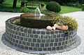
Millstone as a fountain

literature
- Hans Vogt: Lower Rhine water mill guide. Krefeld 1998, pages 454-456.
Web links
Individual evidence
At the Schwalm :
Borner Mühle |
Brempter mill |
Brüggener Mill |
Dilborn Mill |
Frankenmühle |
Jennekes Mill |
Lüttelforster Mühle |
Mühlrath mill |
Breakdown mill |
Papelter mill |
Radermühle |
Vennmühle
An der Niers :
Clörather Mühle |
Gibber mill |
Holtzmühle |
Langendonker Mill |
Mülhausen mill |
Neersdommer Mill |
Oedter Mill |
Schlossmühle Neersen
An der Nette :
Flootsmühle |
Henkenmühle |
Kothmühle |
Leuther Mill |
Lüthemühle |
Mill House Baerlo |
Nelsenmühle |
Neumühle |
Tüschenmühle |
Weuthenmühle
Am Hammer Bach :
Bongartzmühle |
Hammer mill |
Hüstermühle |
Plinzenmühle |
Schnockesmühle |
Sgoedenmühle
Am Dorfer Bach :
Biestenmühle |
Goetersmühle |
Kaisermühle |
Kimmelmühle |
Schricksmühle
Am Kranenbach :
Hausermühle |
Hüttermühle |
Pletschmühle |
Schierer Mühle
Am Mühlenbach :
Weiher Mühle |
Specker Mühle
Am Pletschbach :
Pletschmühle
Am Rintger Bach :
Klostermühle