Popioły (Budry)
| Popioły | ||
|---|---|---|

|
|
|
| Basic data | ||
| State : | Poland | |
| Voivodeship : | Warmia-Masuria | |
| Powiat : | Węgorzewo | |
| Gmina : | Budry | |
| Geographic location : | 54 ° 14 ' N , 21 ° 57' E | |
| Residents : | 250 (2006) | |
| Postal code : | 11-600 | |
| Telephone code : | (+48) 87 | |
| License plate : | NWE | |
| Economy and Transport | ||
| Street : | Ext. 650 : Węgorzewo - Budry ↔ Gołdap | |
| Wydutki → Popioły | ||
| Rail route : | no rail connection | |
| Next international airport : | Danzig | |
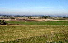
Popioły ( German Popiollen , 1938 to 1945 Albrechtswiesen ) is a place in the Polish Warmian-Masurian Voivodeship . He belongs to the rural community Budry (Buddern) in the powiat Węgorzewski ( Angerburg district ).
Geographical location
Popioły is located on the south bank of the Goldap ( Polish Gołdapa ) in the northeast of the Warmian-Masurian Voivodeship. The district town of Węgorzewo (Angerburg) is 14 km to the south-west.
history
The place called Papiollen before 1785 and Popiollen until 1938 was a village and a large estate until 1928. Both municipalities later merged to form the rural municipality of Popiollen. The place was first mentioned in 1558.
On May 6, 1874 Popiollen office Village and thus its name to an administrative district , which - from 1939 to 1945 renamed in "District Albrecht meadows" - the district Angerburg in Administrative district Gumbinnen the Prussian province of East Prussia belonged.
In 1910 a total of 380 inhabitants were registered in Popiollen, 190 each in the village and 190 in the manor district. The number was 373 in 1925, a total of 518 in 1933 and 495 in 1939.
On June 3, 1938, Popiollen was renamed to "Albrechtswiesen" for political and ideological reasons to avoid foreign-sounding place names. In 1945, the place was in consequence of the war with the entire southern East Prussia to Poland and then received the Polish name "Popioły" in memory of the earlier form of the name. Today the village is the seat of a Schulzenamt ( Polish Sołectwo ), to which the place Wydutki (Storchenberg) also belongs, and a village in the community of Budry (Buddern) in the powiat Węgorzewski , before 1998 the Suwałki Voivodeship , since then the Warmia-Masurian Voivodeship associated.
District Popiollen / Albrechtswiesen (1874–1945)
The district of Popiollen (called "District of Albrechtswiesen" from 1939) originally had six places, in the end there were four:
| Surname | Change name from 1938 to 1945 |
Polish name | Remarks |
|---|---|---|---|
| Brosowken | Birch height | Brzozówko | |
| Small pillacks |
(from 1923 :) Lindenwiese |
Piłaki Małe | |
| Krzywinsken |
(from 1927 :) Sonnheim |
Krzywińskie | |
| Popiollen (village) | Albrechtswiesen | Popioły | |
| Popiollen (good) | 1928 incorporated into the rural community of Popiollen | ||
| Romint lake | 1928 incorporated into Sonnheim |
On January 1st, 1945 only Albrechtswiesen, Birkenhöhe, Lindenwiese and Sonnheim belonged to the district.
Religions
Before 1945 Popiollen was parish in the Protestant Church of Buddern in the church province of East Prussia of the Church of the Old Prussian Union and in the Catholic Church Zum Guten Hirten Angerburg in the Diocese of Warmia .
Today Popioły is part of the Catholic parish in Budry in the Diocese of Ełk (Lyck) of the Roman Catholic Church in Poland and the Protestant parish in Węgorzewo (Angerburg) , a subsidiary of the parish in Giżycko (Lötzen) in the Diocese of Masuria of the Evangelical-Augsburg Church in Poland .
school
A school in Popiollen was founded in 1752. In 1852 it was attended by 43, in 1928 by 42 and in 1935 by 39 schoolchildren. From 1922 the school was organized in two classes. A new school building erected in 1939 was destroyed in 1945.
traffic
Popioły is located on the Polish voivodeship road DW 650 , the former German Reichsstraße 136 , which connects the two district towns of Węgorzewo (Angerburg) and Gołdap (Goldap) and - going beyond Węgorzewo - represents a connection to the powiat Kętrzyński ( Rastenburg district ). The village of Wydutki (Storchenberg) is connected to Popioły by a direct route.
Between 1899 and 1945 Popiollen / Albrechtswiesen was a train station on the Angerburg – Goldap railway line . The station was located two kilometers southeast of the village in the area of the municipality of Polish Dombrowken (1938 to 1945 Talheim, in Polish Dąbrówka Polska ), whose name the station was also briefly known in Polish times. The railway line was not reactivated after 1945 and was partially dismantled.
Sons and daughters of the place
- Adolf Eckert (1830–1916), farmer
Web links
Individual evidence
- ↑ Polish Postal Code Directory 2013, p. 954.
- ^ Dietrich Lange, Geographical Register of Places East Prussia (2005): Albrechtswiesen
- ↑ a b Albrechtswiesen (Popiollen)
- ^ A b Rolf Jehke, Albrechtswiesen district
- ^ Uli Schubert, community directory, district of Angerburg
- ↑ Michael Rademacher: German administrative history from the unification of the empire in 1871 to the reunification in 1990. The district of Angerburg (Polish Wegorzewo). (Online material for the dissertation, Osnabrück 2006).
- ↑ Walther Hubatsch : History of the Protestant Church in East Prussia. Volume 3: Documents. Göttingen 1968, p. 476


