Synelnykowe
| Synelnykowe | ||
| Синельникове | ||

|
|
|
| Basic data | ||
|---|---|---|
| Oblast : | Dnepropetrovsk Oblast | |
| Rajon : | District-free city | |
| Height : | 186 m | |
| Area : | 23.41 km² | |
| Residents : | 31,528 (2015) | |
| Population density : | 1,347 inhabitants per km² | |
| Postcodes : | 52500 | |
| Area code : | +380 5663 | |
| Geographic location : | 48 ° 19 ' N , 35 ° 31' E | |
| KOATUU : | 1213000000 | |
| Administrative structure : | 1 city | |
| Address: | вул. 40 років Жовтня 14 52500 м. Синельникове |
|
| Website : | http://rada.sinelnikovo.net/?mod=main | |
| Statistical information | ||
|
|
||
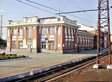
Synelnykowe ( Ukrainian Синельникове ; Russian Синельниково Sinelnikowo ) is a Ukrainian city with about 30,000 inhabitants (2015) and the administrative center of Synelnykowe district in the Dnipropetrovsk Oblast . The city is a railway junction.
geography
Synelnykove lies at Worona , a 28 km long tributary of the Dnieper in the geographical center of Raion 48 km southeast of Dnipro .
history
Synelnykowe was founded in the early nineteenth century as a village in the Pavlograd District in the Yekaterinoslav Province (today's Dnipro) by General I. Sinelnikowu, who also gave the place its name. Synelnykowe railway station was built in 1868/1869. The railway initiated the industrialization of the city. During the civil war , the city changed hands 14 times from one hand of an enemy to the other due to its location. In 1917 the Soviet power was established in Synelnykowe and in 1923 the place became the administrative center of the Rajon of the same name. From autumn 1941 to September 23, 1943, the city was occupied by the German Wehrmacht . In 1979 the city received the status of an independent city.
population

Sources: 1897: Encyclopedia of Ukraine 1923–1939, 1979–2015: 1959: 1970:
sons and daughters of the town
- Jurij Mjeschkow ( Юрій Олександрович Мєшков ; 1945–2019); Ukrainian politician in Crimea
Rajon
The Synelnykowe Rajon, administered from Synelnykowe, has an area of 1648 km² and a population of 39,048 inhabitants (2012). The population density is 24 inhabitants per km².
Web links
- Synelnykowe photo archive (Russian)
Individual evidence
- ↑ City history ( Memento of the original from May 22, 2013 in the Internet Archive ) Info: The archive link was inserted automatically and has not yet been checked. Please check the original and archive link according to the instructions and then remove this notice. on the official site of the city
- ↑ Demography of Ukrainian cities on pop-stat.mashke.org
- ↑ 1959 Census in the USSR on webgeo.ru
- ↑ 1970 census in the USSR on webgeo.ru


