
Tribehou
| Tribehou | ||
|---|---|---|
|
||
| region | Normandy | |
| Department | Some | |
| Arrondissement | Saint-Lô | |
| Canton | Pont-Hébert | |
| Community association | Baie du Cotentin | |
| Coordinates | 49 ° 13 ′ N , 1 ° 15 ′ W | |
| height | 0-24 m | |
| surface | 9.97 km 2 | |
| Residents | 533 (January 1, 2017) | |
| Population density | 53 inhabitants / km 2 | |
| Post Code | 50620 | |
| INSEE code | 50606 | |

Tribehou is a French municipality with 533 inhabitants (at January 1, 2017) in the Manche department in the region of Normandy . It belongs to the arrondissement of Saint-Lô , the canton of Pont-Hébert and the municipality of Baie du Cotentin .
geography
The Terrette flows into the Taute at the municipal boundary to the northeast Graignes-Mesnil-Angot . The other neighboring communities are
- Pont-Hébert with Le Hommet-d'Arthenay in the east,
- Remilly Les Marais with Les Champs-de-Losque and Remilly-sur-Lozon in the south,
- Marchésieux in the west,
- Saint-André-de-Bohon in the north-west.
Population development
| year | 1962 | 1968 | 1975 | 1982 | 1990 | 1999 | 2008 | 2015 |
|---|---|---|---|---|---|---|---|---|
| Residents | 668 | 638 | 587 | 528 | 499 | 519 | 503 | 533 |
Attractions
- Shelter for a barge
- Notre-Dame church

Shelter for a barge

Barge
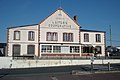
Milk center

Notre-Dame church


Web links
Commons : Tribehou - collection of images, videos and audio files