
Val di Sole
| Val di Sole | |
|---|---|
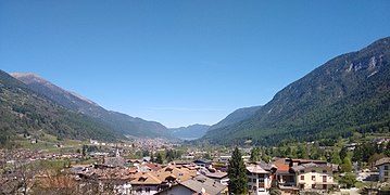
 The lower Val di Sole looking south-west |
|
| location | Trentino , Italy |
| Waters | Noce |
| Mountains | Ortler Alps , Adamello Presanella Alps , Brenta |
| Geographical location | 46 ° 18 ' N , 10 ° 48' E |
 |
|
| Type | Kerbtal |
| rock | siliciclastic sedimentary rocks , plutonites , biogenic sedimentary rocks |
| height | 540 to 3556 m slm |
| length | 37 km |
| climate | alpine to subalpine |
The Val di Sole (German Sulztal or Sulzberg , Sulzbergisch Val de Sol ) is located northwest of Trento in the Italian Alps. It forms with the Non Valley ( Italian Val di Non a dem) Adige Valley tapering valley system . The valley belongs administratively to the valley community Comunità della Valle di Sole of the Autonomous Province of Trento .
etymology
The Italian name Val di Sole probably has nothing to do with the sun. Since there are names that sound the same in North Tyrol , such as Sulztal, Sulzkogel, and perhaps also Silz , one could think of a common Celtic root from which the Italian sole and the German Sulz developed. A Thuls that could be associated with the tribe of the Tuliassi from the Tabula Clesiana could not be too far-fetched . Similarly speculative is the derivation from the Celtic water deity Sulis , who want to establish a connection with the mineral water springs in Val di Sole.
In Val di Sole and in the Non Valley, the dialects Solander (Sulzbergisch) and Nones (Nonsbergisch) are spoken, which are sometimes summarized as Anaunian - Ladin dialects.
geography
location
While the Val di Non forms a gently sloping, wide hollow to the south, which is in no way reminiscent of a valley, the Val di Sole is a typical erosion valley formed by the glaciers, which stretches in slightly suggested curves from Mostizzolo in a south-westerly direction to the Tonale Pass . The southern slopes, which culminate in the eastern section of the valley in the Brenta Dolomites and to the west of the Vermiglio valley in the Presanella and Adamello groups , are less structured than the northern slopes, which are cut through by long side valleys. This valley system is drained by the Noce . The geographical border in the east to the Val di Non is formed by the Barnès brook from the Bresimo valley, which flows into the Noce at Mostizzolo . In the west the border runs on the Tonale pass. The Val di Sole covers an area of 610 km².
Territorial structure of the settlements
Above Mostizzolo, on a 732 m high moraine plateau, lies the town of Cis , which can also be reached by road from the neighboring town of Livo . Cis is like a viewing platform from which you can see the Non Valley and the Val di Sole as far as Dimaro . Up the valley you come to several small villages (Bozzana, Bordiana, Tozzaga, San Giacomo, Cassana), which are collectively known as "all the chapels". The first village on the orographic left side of the valley is Cavizzana . Diagonally opposite is Caldes with the Caldes Castle and above the Samoclevo settlement with the Rocca di Samoclevo. Not very far away you come up the valley to the mouth of the Rabbi Valley, where Terzolas and the hamlets of Magràs and Arnago are located.
The Rabbi Valley is an elongated tributary valley oriented to the northwest with the main town of San Bernardo and a multitude of hamlets and individual farmsteads, whose scattered settlement character is reminiscent of the Bavarian settlement developments in neighboring South Tyrol . However, the Bavarians had nothing to do with the settlement of this area. The road leads into the valley as far as Alm Stablasol, from which the Rifugio Dorigoni at 2,496 m, the 3,349 m high Veneziaspitze and the Hintere Eggenspitze, which is 3436 m higher, can be reached.
The main town of the Val di Sole, Malè, is located above the mouth of the Rabbi Valley at 736 m above sea level . Almost united with Malè follows the village of Croviana , behind which the valley floor has developed into a long plain. The small towns of Monclassico and Presson are at the end of this level. Parallel to the valley floor, a slope terrace extends north to the entrance to the Pejo valley, on which the hamlets of Bolentina and Montes are located above Monclassico. At the place Dimaro at 766 m, which follows immediately, the Meledrio valley and an important traffic artery branch off south to Folgarida and over the Campo Carlo Magno Pass to Madonna di Campiglio . From here the slope of the southern slope is flatter, so that settlements and tourist infrastructures could develop on it, such as the small test-tube town of Costa Rotian from the 1960s.
At Dimaro the valley narrows and rises again slightly. The following places Deggiano, Mastellina, Almazzago, Mestriago and Piano form the municipality of Commezzadura with about 900 inhabitants. Further up the valley, at an altitude of 940 m, you reach the second largest town in the valley, Mezzana , from which a road branches off to another tourist retort settlement, namely to Marilleva at 1400 m, on the southern slope of Val di Sole. The “ ville dei monti ”, small hamlets or individual farms, are located on the steep, north-facing hillside terraces at an altitude of between 1300 and 1550 m . The largest of these is Termenago on the slopes above the village of Pellizzano . From Pellizzano a road leads over the southern slopes to the artificially dammed Lago di Fazzon , also called Lago dei Caprioli , a local recreation area on the scenic foothills of the Presanella . The next villages Cusiano, Ossana with the castle of the same name and Fucine are close together in the mouth of the Pejo Valley. The name Fucine, "the smelting furnaces", refers to the ore mining practiced earlier in the Pejo Valley.

From the slopes above Ossana you can see almost all the villages of the Pejo Valley, which, with the exception of the main town of Cogolo , are located on hillside terraces: the former mining settlement Comasine on the orographically right valley slope, Celentino with the fraction Strombiano on the slope opposite, Celledizzo further on in the valley inside and behind it Cogolo at 1160 m, where the famous Pejo mineral water is bottled. In the background you can see the white peaks of the Vioz , 3645 m, and the Palòn de la Mare , 3703 m. The valley forks behind Cogolo. A branch leads to Pejo Terme and then to the large Pian Palù reservoir . From Pejo Terme a junction leads to the 1576 m high hillside settlement Pejo. This makes it the highest place in Trentino. The other branch is the Val de la Mare, into which a road leads to the alp of the same name at 1900 m. In this valley there is the large Càres reservoir and numerous other lakes such as Lago Nero, Lago Lungo and Lago Marmotta . In the background of the valley you can reach the Martell valley in Vinschgau via the 3032 m high Fürkelescharte . Not far away is the highest mountain peak in Trentino, the 3769 m high Cevedale .
The section of Val di Sole that goes up to the Tonale Pass is also called the Vermiglio Valley. Starting from Ossana, the valley rises much more steeply and after a few kilometers you reach the villages of Cortina, Fraviano and Pizzano, which together form the municipality of Vermiglio . The terrain is relatively steep and you can not help wondering what the 1800 inhabitants used to live on. The small village of Stavel is idyllically located in the background of the valley, from which the road leads through spruce forests and past the old Strino fortress from the First World War into the pass area. The Tonale Pass is embedded in wide meadows at 1,883 m. It is an ancient transition between Val di Sole and Valcamonica or between Trentino and Lombardy .
geology
The Val di Sole is an interesting study area for geologists because several geologically different ceiling systems border one another. The valley was morphologically shaped by the presence of one of the most important fault lines in the Alps, namely the Periadriatic Seam , which stretches from the Valcamonica over the Tonale pass and, following the valley at Dimaro, meets the Judiciary line at an acute angle. From Dimaro it continues in an almost straight line via Malè via Proveis into Ultental . This line separates the so-called east alpine nappes from the south alpine .
The Eastern Alps are called the Tonale unit north of the Periadriatic Seam. This is a geological layer bounded by a local fault line, the Pejo Line, in the north, which consists of paragneiss and mica schists , in which biotite gneisses, granite gneisses, biotite-bearing pegmatite gneisses, two-mica quartzites , amphibolites and metamorphic olivine inclusions ( peridotites ) occur. The Tonale unit is said to have been sheared off the southern alpine nappes and pushed onto the Ortler-Campo Kristallin.
The Pejo line, which separates the Tonale unit in the north from the Ortler-Campo Kristallin, is an approximately 200 m wide fault line made of mylonitic and cataclastic deformed rocks, which extends north of the Tonale pass into the northern slopes of the Val di Sole and then north of the Cima Boai Cogolo in the Pejo Valley, past the Cima Grande, crosses the Rabbi Valley and continues towards Ultental. In the vicinity of Merano , it meets the periadriatic seam at an acute angle.
In the south we are dealing with two very different ceiling systems: to the west of the Meledrio valley, the Presanella and Adamello groups are formed by the Adamello batholites, tonalitic , granodioritic and granitic magma intrusions from the Tertiary that rest on quartz phyllite underlays. To the east of the Meledrio valley, limestone deposits from the Triassic period form the imposing peaks of the Brenta group.
Sightseeing and tourism
The south side of the Ortles-Cevedale group in the north, the Brenta Dolomites in the south and the Adamello-Presanella group in the southwest offer numerous hiking opportunities .
Steeped in history the located near the Tonale pass remnants of defensive forts are from the Alps War of World War I ( work Strino , work Presanella , works Mero and Tonale ).
The Val di Sole has hosted the mountain bike world championships several times since 2008 .
photos

The Noce in the middle of the valley with the Presanella in the background

Ossana with the castle and the entrance to the Val di Peio

The upper valley area with Vermiglio in the background
The middle valley area near Dimaro with a view towards Val di Non

.jpg)


literature
- Aldo Gorfer: Le valli del Trentino: guida geografico-storico-artistico-ambientale Volume 1 Trentino occidentale . Manfrini, Calliano 1975.
- Società degli Alpinisti Tridentini - Sezione del CAI - Commissione Sentieri: … per sentieri e luoghi. Sui monti del Trentino. 4 Cevedale, Maddalene, Monti d'Anaunia. Euroedit, Trento 2014, ISBN 978-88-86147-98-9 .
- Società degli Alpinisti Tridentini - Sezione del CAI - Commissione Sentieri: … per sentieri e luoghi. Sui monti del Trentino. 5 Presanella, Adamello, Dolomiti di Brenta. Euroedit, Trento 2017, ISBN 978-88-941381-3-9 .