
Wellerode
|
Wellerode
community Söhrewald
|
|
|---|---|
.png) |
|
| Height : | 277 (270-360) m above sea level NHN |
| Area : | 41.4 km² |
| Residents : | 2486 (1970) |
| Population density : | 60 inhabitants / km² |
| Incorporation : | 1st December 1970 |
| Postal code : | 34320 |
| Area code : | 05608 |
 Panorama from the iceberg over Wellerode
|
|
Wellerode is a district and the administrative seat of the municipality of Söhrewald in the northern Hessian district of Kassel .
geography
Geographical location
Wellerode is the northernmost district of Söhrewald. It is located in the wooded Söhre low mountain range (max. 643.4 m above sea level ) on the Fahrenbach . The village is about 270 to 360 m above sea level. NN north of the wooded ridge of Hambühlskopf ( 445.2 m above sea level ) in the west and Brandt ( 441.6 m above sea level ) in the east; south of this ridge is the Söhrewald district of Wattenbach .
State road 3236 ( Vollmarshausen - Wattenbach ) runs through Wellerode in a north-west-south-east direction . Almost three kilometers south-southwest of the village is the Stellbergsee , which partly belongs to the municipality of Söhrewald , and about 2.5 km southeast of the Franzosentriesch (approx. 490 m above sea level ) is the Söhrewald-Wellerode telecommunications tower . Around three kilometers east-north-east of the village, the construction of the Söhrewald motorway bridge , which has been started, stands lonely in the Söhre north above the Fahrenbach ; it is a relic of the construction of the Reichsautobahn Kassel - Eisenach , which was started at the time of National Socialism , today's federal motorway 44 in the section between Kassel and Herleshausen - Wommen , which is currently still in planning or is under construction in sections in the Losse valley further north is located.
Three quarters of Wellerode is enclosed by forest.
Waters
Fahr- / Wahlebach
The almost 15 km long Wahlebach rises in the municipality of Söhrewalder , which is called Fahrenbach in its source and upper reaches and is an almost 15 km long eastern tributary of the Fulda . It flows as the Fahrenbach through Söhrewald-Wellerode, Lohfelden-Vollmarshausen and - henceforth called Wahlebach - through Lohfelden-Ochshausen as well as through several districts of Kassel, in order to flow into the western Weser source river Fulda in this large city in the Untereustadt district .
Steinbach
The Steinbach in Wellerode rises on the east side of the Warpel, around 300 meters northeast of the Warpelhütte. Near the garden to the west of the former Söhrebahntrasse, the 1.40 m high, 0.76 m wide and 0.30 to 0.40 m thick atonement or stone cross was cleared, rediscovered and in April after the heavy downpour of July 11, 1980 Established in 1982 by the Söhrewald municipal administration near the Söhrebahntrasse (see there). The brook crosses under the Söhrebahntrasse, then the almost one kilometer long Steinbachstrasse, named after him, and then the Kasseler Strasse, in the passage of which Welleröder was able to find shelter during the Allied bombing raids on Kassel during the Second World War. The Steinbach then flows through the properties of the houses Kasseler Straße 15 a (from 1919 to 1995 restaurant Mendel, called Knochens , then Jantzen, later Göttlicher, currently (2007) branch in North Hesse Probat) and Kasseler Straße 17 (Langhuth), to then opposite the Untermühle (now: Untermühlenweg 6) to flow into the Fahrenbach.
The house Langhuth mentioned shows the symbol of the carpenters on its facade. A craftsman's symbol (carpenter) is only attached to one other house in Wellerode, without being an advertisement for a company: Am Rabbitberg 22 (cellar). The name Steinbach is widely used as a water and family name elsewhere. The water flow in the Steinbach in Wellerode is irregular, and it has often dried up. The lower Steinbach was used as a dirt road until around 1900 until the present Steinbachstrasse. In the absence of suitable roads and paths, the Fahrenbach from the old forester's house down was also used in this way. The dirt road meandered from the Steinbach estuary through "bones caves" to the forest on the iceberg. It is said that the carters announced themselves by cracking their whips when they drove into the ravine, because it was not possible to evade it.
Christmas pond
The Christteich, an artificial stagnant body of water, is located in the Söhre at about 340 m above sea level. NN , about one kilometer northwest of Stellbergsee (see above) between Söhrewald-Wellerode (district of Kassel) and Guxhagen-Wollrode (Schwalm-Eder district) in the Wellerode district.
The dam on the west side of the pond is built of earth, over the crown of which a forestry path leads, which is also from the 34 km long main hiking trail Fulda-Gelster-Weg of the Hessisch-Waldeckische Gebirgs- und Heimatverein from Guxhagen to Großalmerode (code: M 15 ) is crossed. The back of the dam has no structural security, which is why, after the catastrophic rainfall on July 11, 1980, the water flowed wildly over the dam because the drainage structure in the pond, known as the monk , had not existed for years. The experts feared dangerous reverse erosion, which could have led to the dike breaking, because of the resulting damage to the rear of the dam. For this reason, a partial evacuation of the underlying locations of Wollrode and Guxhagen was considered, but this was not necessary. The monk was restored to repair work.
The Christteich is drained via the Schwarzenbach, which flows through the Schnepfental, Wollrode and Guxhagen and flows into the Fulda on the right between the 150 m long weir of the former color mill in Guxhagen and the mill in Breitenau on the one hand and the Fulda bridge on the other .
The tradition that the Christmas pond was created by pioneers in 1905 is incorrect, because the repair of the Christmas borne pond at Wellerode was reported as early as 1734 , i.e. it already existed before this year, and the Christ pond was also in the level map 112 of the Electorate of Hesse from 1857 is registered. Another document from 1851 documents the leasing of the Christbrunnenteich . It remains to be seen whether the pond is actually used for teaching fishing purposes. But carp are used in it. According to the foresters, the pond's importance for the fishing industry is subordinate.
Not to be seen from the Christteich is the CVJM hut, around 200 m to the northeast, named after Pastor Magnus Riebeling from the Church of the Resurrection in Kassel , which was built by students of a Kassel Bible study group, which was built after the National Socialists came to power with the discreet help of the then forest master Betke der Prussian forest administration was handed over to prevent an access of the Hitler Youth after the Gleichschaltung . The land belongs to the state of Hesse , represented by the forest administration, the use of the hut was contractually left to the YMCA and his guests. The date August 31, 1932 carved into a beam is probably the date the hut was built. The "extension" of the hut is the oldest part, it served as a shelter for the forest workers.
According to the photos from 1927 stored in the archive of the German youth movement in Ludwigstein Castle, the Christmas pond was used by the Socialist Workers' Youth (SAJ) from Kassel as a bathing pond.
On the first day of Easter before sunrise, Dörnhagen virgins used to draw Easter water from the spring bubbling above the Christteich pond; that promised beauty as soon as the girls washed themselves with it at home. In the 1970s, young people from Dörnhagen went skiing on the Christteich Wiese.
Stellbergsee
In the western part of the Söhrewald municipality, at the interface to the Schwalm-Eder district, west below the Stellberg belonging to the Söhre, is the Stellbergsee , an approximately 1.4 hectare open-cast lake , i.e. an artificial still water that was created by mining and is now used as a bathing lake.

Roteba pond
The Rotebach or Holzlagerteich is around 1.5 km as the crow flies southeast of Wellerode's center. The 3,500 square meter pond with its 350 square meter sand trap, which is known as a duck pond, was created in the mid-1970s. The dam, 70 meters long, six meters high and six meters wide in its crown, was heaped across the valley. The dam crest of the Rodebachteich is 341 m above sea level. NN , that of the sand trap above at 344 m above sea level. NN . The pond is fed by the Rotebach, a tributary of the Fahrenbach, and a spring on the eastern slope of the facility and is officially used as a wood storage pond by the former Hessian Forestry Office Kaufungen. In the water law permit procedure, the Kaufungen Forestry Office explicitly highlighted the pond to the Lower Water Authority (= District Administrator of the Kassel District) as an increase in the recreational and leisure value for the Wellerode population. In fact, the pond is used as bathing water in summer and for ice skating in winter. The Rotebachteich can be reached on foot using the shortest possible route via Wattenbacher Straße and Tiefenrod or via Diebgrabenstraße to the little knick that branches off to the right (circular path 21) at the so-called Hänsel-und-Gretel-Stein .
Pond on Schornstrasse
Also in the mid-1970s, the 25 × 20 meter (= 500 square meter) pond was created below Schornstrasse on the former turning point of an access tunnel to the Karlsstollen, whose water for the sprinkling area to the northeast in front of the entrance of the old stone custom is needed by the forest administration for wood conservation becomes. The dam height is only one to two meters. The small basin is fed by the water, which up until then had flowed wildly, from the Karlsstollen and from two water sources in the immediate vicinity, which used to be used to obtain drinking water for Wellerode. The intake is around two liters per second.
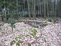
Iceberg pond
The iceberg pond is located 600 m northeast of the Eisberg forester's house on a forest road which, as an agricultural path, joins the road between Söhrewald-Wellerode and Lohfelden-Vollmarshausen at right angles at the level of the dog sports field. The pond was evidently created by the filling of the route over the water ditch (nameless body of water that flows into the Fahrenbach). According to the level map of the Electorate of Hesse, sheet 23, Oberkaufungen, from 1855, the cut is called "Breitegrund" between Hohenrod and Eis Berg . A barely visible drainage structure in the form of a concrete pipe with a diameter of 50 cm is located on the southern edge of the forest road (i.e. towards Wellerode), the route of which is also the dam of the iceberg pond, which is 285 m above sea level. NN lies. You can get to the iceberg pond from Wellerode, for example, via Bahnhofstrasse and Eisberg. Before you reach Haus Eisberg 3 (Köhler) on the edge of the forest, turn right and follow the secondary hiking trail 114 of the Hessisch-Waldeckischer Gebirgs- und Heimatverein (HWGHV) towards Vollmarshausen; this path is also the local hiking trail 6. After around 180 m you will reach the pond on the left.
history
Wellerode was first mentioned in a document in 1351 when the von Elben sold the place to the Kaufungen monastery. It was probably settled from Vollmarshausen in the 7th and 8th centuries. In the document mentioned, the brothers Thyle, Heimrad and Werner von Elben are ready to sell their feudal rights to Wellerode to the abbess Jutta von Katzenelnbogen (1310-1378) of the Kaufungen monastery , which is why the two parties sign a contract on June 2, 1351 , which is kept in the Hessian State Archives in Marburg.
After 1100 a man named Wenno appeared in Niederhessen. After 1200 was a Wenno master of the Livonian Order in Livonia with Riga . He was followed in office by Rudolf von Kassel and Volkmar von Naumburg. It is therefore likely that Wenno also came from Niederhessen. One of his lineage could have given Wellerode ( named Wynebolderode in the document of 1351 ) the name. Around 1950 a teacher had thought up a monk named Winibold as the founding figure of the place, which is scientifically untenable, but ineradicable.
At the time of the Napoleonic Kingdom of Westphalia , Wellerode belonged to the canton of Kaufungen .
In 1836, the close was brown coal - mine Stellberg (.. And Others today Stellbergsee ) developed. With the opening of the Söhrebahn on August 21, 1912, dismantling became profitable, as the coal being transported was now carried out smoothly. In addition, the rich basalt deposits could be mined. Wattenbach became a miners' village. The mining in the colliery stopped in 1967. The mining tradition is maintained to this day. The station building, which is now used as a village community center, reminds of the Söhrebahn, which was shut down on September 30, 1966, as well as the cycle and hiking path on the former railway line.
Wellerode used to be a farming village and gradually became a commuter settlement in the course of Kassel's industrialization after 1866. Most of the residents are gainfully employed in nearby Kassel.
On December 1, 1970 , the formerly independent municipalities of Eiterhagen, Wattenbach and Wellerode merged voluntarily to form the municipality of Söhrewald as part of the regional reform in Hesse .
Historical place names
In historical documents, the place is documented under the following place names (the year it was mentioned in brackets): Wynebolderode (1351); Wenewolderade (1382); Welderade (1469); Welderade (1469); Wellerodt (1585)
coat of arms
|
|
Blazon : "In a red lily ending, viersprossige Silver Stag bar." |
|
Founding of the coat of arms: This coat of arms varies the coat of arms of the Lords of Elben, who owned the place in the 14th century as a fief of the Kaufungen Abbey. The right to use a coat of arms was granted on January 8, 1951 by the Hessian State Ministry. |
Culture and sights
church


The church was built between 1901 and 1902 (the construction plans come from the secret building officer Hoßfeld, Berlin, and the royal building officer Janert, Kassel; the site manager was the builder Krebs, Kassel, construction was carried out by master mason Jakob Zinke, Wellerode) and on the third Sunday in Advent (December 14th ) Inaugurated in 1902. The construction costs amounted to 31,000 marks. Twelve pointed windows are built into the side walls; the gallery comprises the wide wall and the rear wall. The organ is also attached to the back wall.
In 1970, during renovation work under the altar a copper capsule found that a certificate and contemporary coins from Kurhessischer contained time. The current church stands on the site of an old chapel surrounded by a cemetery wall, the tower of which was partially integrated into the new building. To the west of the tower was a nave of only 7.5 m × 7 m, which "lacked any structural or art-historical value" and dates from between 1240 and 1420. The church can be visited on Saturdays and Sundays from 10:00 a.m. to 6:00 p.m.
After burials were no longer permitted in the church in the Landgraviate of Hessen-Kassel since 1726 , the corpses were buried in the enclosed churchyard . The graves were planted with fruit trees - a common grave design at that time . When burials were no longer permitted in the church yards from 1815 onwards, the cemetery in Wellerode was laid out in its current location in 1857.
Half-timbered houses , the oldest of which date from the 18th century, are grouped around the Welleröder church . The ensemble is, however, interrupted by a flat roof building built as a grocery store on Fahrenbachstrasse, which was built in place of smaller half-timbered houses that were demolished in 1974 (including Konsum von Wellerode).
Shepherd's house
(Wattenbacher Strasse 7)
If the no longer legible stone of the house Wattenbacher Straße 7 was correctly deciphered, it reads:
"GREBE IH HERWIG CH - R - HARD-UTHR ... MSTR AO MDCCXCI"
If you follow Max Beyer, it is the Welleröder Shepherd's House. Although the shepherd was entrusted with an important part of the peasant property - sheep, goats, pigs and cattle were handed over to the shepherd's care - he had to lead an extremely meager life and was also socially neglected. The transfigured pastoral idyll of the 16th and 17th centuries therefore had nothing in common with reality. Until well into the 19th century, the shepherds shared their hardship with the schoolmasters, who sometimes lived with them under one roof and often supplemented their poor income with a sideline, such as farming, linen weaving, copying, accounting, making music and daily wages. In 1353 a significant sheep farming was mentioned in Wellerode. As far as we know, the shepherd Clos Bernnig from Simmershausen in Wellerode was first mentioned by name in 1647. In 1919 herding was finally stopped in Wellerode because the goat breeding association could no longer find a shepherd. The last shepherd known by name was Jakob Fißler, known as the “fun man”.
Evangelical parish hall
(At the church 2)

Today's parish hall of the Protestant parish was built in 1719 and served as a school until after the Second World War. From 1919 to 1963 the mayor's office of Wellerode was also housed here. The planned demolition of this half-timbered house, which was to be replaced by a new building, was rejected in 1981 after an appeal by the State Office for Monument Preservation in order to protect the town center. The house was renovated, the entrance opposite the Zur Post restaurant was moved to its current location, with a third gable added again. In February 1983 the house was given its current purpose.
Old forester's house
(Fahrenbachstrasse 1)
The old forester's house was built as a half-timbered house in 1745 according to a bar inscription that can no longer be seen today. The right wing was added later and served the landgraves as a place to stay during court and driven hunts. The cars drove in at one gate and out the other. It has been privately owned since 1960.
Rifle house
(Fahrenbachstrasse 5)

The Thomassche Haus belongs to the ensemble of the "old forest house" (Fahrenbachstrasse 1). It used to be called "Schützenhaus". The other participants of the hunt lived in it.
Former house Neutze
(Fahrenbachstrasse 11)

This farmhouse is an example of a Central German single house , also known as the “Central German Ern-Tenn House”. The Ernhaus is a two-storey residential-stable-storage building, which is accessed at ground level in the middle of the eaves side. In the three-zone floor plan, in the middle zone there is the central Ern, the hallway with the stairs to the upper floor and the hearth in the rear part of the building. A side zone usually has a cellar. In it is the storage cellar, which is often accessible from the Ern, above which the living room is elevated. Above that are the bedrooms on the upper floor. The other side zone is the business section with the cowshed on the ground floor with an entrance from the outside and on the upper floor above the hayloft or storage. The entire roof served as a fruit soil . This house was built in the second half of the 18th century. The right part of the house was added later (sandstone plinth, leveling layer made of fired brick, then the threshold of the ground floor).
Eckhard's house
(Fahrenbachstrasse 15)


According to the house inscription, the house was built in 1625, during the Thirty Years' War. The inscription reads: "Building is a pleasure, I did not know that it cost so much."
Obermühle
(Fahrenbachstrasse 4)
The water required for operation was taken from the Fahrenbach and Rodebach. The work was driven by an overshot water wheel. A grinding mill was operated. Weir, operating ditch and mill systems no longer exist. The upper mill has not been in operation since around 1887.
Forsthaus Fahrenbach
(Fahrbachstrasse 28)
In 1909/10, the forester's house in Fahrenbach was built, the forest district of which was previously called "Wellerode East", while the Wellerode forestry department was then called "Wellerode West". At this forestry on the edge of the forest in Wellerode (today: Fahrenbachstrasse 28), there were still three healthy tulip trees (Liriodendron tulipifera) with a circumference of 1.80 m, 1.20 m and 1.10 m each around 1963/64 . They were considered natural monuments , were entered in the natural monuments books of the district of Kassel, which were revised in 1963/64, and were also listed in the natural monuments of the Meißner-Kaufung forest . According to the notification of the district committee of the district of Kassel on February 11, 2002, these three tulip trees were designated as natural monuments due to their rarity, uniqueness and beauty by ordinance on the safeguarding of natural monuments in the district of Kassel of August 10, 1971, whereby a tulip tree was already designated by ordinance of 2 June 1976 was deleted for reasons no longer known. During a site inspection on July 11, 1986, however, it was found that the two remaining tulip trees were dry, which is why they were also deleted as a natural monument in the same year. In February 2002 there was still a tulip tree that is green and blooming, but is gradually clearing from below. The second tulip tree was next door on the current small stand of a craft business, it was felled. The tulip tree belongs to the magnolia family with one species each in North America and China; the deciduous trees with four- to six-lobed leaves have tulip-like flowers and pine-cone-like upright fruit cones. The species Liriodendron tulipifera, which comes from eastern North America, has yellow-green flowers and is planted as a park tree in Central Europe; However, it is far from reaching the same height as in its home, where it is one of the very tall forest trees. "Tulip tree" is u. a. also called the magnolia .
Hansel-and-Gretel-Stein
(At the kink)
In 1949 an old woman from Welleröder told a primary school teacher - on the occasion of the upcoming 600th anniversary of the village in 1951 - a story about a stone in the Stellberggraben. A pair of siblings quarreled so violently that they killed each other. Teacher added additional details to the old woman's lore. He transferred the figures of the siblings to a quartzite boulder in the Rodebach Valley, with its erasures that could be interpreted. In addition, he gave the stone, apparently for tourist reasons, the previously uncommon name “Hansel and Gretel stone”. The name found its way into the topographic map 4723 Oberkaufungen (1: 25,000) of the Hessian Land Surveying Office, editions 1979 and 1986, whereas the discovery of the atonement cross from around 1500 in 1980, which was in 1982 at the former, was classified as sensational by the experts Söhrebahntrasse was erected again, this appreciation has not happened. Until 1980 the quartzite boulder "Hansel-und-Gretel-Stein" was still lying in a meadow at the edge of the forest and was lovingly surrounded by a small demarcation of birch branches; then it fell apart - and because the small complex was no longer maintained, grass soon overgrown almost the entire stone.
Söhrekampfbahn
(Valley of the Fahrenbach)
On August 28, 1955, the Söhrekampfbahn was opened. It had been built in manual and tensioning services by the Wellerödern after a two-year construction period. 25. At that time every resident had to work hours; even the school children helped by collecting stones and handouts. The day before, the choir association 1871/92 in TSG 1896 Wellerode performed the drama opera Preziosa by C. M. Weber here. After the Freischütz in 1958, Carmen followed . In 1965 Der Verschwender and 1967 Der Freischütz were listed. The open-air theater has long since been given up.
According to Fritz Most's plans, TSG Wellerode began building the clubhouse on the edge of the Söhrekampfbahn in 1896, with a floor area of 94.27 m² including basement and ground floor. There is a common room in the basement. The clubhouse was officially opened on Saturday, July 29, 2006.
Old sports field, the brawn
(between Untere Hamböhlstraße, Schwarzebachweg and Schulstraße)
The acquisition of the land in the Sülze corridor for the construction of a sports field was decided by the municipal council in March 1929. Some of the properties were bought by Heinrich Herwig in the same year or acquired by swapping property with other owners. Jakob Nolte from Vollmarshausen carried out the work on the sports field. In 1931 the sports field (Sülze) was fenced in with stakes instead of wire by the Langhuth company in Wellerode. In 1934, the mayor decided: In order to ensure the correct approach route for the sports field, a decent, massive staircase must be built. After the invasion of the Americans in April 1945, the sports field was temporarily used by the occupying army. Through the mediation of the master baker Hans Werner, who spoke English, the US Army later opened the sports field ( Sülze ) for play again. The footballers of TSG 1896 Wellerode built a wooden tool shed on the foundation of the fire hose drying tower, which was removed in 1980.
Village community center
(To train station 1)

The building was erected in 1912 as the Wellerode-Wald station of the Söhrebahn. At the same time, a Söhrebahn canteen was operated in the house. The landlord Daniel Werner was known locally by the nickname Amsel because he used the phrase “Go home! Outside the blackbirds are already whistling, “which is said to have warned you to leave. The last passenger train ran on September 30, 1966. The building was acquired by the community in 1970 and, after renovation work, serves as a village community center. The original entrance to the street Zum Bahnhof was relocated to Zechenweg in 1991 after a renovation.
Tichhans house
(Wattenbacher Strasse 28)
This house is an Ern-Tenn house that was built in the second half of the 18th century. However, the house is not yet entered on page 23 of the level map of the Electorate of Hesse from 1859. Either the house originally stood in a different location, was demolished there after 1859 and then rebuilt at its current location, or it was built after 1859 by the client in the old style. The name "Tichhäns" ( dialect for Teich-Hans) comes from the pond once above the house, which is drawn as a rectangular pond on sheet 23 of the level map of the Electorate of Hesse from 1859 and is located on the property of today's Kassel office Sparkasse was located (Teichwiesenweg 1). He is also the namesake for the Teichwiesenweg. We do not know when the pond was created. It was obviously fed by the Eckebach and was of considerable size, namely about 55 m long and 15 m wide (825 m²). The “Deutscher Kaiser” inn in the “German House”, Wattenbacher Strasse 21, which was operated from around 1875 to 1900 and was demolished in 1970, got its water from this pond by means of wooden pipes. Since the pond is no longer entered in the topographic map from 1907, it is likely to have been filled between 1900 and 1905 - possibly after the construction of the aqueduct in 1901.
Ahlegrebe's house
(Wattenbacher Strasse 22)
The Ahlegrebesche house was supposedly built in 1734 by Justus Leuhardt.
German house
(Wattenbacher Strasse 21)
At this point stood the “German House”, which got its name from the “Deutscher Kaiser” restaurant mentioned in 1875 and probably operated until 1900. The "German House" was demolished in February 1970 as part of the extension of the 3236 state road.
Fire station
(Schulstrasse 4)

In August 1973 the fire station, financed with DM 160,000, was handed over to the volunteer fire brigade .
school
(Schulstrasse 6)


The first documented teacher in Wellerode was called Peter Roll. He had started his service on September 29, 1644 as a "sacrifice man" (= sexton). The current parish hall of the Protestant parish at An der Kirche 2 served as the school from 1719 until after the Second World War . In addition, a new schoolhouse for one class and a teacher's service apartment with a farm building and stables was built in 1885 at Schulstrasse 6. A new school building was built on the foundations of this building in 1926/27, the aforementioned farm buildings were demolished in 1955/56, and a further school building with three classes, a lecture hall and an administration and teachers' room as well as a school kitchen was added to their front building in 1956 Handicraft room was housed to give way. From January 15, 1948 to 1956, a barrack built on Küsterwiesen in 1944 with two classrooms served as a “school barrack”, in which the “school meals” donated by the Quakers from September 22, 1947 to June 30, 1950 also took place.
Local government
From 1919 to 1963, the mayor's office was located in what is today the parish hall of the Protestant parish at An der Kirche 2 . The new building for the municipal administration was moved into after its completion in 1963. In addition to the municipal administration, the house also temporarily accommodated four apartments. In the basement there was also a freezer until autumn 1996. The house has now undergone several renovations, for example in 1983 and 2000.
Old gym / multipurpose hall
(To Bornhof 2)
The 376 square meter gymnasium (today: multi-purpose hall) was opened in September 1964 after the gymnasts of TSG 1896 Wellerode had been very successful, especially in the 1950s, and they lacked a suitable training facility. The gymnasium was built by the then still independent community of Wellerode. In addition to the primary school and gymnasts, the hall was also used from time to time by the other departments of TSG 1896 Wellerode. Since the neighboring sports hall was put into operation in 1993, it has served as a practice hall for sports as well as the wind orchestra and the choir association in 1871/96. It now belongs to the municipality of Söhrewald.
New sports hall
(To Bornhof 4)
After a year of construction, the new sports hall was opened on July 17, 1993. The construction costs were 2.5 million DM, of which the municipality of Söhrewald paid 1.0 million DM. It is used by the primary school and clubs. The owner of the sports hall is the district of Kassel. In 1995, stage elements were purchased for around DM 11,000, which can also be used in the old gym / multi-purpose hall.
kindergarten
(Schulstrasse 12)
The kindergarten (originally for 75 children) established by the municipality of Söhrewald was inaugurated in July 1975. The original flat roof was replaced by a gable in 1987. The building was expanded in 1995 and now has space for 100 children. On October 21, another kindergarten, “Die kleine Waldwichte”, was set up in Berndtswiesen 2.
Welleröder atonement cross
(on the former Söhrebahntrasse)

Experts estimate that the Welleröder atonement cross was erected around 1500. The corridor Steinkreuzer Feld was named after him. The simple incision on the front side shows a person who is probably holding up a cross or a cross-like object, a representation of a human figure on stone that is unique in Hessen. During the time this stone cross was erected, atonement for manslaughter was a private matter. In order to master the blood revenge, the church had offered atonement contracts, in which the murderer or manslaughter among other things
- Setting up an atonement cross,
- Paying a fine and / or
- Pilgrimage
could be committed.
The latter had the unfortunate consequence that crime increased during the pilgrimages, which were still quite popular at the time. It was not until the Codex Criminalis Carolina of 1553 that the Church's atonement was replaced by secular jurisdiction. It is possible that our Welleröder sinner made a pilgrimage to Rome, Jerusalem, Santiago de Compostela or another place of pilgrimage known at the time. Because of the unjoined shape of the cross and the simple incision, it is assumed that this cross was not made by any stonemason.
The atonement cross was cleared after a downpour on July 11, 1980 in Steinbach , recovered in April 1982 and set up in September of the same year on the former Söhrebahntrasse above the Steinbach valley. The explanatory board provided in 1984 at Willi Jantzen's suggestion has long since fallen victim to the rage of destruction again. In all likelihood, the fairy tale printed here about the two siblings who inflicted fatal wounds on each other during a quarrel can be associated with this stone cross. The so-called Hänsel-und-Gretel-Stein in Rodebach Valley, which became a tourist attraction in the 1950s, is a quartzite stone with erasable erasures, which, since the stone cross was considered lost, the narrative tradition was passed on.
Forsthaus Eisberg

The Eisberg forester's lodge was built in 1940. The hope that was cherished around 1950 that a chief forester's office would be set up again has not been fulfilled. The painted bar inscription reads:
“The master adds the oak wood
to the home in the Hesse region,
by God's providence the building of
the great empire comes about.
Once this house will fall,
pass away, those inside enjoyed happiness and plagues,
but the Fuehrer's work and fame
loom into the distant days. "
After the time of National Socialism, the word "Führer" was changed to "Schöpfers".
Gendarmerie farmstead
(Goethestrasse 1)

On October 1, 1913, the gendarmerie location was moved from Vollmarshausen to Wellerode. The officers lived in private apartments until the construction of the gendarmerie farm in 1931. Around 1952/53 it was taken over by the forest administration as a rental farm and sold privately in 1990.
Under mill
(Untermühlenweg 6)
The water required for operation was taken from the Fahrenbach and Schwarzebach. The work was driven by an overshot water wheel with a diameter of 5.00 m and a width of 0.60 m. The difference in height is 5.20 m and the usable power is approximately three HP (2.208 kW ). A grinding mill was operated. At the discharge point there was a weir made of rubble stones. The precipitation area for the plant was around eleven square kilometers. The operating trench was 250 m long and the underside was 110 m long. The weir was removed when the Fahrenbach was expanded at the end of the 1970s, and the operating ditch has been completely filled. The lower mill has not been in operation since 1916. The mill building burned down in 1928.
graveyard

As bone finds have confirmed, in earlier times the dead were buried in the old chapel, which was on the site of the present church until 1901. Only when burials were no longer possible in the churches and they had been forbidden in the Landgraviate of Hessen-Kassel since 1726, the dead were buried until 1857 in the former cemetery that surrounded the old chapel and was enclosed by a wall. This old cemetery was leveled when the church was rebuilt in 1901/02. The dead have been buried in this cemetery since 1858. The cemetery hall was inaugurated in 1953. With its construction, the local charter came into force, according to which the deceased were no longer allowed to remain in the mourning house until the burial, but had to be brought to the cemetery hall. It was expanded in June 1973 and since then has also served as a memorial for the victims of both world wars. The memorial stone erected in front of the church in 1920 for the fallen of the First World War was removed at this time. In 1983, the Deutsche Bundespost laid a line between the church and the cemetery chapel, so that since then the bell has not been rung on “suspicion”, but timely when the mourners set off to the grave. The new cemetery hall was inaugurated on November 6, 1988, and private donations of DM 33,000 contributed to its construction.
Old highway bridge
About 2.9 km east-north-east of Wellerode or about 700 m northeast of the Fahrenbachsteiche located on the Fahrenbach stream , there is a lonely motorway bridge in the forest of the Söhre , which results from the construction of the Reichsautobahn Kassel– Eisenach (route 78), which began in the time of National Socialism . It would have become part of today's Federal Highway 44 . But because the route of this motorway section, which is still being planned or built - a piece near Hessisch Lichtenau has already been opened - in future not through the Söhre and the area of today's municipality of Söhrewald, but to the north in the corridor of today's B 7 through the Losse - and Wehretal , the bridge that has been started will only remain a monument. The National Socialists integrated an aircraft and engine production hall into this tunnel, which was planned as a forest path underpass.
After Hitler came to power , the plans for the construction of the motorway from the 1920s were revived. For example, the Kassel – Eisenach autobahn was planned to cross what is now the Söhrewald community. From April to October 1939, the route was cleared and excavated and at the same time the local forest path underpass began, which was partially completed in spring 1940. This was also the time when work on this motorway had to be stopped because forced laborers there for the armaments industry of the Second World War were withdrawn.

Old motorway bridge in the Söhrewald area (2007), in which a Junkers factory was located during World War II ( location )

Front view of the motorway bridge


In the autobahn bridge, which was not completed in 1941, Junkers Flugzeug- und Motorenwerke built a production hall of around 200 square meters in the bridge tube for the engine construction plant in Kassel and a usable area of around 250 square meters with corresponding roofs on both sides. The support points of the roof structure were the upper edge of the bridge tube and a wall each about 18 m apart. In addition to a number of workbenches, a number of lathes and drill presses were installed there. In addition to Soviet prisoners of war, Poles, Czechs and Lithuanians, German workers were also deployed, a total of around 50 people. Every day at 5 p.m. food for the employees there was brought in by horse and cart from the kitchen of the Junkers (forced labor) camp in Wellerode-Wald, which was set up at the end of winter 1943/44. The entire area was fenced off and guarded by plainclothes guards. This production continued until the invasion of the US Army on April 1, 1945. The rumor occasionally heard in Wellerode that the Allies searched for the workshop in the motorway bridge during the war using aerial reconnaissance aircraft, but did not find it, turns out to be false, as the British have aerial photos of the bridge structure.
In the decades after the end of the war there had been repeated discussions about continuing to build the A 44 to relieve traffic on federal highways 7 and 27 , and after the reunification of Germany , plans gradually began to close the gap between Kassel ( A 7 ) and Herleshausen ( A 4 ) . This closure would also ensure the trunk road link between the English Channel and Poland. The dispute between the planners and the federal government about the highway extension continues.
Telecommunication tower Söhrewald-Wellerode

The previously 148 m high " Söhrewald-Wellerode telecommunications tower " is located in the Wellerode district between the Franzosentriesch nature park on Landesstraße 3460 ( Wattenbach - St. Ottilien ) (approx. 462 m above sea level ; instead of the 442 m height indicated on the sign there ) and the north-east elevation Franzosentriesch (approx. 490 m above sea level ) at about 475 m above sea level. NN in the forest village 39. It was built in 1962/1963. Operations were stopped in 1984, resumed in 1991 for the private broadcasters RTLplus and Sat1 , and stopped again in 2006. The upper part of the tower was demolished in 2006.
Deserted chapels in the vicinity of Wellerode
Since the 19th century, Stückkirchen has been the name of the fallen church about three kilometers southeast of Wellerode, which is located in a small clearing in a west-east direction on an elevation about 25 × 8 m in size and about 1.50 m high. It was first erroneously referred to as St. Juliane by G. Landau in 1858 or 1842 , which can still be read on various maps today. In the tradition, Stückkirchen is never referred to as the Julian Chapel, but always only as the Hessenhain Church. You can reach Stückkirchen either from Wellerode via hiking trails 11 and 12 or from the parking lot at the television tower via Franzosentriesch in the direction of Heubruchwiesen.
The St. Juliane Chapel is located between Wattenbach, Quentel and St. Ottilien on St. Ottilienberg. It is mentioned in the Kaufunger Salbuch in 1519. Later her name becomes St. Ottilien . This chapel is first mentioned in 1304.
There is another deserted chapel in the vicinity of Wellerode at about 450 m above sea level. NN on the plateau between the Stellberg and the Schorn on the Stellberger Tries west of the meadow on the long-distance hiking trail X 3 (Spangenberger path).
View over the ruin of Stückkirchen

Remains of the wall from the Stückkirchen ruins


Warpelhütte
About three kilometers southwest of Wellerode and about one kilometer north of the Christteich is the Fulda-Gelster-Weg, which is often used by hikers on the occasion of its tenth anniversary by the Hessisch-Waldeckischer Gebirgs- und Heimatverein - Zweigverein Guntershausen Guxhagen e. V. - built refuge that was handed over to its destination on September 22, 1968. The timber was made available by the forest administration at the time. The hut is located at about 387 m above sea level. NN . It is named after the basalt massif called Warpel ( 439 m above sea level ) to the northwest of it .
Sons and daughters of Wellerode
- Bernhard Sturtzkopf (1900–1972), architect
- Elfi Jantzen (* 1954), politician
literature
- Max Beyer: Wellerode - Heimatland - A compilation on the occasion of the 600th anniversary of Wellerode 1351–1951 , Wellerode 1951.
- Friedrich Hartau: Heart of Homeland - Festival for the 600th anniversary of the community of Wellerode near Kassel, Wellerode July 1951.
- Eduard Brauns: The Lobesrode desert and the ruin of Stückkirchen in the Söhre , in: Hessischer Gebirgsbote, Vol. 82 (1981), 4, p. 4; also in: Heimatverein Dorothea Viehmann [Kassel]: Heimatbrief ISSN 0936-854X , Vol. 24 (1980) 4, p. 135
- Working group Söhrewaldbuch (ed.): With contributions by 30 foreign and local authors as well as photos and reproductions by Günter Heß et al. Söhrewald 1984 , Söhrewald 1983 (out of print).
- Heinrich Riebeling: Two atonement finds in the district of Kassel (near Söhrewald-Wellerode and Grebenstein), in: Hessischer Gebirgsbote 1982, pp. 133-134.
- Dietmar Peter: The atonement cross in the Steinbach near Wellerode , in: Yearbook of the district of Kassel 1983, pp. 115–116.
- Th. Hans-Dieter Scholz: Der Christteich (near Wellerode), in: Yearbook of the district of Kassel 1984, p. 105.
- Astrid Wehrle: You can argue about taste - Eating & Drinking in Söhrewald , Empirical Planning Research Working Group, GhK Kassel, December 1985.
- Dietmar Peter: Diary of the country mail carrier Ludwig Werner in Wellerode , in: Hessische Postgeschichte (1987) 32, pp. 21-26.
- Walter Ulwer: From Eintracht 1871 to the choir association 1871/96 in TSG 1896 Wellerode - history and activities of the oldest association in Söhrewald , Wellerode October 1987.
- Dietmar Peter: The Post in Wellerode , in: Hessische Postgeschichte, (1988) 33, pp. 74-78.
- Werner Pausch: Report on the convent in Wellerode on February 28/29 , 1988, Söhrewald-Wellerode February 1988.
- Anna Riedl: Söhrewald want to fight for drinking water - planned lignite mining endangers supply - even naturalists warn , in: Frankfurter Rundschau, Frankfurt am Main, S edition, Vol. 44 (1988), 191, from August 18, 1988, p. 18th
- Th. Hans-Dieter Scholz: Söhrewald from A – Z. , Volume 1: A – F, Söhrewald 1990.
- Günter Boller: Söhre - die endangered forest landscape , in: Yearbook of the district of Kassel (1992), pp. 141–144.
- Th. Hans-Dieter Scholz: Söhrewald from A – Z. , Volume 2: G – Q, Söhrewald 1993.
- Th. Hans-Dieter Scholz: Söhrewald from A – Z. , Volume 3: R – Z, Söhrewald 1995.
- Dietmar Peter: Witnesses and Testimonials - Contributions to the Past of Wellerode , Söhrewald 1995.
- Th. Hans-Dieter Scholz: Chronica of Johann Caspar Jacob from Wellerode 1740–1789 , Söhrewald 1997.
- Ute Döbel: Sources in the southeast of the district of Kassel , in: Yearbook of the district of Kassel 1997, pp. 52–56.
- Konrad Mendel with the assistance of Dietmar Peter: Report on the demonstration of a Tiger tank in front of Adolf Hitler in the Wolfsschanze, in: Wolfschanze - Memories of Contemporary Witnesses, published by Jerzy Szynkowski Kengraf-Verlag, Ketrzyn, ul.Dworcowa 6, Rastenburg / Ketrzyn 1997 , Pp. 46-48.
- Municipality of Söhrewald (ed.): With contributions by Klaus Sippel (Lohfelden), Th. Hans-Dieter Scholz, Helge Nödler, Dietmar Peter, 650 years of Wellerode 1351–2001 , Söhrewald 2001.
- Pupils in grades 4a, 4b and 4c of the Söhrewald primary school: School before , Söhrewald August 2001.
- Dankwart Pankow-Horstmann: 7 Söhre-Balladen , Verl. Wortwechsel, Kaufungen 2001.
- The church council of the Protestant parish Wellerode (ed.): House of God and Human Work - 100 Years of Wellerode Church. With contributions by Werner Pausch, Dietmar Peter and Hans-Ulrich Werner, 167 pages + CD-ROM, Perkunas-Verlag, Söhrewald 2002. ISBN 3-9808444-0-4
- Th. Hans-Dieter Scholz: Village in the Söhre - everyday life in the Lower Hessian community of Wellerode between 1898 and 1951. Söhrewald 2003.
- Claus-Marco Dieterich: Memorial of uselessness: the lonely motorway bridge in the Söhrewald , in: Hessen Forget - Places of Remembrance, 2003.
- Rolf Nagel: Kassel Lilienthalstrasse 150. History of an industrial site 1940–1950 (= Junkers Flugzeug- und -Motorenwerke AG, engine construction plant Kassel). Wolfhagen 2007. Wellerode is mentioned on pp. 17, 24, 44 and 71–72.
- Frank Laska, "Ferdinand Müller's glass painting in Quedlinburg from its founding until 1914", Letterado Verlag, Quedlinburg 2009, ISBN 978-3-938579-20-6 , pp. 191–192 and attachment on CD: Catalog raisonné for sacred buildings in Inland, Part A 1 (chronological) No. 733 and Part A 2 (topographical) No. 1903.
- Th. Hans-Dieter Scholz: A look back at Wellerode 2001-2010. Söhrewald 2011 (out of print).
Festschriften
- Festschrift for the 600th anniversary 1351 Wellerode 1951.
- 40 years of the Wellerode Volunteer Fire Brigade combined with the District Fire Brigade Association Day on May 31 and June 1, 1976.
- 80 years of the Wellerode volunteer fire brigade, 24. – 26. August 1984.
- 100 years of TSG Wellerode 1896–1996.
- 100 years of choir singing, 75 years of gymnastics in Wellerode, 10. – 2. July 1971.
- Gauturnfest 1976/80 years of gymnastics in Wellerode, 9. – 11. June 1976.
- 80th anniversary of the gymnastics department in TSG 1896 Wellerode, June 12th and 13th 1976 Gauturnfest Turngau Nordhessen - Söhrekampfbahn.
- 90 years gymnastics department in TSG 1896 Wellerode 5. – 7. September 1986 - invitation.
- Big football tournament and selection game for the senior men’s team, Saturday, June 11, 1971, start: 5 p.m. City selection Kassel - Söhreauswahl, prelude: youth game, start: 4 p.m.; Sunday, June 12, 1977, start: 12 noon, old men’s tournament.
- Football Association, TSG - Wellerode, 1990/91 season.
- 1919–1994 75 years of football in Wellerode.
- 25 years of the minstrel and music parade in Wellerode, 7. – 9. September 1979.
- 25 years of sport shooters TSG 1896 Wellerode from 3rd to 5th September 2004.
- 100 years of SPD Wellerode, 26.-28. May 2006.
Web links
- The place on the website of the municipality of Söhrewald
- Wellerode, Kassel district. Historical local dictionary for Hessen. In: Landesgeschichtliches Informationssystem Hessen (LAGIS).
- Literature on Wellerode in the Hessian Bibliography
Individual evidence
- ↑ a b c d Wellerode, Kassel district. Historical local dictionary for Hessen. (As of July 29, 2015). In: Landesgeschichtliches Informationssystem Hessen (LAGIS).
- ↑ StAM, Sig. 14641
- ↑ Th. Hans-Dieter Scholz “Here everything revolves around water - The Christteich”, in: Söhrewald 1984, pp. 318-320; "Der Christteich" in: Jahrbuch Landkreis Kassel '84, p. 106; "Söhrewald von A – Z", Söhrewald 1990, Volume 1, p. 76, and "Water and Windmills in the Schwalm-Eder District - An Inventory", published by the Kassel Regional Council, Kassel 1996, p. 72.
- ↑ Th. Hans-Dieter Scholz: Everything revolves around water here - Der Rotebachteich, in: Söhrewald 1984, p. 314; Söhrewald from A – Z , Volume 3, Söhrewald 1995, p. 10;
- ↑ Th. Hans-Dieter Scholz "Here everything revolves around water - The pond on Schornstrasse", in: Söhrewald 1984, p. 314.
- ↑ Merger of the communities Eiterhagen, Wattenbach and Wellerode in the Kassel district to form the new community "Söhrewald" on November 12, 1970 . In: The Hessian Minister of the Interior (ed.): State Gazette for the State of Hesse. 1970 No. 48 , p. 2252 , item 2243 ( online at the information system of the Hessian state parliament [PDF; 5.6 MB ]).
- ^ Federal Statistical Office (ed.): Historical municipality directory for the Federal Republic of Germany. Name, border and key number changes in municipalities, counties and administrative districts from May 27, 1970 to December 31, 1982 . W. Kohlhammer, Stuttgart / Mainz 1983, ISBN 3-17-003263-1 , p. 400 .
- ^ Karl Ernst Demandt and Otto Renkhoff : Hessisches Ortswappenbuch C. A. Starke Verlag, Glücksburg / Ostsee 1956, p. 60.
- ↑ Granting the right to use a coat of arms to the community of Wellerode, district of Kassel, Reg.-Bez. Kassel from January 8, 1951 . In: The Hessian Minister of the Interior (ed.): State Gazette for the State of Hesse. 1951 no. 4 , p. 26 , point 51 ( online at the information system of the Hessian state parliament [PDF; 4.2 MB ]).
- ^ "The architectural and art monuments in the administrative district of Cassel", Volume IV, District of Cassel-Land, pages 214, 215, and atlas plate 116
- ↑ Max Beyer: Die Kirche , in: Wellerode - Heimatland, Wellerode 1951, p. 9.
- ↑ Söhrewaldbuch work group: Söhrewald 1984. , Söhrewald 1983. pp. 180–201.
- ↑ Th. Hans-Dieter Scholz: Söhrewald von A – Z , Volume 2, pp. 85–109.
- ↑ Th. Hans-Dieter Scholz: Village in the Söhre - everyday life in the Lower Hessian community of Wellerode between 1898 and 1951. Söhrewald 2003. pp. 164–180.
- ↑ Editor: Parish Council of the Protestant Parish Wellerode: House of God and Human Work - 100 Years of Wellerode Church. , With contributions by Werner Pausch, Dietmar Peter and Hans-Ulrich Werner, Perkunas-Verlag, Söhrewald 2002.
- ↑ Th. Hans-Dieter Scholz Welleröder Annalen from 1351 to 2000 in: 650 Years Wellerode 1351-2001. , P. 63.
- ↑ Table 11: Natural monuments, in the "Landscape Framework Plan for the Meißner-Kaufunger Wald Nature Park" by Gottfried HEINTZE, under serial no. 79, p. 50
- ↑ Communication from the district committee of the Kassel district of February 11, 2002 - K 320 - Lower Nature Conservation Authority - 149-53.1 - GE
- ↑ Th. Hans-Dieter Scholz: Village in the Söhre. Söhrewald 2003, p. 284
- ^ Stone cross in Wallrode
- ↑ Werner Döhling: Road construction in the Söhrewald , in Söhrewald 1984, Söhrewald 1983, pp. 137-140.
- ↑ Th. Hans-Dieter Scholz: Söhrewald from A – Z. Volume 1, pp. 35-39.
- ^ Dorf in der Söhre - Everyday life in the Lower Hessian community of Wellerode between 1898 and 1951 , pp. 32–34.
- ^ Rolf Nagel: Kassel Lilienthalstrasse 150. History of an industrial location. 140-1950. Wolfhagen 2007, pages 71-72.
- ↑ Map services of the Federal Agency for Nature Conservation ( information )
- ^ "Söhrewald 1984", p. 146 and "650 years Wellerode 1351-2001", p. 155 (aerial photo of the television tower), Th. Hans-Dieter Scholz: "Söhrewald von A – Z", volume 1, p. 96.
- ↑ Hans-Ulrich WERNERs “From the farming village to the commuter settlement. A contribution to the building and population history of Wellerode ”, in: Söhrewald 1984, pp. 225–267
- ^ Klaus Sippel: 650 years of Wellerode 1351-2001. Desolation around Wellerode - Archaeological traces of disappeared villages and churches as a source of the settlement history of the Söhre in the Middle Ages, pp. 1–16
- ^ Bruno Mende: North Hesse and adjacent areas. Bernecker Verlag, Melsungen 1991, ISBN 3-87064-082-0 . and http://www.wandersleut.de/start.htm ( page no longer available , search in web archives ) Info: The link was automatically marked as defective. Please check the link according to the instructions and then remove this notice. (Accessed April 2, 2008)