Šemnice
| Šemnice | ||||
|---|---|---|---|---|
|
||||
| Basic data | ||||
| State : |
|
|||
| Region : | Karlovarský kraj | |||
| District : | Karlovy Vary | |||
| Area : | 1321.2905 ha | |||
| Geographic location : | 50 ° 14 ' N , 12 ° 59' E | |||
| Height: | 428 m nm | |||
| Residents : | 673 (Jan. 1, 2019) | |||
| Postal code : | 362 72 | |||
| License plate : | K (old: KR, KV) | |||
| traffic | ||||
| Street: | Kyselka - Andělská Hora | |||
| structure | ||||
| Status: | local community | |||
| Districts: | 4th | |||
| administration | ||||
| Mayor : | Vladislav Tůma (as of 2007) | |||
| Address: | Dubina 25 362 72 Kyselka |
|||
| Municipality number: | 555614 | |||
| Website : | www.semnice.cz | |||
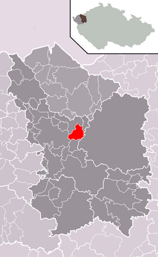
| Location of Šemnice in the Karlovy Vary district | ||||

|
||||
Šemnice (German Schömitz ) is a municipality in the Czech Republic . It is located ten kilometers northeast of the city of Karlovy Vary ( Karlsbad ).
geography
Šemnice is located in the Eger valley on the right side of the river. The Duppauer Gebirge rises to the south of the village and is largely a restricted area as a Hradiště military training area. Šemnice is protected in all directions by wooded ridges. In the north the municipality borders on Kyselka .
history
The first mention of the village took place in 1239. According to the local chronicle, the village should have been founded in 1203, but this is not documented in terms of sources.
After the Munich Agreement , the place was added to the German Empire and belonged to the Karlsbad district until 1945 .
Community structure
The municipality of Šemnice consists of the districts Dubina ( Eichenhof ), Pulovice ( Pullwitz ), Sedlečko ( Satteles ) and Šemnice ( Schömitz ). Basic settlement units are Dubina, Pulovice, Sedlečko, Šemnice and U mostu ( Egerbrück ). The locations Beraní Dvůr ( Mutton farm ) and Muzikov also belong to Šemnice .
The municipality is divided into the cadastral districts Pulovice, Sedlečko u Karlových Var and Šemnice.
Attractions
Šemnická skála (641 m, Hermannstein ) south of the village. The first picture was taken around 1870 and shows the legendary Herrmannstein in the background. Behind the visible barrier there has been a fish-rich lake since 1979, which is also used as a swimming lake by the population in the summer months. The second picture shows the historic Hermannstein Inn, which no longer exists.
Individual evidence
- ↑ http://www.uir.cz/obec/555614/Semnice
- ↑ Český statistický úřad - The population of the Czech municipalities as of January 1, 2019 (PDF; 7.4 MiB)
- ↑ http://www.uir.cz/casti-obce-obec/555614/Obec-Semnice
- ↑ http://www.uir.cz/zsj-obec/555614/Obec-Semnice
- ↑ http://www.uir.cz/katastralni-uzemi-obec/555614/Obec-Semnice


