Jenišov
| Jenišov | ||||
|---|---|---|---|---|
|
||||
| Basic data | ||||
| State : |
|
|||
| Region : | Karlovarský kraj | |||
| District : | Karlovy Vary | |||
| Area : | 518.0475 ha | |||
| Geographic location : | 50 ° 13 ' N , 12 ° 48' E | |||
| Height: | 421 m nm | |||
| Residents : | 1,079 (Jan 1, 2019) | |||
| Postal code : | 362 11 | |||
| License plate : | K | |||
| traffic | ||||
| Street: | Karlovy Vary - Nové Sedlo | |||
| Railway connection: | Chomutov – Cheb | |||
| Next international airport : | Karlovy Vary Airport | |||
| structure | ||||
| Status: | local community | |||
| Districts: | 2 | |||
| administration | ||||
| Mayor : | Ivan Truksa (as of 2008) | |||
| Address: | Jenišov 88 360 01 Karlovy Vary 1 |
|||
| Municipality number: | 537926 | |||
| Website : | www.jenisov.cz | |||
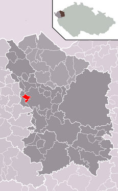
| Location of Jenišov in the Karlovy Vary district | ||||

|
||||
Jenišov (German Janessen ) is a municipality in the Czech Republic . It is located five kilometers west of the center of Karlovy Vary and belongs to the Okres Karlovy Vary .
geography
Jenišov is located on the edge of the Falkenau basin on the right side of the Chodovský creek on a hill. In the south-west rises the former Loket spoil heap, under which the village of Podhoří used to be. To the south lies the hill Roh ( Hornberg , 582 m). The Chomutov – Cheb railway runs north past the village, the nearest railway station is two kilometers east in Dvory. To the south is the section of state road 6 / E 48 between Jenišov and Karlovy Vary-západ, which has been upgraded to the expressway R 6 , from which state road 20 / E 49 branches off to the south.
Neighboring towns are Zátiší and Počerny in the north, Stará Role in the northeast, Dvory in the east, Tašovice in the southeast, Pod Rohem in the south, Hory , Loučky and Nové Sedlo in the southwest, Chranišov in the west and Na Cechu and Mírová in the northwest.
history
The first written mention of the village took place in 1390. Jenišov belonged to the estates of the city of Elbogen . After the Battle of White Mountain , the village was confiscated in 1623. Until the start of mining, Janessen was a purely agricultural village. In 1806 the merchant Josef Kalesánský Paulus acquired the concession to mine lignite and opened the "Mariasorg" colliery. The "Anton-Andreas" mine, owned by Anton Hippmann, followed in 1822. In 1847 the city of Elbogen bought Janessen back.
After the abolition of patrimonial Janessen including Taschwitz formed a political community in the Falkenau district from 1850 . In the second half of the 19th century, more lignite mines opened. In 1855 the "Wilhelmine" was built, in 1859 the "Florian" mine and in 1863 the "Katharina". During this time the first steam engines were installed, first on the "Wilhelmine", in 1864 on the "Johanni-Zeche" and a year later on the "Mariasorg".
The start of rail traffic between Karlovy Vary and Eger by the Buschtěhrad Railway Company (BEB) in 1870 led to an upswing in coal mining and to new sales markets for lignite. In 1870 the "Mariasorg" was the largest mine in town. In 1872 the "Emma" mine opened. From 1880 the community with the districts Haselbeint and Taschwitz belonged to the Karlsbad district. In 1896 the "Poldi" colliery opened between Horn , Janessen and Taschwitz, from which a Bleichert suspension railway led to Chodau station . In 1895 the "Emma" and in 1899 the "Andreas-Caroli" mine were shut down. At the turn of the 20th century, most of the old mines were coaled out and the "Poldi" and "Caroli-Johanni" mines produced most of the coal. In 1900, "Caroli-Johanni" employed 104 miners. At that time there were a total of 19 mines. In 1901 a brother fund was set up in Janessen. Due to the exhaustion of the deposits, the "Poldi" colliery closed in 1927 and the "Caroli-Johanni" mine a year later.
The global economic crisis led to illegal mining operations by the unemployed. On November 2, 1929, the gendarmerie arrested 35 people in the "Poldi" who were digging for coal there. In the "Wilhelmine", almost 300 coal graves excavated a seam in the protective pillar of the state road from Karlovy Vary to Cheb . The resulting landslide in the road led to the permanent cessation of mining in Janessen in the 1930s. In 1930 the community had 2507 inhabitants.
As a result of the Munich Agreement , Janessen was annexed to the German Reich in 1938. In 1939 there were 2487 people in Janessen. From 1938 to 1945 the municipality was part of the German district of Karlsbad and came back to Czechoslovakia after the end of the Second World War.
In 1949 the Tašovice district became an independent municipality. From 1949 to 1960 Jenišov belonged to the Okres Karlovy Vary-okolí. Since 1961 the municipality belongs to the Okres Karlovy Vary. From 1975 to 1990 Jenišov was a part of Karlovy Vary . The community has existed again since 1990.
Community structure
The municipality Jenišov consists of the districts Jenišov ( Janessen ) and Pod Rohem and the settlement Zátiší ( Haselbeint ).
Attractions
- Chapel of St. Anna, built at the end of the 19th century and rededicated by Prague Archbishop Josef Beran after repairs in 1947 . Between 1991 and 1993 the sponge-infested structure was reconstructed.
- Majvals oak; the winter oak with a trunk circumference of 3.95 m at a height of 1.30 m has been a tree monument since 2004
- The summer oak at Vorel has a trunk circumference of 3.83 m and has been protected since 2004
- The Jenišov oak in the old school yard is a summer oak with a trunk circumference of 3.52. On July 30, 2005, two branches broke in a storm. The tree has been protected since September 2005.

