Verušičky
| Verušičky | ||||
|---|---|---|---|---|
|
||||
| Basic data | ||||
| State : |
|
|||
| Region : | Karlovarský kraj | |||
| District : | Karlovy Vary | |||
| Area : | 2477 ha | |||
| Geographic location : | 50 ° 9 ' N , 13 ° 10' E | |||
| Height: | 574 m nm | |||
| Residents : | 473 (Jan 1, 2019) | |||
| Postal code : | 364 52 | |||
| License plate : | K | |||
| traffic | ||||
| Street: | Bochov - Lubenec | |||
| Next international airport : | Carlsbad | |||
| structure | ||||
| Status: | local community | |||
| Districts: | 9 | |||
| administration | ||||
| Mayor : | Petr Kvasnička (as of 2018) | |||
| Address: | Verušičky 5 364 52 Žlutice |
|||
| Municipality number: | 555711 | |||
| Website : | www.obecverusicky.cz | |||
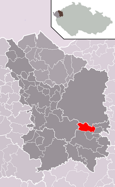
| Location of Verušičky in the Karlovy Vary district | ||||

|
||||
Verušičky (German Klein Werscheditz , also Kleinwerscheditz ) is a municipality in the Czech Republic . It is located nine kilometers east of Bochov and belongs to the Okres Karlovy Vary .
geography
Verušičky is located south of the Duppau Mountains in the Tepler Highlands on the Velká Trasovka river. In the north the municipality borders on the Hradiště military training area . The Verušičký vrch ( Werscheditzer Berg , 668 m) rises to the northwest . State road 6 / E 48 runs in the south .
Neighboring towns are Albeřice and Týniště in the north, Velký Hlavákov in the northeast, Vrbice and Skřipová in the east, Mokrá and Štoutov in the southeast, Čichalov in the south, Veselov and Knínice in the southwest, Budov in the west and Záhoří and Luka in the northwest.
history
The village was first mentioned in a document in 1572. On June 24, 1758, Franz Xaver Putz von Breitenbach acquired the Verušičky estate from the widowed Maria Elisabeth Kfellner von Sachsengrün, née. Countess Caretto von Millesimo for 55,000 florins. Since then, Verušičky and Luka have formed their own manor. On October 6, 1774, the Luka, Buda and Verušičky estates came to Count Franz Anton von Nostitz-Rienek for 115,846 florins.
After the abolition of patrimonial rule, the political municipality of Klein Werscheditz / Verušičky in the Luditz district was established in 1850 . In 1870 the village had 273 inhabitants, of which 242 were Catholic and 7 were Protestant, plus 24 Jews. Ten years later, 246 people lived in the 37 houses in Klein Werscheditz. By 1930 the population sank to 230. After the Munich Agreement , Klein Werscheditz was added to the German Reich in 1938 and until 1945 the village belonged to the Luditz district . In 1939 Klein Werscheditz had 158 inhabitants.
After the end of the war, Verušičky returned to Czechoslovakia and was classified in the Okres Toužim in 1946. Verušičky has belonged to Okres Karlovy Vary since 1961. In 1961 Budov, Týniště and Hřivínov and Vahaneč with Záhoří were incorporated. Luka has also been part of Verušičky since 1975.
As part of the downsizing of the military training areas, Albeřice and Malý Hlavákov came to Verušičky as districts in 2015.
Community structure
The municipality of Verušičky consists of the districts Albeřice ( Alberitz ), Budov ( Buda ), Hřivínov ( Mokowitz ), Luka ( Luck ), Malý Hlavákov ( Kleinlubigau ), Týniště ( Thönischen ), Vahaneč ( Bohentsch ), Verušičky ) and Klein Werschedříčky ( Serles ). Basic settlement units are Budov, Hřivínov, Luka, Týniště, Vahaneč, Verušičky and Záhoří.
The municipality is divided into the cadastral districts of Budov, Hřivínov, Luka u Verušiček, Týniště, Vahaneč, Verušičky and Záhoří u Verušiček.
Attractions
- Church of St. Trinity
- Verušičky Castle
- Pilgrimage Church of All Saints, south of the village
- Church of St. Laurentius in Luka
- former Luka Castle
- Chapel of St. Anna in Luka
- Jewish cemetery in Luka
Web links
Individual evidence
- ↑ http://www.uir.cz/obec/555711/Verusicky
- ↑ Český statistický úřad - The population of the Czech municipalities as of January 1, 2019 (PDF; 7.4 MiB)
- ↑ http://zpravy.idnes.cz/v-cesku-vzniknou-ctyri-nove-obce-prvniho-starostu-si-zvoli-i-libava-11v-/domaci.aspx?c=A120213_120805_domaci_jw
- ↑ http://www.uir.cz/casti-obce-obec/555711/Obec-Verusicky
- ↑ http://www.uir.cz/zsj-obec/555711/Obec-Verusicky
- ↑ http://www.uir.cz/katastralni-uzemi-obec/555711/Obec-Verusicky

