Otročín
| Otročín | ||||
|---|---|---|---|---|
|
||||
| Basic data | ||||
| State : |
|
|||
| Region : | Karlovarský kraj | |||
| District : | Karlovy Vary | |||
| Area : | 3582.2147 ha | |||
| Geographic location : | 50 ° 2 ' N , 12 ° 54' E | |||
| Height: | 632 m nm | |||
| Residents : | 454 (Jan. 1, 2019) | |||
| Postal code : | 364 01 - 364 64 | |||
| License plate : | K | |||
| traffic | ||||
| Street: | Teplá - Krásné Údolí | |||
| Railway connection: | Rakovník - Bečov nad Teplou | |||
| Next international airport : | Karlovy Vary Airport | |||
| structure | ||||
| Status: | local community | |||
| Districts: | 5 | |||
| administration | ||||
| Mayor : | Marie Šašková (as of 2008) | |||
| Address: | Otročín 48 364 01 Toužim |
|||
| Municipality number: | 555444 | |||
| Website : | www.otrocin.eu | |||
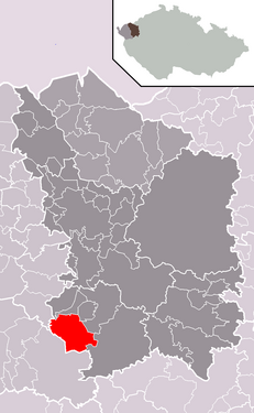
| Location of Otročín in the Karlovy Vary District | ||||

|
||||
Otročín (German Landek ) is a municipality in the Czech Republic . It is located 15 kilometers northeast of Marienbad and belongs to the Okres Karlovy Vary .
geography
Otročín is located in the northwest of the Tepler Highlands on the edge of the ChKO Slavkovský les protected landscape area . The Nadlucký brook flows through the village. To the west rise the Tisovský vrch ( hill height , 740 m) and the Liščí vrch (711 m); to the south are the Holý Kopec (690 m) and the Beranovský výšina (735 m). The railway line from Rakovník to Bečov nad Teplou runs north in the Otročínský potok valley . The “Otročín” train station is just under a kilometer outside the village.
Neighboring towns are Měchov and Brť in the north, Sedlo in the northeast, Poseč in the east, Prachomety, Kladruby and Klášterní Ovčín in the southeast, Beranov, Teplá and Nová Farma in the south, Rankovice and Poutnov in the southwest, Popovice and Bohuslav in the west and Tisová in the northwest.
history
At the end of the 12th century there was a Slavic settlement at the confluence of two streams on the road to Teplá , which is to be regarded as the predecessor of the village. It was first mentioned in a document in 1233, when the Archangel Michael Chapel was built in the vicinity of Otročín. At that time the village belonged to the Teplá Abbey .
After gold had been found in the brooks at the beginning of the 13th century, the monastery brought German Seifner to the area. The original round was enlarged and grew into a row village along the road. Since the place was on the edge of the monastery rule, it was named Landeck .
In 1530 Landeck came to secular owners. Initially, these were the Lords of Pflugk . They were followed by the Lords of Plauen . In 1612 the Landeck Abbey was bought back and held until the patrimonial rule was abolished.
In 1850 the political municipality Landek / Ostročín was established in the Teplá district. In 1920 the Czech name Otročín was created. In 1930 Landek had 729 inhabitants. After the Munich Agreement , the community was added to the German Reich in 1938; until 1945 the village belonged to the district of Teplá . In 1939 Landek had 687 inhabitants. After the end of the war, Otročín came back to Czechoslovakia and was classified in the Okres Toužim in 1946. Since 1961 Otročín belongs to the Okres Karlovy Vary. In 1961 Brť, Měchov, Poseč and Tisová were incorporated.
Community structure
The municipality of Otročín consists of the districts Brť ( Pirten ), Měchov ( Mies ), Otročín ( Landek ), Poseč ( Poschitz ) and Tisová ( Tissau ), which also form cadastral districts.
Attractions
- Church of the Archangel Michael, built in 1838
- Base of the Kaiser Josef monument
- Jewish cemetery, west of the village halfway to Poutnov

