
Kolová
| Kolová | |||||
|---|---|---|---|---|---|
|
|||||
| Basic data | |||||
| State : |
|
||||
| Region : | Karlovarský kraj | ||||
| District : | Karlovy Vary | ||||
| Area : | 703.3539 ha | ||||
| Geographic location : | 50 ° 11 ' N , 12 ° 54' E | ||||
| Height: | 575 m nm | ||||
| Residents : | 763 (Jan. 1, 2019) | ||||
| Postal code : | 360 01 - 362 14 | ||||
| License plate : | K | ||||
| traffic | |||||
| Street: | Útvina - Karlovy Vary | ||||
| Next international airport : | Karlovy Vary Airport | ||||
| structure | |||||
| Status: | local community | ||||
| Districts: | 2 | ||||
| administration | |||||
| Mayor : | Václav Kellner (as of 2008) | ||||
| Address: | Kolová 16 360 01 Karlovy Vary 1 |
||||
| Municipality number: | 555258 | ||||
| Website : | www.kolova-haje.cz | ||||
| Location of Kolová in the Karlovy Vary district | |||||

|
|||||


Kolová (German Kohlhau , formerly also Kohlau ) is a municipality in the Czech Republic . It is located five kilometers south of Karlovy Vary and belongs to the Okres Karlovy Vary .
geography
Kolová is located on the edge of the Imperial Forest on a hill in the headwaters of the Cínový potok. To the northeast lies the Karlovy Vary Airport and to the west the Stanovice reservoir . The Kolovák pond is located on the northern edge of the village. There is a golf course south of Háje.
Neighboring towns are Karlovy Vary , Na Rybníce, Hůrky and Olšová Vrata in the north, Andělská Hora in the northeast, Telenec and Pila in the east, Dolní Dražov and Nové Stanovice in the south, Stanovice in the southwest, Háje in the west and Březová in the northwest.
history
In 1622 the first mention of the Kohlhau wasteland belonging to Funkenstein took place. The berní rula from 1654 identifies an occupant for the charcoal burner settlement. In 1713 Kohlhau, which consisted of four properties, became a separate village community with a Schulzen.
After the abolition of patrimonial Kohlau / Kohlava formed a district of the community Schneidmühl / Pila in the Karlsbad district from 1850. In 1873 the community of Kohlhau was established. In 1900 the community consisted of 103 houses and had 728 inhabitants, all but one of whom belonged to the German ethnic group. In 1923 the Czech name of the village was changed to Kolavá . As a result of the Munich Agreement , Kohlhau was annexed to the German Reich in 1938 and initially assigned to the Karlsbad district . The Czech residents were forcibly evicted. On May 1, 1939, it was incorporated into Karlsbad. Until 1945 the Kohlhau was part of the Karlsbad district and came back to Czechoslovakia after the end of the Second World War. After the end of the war, the incorporation was canceled. Most Germans were expelled from 1945 onwards . The new settlers came from Bohemia, Moravia and Slovakia. There were also some who did not manage the farms, but only plundered them. Overall, many homesteads remained uninhabited, fell into disrepair and were eventually demolished. In 1950 a state estate was established in Kolová with a focus on animal production. This built a complex of cow and pig stalls. A prefabricated block was built in 1964 for the employees of the property.
In the course of the construction of the Stanovice dam , the pig breeding facility was demolished in 1973 and further cattle breeding was significantly reduced. In 1974 the ChKO Slavkovský les protected landscape area was established, to which most of the commune's corridors belong.
From 1946 to 1960 Kolová belonged to the Okres Karlovy Vary-okolí and since 1961 again to the Okres Karlovy Vary. In 1976 Pila was incorporated , which has been independent again since 2000.
The district Kolová consists of 220 houses and has about 600 inhabitants.
Community structure
The municipality Kolová consists of the districts Háje , until 1945 Funkštejn ( Funkenstein ) and Kolová ( Kohlhau ), which also form cadastral districts.
Attractions
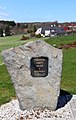
- Chapel of St. Anna, built in 1873. In 1930 a renovation took place.
- Remains of the castle Funkštein ( Funkenstein ) on the Zámecký vrch ( Castle Hill ), west of the community above the valley of the creek Lomnický potok . It was built in the 12th century and was a small watchtower of the Přemyslid border fortification system .

Northern part

chapel
monument


