
Senftenbach
|
Senftenbach
|
||
|---|---|---|
| coat of arms | Austria map | |
 |
|
|
| Basic data | ||
| Country: | Austria | |
| State : | Upper Austria | |
| Political District : | Ried im Innkreis | |
| License plate : | RI | |
| Main town : | mountain | |
| Surface: | 9.72 km² | |
| Coordinates : | 48 ° 16 ' N , 13 ° 25' E | |
| Height : | 414 m above sea level A. | |
| Residents : | 773 (January 1, 2020) | |
| Population density : | 80 inhabitants per km² | |
| Postal code : | 4973 | |
| Area code : | 07751 | |
| Community code : | 4 12 30 | |
| NUTS region | AT311 | |
| Address of the municipal administration: |
Berg 22 4973 Senftenbach |
|
| Website: | ||
| politics | ||
| Mayor : | Johann Leherbauer ( ÖVP ) | |
|
Municipal Council : ( 2015 ) (13 members) |
||
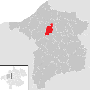
| Location of Senftenbach in the Ried im Innkreis district | ||
  |
||
| Source: Municipal data from Statistics Austria | ||

Senftenbach is a municipality in Upper Austria in the district of Ried im Innkreis in the Innviertel with 773 inhabitants (as of January 1, 2020).
geography
Senftenbach is 414 m above sea level in the Innviertel. The extension is 5 km from north to south and 3.3 km from west to east. The total area is 9.8 km². 19.4% of the area is forested, 73.5% of the area is used for agriculture.
Senftenbach takes its name from the brook , which starts in the village of Ursprung, 2 km above the Hofmark Berg and flows gently through the valley.
Community structure
The municipality includes the following localities (population in brackets as of January 1, 2020):
- Mountain (167)
- Bruck (202)
- Dobl (35)
- Furth (33)
- Long fence (25)
- Location (34)
- Reisedt (22)
- Ortisei (207)
- Stockham (11)
- Wine Village (28)
- Wolfau (9)
The municipality of Senftenbach consists of the two cadastral municipalities Furth and Berg.
The community is located in the judicial district of Ried im Innkreis .
Neighboring communities
history
The place was Bavarian until 1779 and came to Austria after the Treaty of Teschen with the Innviertel (then 'Innbaiern'). Briefly Bavarian again during the Napoleonic Wars , since 1814 it has finally belonged to Upper Austria.
After the annexation of Austria to the German Reich on March 13, 1938, the place belonged to the Gau Oberdonau . After 1945 the restoration of Upper Austria took place.
Population development
In 1991 the community had 655 inhabitants, in 2001 it had 698 inhabitants. The sharp increase occurred because both the birth balance and the migration balance were positive. Since this remained so after 2001, the population increased to 738 people in 2011 and 772 in 2018.
Culture and sights
.JPG)
- The Catholic parish church Senftenbach is a late Gothic church with a single-nave , three-bay nave , a slightly retracted single - bay choir and a tower in the southern corner of the choir. At the end of the 19th century, a three-bay aisle was added to the south. The furnishings (high and side altars) are neo-Gothic.
politics
The municipal council has 13 members.
- With the municipal council and mayoral elections in Upper Austria in 2003, the municipal council had the following distribution: 8 ÖVP, 3 SPÖ, and 2 FPÖ.
- With the municipal council and mayoral elections in Upper Austria in 2009, the municipal council had the following distribution: 7 ÖVP, 3 SPÖ, and 3 FPÖ.
- With the municipal council and mayoral elections in Upper Austria in 2015 , the municipal council has the following distribution: 6 ÖVP, 4 FPÖ, and 3 SPÖ.
- mayor
- until 2014 Georg Schrattenecker (ÖVP)
- since 2014 Johann Leherbauer (ÖVP)
coat of arms
Blazon : In silver a blue, S-shaped rod, accompanied in the curvature at the bottom right by a red hip horn with the mouth facing to the right and a red ribbon and at the top left by a red, straight-armed paw cross. The community colors are red-yellow-blue.
economy
Clay has been processed in a brickworks since 1889. The "Thonwerk Senftenbach" produced roof tiles and has specialized in masonry tiles since 1952. Today the Senftenbacher company offers an extensive range.
societies
- Senftenbach volunteer fire department
- Goldhaubengruppe Senftenbach
- Senftenbach hunters
- Child friends Senftenbach
- Children's folk dance group Senftenbach / Wippenham / Utzenaich
- Senftenbach Music Association
- Senior Citizens' Association of Upper Austria - Senftenbach local group
- Union Senftenbach with the very active football club and the Fit section
Web links
- Community portrait on oberoesterreich.at
- Further information about the municipality of Senftenbach can be found on the geographic information system of the federal state of Upper Austria .
- Senftenbach on land-oberoesterreich.gv.at
Individual evidence
- ^ Province of Upper Austria - Geographical data of the municipality of Senftenbach .
- ↑ Statistics Austria: Population on January 1st, 2020 by locality (area status on January 1st, 2020) , ( CSV )
- ↑ Statistics Austria, A look at the community Senftenbach, population development. Retrieved April 11, 2019 .
- ^ Erwin Hainisch (revised by Kurt Woisetschläger ): Dehio Oberösterreich ; Verlag Anton Schroll & Co, 5th edition, Vienna 1971, page 316
- ^ Province of Upper Austria, results of the 2015 elections. Accessed April 11, 2019 .
- ^ State of Upper Austria, history and geography, coat of arms. Retrieved April 11, 2019 .

Andrichsfurt | Antiesenhofen | Aurolzmünster | Eberschwang | Eitzing | Geiersberg | Geinberg | Belts | Hohenzell | Kirchdorf am Inn | Kirchheim im Innkreis | Lamb rights | Lohnsburg am Kobernaußerwald | Mehrnbach | Mettmach | Mörschwang | Mühlheim am Inn | Neuhofen im Innkreis | Obernberg am Inn | Place in the Innkreis | Pattigham | Peterskirchen | Pramet | Reichersberg | Ried im Innkreis | St. Georgen near Obernberg am Inn | St. Marienkirchen am Hausruck | St. Martin im Innkreis | Schildorn | Senftenbach | Taiskirchen im Innkreis | Tumeltsham | Utzenaich | Waldzell | Weilbach | Wippenham