Bad Bleiberg
|
market community Bad Bleiberg
|
||
|---|---|---|
| coat of arms | Austria map | |
|
|
||
| Basic data | ||
| Country: | Austria | |
| State : | Carinthia | |
| Political District : | Villach-Land | |
| License plate : | VL | |
| Surface: | 44.74 km² | |
| Coordinates : | 46 ° 37 ' N , 13 ° 41' E | |
| Height : | 902 m above sea level A. | |
| Residents : | 2,179 (January 1, 2020) | |
| Population density : | 49 inhabitants per km² | |
| Postcodes : | 9530, 9531 | |
| Area code : | 0 42 44 | |
| Community code : | 2 07 05 | |
| NUTS region | AT211 | |
| Address of the municipal administration: |
Bad Bleiberg 49 9530 Bad Bleiberg |
|
| Website: | ||
| politics | ||
| Mayor : | Christian Hecher (ULB - Independent List Bleiberger Tal) | |
|
Municipal Council : ( 2015 ) (19 members) |
||
| Location of Bad Bleiberg in the Villach-Land district | ||
 Bad Bleiberg |
||
| Source: Municipal data from Statistics Austria | ||

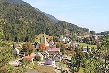
The market town of Bad Bleiberg ( Slovenian : Plajberk pri Beljaku ) is a health resort with 2179 inhabitants (as of January 1, 2020) in the Villach-Land district in Carinthia .
geography
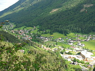
Bad Bleiberg is located in the federal state of Carinthia west of Villach in a high valley between the Dobratsch and the Bleiberger Erzberg . Neighboring communities are, starting in the north in a clockwise direction: Paternion , Weißenstein , Villach, Arnoldstein , Nötsch im Gailtal and Sankt Stefan im Gailtal .
Community structure
The community with the two cadastral communities of Bleiberg ( Plajberk ) and Kreuth comprises the following five localities (population in brackets as of January 1, 2020):
- Bad Bleiberg (446)
- Bleiberg-Kreuth (849)
- Bleiberg-Nötsch (602)
- Hut Village (218)
- Kadutschen (64)
history
The history of Bleiberg was predominantly shaped by lead and zinc mining . In 1007 King Heinrich II transferred the entire area around Villach including Bleiberg to the diocese of Bamberg . The first written mention as Pleyberg comes from the year 1333.
In today's municipality, lead and zinc have been mined since the second quarter of the 14th century. In the 16th century, the Fuggers were among the operators who used their ore in the Arnoldsteiner Fuggerau for the extraction of silver. In 1556 Georgius Agricola described the Carinthian method of smelting lead. In 1717 Bleiberger miners took part in the siege of Belgrade. In recognition of this, Prince Eugene awarded them a flag that is now considered the world's oldest squire flag. It can be viewed in the Bad Bleiberger mining museum Terra Mystica . In 1759 Maria Theresa acquired the Bamberg possessions. In the St. Oswaldi tunnel near Bleiberg, a rare limestone, the so-called Bleiberger shell marble, was discovered in 1780 and described for the first time by Franz Xaver von Wulfen . Numerous jewelry items were made from this colorfully shimmering stone.
On February 23, 1879, 39 people died in an avalanche in the town center.
The local community of Bleiberg was constituted in 1850, in 1930 it was elevated to a market community due to its supra-regional importance .
In 1893 a major fire raged in Bleiberg and destroyed a large part of the archives of the former trades.
In 1867 the Bleiberger Bergwerks Union (BBU) was founded. Until then, mining was operated by various trades. Mining reached a peak during and after the First World War. In 1931, however, mining was shut down for a year due to the global economic crisis. In 1946 the BBU was nationalized.
On March 9, 1951 there was a water ingress of enormous proportions (2800 l / sec) in the tunnel of a building of hope 641 meters underground. This thermal spring with 27 ° C is enriched with trace elements and minerals, especially sodium and magnesium. In 1967 a thermal bath was built, which soon became very popular.
In 1978 the community was given the title bathroom .
In 1993 lead and zinc mining was stopped. Part of the former tunnels is now used as the Terra Mystica and Terra Montana show mine . The Friedrich- and Thomasstollen were expanded and are used as healing caves (99% humidity, 8 ° C).
In 2014 the thermal bath, which was in need of renovation and whose operation had become uneconomical for the municipality and the tourist association, was closed and it was initially empty. In 2018, the municipality sold the thermal baths to the HUMANOMED Group, which announced that it would be demolished and rebuilt as a therapy center. On the one hand, the community was happy about the sale of the thermal bath, which had been vacant for years, to the Humanomed Group. On the other hand, the community had to bear the demolition costs. For Bad Bleiberg it should be a negative deal worth 250,000 euros. In 2019 the thermal bath was demolished.
population
At the end of the 18th century, Bleiberg had 4,000 inhabitants.
The municipality of Bad Bleiberg has 2,753 inhabitants (2001), of which 95.8% have Austrian , 1.9% Bosnian and 1.1% German citizenship . 97.2% give German and 0.1% Slovenian as colloquial language.
66.2% of the population profess the Roman Catholic and 24.2% the Protestant Church, 1.6% are of the Islamic faith and 4.2% have no religious beliefs.
Population development

Culture and sights
Buildings
- Evangelical Church in Bleiberg
- German Chapel (Dobratsch)
- Catholic parish church in Bleiberg
- Catholic parish church in Bleiberg-Kreuth
Bleiberger miners' culture
The Bleiberger Knappenkultur was added to the UNESCO list of intangible cultural heritage in Austria in 2010 . Since the mining industry was closed in 1992, mostly private initiatives have endeavored to preserve and pass on the associated cultural heritage, such as the miner's language , the still existing old Schrämstollen , the Bleiberger Knappenspiel , the Barbaramesse , the “ Leather Jump ”, and other special features worth preserving.
Via ferratas
The Bad Bleiberg via ferratas in the Traninger Wand have all levels of difficulty (A – E) and offer a view of the whole of Bad Bleiberg.
Economy and Infrastructure
According to the 2001 census of workplaces, there are 93 workplaces with 437 employees in the municipality, as well as 767 outbound and 166 inbound commuters. There are 31 agricultural and forestry holdings (5 of which are the main occupation), which together cultivate 976 hectares (1999).
The access to traffic is via the state road L 35.
Thermal spring
The first official analysis of the thermal water took place in 1952. It was classified as an acratic uranium-containing calcium, magnesium, hydrocarbonate thermal spring or, for short, a uranium-containing acrotherm. In spa treatments it is used for diseases of the joints, spine, locomotor system and the cardiovascular system. The origin of the thermal water is at a depth of 3,600 meters. In 1962 a pumping station was built at the Franz-Josef-Stollen, with which the thermal water is pumped via an insulated pipe to the Rudolf main shaft and through this 264 meters up to the surface.
Bioenergy plant
In 2013, a bioenergy plant went into operation next to the sports field, which primarily supplies the companies in the nearby thermal park with local heating. Regional forest chips and, since 2017, wood pellets are used to generate energy.
politics
The municipal council consists of 19 members. In the 2015 municipal council elections , the mandates were distributed as follows:
mayor
- until 2015 Gottfried Gunnar Illing (ULB)
- since 2015 Christian Hecher (ULB)
coat of arms
In the back part of the municipal coat of arms , the lead mark , partly reflected by the tough (mallet and iron), refers to the mining past, in the front half there are springs, fountain bowls and water jets for the thermal springs. The blazon of the coat of arms, which was given to the municipality on September 28, 1967, reads:
- “Split shield. In front, in blue over a black foot, a silver fountain: From a silver fountain bowl fed by a two-rooted silver water vein, the upper edge of which forms the dividing line, a silver water jet rises vertically, which is split in height to the left and then to the right and then declines again . At the back a golden lead mark in green, the legs of which are covered with a golden miner's mark. "
The flag bears the traditional miner colors black, white and green with an integrated coat of arms.
Partner municipality
Bad Bleiberg's partner municipality is Pradamano in the Friuli-Venezia Giulia region , Italy.
Personalities
Sons and daughters of the church
- Oskar Potiorek (1853–1933), kuk deputy. Chief of Staff
- Hans Steinacher (1892–1971), German national folk politician
- Erwin Aichinger (1894–1985), National Socialist plant sociologist
- Kurt Peball (1928–2009), General Director of the Austrian State Archives
- Monika Kemperle (* 1958), politician ( SPÖ ), member of the Federal Council
Personalities associated with the community
- Luis Fuchs (* 1944), politician ( ÖVP ), member of the Austrian National Council and the Bad Bleiberg municipal council
- Matthias Maierbrugger (1913–1991), local history researcher and elementary school teacher in Bleiberg
Web links
- Market town of Bad Bleiberg
- 20705 - Bad Bleiberg. Community data, Statistics Austria .
Individual evidence
- ↑ Statistics Austria: Population on January 1st, 2020 by locality (area status on January 1st, 2020) , ( CSV )
- ↑ Götz von Pölnitz: Jakob Fugger, Volume 2. pp. 34–38 , accessed on July 15, 2010 .
- ↑ kaernten.orf.at, December 4, 2013
- ^ The local council decided to demolish the old thermal baths. In: Small newspaper Carinthia. December 18, 2018, accessed December 31, 2018 .
- ↑ kaernten.orf.at/31.12.2018
- ↑ Bleiberger Knappenkultur ( Memento of the original from May 2, 2015 in the Internet Archive ) Info: The archive link was inserted automatically and has not yet been checked. Please check the original and archive link according to the instructions and then remove this notice. . nationalagentur.unesco.at
- ↑ www.mein Bezirk.at, July 8, 2016
- ↑ Bioenergie Bad Bleiberg , project description by the operator Astra BioEnergie GmbH, last updated in 2020, accessed on August 14, 2020
- ^ Quoted from Wilhelm Deuer: The Carinthian municipal coat of arms . Verlag des Kärntner Landesarchivs, Klagenfurt 2006, ISBN 3-900531-64-1 , p. 52


