
Wechingen
| coat of arms | Germany map | |
|---|---|---|

|
Coordinates: 48 ° 54 ' N , 10 ° 37' E |
|
| Basic data | ||
| State : | Bavaria | |
| Administrative region : | Swabia | |
| County : | Danube Ries | |
| Management Community : | Ries | |
| Height : | 413 m above sea level NHN | |
| Area : | 24.03 km 2 | |
| Residents: | 1432 (December 31, 2019) | |
| Population density : | 60 inhabitants per km 2 | |
| Postal code : | 86759 | |
| Area code : | 09085 | |
| License plate : | DON, Lower Austria | |
| Community key : | 09 7 79 226 | |
| LOCODE : | DE WCI | |
| Community structure: | 7 parts of the community | |
| Address of the municipal administration: |
Im Unterdorf 4 86759 Wechingen |
|
| Website : | ||
| Mayor : | Klaus Schmidt ( community of voters ) | |
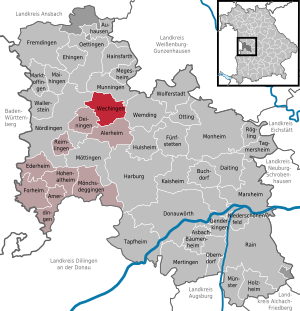
| Location of the municipality of Wechingen in the Donau-Ries district | ||
  |
||

Wechingen is a municipality in the Swabian district of Donau-Ries and a member of the Ries administrative community based in Nördlingen .
geography
The place is in the planning region Augsburg in the Ries formed by a meteorite impact , about 10 km northeast of Nördlingen.
The municipality consists of the three districts and has seven officially named municipality parts : The municipality comprises the following districts:
- Wechingen district with the parish village of Wechingen and the plains of Pfladermühle and Wolfsmühle
- Fessenheim district with the parish village of Fessenheim and the wasteland of Muttenauhof
- Holzkirchen district with the parish village of Holzkirchen and the hamlet of Speckbrodi
history
Until the church is planted
Wechingen belonged to the Principality of Oettingen-Spielberg . With the Rhine Confederation Act 1806, the place came to the Kingdom of Bavaria . With the community edict of 1818 , today's political community was created.
Incorporations
On May 1, 1978, as part of the regional reform, the previously independent communities of Fessenheim and Holzkirchen were incorporated. The history of the three parts of the community, their houses and families is presented in their own extensive books, which were published between 2001 and 2010.
Population development
Between 1988 and 2018 the municipality grew from 1,312 to 1,425 by 113 inhabitants or by 8.6%.
- 1961: 1460 inhabitants
- 1970: 1464 inhabitants
- 1987: 1317 inhabitants
- 1991: 1298 inhabitants
- 1995: 1348 inhabitants
- 2000: 1384 inhabitants
- 2005: 1411 inhabitants
- 2010: 1378 inhabitants
- 2015: 1428 inhabitants
politics
Klaus Schmidt (community of voters) has been mayor since 2008. His predecessor was Johannes Wiedenmann. Schmidt was confirmed in office in 2014 with 89.5% of the votes and in 2020 with 92.3% of the votes - in each case with no opposing candidate. The municipal council consists of twelve members, including:
- Voting community Wechingen 5 seats
- Free voter community Fessenheim 4 seats
- Voting community Holzkirchen-Speckbrodi 3 seats
Architectural monuments
Economy and Infrastructure
Economy including agriculture and forestry
In 1998, according to official statistics, there were 77 employees in the manufacturing sector and 42 in the trade and transport sector at the place of work, and there were 473 employees at the place of residence. There were two companies in the manufacturing and construction sectors. In addition, in 1999 there were 83 farms with an agricultural area of 1735 ha, of which 1437 ha were arable land and 298 ha were permanent green space.
traffic
State road 2221 and district road DON 5 intersect in the village .
The part of the municipality Fessenheim is located on the former Nördlingen – Wemding railway line, which opened in 1903 and on which passenger trains ran until 1981.
education
In 2011 there were the following institutions:
- Kindergarten: 60 kindergarten places with 52 children
- School preparatory facility (SVE) of the Schwabenhilfe with two groups
literature
- Gerhard Beck: 1200 years of Wechingen. Local history of Wechingen. Wechingen 2002
- Gerhard Beck: Local family book of Fessenheim and Muttenauhof 1581–1930. The local families of Fessenheim from 1581–1930 and notes on local history. Wechingen 2010
- Gerhard Beck, Hermann Greiner: wooden churches in the Ries. Ortschronik 2008. Wechingen 2008
- Wilhelm Hermann: Our village through the ages. The Chronicle of Fessenheim. Fessenheim 2001
- Erwin Meyer: Holzkirchen. From the history of a Ries village and its hamlet Speckbrodi Steinmeier, Nördlingen 1980
- Gottfried Stieber: Wechingen . In: Historical and topographical news from the Principality of Brandenburg-Onolzbach . Johann Jacob Enderes, Schwabach 1761, p. 917-918 ( digitized version ).
Web links
- Entry on the coat of arms of Wechingen in the database of the House of Bavarian History
Individual evidence
- ↑ "Data 2" sheet, Statistical Report A1200C 202041 Population of the municipalities, districts and administrative districts 1st quarter 2020 (population based on the 2011 census) ( help ).
- ^ Community Wechingen in the local database of the Bavarian State Library Online . Bayerische Staatsbibliothek, accessed on September 1, 2019.
- ↑ a b c Federal Statistical Office (ed.): Historical municipality directory for the Federal Republic of Germany. Name, border and key number changes in municipalities, counties and administrative districts from May 27, 1970 to December 31, 1982 . W. Kohlhammer, Stuttgart / Mainz 1983, ISBN 3-17-003263-1 , p. 794 .

Alerheim | Amerdingen | Asbach-Bäumenheim | Auhausen | Buchdorf | Daiting | Deiningen | Donauwörth | Ederheim | Ehingen am Ries | Forheim | Fremdingen | Fünfstetten | Genderkingen | Hainsfarth | Harburg (Swabia) | Hohenaltheim | Holzheim | Huisheim | Kaisheim | Maihingen | Marktoffingen | Marxheim | Megesheim | Mertingen | Mönchsdeggingen | Monheim | Möttingen | Munningen | Munster | Niederschönenfeld | Nordlingen | Oberndorf am Lech | Oettingen in Bavaria | Otting | Rain | Reimlingen | Rögling | Tagmersheim | Tapfheim | Wallerstein | Wechingen | Wemding | Wolferstadt
Unregulated areas: Dornstadt-Linkersbaindt | Ester wood