Geography of norway
|
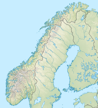
The geography of Norway is characterized by mountain ranges, plateaus (e.g. Hardangervidda ) and the fjords along the long coast, with around 150,000 islands in front of it. The total national area of Norway is 385,199 km² , the Scandinavian mainland 323,759, the Svalbard archipelago 62,700 and the island Jan Mayen 380 km².
Limits
Norway borders Sweden (1,619 km), Finland (736 km), Russia (198 km), the Skagerrak and the Atlantic and extends over a distance of around 1,700 km (north-south) in the west of the Scandinavian Peninsula . The total length of the land borders is 25,344 km. The coastline extends over 21,925 km (mainland 3,419 km, larger islands 2,413 km, smaller islands and fjord coasts 16,093 km).
Mountains
Almost the entire area of mainland Norway is taken up by the Scandinavia mountain range . The highest peaks in the country and all of Scandinavia are in the Jotunheimen Mountains . As the highest mountain in the country is regarded Galdhøpiggen with a height of 2,469 m , but only since the glacial summit of Glittertind is melted by a few meters (now 2464 m ). In Norway, the Jostedalsbreen is the largest continental glacier in Europe.
glacier
There are 1627 glaciers (breen) and 2113 partial glaciers (bre-enheter) in the area of Norway, which cover a total area of 2609 km².
Fjords
- see also list with map -
The longest fjord with 204 km is the Sognefjord , followed by the Hardangerfjord with 179 km and the Trondheimfjord with 126 km. Fjords are sea bays that were formed from valleys formed by glacier tongues during the Ice Age and later flooded by the sea.
Islands
The largest islands in Norway are Hinnøya (Troms / Nordland) with 2,198 km², followed by Senja (Troms) (1,590 km²) and Langøya (Nordland) (860 km²).
Waters
17,900 km² of the area of Norway are freshwater lakes. The largest lake in Norway is Mjøsa . It has an area of 365 km². The Glomma River is the longest river in the country at 601 km.
climate
Despite its northern location, Norway's climate is relatively mild as the North Atlantic Current runs along the coast. But also particularly damp.
administration
The kingdom is divided into eleven provinces ( Fylke ) of the continental "mainland" ( hovedlandet ), as well as Svalbard and Jan Mayen . The smallest province is the capital Oslo . The provinces alphabetically:
Agder , Innlandet , Møre and Romsdal , Nordland , Oslo , Rogaland , Troms and Finnmark , Trøndelag , Vestfold and Telemark , Vestland , Viken .
Major Norwegian cities are (by size):
- Oslo (capital)
- Mountains
- Trondheim
- Stavanger
- Kristiansand
- Fredrikstad
- Tromso
- Drammen
- Bodø
- Hamar
- Lillehammer
- Narvik
- Mo i Rana
- Hammerfest
population
The population is not only concentrated in the largest cities, but is distributed across the country, with the south of Norway being more densely populated than the north.
See also
- List of cities in Norway
- National parks in Norway
- List of Norwegian glaciers
- List of Norwegian landscapes
- List of lakes in Norway
- List of rivers in Norway
- List of mountains and elevations in Norway
- List of Norwegian islands
Individual evidence
- ↑ Country dictionary Norway and specific country data
- ^ Atlas over Breer I Sor-Norge Edited by Norges Vassdrags- og Energiverk Vassdragsdirektoratet 1988, page A-68


