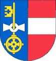
Kočov
| Kočov | ||||
|---|---|---|---|---|
|
||||
| Basic data | ||||
| State : |
|
|||
| Region : | Plzeňský kraj | |||
| District : | Tachov | |||
| Area : | 1146.4122 ha | |||
| Geographic location : | 49 ° 49 ' N , 12 ° 44' E | |||
| Height: | 465 m nm | |||
| Residents : | 205 (Jan. 1, 2019) | |||
| Postal code : | 347 01 - 348 15 | |||
| License plate : | P | |||
| structure | ||||
| Status: | local community | |||
| Districts: | 4th | |||
| administration | ||||
| Mayor : | Miroslav Pešek (as of 2007) | |||
| Address: | Kočov 29 348 15 Planá u Mariánských Lázní |
|||
| Municipality number: | 541559 | |||
| Website : | www.kocov.cz | |||
Kočov (German: "Gottschow / Gottschau") is a municipality with 205 inhabitants (as of January 1, 2019) in the Czech Republic . It is located 8 km east of Tachov at an altitude of 465 m above sea level. M. on the bad .
In the district of Ústí nad Mží, the Hammerbach (Hamerský potok) flows into the Mies.
history
The first mention of Gottschau (Czech: KOCOV (-SKY)) comes from the year 1357, here: the knight Kunrat and his sons Humpert (1359-1379) and Radslav (1368-1379). The parish was after Bruck am Hammer . Gottschau was part of the lordship of Plan -Gottschau until 1850. In 1939, 446 people lived in Gottschau, including the districts of Johannesdorf and St. Johann.
After the Munich Agreement , the place was added to the German Empire and until 1945 belonged to the Tachau district .
On January 1, 1980 Kočov was incorporated into Planá , and since November 24, 1990 it has been an independent municipality again.
Community structure
The municipality Kočov consists of the districts Janov ( Johannesdorf ), Klíčov ( Glitschau ), Kočov and Ústí ( Truß ). Basic settlement units are Klíčov, Kočov and Ústí
The municipality is divided into the cadastral districts of Klíčov, Kočov and Ústí nad Mží. The abandoned town of Svatý Jan ( St. John ) is located in the corridors .
Culture and sights
literature
About Kunrat von KOCOV / -SKY: Ottův slovník naučný (Otto's Konversationslexikon), also Ottova encyklopedie (Otto's encyclopedia), is a 28-volume Czech encyclopedia from the years 1888–1909 with almost 186,000 headings, published on 29,000 pages. It is considered to be one of the cornerstones of Czech culture and identity.
Web links
Individual evidence
- ↑ http://www.uir.cz/obec/541559/Kocov
- ↑ Český statistický úřad - The population of the Czech municipalities as of January 1, 2019 (PDF; 7.4 MiB)
- ↑ http://www.uir.cz/casti-obce-obec/541559/Obec-Kocov
- ↑ http://www.uir.cz/zsj-obec/541559/Obec-Kocov
- ↑ http://www.uir.cz/katastralni-uzemi-obec/541559/Obec-Kocov


