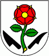
Horná Streda
| Horná Streda | ||
|---|---|---|
| coat of arms | map | |

|
|
|
| Basic data | ||
| State : | Slovakia | |
| Kraj : | Trenčiansky kraj | |
| Okres : | Nové Mesto nad Váhom | |
| Region : | Stredné Považie | |
| Area : | 9.827 km² | |
| Residents : | 1,373 (Dec 31, 2019) | |
| Population density : | 140 inhabitants per km² | |
| Height : | 169 m nm | |
| Postal code : | 916 24 | |
| Telephone code : | 0 32 | |
| Geographic location : | 48 ° 39 ' N , 17 ° 51' E | |
| License plate : | NM | |
| Kód obce : | 506001 | |
| structure | ||
| Community type : | local community | |
| Administration (as of November 2018) | ||
| Mayor : | Ľubomír Krajňanský | |
| Address: | Obecný úrad Horná Streda 407 91624 Horná Streda |
|
| Website: | www.hornastreda.sk | |
| Statistics information on statistics.sk | ||
Horná Streda (until 1927 Slovak "Streda", until 1948 "Horná Streda nad Váhom"; Hungarian Felsőszerdahely - until 1907 Vágszerdahely ) is a municipality in western Slovakia . It is located in the northern Danube hill country on the river Waag , 8 km from Piešťany and 13 km from Nové Mesto nad Váhom .
The place was first mentioned in writing in 1263.
It has a stop on the Bratislava – Žilina railway line and an exit from the D1 motorway .
Web links
Commons : Horná Streda - collection of images, videos and audio files

