
Handeloh
| coat of arms | Germany map | |
|---|---|---|

|
Coordinates: 53 ° 15 ' N , 9 ° 50' E |
|
| Basic data | ||
| State : | Lower Saxony | |
| County : | Harburg | |
| Joint municipality : | Tostedt | |
| Height : | 46 m above sea level NHN | |
| Area : | 26.91 km 2 | |
| Residents: | 2539 (Dec. 31, 2019) | |
| Population density : | 94 inhabitants per km 2 | |
| Postal code : | 21256 | |
| Area code : | 04188 | |
| License plate : | WL | |
| Community key : | 03 3 53 015 | |
| LOCODE : | DE XZS | |
| Community structure: | 4 districts | |
| Address of the municipal administration: |
Am Markt 1 21256 Handeloh |
|
| Website : | ||
| Mayor : | Heinrich Richter | |
| Location of the municipality of Handeloh in the Harburg district | ||
  |
||

Handeloh , until March 16, 1936 Handorf bei Tostedt , is a municipality in the Harburg district in Lower Saxony .
geography
location


Handeloh is located between the Seeve and Este rivers , south of Buchholz in the north heath . The Harburg Mountains are in the northwest and the Lüneburg Heath Nature Reserve in the southeast. The municipality belongs to the Tostedt joint municipality , which has its administrative seat in the municipality of Tostedt .
Neighboring communities
Community structure
Handeloh, Höckel, Inzmühlen and Wörme belong to the municipality of Handeloh.
history

Handeloh was called Handorf until 1936 , but was renamed to Handorf in the Lüneburg district because the name was identical , the neighboring Undeloh was the inspiration for the choice of the new name .
On 8./9. In April 1945 a concentration camp train with 5000 inmates stopped at the Handeloher Bahnhof after a four-day odyssey. The concentration camp inmates were brought to Bergen-Belsen from the Nordhausen concentration camp in the Harz Mountains due to the approaching British army. After an appeal by the mayor of Handeloher Peters, the residents of Handeloher donated more than 40 quintals of boiled potatoes, water and milk, but they also reported numerous atrocities. As a result of hunger, thirst, illness and exhaustion as well as a shooting at the train station, at least 75 people died and were buried in a mass grave near the train station. In the 1950s, 64 dead were exhumed and buried in the Handeloher community cemetery.
Incorporations
On July 1, 1972, the neighboring community of Inzmühlen was incorporated.
Population development
The population of the municipality of Handeloh has been very constant since 2000 and peaked at 2,523 in 2017. A statistical evaluation of individual districts of the municipality of Handeloh is not possible, as these areas are not separated accordingly in the population register.

politics
Municipal council
The municipal council, which was elected on September 11, 2016, is composed as follows:
- Free community of voters Handeloh 5 seats
- CDU 3 seats
- SPD 2 seats
- Alliance 90 / The Greens 2 seats
- FDP 1 seat
mayor
Heinrich Richter (Free Voting Association Handeloh) has been mayor since November 2011.
coat of arms
Blazon : In the split shield, divided on the right, above a golden wagon wheel with eight spokes in green, below in silver two blue wavy bars, on the left in gold a black pine with four roots.
Meaning: The wagon wheel symbolizes the important timber handling in the community. The two wave beams point to the rivers Este and Seeve, which flow through the district. The abundance of wood and forest is represented by the pine, the four roots of which symbolize the four villages in the community.

Museums

- Natural history museum and training center "Alte Schmiede"
- The display collection includes the native songbirds, mammals and birds of Northern Germany including the coasts, native amphibians and reptiles.
- The training center organizes seminars for employees in nature conservation associations and administrations.
Economy and Infrastructure
traffic


Two stations on the Heidebahn , "Handeloh" and "Büsenbachtal", are served. The latter, however, serves the Wörme district and the “Büsenbachtal” hiking area. In addition, Handeloh train station on the Heidebahn is the last one in the HVV tariff. However, season tickets have also been valid up to Soltau since 2008 .
From 1999 to 2002, the tourist light railway “ Wilde Erika ” was operated in the Büsenbachtal .
media
The Baalshof Reiterhof in Handeloh was the main location of the 52-part television series Neues vom Süderhof with many other outdoor scenes .
photos
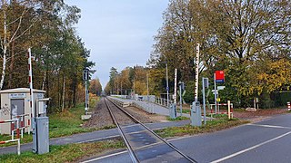
Büsenbachtal train station

Büsenbachtal

Elementary School Handeloh

Fire Department Handeloh

Nicodemus Church Handeloh


literature
- Dierk Lawrenz, Lothar Eichmann: The Heidebahn - From Buchholz via Schneverdingen to Soltau. 85 years through the Lüneburg Heath. EK-Verlag, Freiburg 1986, ISBN 3-88255-209-3 [2nd, revised and newly illustrated edition, EK-Verlag, Freiburg 1997, ISBN 3-88255-419-3 ].
Web links
Individual evidence
- ↑ State Office for Statistics Lower Saxony, LSN-Online regional database, Table 12411: Update of the population, as of December 31, 2019 ( help ).
- ↑ Statistics of the German Reich, Volume 450: Official municipality directory for the German Reich, Part I, Berlin 1939; Page 265
- ↑ http://www.kz-zuege.de/kapitel_06.htm
- ↑ https://kriegsgraeberstaetten.volksbund.de/friedhof/handeloh-gemeindefriedhof
- ↑ Board at the Handeloh cemetery
- ^ Federal Statistical Office (ed.): Historical municipality directory for the Federal Republic of Germany. Name, border and key number changes in municipalities, counties and administrative districts from May 27, 1970 to December 31, 1982 . W. Kohlhammer GmbH, Stuttgart / Mainz 1983, ISBN 3-17-003263-1 , p. 229 .
- ↑ Population of the municipality of Torstedt
- ↑ Archive link ( Memento of the original dated December 30, 2007 in the Internet Archive ) Info: The archive link was inserted automatically and has not yet been checked. Please check the original and archive link according to the instructions and then remove this notice.
Appel | Asendorf | Bendestorf | Brackel | Buchholz in the north heath | Dohren | Drage | Drestedt | Egestorf | Eyendorf | Garlstorf | Garstedt | Gödenstorf | Halvesbostel | Handeloh | Hanstedt | Harmstorf | Heidenau | Hollenstedt | Jesteburg | Kakenstorf | Koenigsmoor | March shaft | Marxen | Moisburg | New Wulmstorf | Otter | Regesbostel | Rose garden | Salzhausen | Seevetal | Place | Tespe | Toppenstedt | Tostedt | Undeloh | Vierhöfen | Wave | Wenzendorf | Winsen (Luhe) | Wistedt | Wulfsen