
Auerbach district
| Basic data | |
|---|---|
| District : | Karl Marx City |
| Administrative headquarters : | Auerbach / Vogtl. |
| Area : | 233 km² |
| Residents: | 69,679 (1989) |
| Population density: | 299 inhabitants per km² |
| License plate : | T and X (1953–1990) TC (1974–1990) AE (1991–1996) |
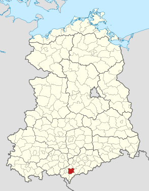
| Location of the district in the GDR | |
  |
|
The Auerbach district was a district in the Karl-Marx-Stadt district of the GDR . From October 3, 1990 to the end of 1995, it continued as the district of Auerbach in the Free State of Saxony . Its area is in today's Vogtlandkreis in Saxony. The seat of the district administration was in Auerbach .
geography
location
The Auerbach district was east of Plauen in the Vogtland .
Neighboring areas
The Auerbach district bordered clockwise in the north, beginning with the Reichenbach , Zwickau-Land , Aue , Klingenthal , Oelsnitz and Plauen-Land districts .
history
The Auerbach Authority had been established in the Kingdom of Saxony as early as 1874 and was renamed the Auerbach District in 1939 . The district of Auerbach belonged to the state of Saxony after 1945 and thus to the GDR since 1949.
On July 25, 1952, there was a comprehensive district reform in the GDR , in which, among other things, the states were dissolved and replaced by districts . 15 municipalities in the district of Auerbach fell to two newly founded districts:
- Klingenthal with 8 communities: Hammerbrücke, Klingenthal, Morgenröthe-Rautenkranz, Mühlleithen, Muldenberg, Oberzwota, Tannenbergsthal and Zwota.
- Reichenbach with 7 communities: Irfersgrün, Lengenfeld, Pechtelsgrün, Schönbrunn, Waldkirchen, Weißensand and Wolfspfütz.
From the following 26 municipalities of the district that remained in the district (Abhorn, Altmannsgrün, Auerbach, Beerheide, Bergen, Eich, Ellefeld, Falkenstein, Grünbach, Hartmannsgrün, Kottengrün, Neustadt b. Falkenstein, Oberlauterbach, Plohn, Rebesgrün, Reumtengrün, Rothenkirchen, Rodewisch, Rützengrün, Schnarrtanne, Schreiersgrün, Treuen, Trieb, Werda, Wernesgrün and Wildenau) and three municipalities from the Zwickau district (Lauterhofen, Obercrinitz and Stangengrün), the new Auerbach district was created. This was assigned to the newly formed Karl-Marx-Stadt district . The district seat was in the city of Auerbach.
On May 17, 1990, the district was renamed the Auerbach district. On the occasion of the reunification of the two German states, the district was awarded to the re-established state of Saxony in October 1990 . The original draft law of the Saxon state government of June 29, 1992 for the first Saxon district reform provided for the formation of a Vogtland district from the districts of Auerbach, Klingenthal, Reichenbach, Oelsnitz and Plauen. In the context of the legislative process, however, the formation of two districts "Elstertalkreis" (Plauen, Oelsnitz, parts of Klingenthal) and "Göltzschtalkreis" (Auerbach, Reichenbach, 6 communities in Klingenthal) was favored. This variant was then decided by the District Reform Act of June 24, 1993. A constitutional complaint was lodged with the Saxon Constitutional Court against the regulation, which ruled that it was null and void. With the 2nd District Area Amendment Act of September 6, 1995, the formation of the Vogtland District was decided on January 1, 1996.
The Auerbach district underwent the following changes and reorganizations from 1952 until it was dissolved:
- December 4, 1952 - The communities Lauterhofen, Obercrinitz and Stangengrün are reorganized into the district of Zwickau
- June 20, 1957 - Röthenbach was spun off from Wildenau ( the community was incorporated on July 1, 1950 )
- Jan. 01, 1979 - Incorporation of Abhorn into Plohn
- July 1, 1992 - Incorporation of Rützengrün into the town of Rodewisch
- April 1, 1993 - Incorporation of Altmannsgrün into the city of Treuen
- July 1, 1993 - incorporation of Plohn into Lengenfeld ( district of Reichenbach )
- January 1, 1994 - Incorporation of Schnarrtanne into the city of Auerbach / Vogtl.
- January 1, 1994 - Reumtengrün is incorporated into Rebesgrün
- January 1, 1994 - Schreiersgrün is incorporated into the city of Treuen
- January 1, 1994 - incorporation of Kottengrün in Werda
- January 1, 1994 - incorporation of Muldenberg in Grünbach, high altitude health resort
- March 1, 1994 - Incorporation of Röthenbach into the town of Rodewisch
- March 1, 1994 - Rothenkirchen, Wernesgrün and Wildenau merged to form Gde. Steinberg
Population development
| Auerbach district | ||||||||
|---|---|---|---|---|---|---|---|---|
| year | 1960 | 1971 | 1981 | 1989 | ||||
| Residents | 86,650 | 81.025 | 72,329 | 69,679 | ||||
economy
Significant companies were among others:
- VEB Robotron-Elektroschaltgeräte Auerbach
- VEB Falkensteiner curtain and lace weaving mills
- VEB machine tools Auerbach
- VEB Suppina Auerbach
- VEB felt and filter cloth Rodewisch
- VEB Vogtland Oilcloth Factory Treuen
- VEB laundry union Rodewisch
traffic
The district was connected to the GDR motorway network via the Plauen – Karl-Marx-Stadt motorway. The F 94 from Rodewisch to Reichenbach and Greiz , the F 169 from Plauen via Auerbach to Karl-Marx-Stadt and the F 173 from Plauen via Treuen to Zwickau also served national road traffic .
The district area was opened up by the Zwickau – Falkenstein and Herlasgrün – Auerbach – Falkenstein – Oelsnitz railway lines.
Population data
Population overview of all 26 communities in the Auerbach district that came to the re-established state of Saxony in 1990.
| AGS | local community | Residents | Area (ha) | |
| October 3, 1990 | December 31, 1990 | |||
| 14013020 | Altmannsgrün | 304 | 299 | 551 |
| 14013030 | Auerbach / Vogtl., City | 21,311 | 20,833 | 1,460 |
| 14013040 | Beerheide | 743 | 731 | 1.929 |
| 14013050 | Mountains | 1,180 | 1,182 | 830 |
| 14013060 | Eich / Sa. | 597 | 590 | 747 |
| 14013070 | Ellefeld | 3,329 | 3,416 | 455 |
| 14013080 | Falkenstein / Vogtl., City | 9,961 | 9,931 | 1,696 |
| 14013090 | Grünbach, mountain health resort | 1,749 | 1,741 | 1,192 |
| 14013100 | Hartmannsgrün | 874 | 873 | 988 |
| 14013110 | Cabbage green | 746 | 741 | 562 |
| 14013120 | Neustadt / Vogtl. | 1,058 | 1,049 | 1,299 |
| 14013130 | Oberlauterbach | 437 | 436 | 756 |
| 14013140 | Plohn | 355 | 358 | 446 |
| 14013150 | Vine green | 1,487 | 1,474 | 535 |
| 14013160 | Reumtengrün | 850 | 846 | 602 |
| 14013170 | Rodewisch, city | 8,042 | 8,033 | 1,669 |
| 14013180 | Roethenbach | 383 | 381 | 457 |
| 14013190 | Rothenkirchen | 1,671 | 1,659 | 584 |
| 14013200 | Rützengrün | 338 | 343 | 562 |
| 14013210 | Snarling fir | 1,244 | 1,245 | 1012 |
| 14013220 | Schreiersgrün | 828 | 824 | 459 |
| 14013230 | Faithful, city | 7,236 | 7.146 | 1,627 |
| 14013240 | Trieb / Vogtl. | 829 | 825 | 654 |
| 14013250 | Who's there | 1,051 | 1,057 | 796 |
| 14013260 | Wernesgrün | 1,131 | 1,129 | 529 |
| 14013270 | Wildenau | 565 | 572 | 929 |
| 14013 | Auerbach district | 68,299 | 67.714 | 23,326 |
License Plate
Motor vehicles (with the exception of motorcycles) and trailers were assigned three-letter distinguishing signs starting with the pair of letters TC from around 1974 to the end of 1990 . The last number plate series used for motorcycles was XG 00-01 to XG 40-00 .
At the beginning of 1991 the district received the distinguishing mark AE . It was issued through March 31, 1996. It has been available in the Vogtland district since November 9, 2012 .
Individual evidence
- ↑ a b Federal Statistical Office (ed.): Municipalities 1994 and their changes since 01.01.1948 in the new federal states . Metzler-Poeschel, Stuttgart 1995, ISBN 3-8246-0321-7 .
- ↑ Law on the self-administration of municipalities and districts in the GDR (municipal constitution) of May 17, 1990
- ^ Statistical yearbooks of the German Democratic Republic. In: DigiZeitschriften. Retrieved October 6, 2009 .
- ↑ Saxony regional register
- ↑ Andreas Herzfeld: The history of the German license plate . 4th edition. German Flag Society V., Berlin 2010, ISBN 978-3-935131-11-7 , pp. 303 .
- ↑ Andreas Herzfeld: The history of the German license plate . 4th edition. German Flag Society V., Berlin 2010, ISBN 978-3-935131-11-7 , pp. 525 .