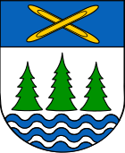
Grünbach (Saxony)
| coat of arms | Germany map | |
|---|---|---|

|
Coordinates: 50 ° 27 ' N , 12 ° 22' E |
|
| Basic data | ||
| State : | Saxony | |
| County : | Vogtland district | |
| Management Community : | Falkenstein (Vogtland) | |
| Height : | 697 m above sea level NHN | |
| Area : | 27.54 km 2 | |
| Residents: | 1643 (Dec. 31, 2019) | |
| Population density : | 60 inhabitants per km 2 | |
| Postal code : | 08223 | |
| Primaries : | 03745, 037465 (Muldenberg) | |
| License plate : | V, AE, OVL, PL, RC | |
| Community key : | 14 5 23 130 | |
| Address of the municipal administration: |
Rathausstrasse 4 08223 Grünbach |
|
| Website : | ||
| Mayor : | Ralf Kretzschmann (initiative) | |
| Location of the community Grünbach in the Vogtlandkreis | ||
Grünbach is a municipality in the Vogtlandkreis / Saxony .
geography
The state-approved resort is located around 700 m above sea level in a forest area. The Wendelstein (732 m), a quartzite cliff, rises directly from Grünbach . In the district of Muldenberg, the Zwickauer Mulde is dammed up to form the Muldenberg drinking water reservoir. The highest point of the community is about 842 m above sea level on the western slope of the Kiel mountain ( 943.3 m above sea level ).
Community structure
The following districts belong to the municipality:
- See you for (incorporated on July 1, 1948)
- Muldenberg (incorporated on March 1, 1994)
Neighboring communities
Neighboring communities are Muldenhammer , Neustadt , Falkenstein / Vogtl. , Klingenthal , Schöneck / Vogtl. as well as Zwota .
history
Grünbach was first mentioned in 1524 as “newes dörfflein” in front of the “green bächel”. The place belonged to the Electoral Saxon or Royal Saxon Office Plauen until 1856 . After 1856 Grünbach belonged to the Falkenstein court office and from 1875 to the Auerbach administration .
During the GDR era, the FDGB rest home "Druckersmühle" existed in Grünbach .
As a result of the second district reform in the GDR, the municipality of Grünbach became part of Auerbach in the Chemnitz district (renamed Karl-Marx-Stadt district in 1953 ), which was continued as the Saxon district of Auerbach from 1990 and was added to the Vogtland district in 1996.
Development of the population (December 31):
|
|
|
|
politics
City council and mayor
- IGM : 6
- CDU : 4th
Since the municipal council election on May 25, 2014 with a turnout of 58.1%, the 10 seats of the municipal council have been distributed among the individual groups as follows:
- Initiative Grünbach / Muldenberg (IGM): 6 seats, share of votes 61.3%
- CDU : 4 seats, 38.7% of the votes
Mayor is Ralf Kretzschmann.
Town twinning
Grünbach's twin town is Goldkronach in Bavaria.
Culture and sights
The center of the town is the Hotel Bayrischer Hof with a small brewery.
A memorial called a memorial with an eagle's head turned to the left and several large memorial stones on which lists of names are carved, commemorates the dead of the First World War from Grünbach.
The rock formation of the helical stone is composed of a plurality of groups, a portion in Riffzug the widespread in the upper Vogtland graywackes quartzite the Cambro - Ordovician Schöneck formation . The rocks are in the forest to the west of the village and have a summit cross at their highest point in the southern section . There is also a granite column from the historical measuring point No. 142 of the Royal Saxon Triangulation . The Wendelstein is part of the Upper Göltzschtal protected landscape area .
Economy and Infrastructure
traffic
The breakpoint Grünbach (Vogtl) is located on the railway line Falkenstein-Muldenberg , the Muldenberg station on the railway line Chemnitz-Adorf . Since the opening of the Muldenberg Floßplatz stop on the Chemnitz – Adorf railway line, it has been without a stop. Both stops are served by the Vogtlandbahn .
Web links
- Grünbach in the Digital Historical Directory of Saxony
Individual evidence
- ↑ Population of the Free State of Saxony by municipalities on December 31, 2019 ( help on this ).
- ↑ Directories of the municipalities incorporated since May 1945, 1952, published by the Ministry of the Interior of Saxony
- ^ Karlheinz Blaschke , Uwe Ulrich Jäschke : Kursächsischer Ämteratlas. Leipzig 2009, ISBN 978-3-937386-14-0 ; P. 76 f.
- ^ The Auerbach administration in the municipality register 1900
- ↑ Historical place directory of Saxony
- ↑ Results of the 2014 municipal council elections
- ^ Hotel website , accessed October 18, 2017
- ↑ Max Schröder: Explanations of the special geological map of the Kingdom of Saxony. No. 144 sheet Falkenstein . 2nd edition, Leipzig 1915, p. 6
- ↑ Werner Paelchen, Harald Walter (Ed.): Geology of Saxony . Stuttgart (Schweizerbart) 2008, ISBN 978-3-510-65239-6 , p. 84.
- ^ Community of Grünbach: Wendelstein . on www.gruenbach.de


