
Theuma
| coat of arms | Germany map | |
|---|---|---|

|
Coordinates: 50 ° 28 ' N , 12 ° 13' E |
|
| Basic data | ||
| State : | Saxony | |
| County : | Vogtland district | |
| Administrative association: | Jägerswald | |
| Height : | 483 m above sea level NHN | |
| Area : | 9.94 km 2 | |
| Residents: | 1019 (Dec. 31, 2019) | |
| Population density : | 103 inhabitants per km 2 | |
| Postal code : | 08541 | |
| Area code : | 037463 | |
| License plate : | V, AE, OVL, PL, RC | |
| Community key : | 14 5 23 410 | |
| LOCODE : | DE TMS | |
| Address of the municipal administration: |
Hauptstrasse 29 08541 Theuma |
|
| Website : | ||
| Mayor : | Lothar swivel beer | |
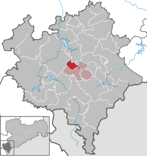
| Location of the municipality of Theuma in the Vogtlandkreis | ||
  |
||

Theuma is a municipality in the Saxon Vogtlandkreis . It belongs to the administrative association Jägerswald .
geography
location
Theuma municipality is located in the center of the Vogtlandkreis and in the Saxon part of the historical Vogtland . Theuma is located about eight kilometers southeast of the district town of Plauen . The municipality extends to 9.82 km² between the federal highway 72 in the west, the federal highway 169 in the east and the state highway 315 in the south. In the west the community is bounded by a larger forest area .
Theuma is located on a plateau about 500 meters above sea level. The height differences range from 430 m above sea level. NN at the Lieboldsmühle in the Rabenbachtal up to 630 m above sea level. NN on the Hohen Reuth in the eastern corner of the district. In addition to the Hohen Reuth , the Steinbruchpöhl is 563 m above sea level. NN southeast of the village another elevation in the area.
Geographically, the area belongs to the natural area Vogtland (East Vogtland ). To the south-west, west and north-west borders the much more agitated landscape of the Central Vogtland hill country . As one of the most striking green stone peaks, the Kemmler ( 507 m above sea level ) near Plauen immediately catches the eye from the Theuma plateau . Behind it, on the western horizon, the Elster-Saale-Schwelle spreads out as a long line. If the visibility is good, the Reuther Linde ( 584 m above sea level ) and the high-lying church village of Misslareuth ( 633 m above sea level ) can be seen there.
Neighboring places
| Mechel green | ||
| Large friezes |
.svg)
|
Mountains |
| Schloditz | Droßdorf , Lottengrün | Tirpersdorf |
Theuma is bordered by Neuensalz (district of Mechelgrün) in the north, Bergen in the east, Tirpersdorf (districts of Tirpersdorf, Schloditz, Droßdorf and Lottengrün) in the south and the district town of Plauen (district of Großfriesen) in the west.
history


Theuma was mentioned for the first time in 1267 in the deed of donation to the Theuma church as Dymen (from the Old Sorbian dym for smoke, haze). The construction of a stone church is recorded for the year 1275. It replaced the existing wooden chapel in the village. In the years 1419 to 1430 parts of the village were destroyed by the Hussites . Among other things, the church was set on fire, which was rebuilt from 1430.
During the Peasants' War, insurgent peasants storm the village's rectory in 1525. The parish became Evangelical-Lutheran in the course of the Reformation in 1528 . In 1633 Theuma was sacked by imperial soldiers. 331 people in the parish died of the plague . There was renewed construction work on the church building in 1668. The church tower was erected in its present form. In the years 1690 to 1698 the rectory was rebuilt in its current state. In 1706 the church received the pulpit that is still preserved today. In the following years there were several construction projects in the church building until 1720, among other things galleries were set up. The most important event in the early 19th century was the sack of Theuma by Napoleonic soldiers in 1806.
The manorial rule over Theuma was divided proportionally to the manors Neuensalz , Mechelgrün upper and lower part and Reusa around 1583 . Another part was directly subordinate to the Plauen office as an administrative village . In 1764 Theuma was next to the official share on the manor of the manors Mechelgrün upper and lower part, Reusa, Schloditz and Unterlosa .
Theuma belonged to the Electoral Saxon or later Royal Saxon Office of Plauen until 1856, to which the place was subject until 1856. In 1856 Theuma was affiliated with the Plauen court office and in 1875 with the Plauen administration . In 1833 and 1883 a volunteer fire brigade and the first local men's choir were founded. At the beginning of the 20th century, in 1907, the “Gasthof zum Anker” was inaugurated. In the same year construction began on a new school building, which was inaugurated in 1908. In 1913 the Germania football club was founded . Today's SV Theuma emerged from him.

The Theuma slate was first mined southeast of the village in the mid-19th century. The company "Theuma'er Plattenbrüche" has been mining the slate since 1899. This was initially done in a boiler that could only be reached via stairs and ladders. Today's terraced quarries of the "Natural Stone Works Theuma" are accessible via driveways. The natural fissure is drilled off with drilling equipment on the sole, blasted with black powder and trimmed to machine-friendly block sizes. This results in ingots of 3 - 12 tons. In 1897, the owners of the Theuma slate quarries requested a rail connection to the Herlasgrün – Oelsnitz railway in Lottengrün, which opened in 1874, for the first time . After the preparatory work of the Lottengrün – Theuma industrial line in 1901, the 3 km long freight line was inaugurated on December 15, 1903. Theuma itself only received a railway station for goods and passenger traffic in 1923 with the inauguration of the Lottengrün – Plauen railway line that was extended to Plauen . In the Second World War , the community recorded 132 fallen soldiers .
After the founding of the GDR in 1949, the municipality of Theuma became part of the Plauen-Land district in the Karl-Marx-Stadt district in the second district reform of 1952 . The agriculture was collectivized as throughout the country. The agricultural production cooperatives (LPG) "Aufbau" Type III and "Fresh Wind" Type I were founded in the 1950s and 1960s. The five LPG of the villages Großfriesen, Mechelgrün and Theuma were combined in 1967 to form a "Groß-LPG" Theuma with 1250 hectares of agricultural land. In the village was in GDR times by a state-owned operation, the children's summer camp operated Streuberg.
Passenger traffic on the railroad was discontinued in 1970, and freight traffic continued until 1972. In 1989 new buildings with 36 residential units were completed in the village. After reunification and reunification , Theuma became part of the newly founded Free State of Saxony and remained in the district of Plauen . In 1992, the local council drew up a new local development plan, which enabled the building areas “An der Bahn” and “An der Oelsnitzer Straße” as well as the industrial area Großfriesener Straße to emerge later .
In the Saxon district reform in 1996 , Theuma was added to the Vogtlandkreis, which was expanded in the second Saxon district reform in 2008 to include the previously independent city of Plauen. Since December 25, 1998, Theuma has formed the Jägerswald administrative association with Tirpersdorf, Bergen and Werda . At the beginning of the 1990s, like many other East German municipalities, the community suffered from a decline in population; the proximity to the larger cities of Plauen and Oelsnitz was able to partially compensate for this loss in recent years and contributed to population growth .
Development of the population
|
|
|
|
politics
Ulrich Sörgel is the mayor of the municipality.
- IT : 4
- SVT : 2
- KZV : 2
- FFw : 1
- DRK : 1
- FDP : 2
Since the municipal council election on May 25, 2014 , the 12 seats of the municipal council have been distributed among the individual groups as follows:
- Initiative for Theuma (IT): 4 seats
- FDP : 2 seats
- Sportverein Theuma eV (SVT): 2 seats
- Theuma Small Animal Breeding Association (KZV): 2 seats
- Theuma Volunteer Fire Brigade (FFw): 1 seat
- DRK local group Theuma (DRK): 1 seat
Attractions
Sons and daughters of the city and other personalities related to Theuma
- Joachim Günther (* 1948), politician ( LDPD / FDP )
literature
- Plauen and the middle Vogtland (= values of our homeland . Volume 44). 1st edition. Akademie Verlag, Berlin 1986.
- Richard Steche : Theuma. In: Descriptive representation of the older architectural and art monuments of the Kingdom of Saxony. 11th booklet: Amtshauptmannschaft Plauen . CC Meinhold, Dresden 1888, p. 82.
Web links
- Homepage of the community of Theuma
- Homepage of the Theumaer Dorf- und Heimatverein
- Theuma in the Digital Historical Directory of Saxony
Individual evidence
- ↑ Population of the Free State of Saxony by municipalities on December 31, 2019 ( help on this ).
- ↑ The manor Neuensalz on www.sachsens-schlösser.de
- ↑ The Mechelgrün manor at www.sachsens-schlösser.de
- ↑ The Mechelgrün moated castle at www.sachsens-schlösser.de
- ↑ The Reusa Manor at www.sachsens-schlösser.de
- ↑ The Schloditz manor at www.sachsens-schlösser.de
- ↑ The Unterlosa manor at www.sachsens-schlösser.de
- ^ Karlheinz Blaschke , Uwe Ulrich Jäschke : Kursächsischer Ämteratlas. Leipzig 2009, ISBN 978-3-937386-14-0 ; P. 76 f.
- ^ The Plauen District Administration in the municipality register 1900
- ^ Website of the Theuma natural stone factory
- ^ Description of the Theuma slate
- ↑ Facebook entry
- ↑ a b Theuma in the Digital Historical Directory of Saxony
- ↑ Information for 14 1 78 660 municipality Theuma in the Saxon regional register
- ↑ Information for 14 1 78 660 municipality Theuma in the Saxon regional register
- ↑ Imprint of the website of the municipality of Theuma
- ↑ Results of the 2014 municipal council elections
Adorf / Vogtl. | Auerbach / Vogtl. | Bad Brambach | Bad Elster | Mountains | Bösenbrunn | Eichigt | Ellefeld | Elsterberg | Falkenstein / Vogtl. | Grünbach | Heinsdorfergrund | Klingenthal | Lengenfeld | Limbach | Markneukirchen | Mill Valley | Hollow hammer | Netzschkau | Neuensalz | Neumark | Neustadt / Vogtl. | Oelsnitz / Vogtl. | Pausa-Mühltroff | Plauen | Pöhl | Reichenbach im Vogtland | Rodewisch | Rosenbach / Vogtl. | Schöneck / Vogtl. | Steinberg | Theuma | Tirpersdorf | Faithful | Triebel / Vogtl. | Weischlitz | Who's there