
Ellefeld
| coat of arms | Germany map | |
|---|---|---|

|
Coordinates: 50 ° 29 ' N , 12 ° 23' E |
|
| Basic data | ||
| State : | Saxony | |
| County : | Vogtland district | |
| Height : | 504 m above sea level NHN | |
| Area : | 4.55 km 2 | |
| Residents: | 2546 (Dec. 31, 2019) | |
| Population density : | 560 inhabitants per km 2 | |
| Postal code : | 08236 | |
| Area code : | 03745 | |
| License plate : | V, AE, OVL, PL, RC | |
| Community key : | 14 5 23 090 | |
| LOCODE : | DE LLE | |
| Address of the municipal administration: |
Hauptstrasse 21 08236 Ellefeld |
|
| Website : | ||
| Mayor : | Jörg Kerber | |
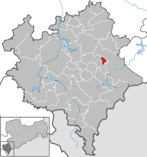
| Location of the municipality of Ellefeld in the Vogtland district | ||
  |
||

Ellefeld is a municipality in the Saxon Vogtland district near Plauen .
geography
In the municipality in the eastern part of the Vogtland , the Red and White Göltzsch unite to form Göltzsch . With over 2600 inhabitants, Ellefeld is already one of the larger communities in the Vogtlandkreis and, at 4.55 km², is also the smallest municipality in terms of area. It is owned by the cities of Auerbach / Vogtl. and Falkenstein / Vogtl. completely surrounded. The altitude of Ellefeld is 490 to 650 meters. Plauen , the largest city in the Vogtland, is 24 kilometers to the west by car. Zwickau is 32 kilometers north of the municipality.
history


.jpg)

Ellefeld was first mentioned in a document in 1459 . Workers from the Eger and Saale valleys were active on Heinrich Reuss von Plauen's lands . The property later went to the Barons von Trützschler . The manor was built in 1469. Before that there was already a hammer mill and the nearby ore mining. The Upper Castle dates from 1710; the lower castle was built in 1734. Industrialization began in the 17th and 18th centuries . Ellefeld developed from a farming village to a weaving village, and embroidery was also added. The community previously belonged to the Auerbach district and has been with the Vogtlandkreis since 1996. The district was created by amalgamating the districts of Auerbach, Klingenthal , Oelsnitz , Reichenbach and Plauen-Land . In 2009 Ellefeld celebrated the 550th anniversary of the community.
Administrative affiliation
- 1606: Plauen Office
- 1764: Plauen Office
- 1816: Plauen office with pause
- 1843: Plauen office with pause
- 1856: Falkenstein court office
- 1875: Auerbach administration
- 1952: Auerbach district
- 1994: Auerbach district
- 1996: Vogtlandkreis
- 2008: Vogtlandkreis with Plauen
Development of the population
|
|
|
|
politics
City council and mayor
The council consists of 16 councilors and the mayor. Since the municipal council election on May 25, 2014 , the 16 seats of the municipal council have been distributed among the individual groups as follows:
- Independent list for Ellefeld (ULE): 10 seats
- CDU : 4 seats
- LEFT : 1 seat
- Ellefeld Citizens' Association (EBV): 1 seat
The mayor of the community is Jörg Kerber (non-party). A special effort by Ellefeld is to preserve the autonomy of the community also with future Saxon territorial reforms .
Coats of arms and name forms
The coat of arms shows a yellow building on a black background. The depicted Upper Castle, the mansion of the Ellefeld manor, is the most striking building in the community. Underneath, a red and white wavy horizontal stripe symbolizes the confluence of the white and the red Göltzsch to the Göltzsch in the municipality. At the bottom there is a white lace cutout on a black background. This stands for the importance of the textile industry and especially embroidery in the history of the municipality.
- 1459: Ellefelt
- 1531: Ellefelt
- 1579: Ellefelt, Elefeld
- 1791: Ellefeld
Infrastructure and economy
Ellefeld is on federal highway 169 and is approached by the Vogtlandbahn . The Auerbach airfield is located north of the municipality .
Cultural monuments
Personalities
Sons and daughters of the church
- Hugo Herold (1880–1945), composer
- Klaus D. Koch (* 1948), surgeon and aphorist
Web links
- Website of the Ellefeld community
- Ellefeld in the Digital Historical Directory of Saxony
Individual evidence
- ↑ Population of the Free State of Saxony by municipalities on December 31, 2019 ( help on this ).
- ↑ Information about the community of Ellefeld
- ↑ Tourist information about Ellefeld
- ^ A b Digital Historical Directory of Saxony
- ↑ Results of the 2014 municipal council elections
- ↑ Proud community wants to maintain independence In: Freie Presse from April 23, 2014
- ^ Community of Ellefeld: The coat of arms of Ellefeld
Adorf / Vogtl. | Auerbach / Vogtl. | Bad Brambach | Bad Elster | Mountains | Bösenbrunn | Eichigt | Ellefeld | Elsterberg | Falkenstein / Vogtl. | Grünbach | Heinsdorfergrund | Klingenthal | Lengenfeld | Limbach | Markneukirchen | Mill Valley | Hollow hammer | Netzschkau | Neuensalz | Neumark | Neustadt / Vogtl. | Oelsnitz / Vogtl. | Pausa-Mühltroff | Plauen | Pöhl | Reichenbach im Vogtland | Rodewisch | Rosenbach / Vogtl. | Schöneck / Vogtl. | Steinberg | Theuma | Tirpersdorf | Faithful | Triebel / Vogtl. | Weischlitz | Who's there
