
Hainichen district
| Basic data | |
|---|---|
| District : | Karl Marx City |
| Administrative headquarters : | Hainichen |
| Area : | 318.44 km² |
| Residents: | 63,357 (Oct 3, 1990) |
| Population density: | 199 inhabitants per km² |
| License plate : | T, X (1953–1990) TH (1974–1990) HC (1991–1994) |
| Circle structure: | 40 municipalities , 3 cities |
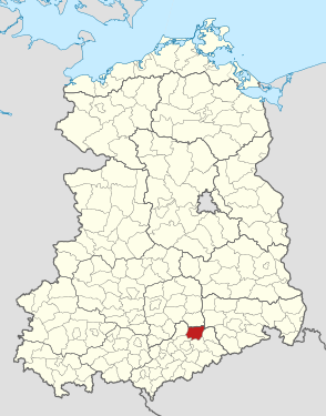
| Location of the district in the GDR | |
  |
|
The Hainichen district was an administrative unit in the Karl-Marx-Stadt district of the GDR . From 1990 to 1994 it existed as the district of Hainichen in the Free State of Saxony . His area is now in the Central Saxony district . The seat of the district administration was in Hainichen .
geography
location
The district of Hainichen belonged to the district of Karl-Marx-Stadt and was located northeast of the district capital, Karl-Marx-Stadt .
Neighboring areas
The Hainichen district bordered clockwise to the north, beginning with the districts Döbeln , Meißen , Freiberg , Flöha , Karl-Marx-Stadt-Land (until 1953 and from 1990 Chemnitz-Land) and Rochlitz .
history
The district of Hainichen was created on July 25, 1952 as part of the dissolution of the states and the formation of 14 districts of the GDR. As a completely new establishment, it had no administrative unit as a model. The new district was created from the previously existing districts of Rochlitz , Döbeln and Flöha , which roughly corresponded to the previous administrative authorities with the same name. The district town was Hainichen.
The following 49 municipalities formed the district of Hainichen :
- 26 from the Döbeln district :
- Arnsdorf , Beerwalde , Berbersdorf , Böhrigen , Cunnersdorf , Dittersdorf , Ehrenberg , Etzdorf , Falkenau , Gersdorf , Goßberg , Greifendorf , Grunau , Grünlichtenberg , Hainichen , Höckendorf near Waldheim , Höfchen , Kaltofen , Kriebethal , Marbach , Mobendorf , Moosheim , Naundorf near Roßwein , Pappendorf , Reichenbach and Schlegel
- 9 from the district of Flöha :
- Bockendorf , Dittersbach , Eulendorf , Frankenberg / Sa. , Irbersdorf , Langenstriegis , Merzdorf , Riechberg , Sachsenburg
- 1 from the Freiberg district :
- 13 from the Rochlitz district :
- Altmittweida , Erlebach , Hermsdorf b. Mittweida , Krumbach near Mittweida , Lauenhain , Mittweida , Ottendorf b. Mittweida , Ringethal , Rossau , Schönborn-Drei Werden , Seifersbach , Tanneberg and Zschöppichen .
As a result of changes in municipal area and reclassifications across district borders, the number of municipalities shrank from an initial 49 to 16 on the day it was dissolved.
- The municipality of Falkenhain b. Mittweida was incorporated into Ringethal before the district was formed (on January 1, 1952).
Bockendorf, Langenstriegis, Riechberg moved from Döbeln to Flöha on July 1, 1950.
- On December 4, 1952, two communities moved back to their districts of origin: Grunau ( incorporated into Niederstriegis in 1973 ) and Bräunsdorf b. Freiberg (merged with Langenhennersdorf in 1994, incorporated into Oberschöna in 1997). The community of Gunnersdorf moved from the Flöha district to the Hainichen district on the same day.
- On January 1, 1967, Merzdorf was reclassified into the Karl-Marx-Stadt-Land district and at the same time incorporated into the Niederlichtenau community.
On May 17, 1990, the district was renamed the Hainichen District. From 1990 to 1994 it was an administrative unit of the Free State of Saxony . On August 1, 1994, a merger took place with the district Rochlitz , parts of the district Chemnitz and with some communities of the former counties Geithain and Floeha to Mittweida .
politics
District Administrator of the Hainichen district were:
- Hans-Jürgen Merker (May 6, 1990 to September 1, 1992)
- Andreas Schramm (CDU) (September 2, 1992 to July 31, 1994)
Changes to the municipality area from 1950 in chronological order
- July 1, 1950 - Niederrossau, Oberrossau and Weinsdorf merge to form Rossau
- Jan. 01, 1952 - Incorporation of Falkenhain into Ringethal
- Jan. 01, 1961 - Incorporation of Gunnersdorf into Frankenberg, city
- January 01, 1967 - Merzdorf is incorporated into Niederlichtenau
- July 01, 1973 - incorporation of Zschöppichen into Mittweida, city
- January 1, 1974 - Kaltofen is incorporated into Pappendorf
- January 01, 1979 - Incorporation of Falkenau into Gersdorf
- October 1, 1992 - Sachsenburg and Irbersdorf merge to form Sachsenburg-Irbersdorf
- October 1, 1992 - Merger of Schönborn-Drei Werden and Seifersbach to form Schönborn-Drei Werden
- January 1, 1994 - Integration of Beerwalde in Erlau, thus separation of Beerwalde from the Hainichen district and integration into the Rochlitz district
- January 1, 1994 - Integration of Bockendorf, Cunnersdorf, Eulendorf, Gersdorf, Riechberg into Hainichen, Stadt
- January 1, 1994 - Hermsdorf b. Mittweida, Moosheim in Rossau
- January 1, 1994 - Ringethal is incorporated into Mittweida, Stadt
- January 1, 1994 - Arnsdorf merger. Böhrigen. Dittersdorf, Etzdorf, Marbach and Naundorf b. Roßwein zu Tiefenbach
- January 1, 1994 - Berbersdorf, Goßberg, Mobendorf and Pappendort merge to form Striegisthal
- January 1, 1994 - Lauenhain and Tanneberg merge to form Lauenhain-Tanneberg
- January 1, 1994 - Ehrenberg, Höfchen and Kriebethal merge to form Kriebstein
- January 1, 1994 - Niederlichtenau and Oberlichtenau merge to form Lichtenau
- March 1, 1994 - Erlebach incorporated into Kriebstein
- March 1, 1994 - Greifendorf incorporated into Rossau
- March 1, 1994 - Höckendorf b. Waldheim in Grünlichtenberg
- March 1, 1994 - Langenstriegis is incorporated in Frankenberg, Stadt
Population data
Population overview of all 43 municipalities in the district that came to the re-established state of Saxony in 1990.
| AGS | local community | Residents | surface | |
| 10/03/1990 | December 31, 1990 | in ha | ||
| 14032010 | Altmittweida | 1.937 | 1.924 | 1,407 |
| 14032020 | Arnsdorf | 363 | 354 | 415 |
| 14032030 | Beerwalde | 259 | 258 | 245 |
| 14032040 | Berbersdorf | 769 | 761 | 1,080 |
| 14032050 | Bockendorf | 342 | 337 | 731 |
| 14032060 | Böhrigen | 887 | 873 | 528 |
| 14032070 | Cunnersdorf | 288 | 285 | 561 |
| 14032080 | Dittersbach | 660 | 648 | 1,080 |
| 14032090 | Dittersdorf | 122 | 122 | 225 |
| 14032100 | Ehrenberg | 529 | 523 | 603 |
| 14032110 | Erlebach | 66 | 63 | 209 |
| 14032120 | Etzdorf | 1,058 | 1,043 | 1,304 |
| 14032130 | Owl Village | 164 | 158 | 404 |
| 14032150 | Frankenberg, city | 14,630 | 14,490 | 1,149 |
| 14032160 | Gersdorf | 398 | 400 | 452 |
| 14032170 | Goßberg | 116 | 118 | 313 |
| 14032180 | Greifendorf | 376 | 372 | 806 |
| 14032190 | Grünlichtenberg | 648 | 640 | 898 |
| 14032200 | Hainichen, city | 8,983 | 9,149 | 2,025 |
| 14032210 | Hermsdorf b. Mittweida | 218 | 217 | 394 |
| 14032220 | Höckendorf near Waldheim | 119 | 118 | 233 |
| 14032230 | Hofchen | 221 | 228 | 495 |
| 14032240 | Irbersdorf | 276 | 271 | 290 |
| 14032260 | Kriebethal | 1,163 | 1,156 | 51 |
| 14032270 | Krumbach | 306 | 307 | 433 |
| 14032280 | Langenstriegis | 545 | 540 | 1,341 |
| 14032290 | Lauenhain | 867 | 865 | 490 |
| 14032300 | Marbach | 1,460 | 1,459 | 1,636 |
| 14032310 | Mittweida, city | 17,287 | 17.163 | 1,470 |
| 14032320 | Mobendorf | 430 | 421 | 866 |
| 14032330 | Moosheim | 159 | 148 | 346 |
| 14032340 | Naundorf b. Horse wine | 232 | 237 | 283 |
| 14032350 | Ottendorf b. Mittweida | 1,337 | 1,330 | 1,129 |
| 14032360 | Pappendorf | 733 | 722 | 1,061 |
| 14032370 | Reichenbach | 264 | 257 | 611 |
| 14032380 | Riechberg | 382 | 370 | 632 |
| 14032390 | Ringethal | 539 | 533 | 464 |
| 14032400 | Rossau | 1,202 | 1,188 | 2,619 |
| 14032410 | Sachsenburg | 693 | 674 | 619 |
| 14032420 | Schlegel | 270 | 260 | 354 |
| 14032430 | Schönborn becoming three | 1,164 | 1,163 | 622 |
| 14032440 | Seifersbach | 598 | 599 | 542 |
| 14032450 | Tanneberg | 297 | 295 | 431 |
| 14032 | District of Hainichen | 63,357 | 63,039 | 31,845 |
License Plate
Motor vehicles (with the exception of motorcycles) and trailers were assigned three-letter distinguishing signs from around 1974 to the end of 1990, starting with the pair of letters TH . The last number plate series used for motorcycles was XT 30-01 to XT 70-00 .
At the beginning of 1991 the district received the distinctive sign HC . It was issued until December 31, 1994. It has been available in the Central Saxony district since November 9, 2012 .
Individual evidence
- ↑ a b c Federal Statistical Office (ed.): Municipalities 1994 and their changes since 01.01.1948 in the new federal states . Metzler-Poeschel, Stuttgart 1995, ISBN 3-8246-0321-7 .
- ↑ Law on the self-administration of municipalities and districts in the GDR (municipal constitution) of May 17, 1990
- ↑ Saxony regional register
- ↑ Andreas Herzfeld: The history of the German license plate . 4th edition. German Flag Society V., Berlin 2010, ISBN 978-3-935131-11-7 , pp. 303 .
- ↑ Andreas Herzfeld: The history of the German license plate . 4th edition. German Flag Society V., Berlin 2010, ISBN 978-3-935131-11-7 , pp. 525 .