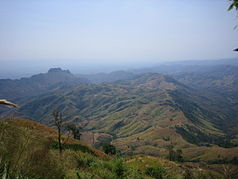
Phu Hin Rong Kla National Park
| Phu Hin Rong Kla National Park | ||
|---|---|---|
| View of the Phu Hin Rongkla National Park | ||
|
|
||
| Location: | Phitsanulok , Thailand | |
| Next city: | Nakhon Thai | |
| Surface: | 307 km² | |
| Founding: | July 26, 1984 | |
The Phu Hin Rongkla National Park ( Thai อุทยานแห่งชาติภู หิน ร่อง กล้า ) is a national park in the provinces of Phitsanulok and Loei and Phetchabun in northern Thailand .
location
Phu Hin Rongkla National Park covers an area of about 307 square kilometers in the districts ( Amphoe ) of Nakhon Thai (Phitsanulok Province), Dan Sai (Loei Province). The southern part of the national park passes into Phetchabun Province. The smaller rivers Mueat Don and Luang Yai have their source here.
topography
The landscape of the national park is characterized by steep mountains and rocks. Larger peaks form the Phu Phangma, Phu Lomlo (height: 1664 meters), Phu Hin Rongkla and Phu Man Khao, which is the highest point in the park with a height of 1820 meters.
fauna and Flora
The mountains are covered with evergreen forest. Dry Dipterocarpus forests are predominant .
There are many species of animals in the park. In addition to the rare tiger and leopard , the Asian black bear and various species of birds are at home here.
Attractions
Lan Hin Taek ( ลาน หิน แตก , Field of Broken Rocks) is located about 300 meters west of the former headquarters of the Thai army and forms a very beautiful natural rock formation with numerous orchids , ferns , mosses , lichens and seasonal flowers.
The Man Daeng waterfall ( น้ำตก หมัน แดง ) is about 22 kilometers from the headquarters of the Park administration toward Lom Sak removed. It has a total of 32 steps and receives its water from the height of Phu Man Khao.
The former accommodations of the headquarters of the communist armed forces are three kilometers from the park administration. Not far away is a water mill by the river .
climate
Due to the mountain location, the climate is relatively moderate and not as hot as in the lowlands. Temperatures don't rise much above 25 ° C and can even drop below freezing on occasion .
history
Between 1968 and 1972, the area of the national park was the scene of fighting between communist insurgents, who had established a base here, and Thai soldiers. Due to the difficult terrain, it was not possible to achieve any success against the communists at first and had to change tactics. Military police and civil forces supported the soldiers and were able to convince the Hmong to sever ties with the insurgents and to work for the Thai authorities. The communists could then be surrendered without bloodshed.
In February 1983, officials of the national park administration of the country examined the area for the first time and found that there are many natural beauties here that made them suitable for a national park. In 1984 the national park was opened as the 48th in the country.
literature
- Vasa Sutthipibul (et al., Ed.): National parks in Thailand . National Park, Wildlife and Plant Conservation Department, Bangkok 2006, ISBN 974-286087-4
- Thung Salaeng Luang, Phu Hin Rong Kla. Pine forest, Grassland, and Rocky Hardpan of the Phetchabun Range. Tourism Authority of Thailand, 2000, ISBN 974-8252-74-4 .
Web links
- Phu Hin Rong Kla National Park from the Thai "Department of National Parks" - description in English [last accessed October 15, 2013]

