Rift Valley (Kenya)
| Rift Valley | |
|---|---|
| Basic data | |
| Capital | Nakuru |
| surface | 182,413 km² |
| Residents | 12,231,900 (calculation 2015) |
| Population density | 48 inhabitants per km² |
| ISO 3166-2 | KE-700 (repealed) |
Rift Valley was the largest of Kenya's provinces . Their capital was at Lake Nakuru located Nakuru . In 2013 it was divided into several so-called districts (counties).
geography

The province consisted of a valley up to 100 km wide, which stretches in north-south direction from Lake Turkana to Nairobi . There is a section of by the geologist and explorer John Walter Gregory as the Great Rift Valley named East African grave breach . In this stunning Kenyan countryside near the Baringosees Gregory had the concept of the Great Rift Valley coined later to the entire system of the African Great grave breach was expanded.
The Rift Valley also has Kenya's largest dam , the Turkwel Dam .
Not all the plains in the valley are fertile; grasslands alternate with desert areas. The soda lakes are home to a peculiar bird world, characterized by the occurrence of the flamingos characteristic of this part of Africa.
Rift Valley bordered Tanzania to the south, Uganda to the west and Ethiopia and South Sudan to the north, or the Ilemi Triangle, which is disputed between the three neighboring states .
population

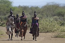
Rift Valley was the fastest growing province in Kenya in terms of population; in 1989 there were about 4,981,613 inhabitants, in 1999 there were already 6,987,036 and in 2015 there were an estimated 12,231,900. Different groups of the population lived here, including the Maasai , Samburu , Turkana and Kalendjin .
In the north, refugees from South Sudan, Ethiopia and Somalia lived in Kakuma .
As part of the 2010 constitution , the Kenyan provinces were dissolved. The Rift Valley Province now includes the counties of Baringo , Bomet , Elgeyo-Marakwet , Kajiado , Kericho , Laikipia , Nakuru , Nandi , Narok , Samburu , Trans-Nzoia , Turkana , Uasin Gishu and West Pokot .
Administrative division
Rift Valley was divided into 18 districts:
Trivia
The Rift Valley fever was named after the valley because it is thought that the contagious fever in this area has its origin.
literature
- Uwe George (report and photos): Birth of an ocean . In: Geo-Magazin. Hamburg 1978, 7, pp. 50-80. ("Uwe George witnessed the first phase of a process that took millions of years: Africa is falling apart in the Rift Valley.") ISSN 0342-8311
Individual evidence
- ^ Rift Valley (Former Province, Kenya) - Population Statistics, Charts, Map and Location. Retrieved September 26, 2017 (English).
- ↑ bevölkerungsstatistik.de (2007)
- ↑ Kenya: Provinces, Major Cities, Municipalities, Towns & Urban Centers - Population Statistics in Maps and Charts. Retrieved December 1, 2017 .
Web links
Coordinates: 0 ° 30 ′ 0 ″ N , 36 ° 0 ′ 0 ″ E


