Ringwall Stiglerfelsen
| Ringwall Stiglerfelsen | ||
|---|---|---|
|
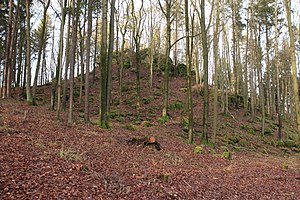
Stieglerfelsen on Mayersberg near Hörmannsdorf (2013) |
||
| Creation time : | Prehistoric and early historical building | |
| Castle type : | Hilltop castle | |
| Conservation status: | Wall received | |
| Place: | Hörmannsdorf (Parsberg) | |
| Geographical location | 49 ° 13 '6.6 " N , 11 ° 45' 21.1" E | |
|
|
||
The ring wall Stiglerfelsen is located 1050 m north-northeast of Hörmannsdorf , today a district of the Upper Palatinate town of Parsberg in the Neumarkt district in the Upper Palatinate of Bavaria . The ring wall lies on the so-called Mayersberg.
description
On the humped mountain top of Mayersberg there are the remains of an almost rhombic stone wall, the length of which is about 110 m. On the west side the wall is clearly pronounced, in the east it is hardly present any more; there is no settlement area.
history
In 1936 prehistoric shards and a millstone were found. These artefacts are now in the Amberg Archaeological Museum . Further reading finds exist in ceramics from the Metal Age , which are kept in the Historical Museum in Regensburg .
literature
- Sixtus Lampl : Monuments in Bavaria - ensembles, architectural monuments, archaeological site monuments: Volume III. Upper Palatinate. Bavarian State Office for Monument Preservation (Ed.), Munich 1985.
- Armin Stroh : The prehistoric and early historical monuments of the Upper Palatinate. (Material booklets on Bavarian prehistory, series B, volume 3). Verlag Michael Lassleben, Kallmünz 1975, ISBN 3-7847-5030-3 , p. 176.
Web links
- Entry on Wallburg Stiglerfels Mayersberg in the private database "Alle Burgen".


