Burgstall Thürsnacht
| Burgstall Thürsnacht | ||
|---|---|---|
|
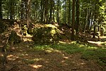
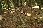
Burgstall Thürsnacht - rock fall on the north side |
||
| Creation time : | probably high Middle Ages | |
| Castle type : | Höhenburg, summit location | |
| Conservation status: | Burgstall | |
| Place: | Lauterhofen -Thürsnacht | |
| Geographical location | 49 ° 19 '49.6 " N , 11 ° 39' 33" E | |
| Height: | 557.8 m above sea level NN | |
|
|
||
The Thürsnacht castle stable, presumably from the Middle Ages, is the remnant of an abandoned summit castle that once rose on a rocky hilltop. The Burgstall is located east of the hamlet Thürsnacht in the municipality Lauterhofen in the Upper Palatinate district of Neumarkt in the Upper Palatinate in Bavaria , Germany . Of the castle, about which not much is known to this day, and which may be Thürstein Castle, only a ring wall remains.
Geographical location
The site of the former castle is located in the center of the Franconian Alb low mountain range , the middle Franconian Alb , at 557.8 m above sea level. NN high summit of a neighboring elevation of the Fleckelberg to the west . The Burgstall is located about 450 meters east of the center of Thürsnacht or about 6 kilometers southeast of Lauterhofen.
The north side of the hilltop, which is best protected by nature, first falls very steeply at up to 15 meters, mostly due to a vertical rockfall, and then merges into the Wirlbachtal in a moderately steep slope . The entire western and southern slopes of the mountain also only drop with a moderately steep slope into the neighboring lowlands, only the eastern side merges into a mountain saddle just a few meters lower than the castle grounds , and then climbs to a neighboring, roughly equal crest which then drops into the valley of the Utzenhofer Bach .
There are other former medieval castles in the vicinity, just a few kilometers north-northwest on the 626.6 meter high Dietrichstein is the so-called Burgstall Schweppermannsburg , which is probably Thierenstein Castle. In a south-westerly direction there was another castle stable on the Habsberg, but it was built over by the large and small pilgrimage churches of the Assumption of Mary. A little further are the castle stables Lützelburg , and Hofberg or Old Church, as well as an early medieval ring wall near Unterwiesenacker. To the south of this castle stables are the Plankenstein castle stables and the castle ruins of Helfenberg , Velburg and Adelburg .
History of the castle
There is no known historical information about the lost castle near Thürsnacht, it can not be clearly assigned in a document , so that neither the builder nor the time of construction of the castle can be found, but according to Rädle it could be the "very old" Thürstein castle. The name is probably derived from "tower", and the neighboring hamlet of Thürsnacht could also derive its name from "near the tower". However, the Burgstall on the Dietrichstein is also identified with the Thürstein Castle. Thürstein Castle was probably only a ruin around the year 1200, because in 1219 the destroyed Kastl Monastery was rebuilt " with the ruins of Thürstein Castle ".
The site of the former castle is densely overgrown with forest, only a ring wall has survived. An unmarked forest path leads to the freely accessible Burgstall.
The ground monument registered by the Bavarian State Office for the Preservation of Monuments as "Medieval Castle Stables" has the monument number D-3-6635-0051.
description
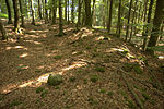
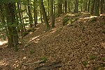
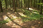
The place of the abandoned hilltop castle is on the highest point of a flat hilltop that slopes slightly to the south (Fig. 1). The north side of the crest drops about 15 meters vertically (title picture), the south side of the system sits on a two meter high rock step (picture 2). The two remaining sides merge into a moderately steep mountain slope , so that these three sides, which are naturally the poorest protected, had to be surrounded by a stone wall. This wall (Fig. 3, 4 and 5) is preserved up to one meter high above the inner surface of the system. A ditch, which is now very shallow, can be seen on its inside.
The area of this presumably one-piece summit castle is oval in shape, and measures around 85 × 40 meters, traces of former buildings can no longer be seen above ground (panorama). An interruption in the wall on the north side of the complex probably shows the former entrance to the castle (Fig. 6 and 7). This assumption is also underlined by a bastion-like projecting part of the rampart from the rampart and flanking the access on the south side (Figs. 7 and 8), which may be a tower.
literature
- Herbert Rädle: Castles and fortress stables in the Neumarkt district . Published by the district of Neumarkt in der Oberpfalz, Neumarkt o. J., ISBN 3-920142-14-4 , p. 119.
- Armin Stroh : The prehistoric and early historical monuments of the Upper Palatinate . (Material booklets on Bavarian prehistory, series B, volume 3). Verlag Michael Lassleben, Kallmünz 1975, ISBN 3-7847-5030-3 , p. 169.
Web links
Individual evidence
- ^ Topographic map 1: 25000, sheet 6635 Lauterhofen
- ^ The Burgstall on the website of the Bavarian State Office for Monument Preservation
- ↑ Source: Information board at the Burgstall
- ^ The Burgstall on the website of the Bavarian State Office for Monument Preservation
- ^ The ring wall on the side of the Bavarian State Office for Monument Preservation
- ^ Source: Herbert Rädle: Castles and castle stables in the Neumarkt district, p. 51
- ^ The Burgstall Thürsnacht on the website of the Bavarian State Office for Monument Preservation


