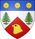
Saint-Julien-Molhesabate
| Saint-Julien-Molhesabate | ||
|---|---|---|

|
|
|
| region | Auvergne-Rhône-Alpes | |
| Department | Haute Loire | |
| Arrondissement | Yssingeaux | |
| Canton | Boutières | |
| Community association | Pays de Montfaucon | |
| Coordinates | 45 ° 11 ′ N , 4 ° 26 ′ E | |
| height | 809-1,388 m | |
| surface | 27.5 km 2 | |
| Residents | 176 (January 1, 2017) | |
| Population density | 6 inhabitants / km 2 | |
| Post Code | 43220 | |
| INSEE code | 43204 | |
Saint-Julien-Molhesabate is a French municipality with 176 inhabitants (as of January 1 2017) in the department of Haute-Loire in the region Auvergne Rhône-Alpes . It belongs to the arrondissement of Yssingeaux and the canton of Boutières (until 2015: canton of Montfaucon-en-Velay ).
geography
Saint-Julien-Molhesabate is located about 46 kilometers east-northeast of Le Puy-en-Velay and about 27 kilometers south-southeast of Saint-Étienne in the Velay , a landscape in the French Massif Central . Saint-Julien-Molhesabate is surrounded by the neighboring municipalities of Riotord in the north, Monestier in the east and northeast, Saint-Julien-Vocance in the east and southeast, Saint-Bonnet-le-Froid in the south, Montregard in the west and southwest, and Dunières in the west and Northwest.
Population development
| year | 1962 | 1968 | 1975 | 1982 | 1990 | 1999 | 2006 | 2013 |
|---|---|---|---|---|---|---|---|---|
| Residents | 425 | 358 | 302 | 254 | 253 | 196 | 205 | 180 |
Source: Cassini and INSEE
