
Tyrlaching
| coat of arms | Germany map | |
|---|---|---|

|
Coordinates: 48 ° 4 ′ N , 12 ° 40 ′ E |
|
| Basic data | ||
| State : | Bavaria | |
| Administrative region : | Upper Bavaria | |
| County : | Altötting | |
| Management Community : | Kirchweidach | |
| Height : | 520 m above sea level NHN | |
| Area : | 20.54 km 2 | |
| Residents: | 1042 (Dec. 31, 2019) | |
| Population density : | 51 inhabitants per km 2 | |
| Postal code : | 84558 | |
| Area code : | 08623 | |
| License plate : | AÖ, LF | |
| Community key : | 09 1 71 134 | |
| Community structure: | 24 districts | |
| Address of the municipal administration: |
Hauptstrasse 21 84558 Kirchweidach |
|
| Website : | ||
| Mayor : | Andreas Zepper (free electorate) | |
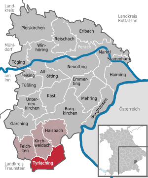
| Location of the municipality of Tyrlaching in the Altötting district | ||
  |
||


Tyrlaching ( Bavarian : Dialing) is the southernmost municipality in the Upper Bavarian district of Altötting and a member of the Kirchweidach administrative community .
geography
The Rainbichl , the highest point in the district, is located in the municipality in the Rupertiwinkel .
Community structure
Tyrlaching has 24 districts:
history
Until the church is planted
The name of the place comes from the time of the Bavarian conquest in the 6th and 7th centuries. It was first mentioned in 790 as Deolekingas and means "With the people of Deorlaik". ( Deorlaik was the name of the leader of the settlers at that time.) Since the beginning of the 8th century, the St. Peter monastery in Salzburg owned goods in the village. When the Salzburger Land broke away from Bavaria in 1328, Tyrlaching was part of this new, independent state.
Tyrlaching was an office of the Archbishopric of Salzburg and fell to Archduke Ferdinand of Tuscany during its secularization in 1803 , to Austria in 1805 in the Peace of Pressburg , which ceded it to Bavaria in 1809/10 together with the Rupertiwinkel .
The wasteland of Lauterholzen fell into desolation in the 19th century.
District affiliation
Tyrlaching was part of the district of Laufen, which was dissolved as part of the local government reform in 1972 . The community came on July 1, 1972 Altötting and forms since then with the communities Kirchweidach , feichten and Halsbach the administrative community Kirchweidach .
Incorporations
On May 1, 1978, parts of the dissolved community of Kay ( Traunstein district ) were incorporated.
Population development
Between 1988 and 2018 the municipality grew from 839 to 1,006 by 167 inhabitants or 19.9%.
politics
mayor
Mayor has been Andreas Zepper (free electorate) since May 1, 2014. He was elected for a further six years on March 15, 2020 with 87.5% of the vote.
Municipal council
After the last local election on March 15, 2020 , the local council has twelve members who - as in the 2014 to 2020 term of office - all belong to the Free Voters parliamentary group . The turnout was 61.7% (2014: 64.2%). Another member and chairman of the municipal council is the mayor.
Attractions
- Parish Church of St. John the Baptist (built in 1509, neo-Gothic furnishings)
- Filialkirche Oberbuch (from the 15th century)
education
There is a day-care facility in the municipality with 69 places and 56 visitors. Elementary school classes from the Kirchweidach elementary and middle school are housed in the local school building.
Geotopes
- Dead ice kettle Waldweiher Wiesenzart; geoscientific meaning "valuable".
- Nagelfluh outcrop near Moosen; geoscientific meaning "significant", grown together.
- Moränenhüger S by Wiesenzart; two small moraine hills in a beautiful location; geoscientific meaning "significant".
- Nagelfluh outcrop near Niederbuch; geoscientific meaning "significant", grown together.
Individual evidence
- ↑ "Data 2" sheet, Statistical Report A1200C 202041 Population of the municipalities, districts and administrative districts 1st quarter 2020 (population based on the 2011 census) ( help ).
- ↑ Place name search - history - district - Altötting district office. Retrieved April 23, 2020 .
- ^ Community Tyrlaching in the local database of the Bayerische Landesbibliothek Online . Bavarian State Library, accessed on December 23, 2017.
- ↑ Wolf-Armin Frhr. v. Reitzenstein : Lexicon of Bavarian place names. Origin and meaning . CH Beck, Munich 2006, ISBN 3-406-55206-4 , p. 280 .
- ^ Federal Statistical Office (ed.): Historical municipality directory for the Federal Republic of Germany. Name, border and key number changes in municipalities, counties and administrative districts from May 27, 1970 to December 31, 1982 . W. Kohlhammer GmbH, Stuttgart / Mainz 1983, ISBN 3-17-003263-1 , p. 567 .
- ↑ Homepage of the elementary and middle school
- ↑ Dead ice kettle
- ↑ Nagelfluh outcrop near Moosen
- ↑ Moraine Hill
- ↑ Nagelfluh outcrop near Niederbuch
Web links
- Entry on the coat of arms of Tyrlaching in the database of the House of Bavarian History
Aichbichl | Bartl | Eberheissing | Emmering | Hainbuchreut | Kienertsham | Kraham | Loah | Loding | Mosses | Niederbuch | Oberbuch | Oberschnitzing | Pilling | Pirkern | Strongers | Heel | Stockham | Tyrlaching | Signature carving | Waltenham | Meadow tender | Zageln | Zaiselham

Altötting | Burghausen | Burgkirchen an der Alz | Emmerting | Erlbach | Feichten an der Alz | Garching an der Alz | Haiming | Halsbach | Kastl | Kirchweidach | Marktl | Mehring | Neuötting | Perach | Pleiskirchen | Reischach | Stammham | Teising | Töging am Inn | Tüßling | Tyrlaching | Untereukirchen | Winhöring