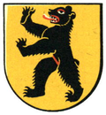
Uors GR
| GR is the abbreviation for the canton of Graubünden in Switzerland and is used to avoid confusion with other entries of the name Uors . |
| Uors | ||
|---|---|---|
| State : |
|
|
| Canton : |
|
|
| Region : | Surselva | |
| Political community : | Lumnezia | |
| Postal code : | 7114 | |
| Coordinates : | 733.43 thousand / 173 648 | |
| Height : | 927 m above sea level M. | |
| Website: | www.lumnezia.ch | |
|
Uors |
||
| map | ||
|
|
||
Uors (German and to 1943 officially Furth ) is a location in the community 2013 formed Lumnezia in Biinden Lugnez .
geography

Located above the gorge of Val Mulin, where the Glogn (in German: Glenner) and the Valserrhein unite, the place is located at the junction of the connecting paths between Oberlugnez, the valley center of Vella and the southern Valsertal. Old road connections lead into the valley via Surcasti to Vrin towards Greina or on foot through a geologically unstable slide area to Degen .
history
Finds from the late Bronze Age and remains of a late Iron Age settlement in the neighboring town of Surcasti are evidence of an early settlement . The first mention Uors in the Carolingian period in the kingdom Urbar of 831 as villa Vorce and occurs 1290/98 as Furze or 1325 as Vurz on what from 1376 for the first time as Wade , testified to 1943 official German place name Furth revealed. The current form of the name Uors is a further development of the late medieval sound Vurz . The place name goes back to the Latin bǐfurcus «forked» and refers to the junction of the two valleys Lugnez (valley river Glenner) and Valsertal (valley river Valserrhein).
In the Middle Ages, Uors was a fiefdom of the Diocese of Chur until 1371 under the bailiwick of the feudal lords of Belmont and from 1390 under the Sax-Misox . In 1538 the sovereign rights were bought out. Uors formed a neighborhood with Tersnaus and Duvin until 1851 , after which it became its own political municipality . From 1963 to 2001, formed together with Peiden the community Uors-Peiden . From 2002, Uors belonged to the newly formed Suraua community, which only existed for ten years , until it was merged into the newly founded Lumnezia community in early 2013 . Ecclesiastically, the place first belonged to the parish church of St. Vinzenz , from 1528 to that of Surcasti. Uors was until the late 20th century by turns rural community place of the circle Lumnezia / Lugnez .
Uors also included the farmsteads and estates of Cresta, Caglia and Runs on the Camuns settlement terrace until 1903 . Alpine agriculture largely shapes everyday life and the settlement structure to this day. In 1965 an agricultural property improvement was carried out with the aim of preserving the farming community. The constant expansion of Glennerstrasse improved the traffic situation and the connection to the regional center of Ilanz in the 20th century .
population
| Population development | ||||
|---|---|---|---|---|
| year | 1850 | 1900 | 1950 | 1960 |
| Residents | 156 | 104 | 88 | 91 |
structure
The population has decreased since the 19th century due to emigration and other structural influences, especially in alpine mountain agriculture . The employment structure also changed significantly over time. In 1960 around a third of the residents were active in agriculture and trade, today there are only a few such businesses. Alternatively, tourism, trade and the construction industry offer an existence with the construction of second homes, which is, however, severely restricted.
In 1968 a primary school and a cultural center for the neighborhoods in Unterlugnez was established in Uors: Peiden, Camuns, Tersnaus and the neighboring town of Surcasti . The primary school center existed until 2008 and is used differently today due to the changed population structure. Since 2013, the administrative center of Uors has been located on the opposite side of the Lugnez valley in Vella in the merged valley municipality of Lumnezia .
Attractions
The Chapel of St. Karl Borromeo from the 17th century is in Uors . A narrow suspension bridge for hikers leads over Runs and Caglia over the Val Tersnaus.
literature
- Adolf Collenberg: Uors. In: Historical Lexicon of Switzerland . 2016 .
- Caduff Christian. Congregation portrait Uors / Peiden. In: Bündner Zeitung of May 12, 1984
- Duri Blumenthal, Armin Caduff u. a .: cultural guide Val Lumnezia and Chur / Vella. 2000, p. 201 f.
- Churches in Surcasti and Uors. In: Peda art guide No. 363/1996. ISBN 3-89643-019-X
Individual evidence
- ^ Rhaetian name book . Volume 2, arr. and ed. by Andrea Schorta . Francke, Bern 1964, p. 42 (bifurcus) and 879 (Uors) .


