Zerninsee
Coordinates: 53 ° 53 ′ 57.8 " N , 14 ° 11 ′ 45.2" E
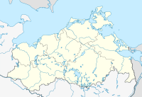
The Zerninsee is a silted lake in the east of the island of Usedom in the district of Garz . As fen he is now a nature reserve Zern Insee sink and Swinemoor . The lake got its name from the place Sennin, which was documented between 1277 and 1468 on its west bank . The Zernin Sea Depression is located north of the federal highway 110, right on the border with Poland . South of the area is the Golm, the highest point on the island.
history
The Zerninsee was formed after the last ice age in a glacier tongue basin that is surrounded by moraines in the north, west and south. The original connection to the Swine was separated by the formation of dunes. East of the lake, a one to two meter high moor, the Swinemoor, formed.
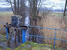
Around 1842 work began on draining the raised bog by building drainage ditches in order to gain new agriculturally usable areas. As a result, the Zerninsee began to silt up. In 1916 the government of the province of Pomerania classified the lake as worthy of conservation. Because of the occurrence of rare bird species on the shores of the lake, it was treated as a bird sanctuary from 1922 . However, that changed in 1936. By means of a ring ditch created by the Reich Labor Service around the lake, attempts were made to wrest more land from the lake in order to improve the food supply for the population in times of war. The water was discharged into the Szczecin Lagoon via the peat ditch . The lake continued to silt up. The Swinemoor was already largely forested at that time. However, the company missed its target and was eventually abandoned.
Nature reserve
The ornithologists Paul Robien and Ulrich Dunkel tried at this time to put the area under nature protection. After the Peenemünder Haken was declared a nature reserve in 1925 , the Zerninsee followed in 1938 with its bank areas on a total area of 145 hectares. The Swinemoor, however, was not under protection. Here the sinking water levels decimated the moor flora. When the border between Germany and Poland was drawn on the island of Usedom in 1945, the Zerninsee was largely silted up. The water surface that still exists today near the B 110 is the remaining hole from gravel mining. In 1963 the government of the GDR revoked the status as a nature reserve. From the mid-1960s, attempts were made again to dry up the moorland using swimming pumps and deepening existing sewage ditches and creating further sewer ditches in 1980. However, this condition could not be maintained permanently, the forestation of the high moor progressed faster.
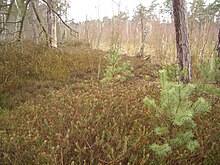
In 1995 an area of 375 hectares, including the Swinemoor, was placed under nature protection again. The preservation of the moor should be guaranteed by increasing the water level. The largest living raised bog in Usedom is now located here. The current state of the area is classified as unsatisfactory, since the water balance of the areas is disturbed by drainage ditches that are still active in places. The area can be viewed from the federal road bordering to the south.
literature
- Environment Ministry Mecklenburg-Western Pomerania (Ed.): Zerninsee-Senke 300 . In: The nature reserves in Mecklenburg-Western Pomerania . Demmler, Schwerin 2003, p. 176 f.
Web links
- Dirk Weichbrodt: Zerninsee - A natural area through the centuries. In: Usedom exclusiv. 2004, archived from the original on October 12, 2007 ; Retrieved August 11, 2007 .
- Ordinance on the Zerninsee-Senke nature reserve . August 15, 1995, accessed May 1, 2016 .
- Map portal Umwelt MV with geodata (protected area border), results of the biotope mapping
Individual evidence
- ↑ Geodata viewer of the Office for Geoinformation, Surveying and Cadastre of Mecklenburg-Western Pomerania ( information )


