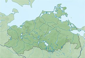
Anklamer Stadtbruch nature reserve
|
Anklamer Stadtbruch nature reserve
|
||
|
Anklamer peat bog |
||
| location | Southeast of Anklam in Vorpommern District Vorpommern-Greifswald | |
| surface | 1461 ha | |
| Identifier | LU MV 47 | |
| WDPA ID | 14364 | |
| Geographical location | 53 ° 49 ' N , 13 ° 52' E | |
|
|
||
| Sea level | from -2 m to 6 m | |
| Setup date | April 27, 1934 | |
| administration | LUNG | |
The Anklamer Stadtbruch nature reserve is a 1461 hectare nature reserve in Mecklenburg-Western Pomerania . It was placed under protection on April 27, 1934 with the aim of protecting and developing a large moor landscape with a rain bog interspersed with it. There were two extensions in 1937 and 1964. The area is located south of the confluence of the Peene in the Stettiner Haff . The surrounding towns are to the northeast of Kamp and to the west of Bugewitz and Rosenhagen . The state of the area is considered to be good. There are almost natural hydrological conditions. The area can be hiked on two circular routes south of Grünberg .
History and water balance
The Peene Valley was created at the end of the last Ice Age and was located on the northwest edge of the late glacial Haff reservoir . The areas were permanently flooded in the course of the sea level rise of the Littorina transgression . Moor formation processes started and over the millennia led to a swamping moor , which essentially consists of alder quarry peat and reaches a thickness of three meters. Inland a groundwater fed through-flow moor grew . Sedges essentially formed the peat here . In the central part of today's protected area, a raised moor that was only fed by rainwater could then grow.
Human use began in the 16th century. Small peat cuttings were made in the raised bog areas . The rest of the area was subject to pasture and meadow use. Frederick the Great issued an edict in 1750 to force the use of peat. Three navigable peat canals were built by 1850. The peat mining continued until 1945 and led to the halving of the original 500 hectares of raised bog area. In 1932 the Anklamer Stadtbruch was diked and drained with two pumping stations . The now dry areas were reforested with spruce and the paths were expanded. The drained bog sank so that the areas are now partially below sea level . The storm flood on November 4, 1995 led to the dike breach and subsequent permanent flooding of the Anklamer Stadtbruch and thus to the formation of the Anklamer peat bog , which was controversially discussed by the residents concerned. Since then, forest use has only been possible to a limited extent. Trees die extensively.
At the end of 2018, the NABU Foundation for National Natural Heritage acquired 1,360 hectares of the Anklam urban district. The previously intensive hunting in the area has been discontinued and it is planned to backfill the drainage ditches.
Flora and fauna
Most of the protected area is planted with swamp forests with flutter grass, common ash and alder . Bog forests with peat moss , beak sedge and birch grow in the arid areas . The royal fern occurs, as well as gagel and loosestrife . In the high moor area, 55 hectares are still free from forests.
There are significant populations of butterflies throughout the area . Noteworthy are the moorland welted moth , the blue gentian and numerous other butterfly species . There are 100 breeding bird species, including white-tailed eagles , red and black kites , goshawks , honey buzzards , cranes , wrynecks , wood sandpipers , sparrowhawks , owls and carminers . Otters and beavers are native to the area.
literature
- Anklamer Stadtbruch Nature Reserve 47 . In: Ministry of Environment Mecklenburg-Western Pomerania (Hrsg.): The nature reserves in Mecklenburg-Western Pomerania . Demmler-Verlag, Schwerin 2003, ISBN 3-910150-52-7 , p. 190 f .
- Alexander Nikolai Baron von Schilling: Acceptance of ecosystem development after natural rewetting of a moor landscape using the example of the Anklam urban break. (PDF; 3.0 MB) In: yumpu.com. 2003, p. 103 , accessed on November 11, 2016 .
- Karsten Schulz: Vegetation and site development of the rewetted grassland in the Anklamer Stadtbruch (Mecklenburg-Western Pomerania). (PDF; 5.5 MB) In: yumpu.com. 2005, p. 140 , accessed November 11, 2016 .
Web links
- Anklamer Stadtbruch at the NABU Foundation for National Natural Heritage
- Zweckverband Peenetal-Landschaft
- Geobotany and Landscape Ecology Working Group: Anklamer Stadtbruch. ( Memento from May 16, 2010 in the Internet Archive )
- Map portal environment of the State Office for the Environment, Nature Conservation and Geology Mecklenburg-Western Pomerania ( information ) with geodata


