
Ōita Prefecture
|
Ōita-ken 大分 県 |
|
|---|---|
  |
|
| Basic data | |
| Administrative headquarters : | Ōita |
| Region : | Kyushu |
| Main island : | Kyushu |
| Area : | 6,340.76 km² |
| Water content: | 0.7 % |
| Residents : | 1,134,431 (October 1, 2019) |
| Population density : | 179 inhabitants per km² |
| Counties : | 3 |
| Municipalities : | 18th |
| ISO 3166-2 : | JP-44 |
| Governor : | Katsusada Hirose |
| Website: | www.pref.oita.jp |
| Symbols | |
| Prefecture flag : |
 |
| Prefecture tree : | Bungo - Ume |
| Prefecture flower : | Bungo Ume flower |
| Vogel prefecture : | Japanese eyeglass bird |
| Prefecture song : | Jidai o choete |
| Prefectural Day: | 14th November |
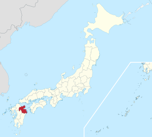
The prefecture Ōita ( Japanese 県 , Ōita-ken ) is one of the prefectures of Japan . It is located in the Kyūshū region in the north (east) of the island of Kyūshū. The third smallest province in terms of area takes up about 15 percent of the area of Kyūshū. The population has been declining since the 1980s and is currently around 9 percent, the population density is lower than that of the region or island. The seat of the prefecture administration is the city of the same name Ōita .
Location and geography
The prefecture extends between 130 ° 49'29 "and 132 ° 10'38" east. and between 32 ° 42'52 "and 33 ° 44'26" n. Br. It has a coastline of 774 kilometers. The Nakadake ( 中岳 ) in the Kūju Mountains ( 九重 山 , Kujūsan) is located in the Aso-Kujū National Park and is the highest mountain in the prefecture at 1791 m.
politics
Governor of Ōita is Katsusada Hirose , who was confirmed for a fifth term in the unified regional elections in April 2019 . In the parliamentary elections that took place at the same time, the Liberal Democratic Party (LDP) was clearly the strongest party.
In 2017 the LDP was again able to win all three constituencies of Ōitas for the lower house of the national parliament . In the upper house , the prefecture after the elections will be in 2016 and 2019 by two members of the opposition represented. In particular, the directly elected Delegitas delegation to the national parliament currently (as of August 2019) consists of:
- in the lower house
- Constituency 1: Yōichi Anami (LDP, 3rd term), who narrowly prevailed against incumbent Shūji Kira from the Hope Party in 2017 ,
- Constituency 2: Seishirō Etō (LDP, 12th term), former Minister of Defense and Vice-President of the House of Commons,
- Constituency 3: Takeshi Iwaya (LDP, 8th term), Minister of Defense in Abe's fourth cabinet,
- in the upper house
- until 2022: Shin'ya Adachi ( DVP , 3rd term), and
- until 2025: Kiyoshi Adachi (non-party and non-attached, 1st term of office), elected in 2019 as the unity candidate of the center-left opposition just against his predecessor Yōsuke Isozaki (LDP).

Administrative division
The number of communities fell from 258 to 214 between 1920 and 1950. In 1955 there were still 58 communities 70 and 25 years later. Due to the large Heisei incorporation from 2005 to 2006, which included all communities in the prefecture except for Beppu , Tsukumi , Himeshima , Hiji , Kokonoe , Kusu , their number fell from 58 on December 31, 2004 to March 31, 2006 to 18 .
In the table below, the districts (郡) are shown in italics, below (indented) the small towns (町) and the village (村) in them. The first three digits of the code (1st column) also show a relationship between the district and the small town. At the beginning of the table are the independent cities (市).
| code | Surname | Area (in km²) | population | Population density (inh / km²) |
||
|---|---|---|---|---|---|---|
| Rōmaji | Kanji | 01.10.2017 1 | 01.10.2018 2 | 01/10/2015 3 | ||
| 44201 | Ōita- shi | 大分 市 | 502.38 | 478.113 | 478.146 | 951.76 |
| 44202 | Beppu- shi | 別 府 市 | 125.34 | 119,448 | 122,138 | 974.45 |
| 44203 | Nakatsu- shi | 中 津市 | 491.53 | 83.024 | 83,965 | 170.82 |
| 44204 | Hita- shi | 日 田 市 | 666.03 | 63,887 | 66,523 | 99.88 |
| 44205 | Saiki- shi | 佐伯 市 | 903.11 | 69,022 | 72.211 | 79.96 |
| 44206 | Usuki- shi | 臼杵 市 | 291.20 | 37,124 | 38,748 | 133.06 |
| 44207 | Tsukumi- shi | 津 久 見 市 | 79.48 | 16,772 | 17,969 | 226.08 |
| 44208 | Taketa- shi | 竹田 市 | 477.53 | 20,959 | 22,332 | 46.77 |
| 44209 | Bungotakada -shi | 豊 後 高田 市 | 206.24 | 22.307 | 22,853 | 110.81 |
| 44210 | Kitsuki- shi | 杵 築 市 | 280.08 | 29,047 | 30.185 | 107.77 |
| 44211 | Usa- shi | 宇佐 市 | 439.05 | 54,524 | 56,258 | 128.14 |
| 44212 | Bungoono -shi | 豊 後 大野 市 | 603.14 | 3,462 | 36,584 | 60.66 |
| 44213 | Yufu shi | 由 布 市 | 319.32 | 33,394 | 34,262 | 107.3 |
| 44214 | Kunisaki- shi | 国 東 市 | 318.10 | 27,082 | 28,647 | 90.06 |
| 44320 | Higashikunisaki gun | 東 国 東郡 | 6.99 | 183 | 1.991 | 284.84 |
| 44322 | Himeshima- mura | 姫 島村 | 6.99 | 183 | 1.991 | 284.84 |
| 44340 | Hayami gun | 速 見 郡 | 73.32 | 28.007 | 28,058 | 382.68 |
| 44341 | Hiji-machi | 日出 町 | 73.32 | 28.007 | 28,058 | 382.68 |
| 44460 | Kusu-gun | 玖 珠 郡 | 557.88 | 23,783 | 25,468 | 45.65 |
| 44461 | Kokonoe-machi | 九重 町 | 271.37 | 9,044 | 9,645 | 35.54 |
| 44462 | Kusu-machi | 玖 珠 町 | 286.51 | 14,739 | 15,823 | 55.23 |
| Ōita Prefecture | 大分 県 | 6,340.73 | 1,142,943 | 1,166,338 | 183.94 | |
swell
1 Area data from 2017
2 Estimated population 2018
3 Results of the 2015 census
Biggest places
| Census year | Residents | |||
|---|---|---|---|---|
| 2015 | 2010 | 2005 | 2000 | |
| Ōita | 478.146 | 474.094 | 462.317 | 436.470 |
| Beppu | 122,138 | 125,385 | 126,959 | 126,523 |
| Nakatsu | 83,965 | 84,312 | 84,368 | 67,083 |
| Saiki | 72.211 | 76,951 | 80.297 | 50,120 |
| Hita | 66,523 | 70,940 | 74,165 | 62.507 |
| United States | 56,258 | 59.008 | 60,809 | 49,312 |
| Usuki | 38,748 | 41,469 | 43,352 | 35,786 |
| Bungoōno | 36,584 | 39,452 | 41,548 | —— |
| Yufu | 34,262 | 34,702 | 35,386 | —— |
| Kitsuki | 30.185 | 32,083 | 33,567 | 22,746 |
| Kunisaki | 28,647 | 32.002 | —— | —— |
| Bungotakada | 22,853 | 23,906 | 25.114 | 18,506 |
| Taketa | 22,332 | 24,423 | 26,534 | 17,489 |
| Tsukumi | 17,969 | 19,917 | 21,456 | 23.164 |
The independent cities of Bungoōno and Yufu were created in 2005 by amalgamation.
The small town of Kunisaki was raised to an independent city in 2006 .
Population development
| Census year |
Residents on Census day | Density (inh / km²) |
||
|---|---|---|---|---|
| All in all | of which male | Proportion of male population |
||
| 1920 | 860.282 | 422.708 | 49.1 | 96.6 |
| 1925 | 915.136 | 451.298 | 49.3 | 97.3 |
| 1930 | 945.771 | 465.994 | 49.3 | 97.1 |
| 1935 | 980.458 | 481,549 | 49.1 | 96.5 |
| 1940 | 972.975 | 473.297 | 48.6 | 94.8 |
| 1945 | 1,233,651 | 593.075 | 48.1 | 92.6 |
| 1950 | 1,252,999 | 604.825 | 48.3 | 93.3 |
| 1955 | 1,277,199 | 616.402 | 48.3 | 93.3 |
| 1960 | 1,239,655 | 590.963 | 47.7 | 91.1 |
| 1965 | 1,187,480 | 559,433 | 47.1 | 89.1 |
| Census year |
Residents on Census day | Density (inh / km²) |
||
|---|---|---|---|---|
| All in all | of which male | Proportion of male population |
||
| 1970 | 1,155,566 | 540,541 | 46.8 | 87.9 |
| 1975 | 1,190,314 | 561.760 | 47.2 | 89.4 |
| 1980 | 1,228,913 | 583.097 | 47.5 | 90.3 |
| 1985 | 1,250,214 | 593.014 | 47.4 | 90.2 |
| 1990 | 1,236,942 | 584,672 | 47.3 | 89.6 |
| 1995 | 1,231,306 | 581.909 | 47.3 | 89.6 |
| 2000 | 1,221,140 | 575.985 | 47.2 | 89.3 |
| 2005 | 1,209,571 | 569,796 | 47.1 | 89.1 |
| 2010 | 1,196,529 | 564,890 | 47.2 | 89.4 |
| 2015 | 1,166,338 | 551.932 | 47.3 | 89.8 |

Outline

Mount Yufu (1583 m)

Road signs in Ōita prefecture


Web links
Individual evidence
- ↑ www.uuu.jp (Japanese) , accessed December 16, 2018
- ↑ www.japan-guide.com , accessed on December 16, 2018 (English)
- ^ Präita Prefectural Parliament : MPs , accessed August 19, 2019.
- ↑ 統一 地方 選 2019 大分 県 知事 選 . In: NHK Senkyo Web. April 8, 2019. Retrieved August 19, 2019 (Japanese).
- ↑ 統一 地方 選 2019 大分 県 議 選 各 党 議席 . In: NHK Senkyo Web. April 8, 2019. Retrieved August 19, 2019 (Japanese).
- ↑ Kokudo Chiriin (GSI - Geospatial Information Authority of Japan), 平 成 29 年 全国 都 道 府 県 市区 町 村 別 面積 調 (Nationwide survey of all prefectures and municipalities 2017) , p. 95: 44 Oita-ken (Japanese), accessed on 16 December 2018
- ↑ 簡 単 検 索 ・ 詳細 検 索 ・ 検 索 サ ン プ ル , accessed on December 16, 2018 (Japanese)
- ↑ e-stat (English), accessed on December 16, 2018
- ↑ Prefecture Census Page (Japanese) , accessed December 16, 2018
Aichi | Akita | Aomori | Chiba | Ehime | Fukui | Fukuoka | Fukushima | Gifu | Gunma | Hiroshima | Hokkaidō | Hyōgo | Ibaraki | Ishikawa | Iwate | Kagawa | Kagoshima | Kanagawa | Kochi | Kumamoto | Kyoto | Mie | Miyagi | Miyazaki | Nagano | Nagasaki | Nara | Niigata | Ōita | Okayama | Okinawa | Osaka | Saga | Saitama | Shiga | Shimane | Shizuoka | Tochigi | Tokyo | Tokushima | Tottori | Toyama | Wakayama | Yamagata | Yamaguchi | Yamanashi
Coordinates: 33 ° 15 ' N , 131 ° 31' E