Brasiliano orogeny
Under Brasiliano Orogenese ( English Brasiliano Orogenic Cycle ) is a long and large-scale geodynamic cycle of tectonic , igneous , metamorphic and sedimentary processes with formation of mountains or unfolding orogenic understood belts. These belts contributed significantly to the formation of the continent of South America from fragments of the supercontinent Rodinia .
When the Adamastor Ocean and other oceans closed, the cratons Amazonas and Rio de la Plata as well as the Paranapanema block collided with the African cratons West Africa, Congo-São Francisco (abbreviated to Congo-SF) and Kalahari. These processes are therefore directly related to Pan-African orogeny and are collectively referred to as Pan-African / Brasiliano orogeny. Both formed Western Gondwana, of which the Brasiliano orogeny in turn represents the westernmost part.
The period of the Brasiliano orogeny falls in the era of the Neoproterozoic and began about 1,000 million years ago (abbreviated mya ) and was largely completed in the early Phanerozoic , the Lower Cambrian , around 480 mya.
Conceptualization
The term Brasiliano Orogenic Cycle (Brasiliano Orogenesis) was first coined by the Brazilian geologist Fernando Flávio Marques de Almeida and colleagues in 1973. The term referred to geodynamic processes in South American continental masses in the period from about 700 to 450 mya and delimited these from pre- neoproterozischen orogenes between the intervals 1,400 to 900 mya, 2,000 to 1,800 mya and even earlier phases.
Lithospheric plates and oceans
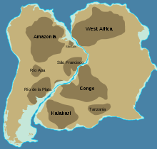
The Brasiliano orogeny is based on plate tectonic processes of global proportions, starting with the breakup of lithospheric plates (continental plates ) and the opening of intra-continental rift breaks up to the closing of the oceans or seas that have formed . These processes can be traced back to the development phases of the supercontinent Rodinia and are related to the later formation of the supercontinent Pannotia with the great continent Gondwana as its most important continental mass. South America was the westernmost continent.
Lithospheric plates and sedimentary basins
The paleoarchaic to paleoproterozoic cratons Amazonas, Rio de la Plata and the Paranapanema block as well as the cratons Congo-SF, West Africa and Kalahari were involved in the processes of the Brasiliano orogeny . Several smaller Terrane , as the Rio APA, Apiaí- and Luiz Alves- blocks and the Goias Massif also had significant shares in the geodynamic evolution.
Location of the Brazilian state of Maranhão
Location of the Brazilian state of Piauí
Satellite image of the Paraná Basin
Simplified geological map of the Paraná Basin
Important sedimentary basins were the Parnaíba Basin and the Paraná Basin .
- The Parnaíba Basin essentially comprises the Brazilian states of Maranhão and Piauí . It develops on the basement mountains of the Borborema province, the Paranába block and the Amazon craton with the deferred Araguaia belt.
- The Paraná Basin stretches across Brazil, northeast Argentina, eastern Paraguay, and northern Uruguay. It is based on the basement mountains of the Río de la Plata Kratons, Mantiqueira Province, Luis Alves Block, Tocantins Province, and Paranapanema Block.
Oceans
- The Adamstor Ocean spread out between the South American and African lithospheric plates . It stretched from the golf-shaped bay between the then still connected São Francisco and Congo partial cratons to the Kalahari craton on the one hand and the Río de la Plata craton on the other.
- The Brazilide Ocean separated the Amazon craton from the Paranapanema block.
- The Goianides Ocean spread between the northwest flank of the Congo-SF craton and the Rio de la Plata-Craton. It is assumed that this ocean was connected to the Pharusian Ocean (see also → Pharusian Belt ).
- Between the Amazon craton on the one hand and the Rio de la Plata and Congo SF cratons on the other hand, the Goiás Ocean opened up. In this the Goiás Island Arch Complexes developed. This ocean was also connected to the Pharusian Ocean.
- The Churra Ocean separated the Nico Perez microplate from other terrans of the Rio de la Plata craton.
Geological Provinces and Orogens
Satellite image of South America
Topography and countries of South America
States of Brazil
During the Brasiliano orogeny, several geological provinces and orrogens were formed, which differ significantly in their structures and formation processes. These orogenes led to the closure of several oceans and aulacogenes , particularly the Adamastor Ocean, the Brazilides Ocean, and the Goianides Ocean.
Borborema Province
States in northeastern Brazil
The Borborema Province, or the Borborema Plateau or the Serra da Borborema, extends in northeastern Brazil in whole or in part in the states 1: Maranhão , 2: Piauí , 3: Ceará , 4: Rio Grande do Norte , 5: Paraíba , 6: Pernambuco , 7: Alagoas , 8: Sergipe and 9: Bahia . The geological limits are today's São Francisco craton in the south and the Parnaíba basin in the west.
Pedra da Rajada mountains in the Serra de Maranguape in the north of Ceará
Rock formations near the city of Queimadas / Paraíba
Serra da Ponta plateau near the municipality of Brejo da Madre de Deus / Pernambuco
The Borborema province is based on archaic to paleoproterozoic, highly metamorphosed basement mountains in the northeast of the Congo SF craton. During a stretching regime, intra-cratonic and oceanic basins were created. With the closure of these rifts, a multitude of tectonically connected terranos and orrogens of different orogenesis formed, which are separated by shear zones , such as the important Transbrasiliano lineament or shear zone and faults . These are dominated by volcanic sedimentary and calcium carbonate deposits as well as granites caused by collision . The age of the rock spectrum covers a period of 1,050 and 930 mya. In a further expansion phase of 800 to 700 mya, juvenile island arch complexes and magmatites formed in ocean basins. Between 640 and 540 mya, the Borborema Province collided with the West Africa Craton , the Amazon Craton and the Congo SF Craton, closing the foothills of the African Pharusian Ocean. The collisions created intense rock deformations and metamorphoses as well as further magmatism. Massive post-orogenic intrusions still occurred up to 500 mya. To the west, the Borborema province is bounded or covered by thick layers of sediment from the Parnaíba basin. Since the Transbrasiliano lineament continues in West Africa, where it is known as the Kandi lineament or shear zone, it is likely that geological units of the Borborema province correlate with those in the African Pharusian belt (see also → Pharusian belt ) .
Tocantins Province
The Tocantins Province appears in the Brazilian states of Pará , Tocantins , Minas Gerais , Mato Grosso and Mato Grosso do Sul as well as in the Paraguayan administrative district of Concepción and the administrative district of Santa Cruz / Bolivia .
Geologically, it lies between the eastern flank of the Amazon craton and the western area of today's São Francisco craton and the Paranapanema block. It forms the largest ore in South America. This province is structured into the Araguaia Belt, the Brasilia Belt and the Paraguay Belt. The Araguaia Belt connects to the west of the Borborema Province and represents the northern section of the province. The southeastern areas of the Araguaia Belt are separated from the Brasilia Belt by the Transbrasiliano Lineament. The Paraguay Belt connects to the south of the Araguaia Belt.
The orogeny of the Tocantins province probably began around 1,270 mya with the opening of the Goiás Ocean, in which between 1,000 and 760 mya volcanic-sedimentary sequences formed, which suggest magmatic arches of islands. The collision of the cratons West Africa, Amazonas and Congo-SF began at 800 mya with subduction of the ocean floor with accretions of the island arcs to the Amazon craton. Between 650 and 513 mya the ocean closed with the formation of deformations, thrusts , transform faults and massive intrusions.
Estuary of the Amazon with the island of Marajó
Location of the Brazilian state of Pará
Location of the Brazilian state of Tocantins
Araguaia belt
The Araguaia Belt stretches in northeastern Brazil between the island of Marajó in the delta of the Amazon in the state of Pará to the south of the state of Tocantins . From a geological point of view, it developed between the eastern areas of the Amazon craton and the western flank of today's São Francisco craton. In the northeast, the belt is covered by the sediments of the Parnaíba basin, while in the southwest the sediments of the Paraná basin represent the boundary.
The belt is based on predominantly archaic basement and is structured into an outer and an inner zone. The outer zone consists of ophiolithic thrusts , sedimentary rocks that originate from igneous island arcs, as well as volcanic rocks and parts of a passive continental margin with low-grade metamorphic rocks. The inner zone contains long, steep bulges made of archaic basement rocks, surrounded by low to medium stressed metasediments. Massive granitic magmatism occurred during the continental collision. Their age dates to around 550 mya.
Originally the Araguaia belt was related to the African Mauritanide – Bassaride – Rokelide belt (see also → Northwest African Belt ).
Location of the Brazilian state of Tocantins
Location of the Brazilian state of Goiás
Location of the city of Fortuna de Minas in the Brazilian state of Minas Gerais
Location of the Brazilian state of São Paulo
Brasilia belt
The Brasilia belt occurs in the Brazilian states of Tocantins , Goiás , Minas Gerais and the northern area of São Paulo . It forms the eastern belt of the Tocantins province and connects to the north-west of the Araguaia belt and to the south of the Ribeira belt. The eastern boundary is the western edge of today's São Francisco craton, in the west the sediments of the Paraná basin.
His lithostratigraphy consists of an archaic to paleoproterozoic basement foundation, a central, sedimentary tectonic blanket , the archaic to neoproterozoic Goiás massif and the magmatic Goiás island arch complex. This complex is composed of intra-oceanic island arches and volcanic arches of an active continental margin. The two sectors of the Goiás island arch complex were severely affected by the leaf displacements of the Transbrasiliano lineament. The supracrustal sediments have different tectonic origins and deposition periods: One sequence comes from the passive continental margins of today's São Francisco craton, while the more recent sequence comes from the Goiás island arch complex and relates to the orogenic phases of this belt. These took place between 640 and 610 mya during the collision of the Paranapanema block, the Goiás massif and the Goiás island arcs. They were pushed against the western passive edge of the Congo-SF craton and subjected to massive deformations and metamorphoses. The third sequence was created between 550 and 540 mya as a foreland basin sediment package .
Location of the state of Mato Grosso / Brazil
Location of the state of Mato Grosso do Sul / Brazil
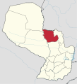
Location of the administrative district Concepción / Paraguay
Location of the Santa Cruz administrative district / Bolivia
Sedimentary plateau in the National Park Chapada dos Guimarães / Mato Grosso
Mountain range in the Santa Cruz administrative district / Bolivia
Sedimentary island mountain Cerro Memby in the administrative district of Concepción / Paraguay
Paraguay belt
The Paraguay Belt emerges in the short southern branch, the elongated northern branch and a narrow, arched connecting zone within the Paraná basin . The remaining belt structures are framed by mighty basin sediments. It is bounded in the west by the Amazon craton, in the east by the Congo SF craton and in the south by the Rio Apa terran. This belt is mostly located in the Brazilian states of Mato Grosso and Mato Grosso do Sul , the western section extends to the Santa Cruz / Bolivia administrative district , the southernmost section protrudes into the Paraguayan Concepción administrative district .
The metasedimentary belt developed during a stretching regime that extended to the Brazilide Ocean. Sediment packages were deposited on passive margins in the shallow shelf regions of the Amazon craton, the Paranapanema block and the Rio Apa terran. These consist mainly of limestones , dolomite stones , carbonate platforms , siliciclastics , conglomerates and volcanic breccias . This sequence contains two diamictitic layers that formed during the Marinionic (650 to 635 mya) and the Gaskiers Ice Ages (around 580 mya). From 800 mya, the expansion of the pelvis inverted with the closure of the Brazilide Ocean. From 660 mya die the orogenic phase began with massive deformations, folds, foliations and metamorphic overprints. It lasted until 513 mya. Granitic intrusions rose by 504 and 453 mya.
Mantiqueira Province
The Mantiqueira province stretches from the southern area of the Brazilian state of Bahia along the southeast of South America to the Uruguayan city of Montevideo . Geologically, it is the eastern flanks of today's Sao Francisco and Rio de La Plata cratone, as well as the Paranapanema block, which also form the archaic to paleoproterozoic basement of the province. To the west, the belt formations are covered by thick layers of sediment from the Paraná basin and Chaco-Paraná basin. This province consists of the northern Araçuaí belt, the south adjoining Ribeira belt and the southern Dom Feliciano belt. They result from collisions between South American and South African continental plates.
The geological development took place in three phases: The first was characterized from 930 mya by the formation of rifts and ocean basins. The Adamastor Ocean opened. New crusts formed in this area, including juvenile intra-oceanic magmatic island arcs that collided between 790 and 700 mya. In the second and third phases, the collision of the lithospheric plates with the reprocessing of older crusts and the formation of the orogenic belt took place over a period of 640 to 480 mya.
Location of the state of Espírito Santo / Brazil
Location of the state of Minas Gerais / Brazil
Location of the state of Rio de Janeiro / Brazil
Intrusion Ibituruna / Minas Gerais
Araçuaí belt
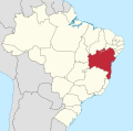
The Araçuaí belt runs roughly from the southern area of the Brazilian state of Bahia via the states of Espirito Santo , Minas Gerais to Rio de Janeiro . Geologically, this area corresponds to the typical gulf-like southeastern edge area of today's São Francisco Craton. In the east, the belt is bounded by the South Atlantic .
The Araçuaí belt is structured into an outer, an inner and a northern zone. The outer zone provides a western About Schiebungs - and wrinkles are buckles It is characterized by the deposition of powerful volcano-sedimentary rock sequences consisting of. Gabbros , mafic Dykes, granites, siliciclastic , conglomerates . The sediment package contains diamictitic layers that are attributed to the Sturtic Ice Age (approx. 760 to 649 mya) and the Gaskiers Ice Age (around 580 mya). The sedimentation began around 930 mya in rift breaks or in the opening Adamastor Ocean at the passive edges of the cratons Rio de La Plata Congo-SF. Several Plutonites and Dykes intruded between 906 and 880 mya.
The inner, eastern zone is the core of the belt. It developed during the closure of the Adamastor Ocean and collision of continental plates. It is characterized by widespread orogenic magmatism and a high degree of metamorphic overprinting. It is dominated by granitic rocks that were formed during the orogenic phases. In addition, a geosuture with remnants of the ocean floor and igneous island arcs was detected. The northern zone contains segments from the other two zones. In all zones there are archaic to paleoproterozoic TTG complexes made of granites and orthogneiss that come from the reworked basement. With the collision of the cratons, the orogen phase set in, which lasted in several phases from 630 to 500 mya. This was connected with further massive igneous intrusions, deformations and metamorphoses.
The Araçuaí belt has its geological counterpart in the African Western Congo belt .
Location of the state of Minas Gerais / Brazil
Location of the state of Rio de Janeiro / Brazil
Location of the state of São Paulo / Brazil
Location of the Brazilian state of Paraná
Intrusions in the Vale dos Frades / State of Rio de Janeiro
Sugar Loaf , Morro da Urca and other intrusions in Guanabara Bay / State of Rio de Janeiro
Intrusion Pedra Bonita in the Tijuca National Park / State of Rio de Janeiro
Batholith Serra dos Órgãos in the Serra do Mar mountain range in the Serra dos Órgãos National Park / State of Rio de Janeiro
Ribeira belt
The Ribeira Belt extends roughly along the Brazilian states of Minas Gerais , Rio de Janeiro , São Paulo to Paraná . The southern Atlantic forms the eastern limit . Geologically, it runs along the south-eastern edge of today's São Francisco craton.
The Ribeira Belt developed in several phases. Orogen formation occurred between 590 and 510 mya, followed by orogen collapse caused by stretching between 510 and 480 mya. The formation of the Ribeira belt also led to the overprinting of the southern area of the Brasilia belt.
The Ribeira belt is based on archaic to paleoproterozoic basement mountains. It consists of green stone belts , volcanic rocks with different compositions , various orthogneiss and granulites . In addition, paleoproterozoic to mesoproterozoic sediment sequences were deposited. The formation of the Ribeira Belt was preceded by the collision of the Congo-SF craton with the Paranapanema block between 630 and 625 mya. It consists of a system of tectonic nappes formed from accretions of four terrans as a result of the subduction of the Adamastor ocean floor along the Congo SF craton.
The terranes have different geneses and petrographic compositions. They are separated by faults , shear zones and transform faults . The Occidental Terran represents the outer sector of the belt. It consists of reprocessed archaic to paleoproterozoic basement units, mesoproterozoic intra-cratonic sedimentary basin deposits as well as neoproterozoic sediment packages that arose on passive and active continental margins, the latter with igneous island arch complexes that accreted on the Paranapanema block. The Paraíba do Sul-Terran or the cliff consists of archaic to palaeoproterozoic basement, Neoproterozoic sediment deposits and a continental igneous volcanic arch complex that accreted on the edge of the Congo SF craton. The Oriental Terran collided under crust thickenings and widespread granitic intrusions ( plutonites ) that penetrated the basement and strata in other sectors of the belt. The Cabo Frio Terrans collided with the Congo SF craton. Earlier terranos were tectonically revised. Large-format folds and leaf displacements as well as massive igneous processes developed in this terran .
The Ribeira Belt was originally associated with the northern section of the African Kaoko Belt .
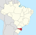
Location of the state of Santa Catarina / Brazil
Location of the state and Rio Grande do Sul / Brazil
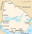
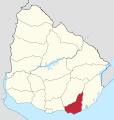
Location of the administrative district Maldonado Department / Uruguay
Lagoa dos Patos lagoon in the state of Rio Grande do Sul with the adjacent Florianópolis-Pelotas-Aigua batholith
Cambirela mountain range near the municipality of Palhoça / Santa Catarina
Snow-capped mountains in the Serra do Tabuleiro National Park near the city of Florianópolis / Santa Catarina
Dom Feliciano belt
The Dom Feliciano Belt appears in the Brazilian states of Santa Catarina and Rio Grande do Sul as far as the Uruguayan Maldonado Department . The southern Atlantic forms the eastern limit . It forms the southern extension of the Ribeira belt.
Geologically, it developed in the southeastern areas of the archaic to paleoproterozoic Rio de la Plata-Kraton, which also forms the basement of the belt. It consists of green stone belts , differently composed volcanic rocks , various orthogneisses and granulites . In addition, paleoproterozoic to mesoproterozoic sediment sequences were deposited.
The formation of the Dom Feliciano Belt was preceded by the opening of the Churra Ocean from 950 to 900 mya. He separated the Nico Perez microplate from other terrans of the Rio de la Plata-Kratons. The Churra Ocean was closed between 890 and 680 mya. An intra-oceanic igneous island arc and a terrestrial volcanic arc formed on an active continental margin. From 650 to 620 mya the ocean floor of the Adamastor Ocean subducted with collisions of the Rio de la Plata craton with the Nico Perez microplate on the one hand and the cratons Congo-SF and Kalahari on the other. Sedimentation from passive continental margins was widespread. The continental collisions took place between 600 and 570 mya, accompanied by strong deformations and metamorphic overprints of the igneous rocks , volcanic rocks and sedimentary rocks as well as the terrestrial basement units with partial partial melting (see also → Anatexis ). During the last phase further plutonic, volcanic and sedimentary units developed from 590 to 500 mya in a stretching regime, connected with the orogen collapse.
The Dom Feliciano belt is structured into the westernmost São Gabriel terran, the Tijucas terran, the Florianópolis-Pelotas-Aigua batholith and the easternmost Rocha and Punta del Este terranos. They form a system of tectonic nappes along the Rio de la Plata craton with the Nico Perez microplate. The belt is criss-crossed by several faults , shear zones and transform faults .
The São Gabriel Terran consists of an ophiolithic accretion wedge complex of metamorphic overprinted rocks of the earth's mantle. It also contains a sequence that comes from deposits of the oceanic island arc and the terrestrial volcanic arc, as well as a volcanic-sedimentary, igneous deposit. The Tijucas Terran consists of large paleoproterozoic basement arches , surrounded by volcanic-sedimentary deposits, late-paleoproterozoic to early-mesoproterozoic granites and metabasalts as well as neoproterozoic volcanic-sedimentary deposits. The Florianópolis-Pelotas-Aigua batholith developed in the Neoproterozoic during and after the orogenic phase of the Dom Feliciano belt. It is made up of plutonites of various compositions and Dyke swarms. Most of the batholith rises directly behind the Lagoa dos Patos lagoon in the Brazilian state of Rio Grande do Sul , the other section emerges in the northern belt area near the city of Florianópolis . The Punta del Este and Rocha Terrane form the southeastern end of the belt. There the Punta del Este-Terran accreted, which consists predominantly of ortho- and para- gneiss , metabasalts and migmatites , which probably originate from an earlier basement. They were subject to high-grade metamorphic overprints and magmatic events. The Punta del Este-Terran is connected to the east of the Rocha-Terran, which is a siliciclastic sequence.
The Dom Feliciano Belt was originally associated with the southern section of the African Kaoko Belt , the Gariep Belt, and the Saldania Belt.
Web links
- Joseph G. Meert and Rob Van Der Voo: The assembly of Gondwana 800-550 Ma In: Journal of Geodynamics, Volume 23, Issues 3-4, May-July 1997, pages 223-235. doi: 10.1016 / S0264-3707 (96) 00046-4 , alternatively here
- Fernando F. Alkmim Stephen Marshak Marco A. Fonseca: Assembling West Gondwana in the Neoproterozoic: Clues from the São Francisco craton region, Brazil. In: Research Article, April 01, 2001. doi : 10.1130 / 0091-7613 (2001) 029 <0319: AWGITN> 2.0.CO; 2 , alternatively here
- BB De Brito Neves, Mario da Costa Campos Neto and Reinhardt Fuck: From Rodinia to Western Gondwana: An approach to the Brasiliano-Pan African Cycle and orogenic collage. In: Episodes 22 (3): 155-166, September 1999. online
- Claudio Gaucher, Alcides N. Sial, Galen P. Halverson and Hartwig E. Frimmel: Neoproterozoic-Cambrian Tectonics, Global Change and Evolution, A Focus on Southwestern Gondwana. In: Zentralblatt für Geologie und Paläontologie, Part II. Clickpe PDF
- Umberto Giuseppe Cordani and Wilson Teixeira: Proterozoic accretionary belts in the Amazonian Craton. In: Memoir of the Geological Society of America 200: 297-320, January 2007. doi: 10.1130 / 2007.1200 (14) , alternatively online
- Marcos Egydio-Silva, Alain Vauchez, Haakon Fossen, Geane Carolina Gonçalves Cavalcante and Bruna Catarino Xavier: Connecting the Araçuaí and Ribeira belts (SE - Brazil): Progressive transition from contractional to transpressive strain during the Brasiliano orogeny. In: Journal of South American Earth Sciences 86 (2018) pp. 127-139. doi: 10.1016 / j.jsames.2018.06.005 , alternatively folk.uib PDF
Individual evidence
- ^ A b Mario da Costa Campos Neto: Orogenic systems from Southwestern Gondwana: an approach to Brasiliano-Pan African cycle and orogenic collage in southeastern Brazil. In: Tectonic evolution of South America, P 335-365 / RIO DE JANEIRO, 2000. online
- ^ A b Benjamim Bley de Brito Neves, Reinhardt Adolfo Fuck and Marcio Martins Pimente: The Brasiliano collage in South America: a review In: Brazilian Journal of Geology , Vol. 44, No.3 São Paulo July / Sept. 2014, ISSN 2317-4889 doi: 10.5327 / Z2317-4889201400030010 , alternatively here
- ↑ Sebastián Oriolo, Pedro Oyhantçabal, Klaus Wemmer and Siegfried Siegesmund: Contemporaneous assembly of Western Gondwana and final Rodinia break-up: Implications for the supercontinent cycle. In: Geoscience Frontiers , Volume 8, Issue 6, November 2017, pp. 1431–1445. doi: 10.1016 / j.gsf.2017.01.009 , alternatively here
- ↑ FFM de Almeida, G. Amaral, Umberto Giuseppe Cordani and Koji Kawashita: The Precambrian Evolution of the South American Cratonic Margin South of the Amazon River. In: Chapter from book The South Atlantic (pp. 411-446). doi: 10.1007 / 978-1-4684-3030-1_11 , alternatively here
- ^ Salomon B. Kroonenberg and Emond de Roever: Geological Evolution of the Amazonian Craton. In: Amazonia: Landscape and Species Evolution: A look into the past , pp. 7-28. (Book excerpt) doi: 10.1002 / 9781444306408.ch2 , alternatively here
- ↑ Carlos W. Rapela, C. Mark Fanning, Cesar Casquet, Robert J. Pankhurst and others: The Rio de la Plata craton and the adjoining Pan-African / brasiliano terranes: Theirorigins and incorporation into south-west Gondwana. In: Gondwana Research 20 (4): 673–690, November 2011. doi: 10.1016 / j.gr.2011.05.001 , alternatively here
- ↑ Marta Mantovani, MCL Quintas, Wladimir Shukowsky and Brito Neves: Delimitation of the Paranapanema Proterozoic Block: A Geophysical Contribution. In: Episodes 28 (28): 18–22 • March 2005. here
- ↑ M. Fernandez-Alonso, L. Tack, A. Tahon and B. De Waele: The Proterozoic Histoy of the Proto-Congo Craton of Central Africa. In: Department of Earth Sciences, Royal Museum for Central Africa, B-3080 Tervuren, Belgium. africamuseum.be PDF
- ↑ Armin Zeh, Axel Gerdes and Jackson M. Barton, Jr .: Archean Accretion and Crustal Evolution of the Kalahari Craton — the Zircon Age and Hf Isotope Record of Granitic Rocks from Barberton / Swaziland to the Francistown Arc. In: Journal of Petrology, Volume 50, Issue 5, 1 May 2009, pp. 933-966. doi: 10.1093 / petrology / egp027 , alternatively here
- ↑ Umberto Giuseppe Cordani, Wilson Teixeira, Colombo Gaeta: Tassinari and José MV Coutinho: The Rio Apa Craton in Mato Grosso do Sul (Brazil) and northern Paraguay: Geochronological evolution, correlations and tectonic implications for Rodinia and Gondwana. In: American Journal of Science 310 (9), November 2010. doi: 10.2475 / 09.2010.09 , alternative [1]
- ↑ Oswaldo Siga Junior, Miguel Angelo Stipp Basei, Allen P. Nutman, Kei Sato Ian McReath and others: Extensional and colisional magmatic records in the Apiai Terrane, south-southeastern Brazil: integration of geochronological U-Pb zircon ages. In: Geologia USP , Série Cientifica, Geol. USP, Sér. cient., São Paulo, v. 11, n.3, December 2011, pp. 149-175. PDF
- ↑ Claudia Regina Passarelli, Miguel Angelo Stipp Basei, Oswaldo Siga and Ossama Mohamed Milah Harara: The Luis Alves and Curitiba Terranes: Continental Fragments in the Adamastor Ocean. In: Geology of Southwest Gondwana, pp. 189-215. , Book excerpt doi: 10.1007 / 978-3-319-68920-3_8 , alternatively here
- ^ A b Pedro Cordeiro and Claudinei Gouveia de Oliveira: The Goiás Massif: Implications for a pre-Columbia 2.2 to 2.0 Ga continent-wide amalgamation cycle in central Brazil. In: Precambrian Research 298: 403-420 • June 2017. doi: 10.1016 / j.precamres.2017.06.021 , alternatively here
- ↑ Michael Christopher Daly, Reinhardt Fuck, Jordi Julià and David Macdonald: Cratonic basin formation: A case study of the Parnaíba Basin of Brazil. In: Geological Society London Special Publications, September 2018. doi: 10.1144 / SP472.20 , alternatively here
- ↑ Miguel Angelo Stipp Basei, Hartwig Ernest Frimmel, Mario da Costa Campos Neto, Carlos Eduardo Ganade de Araujo and others: The Tectonic History of the Southern Adamastor Ocean Based on a Correlation of the Kaoko and Dom Feliciano Belts. In: Geology of Southwest Gondwana. Pp. 63-85. doi: 10.1007 / 978-3-319-68920-3_3 , alternatively here
- ↑ Luiz R. Bastos Leal, José C. Cunha, Umberto G. Cordani, Wilson Teixeira and others: SHRIMP U – Pb, 207Pb / 206Pb zircon dating, and Nd isotopic signature of the Umburanas greenstone belt, northern São Francisco craton, Brazil. In: Journal of South American Earth Sciences 15 (2003) pp. 775-785. PDF
- ^ J. Brendan Murphy, Sergei A. Pisarevsky and R. Damian Nance: Potential geodynamic relationships between the development of peripheral orogens along the northern margin of Gondwana and the amalgamation of West Gondwana. In: Mineralogy and Petrology 107 (5) • October 2013. doi: 10.1007 / s00710-012-0207-9 , alternatively here
- ^ A b Cees R. van Staal, Mónica P. Escayola and William J. Davis: Neoproterozoic to Cambrian Tectonic Evolution of the Proto-Andean Margin of Gondwana: Implications for the Opening of Iapetus. In: Journal of South American Earth Sciences, Volume 32, Issue 4, December 2011, pp. 438-459. doi: 10.1016 / j.jsames.2011.04.013 , alternatively here
- ↑ Sebastián Oriolo, Pedro Oyhantcabal, Miguel Basei and Klaus Wemmer: The Nico Pérez Terrane (Uruguay): From Archean crustal growth and connections with the Congo Craton to late Neoproterozoic accretion to the Río de la Plata Craton. In: Precambrian Research 280, May 2016. doi: 10.1016 / j.precamres.2016.04.014 , alternatively here
- ^ WR van Schmus, EP Oliveira, AF da Silva Filho, SF Toteu, J. Penaye and IP Guimarães: Proterozoic links between the Borborema Province, NE Brazil, and the Central African Fold Belt. In: Journal of the Geological Society , Special Publications 2008, v. 294, pp. 69-99. doi: 10.1144 / SP294.5 , alternatively here
- ↑ a b Umberto Giuseppe Cordani, Márcio M Pimentel, Carlos E. Ganade de Araujo and Reinhardt Fuck: The significance of the Transbrasiliano-Kandi tectonic corridor for the amalgamation of West Gondwana. In: Brazilian Journal of Geology 43 (3): 583-597, July 2013. doi: 10.5327 / Z2317-48892013000300012 , alternatively here
- ↑ Adelir José Strieder and Marcos Tadeu de Freitas Suita: Neoproterozoic geotectonic evolution of Tocantins Structural Province Central Brazil. In: Geodynamics 28 (1999) pp. 267-289. citeseerx.ist.psu PDF
- ↑ Marco A. Fonseca, Claudinei G. de Oliveira and Hanna J. Evangelista: The Araguaia Belt, Brazil: Part of a Neoproterozoic Continental-Scale Strike-Slip-Fault System. In: Journal of the Virtual Explorer 17, January 2004. doi: 10.3809 / jvirtex.2004.00107 , alternatively here
- ↑ Márcio Martins Pimentel: The tectonic evolution of the Neoproterozoic Brasília Belt, central Brazil: a geochronological and isotopic approach In: Brazilian Journal of Geology, 46 (Suppl 1): 67–82, June 2016 doi: 10.1590 / 2317-4889201620150004 , alternative PDF
- ↑ Elzio Barboza, Anderson Costa dos Santos, Carlos José Fernandes and Mauro C. Geraldes: Paraguay Belt Lithostratigraphic and tectonic characterization: Implications in the evolution of the orogen (Mato Grosso-Brazil). In: Journal of Sedimentary Environments. , Published by Universidade do Estado do Rio de Janeiro 3 (2): 54–73, April – June 2018. doi: 10.12957 / jse.2018.34219 , alternatively here
- ↑ Luiz Carlos da Silva, Neal J. McNaughton, Richard Armstrong, Leo Afraneo Hartmann and Ian R. Fletcher: The neoproterozoic Mantiqueira Province and its African connections: a zircon-based U – Pb geochronologic subdivision for the Brasiliano / Pan-African systems of orogens. In: Precambrian Research 136 (2005) pp. 203-240. doi: 10.1016 / j.precamres.2004.10.004 , alternatively citeseerx.ist.psu PDF
- ↑ Monica Heilbron, Antônio Carlos Pedrosa-Soares, Mário Campos Neto and others: Northern segment: Northern segment: The Araçuaí Orogen. In: Journal of the Virtual Explorer, Brasiliano Orogens in Southeast and South Brazil. here
- ↑ Monica Heilbron, Antônio Carlos Pedrosa-Soares, Mário Campos Neto and others: The Ribeira Orogen, including the zone of interference with the Southern Brasília Orogen. In: Journal of the Virtual Explorer, Brasiliano Orogens in Southeast and South Brazil. here ( Memento of the original from April 6, 2019 in the Internet Archive ) Info: The archive link was inserted automatically and has not yet been checked. Please check the original and archive link according to the instructions and then remove this notice.
- ^ Ruy Paulo Philipp, Marcio Martins Pimentel and Farid Chemale, Junir .: Tectonic evolution of the Dom Feliciano Belt in Southern Brazil: Geological relationships and U-Pb geochronology. In: Brazilian Journal of Geology 46: 83-104, June 2016. Print version ISSN 2317-4889 Online version ISSN 2317-4692 doi: 10.1590 / 2317-4889201620150016 , alternatively here or here


