
Dernbach (Bad Endbach)
|
Dernbach
Bad Endbach municipality
|
|
|---|---|
.svg) |
|
| Height : | 460 (456-489) m above sea level NHN |
| Area : | 1.88 km² |
| Residents : | 285 |
| Population density : | 152 inhabitants / km² |
| Incorporation : | July 1, 1974 |
| Postal code : | 35080 |
| Area code : | 02776 |
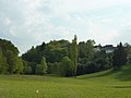
 Entrance to the village (south-west)
|
|
Dernbach is a district of the Bad Endbach community in the Marburg-Biedenkopf district in central Hesse . Until 1748 the place was the seat of the noble family von und zu Dernbach .
Geographical location
Dernbach is located 4.5 km north of Bad Endbach am Dernbach in the Gladenbacher Bergland (eastern foothills of the Westerwald , which here intersects with the southern foothills of the Rothaargebirge ) in a changeable low mountain range between the cities of Marburg and Herborn , in the middle of the Hessian hinterland .
In terms of nature, the plateau around Dernbach, which stretches from the 552 m high Daubhaus north of Gladenbach to the northern edge of the Scheldt Forest ( Angelburg (mountain) 609 m above sea level), is called the Bottenhorn plateau . These plateaus, created in the Tertiary , are one of the oldest land surfaces in the Rhenish Slate Mountains .
history
The village of Dernbach came into being with the construction of Neu-Dernbach Castle , when builders and servants of the Lords of Dernbach settled in the area around the castle . In 1363 the settlement, the village, was first mentioned as Therinbach . After the end of the Dernbach feud, the Lords of Dernbach had their entire property, their extensive rights and the destroyed Alt-Dernbach Castle in the Herborner Mark to Count Heinrich III. sold by Nassau-Dillenburg and moved to the Landgraviate of Hesse . There they built the new hill fort Neu-Dernbach . It was intended to secure the border area to the county of Nassau and was intended as a bailey to Blankenstein Castle .
The year 1255, which is often mentioned as the first mention in older literature, does not concern the present-day town of Dernbach. This refers to the Derenbach / Derinbach farm near Altenberg monastery, district of Oberbiel an der Lahn , which was mentioned as early as 1226 and later fell in ruins .
The Hessian landgrave enfeoffed the Lords of Dernbach around 1350 with the new building including the newly created district and the settlement, initially called Tal, and with other properties in the surrounding villages. The castle seat and the district of Dernbach were separated from the district of Wommelshausen. As early as 1570 the castle was described as old and in ruins, continued to fall into disrepair and also served as a quarry . The family branch that remained in Dernbach in 1540 after the departure of the family branch called by Dernbach , the “von und zu Dernbach”, was already living outside in the Hofgut at that time .

In 1748 the evangelical branch of the family with the right to live died with the only 40-year-old captain of the guard Friedrich Ludwig Christian von Dernbach . Landgrave Ludwig VIII of Hesse-Darmstadt moved the castle and the associated lands (including the entire district of Dernbach) as a settled fiefdom, made a manor (domain) out of it, built a new manor house in 1750 and leased the lands. The inhabitants of Dernbach owned nothing but their own court rites ; They had to lease fields and meadows. The manor no longer exists. The last courtyard buildings, which stood northwest of the castle hill, were demolished in the middle of the 19th century except for a cellar vault.
Only the remains of two shell towers and the castle wall remain from the castle.
The statistical-topographical-historical description of the Grand Duchy of Hesse reports about Dernbach in 1830:
"Dernbach (L. Bez. Gladenbach) evangel. Branch village; is located 1 1 ⁄ 2 hours from Gladenbach in a wild, wooded area on a high mountain peak, has 22 houses and 124 inhabitants, who are Protestant except for 2 Catholics, and who make their living almost mainly from knitting stockings and selling them. The place was the seat of the noble von Dernbach family, who had long since died out. "
In the vernacular , the residents of Dernbach are still jokingly called robber barons. However, there is no report that the gentlemen von und zu Dernbach acted as such, in contrast to their relatives at Vetzberg Castle .
In a nearby quarry, diabase was mined until 2010 . The bakery , which was already mentioned in 1777 and has since been renovated, is now used as a holiday home.
In documents that have survived, Dernbach was mentioned under the following place names (the year it was mentioned in brackets):
- Therinbach (1363),
- Derenbach (1398),
- Dernbach (since 1411)
Territorial reform
On July 1, 1974 were part of the municipal reform in Hesse , the communities of Bad Endbach, Bottenhorn, Dernbach, Hartenrod and Hülshof to advanced power state law large village called Bad Endbach together .
Territorial history and administration
The following list gives an overview of the territories in which Dernbach was located and the administrative units to which it was subordinate:
- from 1350: Holy Roman Empire , Landgraviate of Hesse , local rule of the Lords of Dernbach
- from 1502: Holy Roman Empire, Landgraviate of Hesse, Gladenbach court.
- 1567–1604: Holy Roman Empire, Landgraviate Hessen-Marburg , Gladenbach court.
- 1604–1648: disputed between Hessen-Kassel and Hessen-Darmstadt ( Hessenkrieg )
- from 1604: Holy Roman Empire, Landgraviate Hessen-Kassel, Blankenstein Office
- from 1617: Holy Roman Empire, Landgraviate of Hessen-Darmstadt , Blankenstein Office , Gladenbach High Court
- until 1748: the lower jurisdiction lies with the noble family von und zu Dernbach
- from 1748: Holy Roman Empire, Landgraviate of Hesse-Darmstadt, Upper Duchy of Hesse , Blankenstein Office, Gladenbach High Court
- from 1806: Grand Duchy of Hesse , Upper Duchy of Hesse , Blankenstein Office, Regional and Rügen Court
- from 1815: German Confederation , Grand Duchy of Hesse, Province of Upper Hesse , Blankenstein Office
- from 1821: German Confederation, Grand Duchy of Hesse, Province of Upper Hesse, District of Gladenbach
- from 1832: German Confederation, Grand Duchy of Hesse, Province of Upper Hesse, Biedenkopf district
- from 1848: German Confederation, Grand Duchy of Hesse, Biedenkopf district
- from 1852: German Confederation, Grand Duchy of Hesse, Province of Upper Hesse, Biedenkopf district
- from 1867: North German Confederation , Kingdom of Prussia , Province of Hesse-Nassau , District of Wiesbaden , District of Biedenkopf (transitional hinterland district)
- from 1871: German Empire , Kingdom of Prussia, Province of Hesse-Nassau, District of Wiesbaden, District of Biedenkopf
- from 1918: German Empire, Free State of Prussia , Province of Hessen-Nassau, Administrative Region of Wiesbaden, District of Biedenkopf
- from 1932: German Reich, Free State of Prussia, Province of Hessen-Nassau, Administrative Region of Wiesbaden, District of Dillenburg
- from 1933: German Empire, Free State of Prussia, Province of Hessen-Nassau, Administrative Region of Wiesbaden, District of Biedenkopf
- from 1944: German Empire, Free State of Prussia, Nassau Province , Biedenkopf District
- from 1945: American occupation zone , Greater Hesse , Wiesbaden administrative district, Biedenkopf district
- from 1949: Federal Republic of Germany , State of Hesse , Wiesbaden district, Biedenkopf district
- from 1968: Federal Republic of Germany, State of Hesse, Darmstadt district, Biedenkopf district
- 1974: Federal Republic of Germany, Land Hessen, Kassel , Marburg-Biedenkopf
- on July 1, 1974 Dernbach were incorporated as a district of the municipality of Bad Endbach.
- from 1981: Federal Republic of Germany, State of Hesse, Gießen district, Marburg-Biedenkopf district
population
Population development
Source: Historical local dictionary
| • 1577: | 7 house seats |
| • 1630: | 8 house seats |
| • 1742: | 17 households |
| • 1791: | 66 inhabitants |
| • 1800: | 66 inhabitants |
| • 1806: | 90 inhabitants, 15 houses |
| • 1829: | 124 inhabitants, 22 houses |
| Dernbach: Population from 1781 to 2000 | ||||
|---|---|---|---|---|
| year | Residents | |||
| 1781 | 66 | |||
| 1800 | 66 | |||
| 1806 | 90 | |||
| 1829 | 124 | |||
| 1834 | 140 | |||
| 1840 | 151 | |||
| 1846 | 169 | |||
| 1852 | 175 | |||
| 1858 | 171 | |||
| 1864 | 145 | |||
| 1871 | 141 | |||
| 1875 | 178 | |||
| 1885 | 158 | |||
| 1895 | 160 | |||
| 1905 | 156 | |||
| 1910 | 174 | |||
| 1925 | 236 | |||
| 1939 | 237 | |||
| 1946 | 354 | |||
| 1950 | 319 | |||
| 1956 | 262 | |||
| 1961 | 273 | |||
| 1967 | 322 | |||
| 1980 | ? | |||
| 1990 | ? | |||
| 2000 | ? | |||
| Data source: Historical municipality register for Hesse: The population of the municipalities from 1834 to 1967. Wiesbaden: Hessisches Statistisches Landesamt, 1968. Other sources: | ||||
Religious affiliation
Source: Historical local dictionary
| • 1829: | 122 Protestant and 2 Roman Catholic residents |
| • 1885: | 157 evangelical, one catholic resident |
| • 1961: | 258 Protestant, 8 Roman Catholic residents |
Gainful employment
Source: Historical local dictionary
| • 1867: | Labor force: 25 agriculture, 1 forestry, 2 mining and metallurgy, 3 trade and industry, 1 municipal administration, 5 people without professional practice, 7 people without professional information. |
| • 1961: | Labor force: 53 agriculture and forestry, 48 manufacturing, 12 trade and transport, 12 services and other. |
Picture gallery
The wooded castle hill from the north-east

Ev. church

Backhaus Dernbach, today a holiday home


Web links
- District Dernbach on the website of the municipality of Bad Endbach.
- Dernbach, Marburg-Biedenkopf district. Historical local dictionary for Hessen. In: Landesgeschichtliches Informationssystem Hessen (LAGIS).
- Literature about Dernbach in the Hessian Bibliography
Individual evidence
- ↑ a b c d e f g Dernbach, Marburg-Biedenkopf district. Historical local dictionary for Hessen. (As of March 23, 2018). In: Landesgeschichtliches Informationssystem Hessen (LAGIS).
- ↑ The district on the website of the municipality of Bad Endbach , accessed on July 21, 2016
- ↑ Horst W. Müller: Dernbach and the 'von Dernbach'. In: Hinterland history sheets. Biedenkopf, No. 3, October 2005, No. 4, December 2005, No. 1, March 2006 and No. 2, June 2006.
- ^ Horst W. Müller: Dernbach 1255 ?, On the first mention of Dernbach. In: Hinterland history sheets. Biedenkopf, No. 3, November 2013.
- ↑ Beyer, Eltester, Goerz: Document book for the history of the Middle Rhine territories. Vol. 1-3, reference: MUB3, pp. 242, 1226.
- ^ Thomas Doepner: The Premonstratensian Convent Altenberg in the High and Late Middle Ages. Investigations in the history of social and piety. (= Studies and materials on constitutional and national history. Volume 16). At the same time: Cologne, Univ. Diss., Hrsg. Hessisches Landesamt für Geschichtliche Landeskunde, N. G. Elwert Verlag, Marburg 1999, ISBN 3-7708-1128-3 ; Pp. 42, 43, 44 and 423.
- ^ A b c Georg Wilhelm Justin Wagner : Statistical-topographical-historical description of the Grand Duchy of Hesse: Province of Upper Hesse . tape 3 . Carl Wilhelm Leske, Darmstadt August 1830, OCLC 312528126 , p. 52 ( online at google books ).
- ↑ Law on the reorganization of the Biedenkopf and Marburg districts and the city of Marburg (Lahn) (GVBl. II 330-27) of March 12, 1974 . In: The Hessian Minister of the Interior (ed.): Law and Ordinance Gazette for the State of Hesse . 1974 No. 9 , p. 154 , § 18 ( online at the information system of the Hessian state parliament [PDF; 3.0 MB ]).
- ^ Federal Statistical Office (ed.): Historical municipality directory for the Federal Republic of Germany. Name, border and key number changes in municipalities, counties and administrative districts from May 27, 1970 to December 31, 1982 . W. Kohlhammer, Stuttgart / Mainz 1983, ISBN 3-17-003263-1 , p. 351 .
- ^ Michael Rademacher: German administrative history from the unification of the empire in 1871 to the reunification in 1990. State of Hesse. (Online material for the dissertation, Osnabrück 2006).
- ^ Grand Ducal Central Office for State Statistics (ed.): Contributions to the statistics of the Grand Duchy of Hesse . tape 13 . G. Jonghause's Hofbuchhandlung, Darmstadt 1872, DNB 013163434 , OCLC 162730471 , p. 12 ff . ( Online at google books ).
- ↑ a b Wilhelm von der Nahmer: Handbuch des Rheinischen Particular-Rechts: Development of the territorial and constitutional conditions of the German states on both banks of the Rhine: from the first beginning of the French Revolution up to the most recent times . tape 3 . Sauerländer, Frankfurt am Main 1832, OCLC 165696316 , p. 7 ( online at google books ).
- ↑ a b Grand Ducal Central Office for State Statistics (ed.): Contributions to the statistics of the Grand Duchy of Hesse . tape 13 . G. Jonghause's Hofbuchhandlung, Darmstadt 1872, DNB 013163434 , OCLC 162730471 , p. 27 ff ., § 40 point 6c) ( online at google books ).
- ↑ a b Hessen-Darmstadt state and address calendar 1806 . In the publishing house of the Invaliden-Anstalt, Darmstadt 1806, p. 244 ( online in the HathiTrust digital library ).
- ↑ Latest countries and ethnology. A geographical reader for all stands. Kur-Hessen, Hessen-Darmstadt and the free cities. tape 22 . Weimar 1821, p. 416 ( online at Google Books ).
- ↑ Hessen-Darmstadt state and address calendar 1791 . In the publishing house of the Invaliden-Anstalt, Darmstadt 1791, p. 189 ( online in the HathiTrust digital library ).
- ↑ Hessen-Darmstadt state and address calendar 1800 . In the publishing house of the Invaliden-Anstalt, Darmstadt 1800, p. 201 ( online in the HathiTrust digital library ).
- ↑ Selected data on population and households on May 9, 2011 in the Hessian municipalities and parts of the municipality. (PDF; 1 MB) In: 2011 Census . Hessian State Statistical Office
Bottenhorn | Dernbach | Endbach | Günterod | Hartenrod | Hülshof | Schlierbach | Wommelshausen