Deza (Soria)
| Municipality of Deza | ||
|---|---|---|
 Deza - town view with Iglesia de la Nuestra Señora de la Asunción
|
||
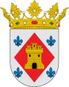
| coat of arms | Map of Spain | |

|
|
|
| Basic data | ||
| Autonomous Community : |
|
|
| Province : | Soria | |
| Comarca : | Campo de Gómara | |
| Coordinates | 41 ° 28 ′ N , 2 ° 1 ′ W | |
| Height : | 885 msnm | |
| Area : | 118.15 km² | |
| Residents : | 214 (Jan. 1, 2019) | |
| Population density : | 1.81 inhabitants / km² | |
| Postal code : | 42125 | |
| Municipality number ( INE ): | 42076 | |
| administration | ||
| Website : | Dec | |
Deza is a place and a municipality with 214 inhabitants (as of January 1, 2019) in the east of the Spanish province of Soria in the autonomous community of Castile and León . The municipality also includes the two hamlets (pedanías) La Alameda and Miñana , each with about 10 inhabitants.
location
The place Deza is on the Río Henar near the former border between Old Castile and the Kingdom of Aragón at an altitude of about 885 m above sea level. d. M. The provincial capital Soria is a good 60 km (driving distance) in a north-westerly direction; the next largest city is Calatayud in the province of Saragossa . The climate in winter is cool, but in summer it is quite warm; the low rainfall (approx. 470 mm / year) falls - with the exception of the rather poorly rainy summer months - distributed throughout the year.
Population development
| year | 1900 | 1950 | 2000 | 2016 |
| Residents | 1,600 | 1,478 | 388 | 239 |
The significant population decline since the 1950s is mainly due to the mechanization of agriculture and the associated loss of jobs.
economy
The place was and is the economic center of a rural community. Today tourism in the form of renting out holiday homes ( casas rurales ) plays a not insignificant role for the town's income.
history
Small prehistoric, Roman and Visigothic finds were discovered in the municipality, but the traces are generally rather poor. After the Arab-Moorish conquest , large areas in the north of the Iberian Peninsula were depopulated . The first news of the existence of a castle (castillo) comes from the year 876; it was besieged in 974 by the troops of the Castilian Count García Fernández without success and only fell into the hands of the Christians in 1136. The region was then repopulated ( repoblación ), but for a long time it remained controversial between Castile and the Kingdom of Aragón and was passed on to Bertrand du Guesclin around 1370 as thanks for his previous services . A few decades later it came into the possession of the Dukes of Medinaceli .
Attractions
- The most important building of the place is the castle (castillo) , which in its present form goes back to the dukes of Medinaceli.
- The Igesia de Nuestra Senora de la Asunción , which belongs to the diocese of Sigüenza, is an imposing three-aisled hall church from the 16th century, whose star vaults rest on columns.
- The Palacio de San Martín de Finojosa also deserves attention.
- Surroundings
- Of the five former hermit churches (ermitas) , three are still preserved: La Soledad, San Roque and San Antonio .
Web links
- Deza, sights - photos + information (Spanish)
Individual evidence
- ↑ Cifras oficiales de población resultantes de la revisión del Padrón municipal a 1 de enero . Population statistics from the Instituto Nacional de Estadística (population update).
- ↑ Deza - map with altitude information
- ↑ Deca - climate tables
- ↑ SDC - population development
- ↑ Deca - History
- ↑ Deza - Castle
- ↑ Deza - Castle
- ^ Deca - Iglesia
- ^ Deca - Iglesia

