
Reichenau (Carinthia)
|
Reichenau
|
||
|---|---|---|
| coat of arms | Austria map | |
 |
|
|
| Basic data | ||
| Country: | Austria | |
| State : | Carinthia | |
| Political District : | Feldkirchen | |
| License plate : | FE | |
| Surface: | 113.99 km² | |
| Coordinates : | 46 ° 51 ' N , 13 ° 54' E | |
| Height : | 1095 m above sea level A. | |
| Residents : | 1,765 (January 1, 2020) | |
| Postcodes : | 9564, 9565 | |
| Area code : | 04275 | |
| Community code : | 2 10 07 | |
| NUTS region | AT212 | |
| Address of the municipal administration: |
Level Reichenau 80 9565 Reichenau |
|
| Website: | ||
| politics | ||
| Mayor : | Karl Lessiak ( SPÖ ) | |
|
Municipal Council : ( 2015 ) (15 members) |
||
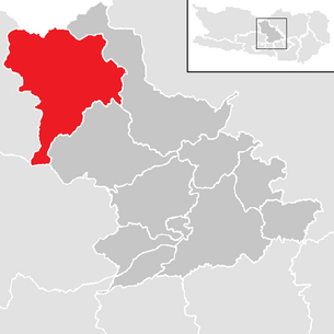
| Location of Reichenau in the Feldkirchen district | ||
  |
||
 View over the village of Ebene Reichenau |
||
| Source: Municipal data from Statistics Austria | ||


Reichenau is a municipality with 1765 inhabitants (as of January 1, 2020) in the Feldkirchen district in Carinthia .
geography
The community is 1010 m (Gurk bei St. Margarethen) to 2334 m (summit of the Klomnock ) above sea level in the Gurktal Alps . It essentially coincides with the catchment area of the upper Gurk and has a share in the north of the Turracher Höhe, known as the ski area, and the Turracher See , which Reichenau shares with the neighboring Styrian municipality of Stadl-Predlitz .
Community structure
Reichenau is divided into five cadastral communities (level Reichenau, Sankt Lorenzen, Sankt Margarethen, Wiedweg and Winkl), which comprise the following 21 localities (population in brackets as of January 1, 2020):
KG level Reichenau KG Sankt Lorenzen KG Sankt Margarethen KG Wiedweg KG Winkl Reichenau plain (327) St. Lorenzen (17) Let (14) Falkertsee (39) Saureggen (29) Hinterkoflach (88) Mitterdorf (90) Plaß (33) Turracherhöhe (74) Lorenzenberg (34) Patergassen (234) Rottenstein (49) Winkl (107) Shot (47) St. Margarethen (104) Seebach (29) Waidach (12) Re-vibrating (54) Front compartment (82) Vorwald (233) Wiedweg (69)
Another location is the Rotte Berg in the village of Winkl.
Waters
The main river in the municipality is the upper reaches of the Gurk , which is fed by several small tributaries.
There are several, mostly small lakes in Reichenau, of which the mountain lakes Turracher See at 1763 m and the Falkertsee at 1872 m above sea level are known as excursion destinations even beyond the municipal boundaries. The two smaller lakes Grünsee and Schwarzsee on the Turracher Höhe are on popular hiking trails.
Neighboring communities
| Stadl-Predlitz | ||
| Bad Kleinkirchheim |
.svg)
|
Albeck |
|
Field at the lake Afritz am See |
Arriach | Gnesau |
history
The Gurktal Alps were uninhabited until the Bronze Age . In Eben Reichenau an old iron mine indicates a settlement in Celtic-Roman times and the river name of Gurk is reminiscent of pre-Roman settlement. At the time of the Noricum , the Gurktal was partly inhabited by Roman colonialists, but there is no evidence that they also settled in the area of today's Reichenau municipality. Towards the end of the migrations at the end of the 6th century, the Celto-Romans, besieged by Slavic settlers, withdrew to more remote valleys. The ending “itz” in the place name indicates the first Slavic places, such as the Sirnitz and Flattnitz near Reichenau. The Upper Gurktal was still almost uninhabited in the 9th century, when towns like Gurk and places around Strasbourg were already mentioned along the Gurk .
Baier settlers came to Carinthia around the year 1000, and large parts of them came into the possession of churches and monasteries through donations. The ownership of the Millstatt Monastery extended to the Upper Gurktal. The first forest clearings were carried out here in the 10th, 11th and 12th centuries, and the first closed settlements emerged, including Gnesau (first mentioned in 1160).
The Lorenzenberg was developed around 1200, the previous building of today's parish church of St. Lorenzen was consecrated in 1216. The swampy valley floor was not cultivated and settled until after 1300. Reichenau was first mentioned in a document in 1332, the name suggests that the area was opened up by slash and burn (“smoking”). Various settlements can be proven for the time before; Up to 1300 there was clearing activity up to the village of Vorwald, the name of which comes from this.
The parish of Sankt Lorenzen (the highest parish in Carinthia at 1460 m above sea level , with a fortified church in the village and, somewhat remote, the Romanesque pilgrimage church of St. Anna) became independent in 1633. The tax communities Winkl-Reichenau, Ebene Reichenau, St. Margarethen and Wiedweg did not come into being until 1829. In 1849 they were initially incorporated into the Feldkirchen district, and in 1850 the community Reichenau was formed.
The Protestant church in Wiedweg was built in 1845 as a tolerance prayer house.
In 1928 a bus service was set up on the Turracher Höhe. Since then, modern tourism has developed in Reichenau.
population
According to the 2001 census, Reichenau had 2,029 inhabitants, 97.0% of whom were Austrian citizens. 79.9% of the population confessed to the Roman Catholic , 15.8% to the Protestant Church and 3.6% were without religious beliefs.
Culture and sights
- Today's parish church of St. Martin at the southern end of Ebene Reichenau was in 1384 on the occasion of the consecration of a chapel Sts. Andreas and Martin first mentioned in a document. St. Martin was a branch of St. Lorenzen until 1754 and only then received its own vicariate , in 1812 it became a parish church. The cemetery surrounding the church was consecrated in 1806. The current church was built in the late baroque style in the middle of the 18th century. The tower attached to the choir has round arched sound openings and a pointed pyramid roof.
- The parish church of St. Laurentius in the village of St. Lorenzen, 1477 m above sea level, is the highest parish in Carinthia. There is documentary evidence of a Capella S. Mariae et S. Laurentii in alpibus , consecrated in 1216 . The church is essentially a Romanesque and Gothic structure from the 14th century, which was changed in the Baroque style in the last quarter of the 18th century. The north tower has ogival sound openings and a pyramid roof. The ogival west portal is marked with the year 1787.
- The church of St. Margaretha in St. Margarethen was first mentioned in a document in 1307 and in 1433 as a parish church. In its current form, it was built in the Gothic style at the end of the 15th century. It has a square vestibule tower with a pointed gable spire from the 19th century. A sacristy is built on the north side of the slightly recessed choir. A mural of St. Christopher was placed on the south facade in the 15th century.
- The Evangelical Parish Church in Wiedweg was first mentioned in 1787 as a branch of St. Margarethen or Wiederschwing. Wiedweg was a branch of Feld am See until 1898, then of Gnesau until 1950, and Wiedweg has been an independent parish since 1954. The current church was built in 1844 by the Villach master builder Simon Pirker.
- The branch church of St. Anna above St. Lorenzen is a later Baroque, originally Gothic building from the 14th century. It was extended to the west at the end of the 18th century, provided with a roof turret with a round arched sound opening and a graceful onion dome. The construction seam is still clearly visible on both the north and south sides.
- The Devil's Bridge is on the road to the Turrach near the village of Winkl. The stone-walled structure erected in 1893 in place of an older stone bridge leads over the Stangenbach gorge. After it could no longer meet the demands of car traffic, it was replaced in 1978 by a wider reinforced concrete bridge as a traffic route; however, part of the older structure can still be seen today.
- To the southwest of Ebene Reichenau, in the village of Schuß, there is a boundary stone (re. 1814) that marked the border between Illyria and the Austrian Empire after the Napoleonic Wars.
- Nockalm Reptile Zoo in Patergassen
- The Hochsinner , Carinthia's highest farm, is at an altitude of 1616 m above sea level. A.
Economy and Infrastructure
traffic
The upper Gurktal is crossed by the former federal highway 95, also known as Turracher Straße , in a north-south direction, which connects the Murtal in the north with the Klagenfurt basin . Between Patergassen and Wiedweg, the Kleinkirchheimer Straße B 88 branches off as a connection via Kleinkirchheim to Radenthein in a westerly direction. The L 65 leads from Ebene Reichenau via Sirnitz into the middle Gurktal ( Gurktal Straße B 93), from which the upper Gurktal is separated by the Enge Gurk , a gorge that has not been developed for road traffic . In Winkl, the Nockalmstraße branches off , which leads into Innerkrems and via the L 19 into Katschtal .
Established businesses
Due to the Turracher Höhe and Falkert ski areas in the municipality as well as the proximity to those in Kleinkirchheim and Hochrindl , visitor traffic plays a certain role due to the location in the Nock Mountains on the eastern edge of the Nockberge National Park , whose administration is based in the village of Ebene Reichenau summer tourism. There are also no significant commercial enterprises.
politics
The municipal council of Reichenau has 15 members and has been composed as follows since the municipal council election in 2015 :
mayor
- since 2001 Karl Lessiak (SPÖ)
coat of arms
The Reichenau coat of arms, which was awarded to the municipality on January 20, 1986 by the Carinthian provincial government, clearly combines elements of cultural history and the natural area: It shows the church of St. Lorenzen, consecrated in 1216 and thus the oldest church in the municipality, as well as on the rear half of the shield with the stemless gentian ( Gentiana acaulis ) a plant typical of the alpine landscape of the Nock region (which is expressed in the shield by the green mountain).
The official blazon of the coat of arms reads:
- "Above a green mountain split by red and silver, on the right on the mountain behind a silver, black-roofed wall rising to the left, a silver, black-covered and black-open Gothic church with a tower reaching under the main edge, on the left a stemless church growing out of three green leaves Gentian floating with a silver stamp. "
The flag is red and white with an incorporated coat of arms.
Partner municipality
- Nersingen , Germany (since May 2009)
Personalities
- Siegfried Grabner (* 1975), snowboard world and European champion and Olympic participant, comes from Saureggen
- Matthias Maierbrugger (1913–1991), local history researcher and author, was born in Berg
- Erika Molny (1932–1990), author, was born in Patergassen
Web links
- Website of the municipality of Reichenau
- 21007 - Reichenau (Carinthia). Community data, Statistics Austria .
- Reichenau through the ages , documentation of the Reichenau community, 2000 (video, approx. 60 minutes)
Individual evidence
- ↑ Statistics Austria: Population on January 1st, 2020 by locality (area status on January 1st, 2020) , ( CSV )
- ^ Statistics Austria, population census, demographic data. May 15, 2001, accessed March 3, 2019 .
- ^ Dehio manual. The art monuments of Austria. Carinthia . Anton Schroll, Vienna 2001, ISBN 3-7031-0712-X , p. 89f.
- ^ Dehio manual. The art monuments of Austria. Carinthia . Anton Schroll, Vienna 2001, ISBN 3-7031-0712-X , p. 760.
- ^ Dehio manual. The art monuments of Austria. Carinthia . Anton Schroll, Vienna 2001, ISBN 3-7031-0712-X , p. 767f.
- ^ Dehio manual. The art monuments of Austria. Carinthia . Anton Schroll, Vienna 2001, ISBN 3-7031-0712-X , p. 1067.
- ^ Dehio manual. The art monuments of Austria. Carinthia . Anton Schroll, Vienna 2001, ISBN 3-7031-0712-X , p. 760.
- ↑ Georg Sterk, Friedrich H Ucik: The Turracher Höhe . Verlag Johannes Heyn, Klagenfurt 2003, ISBN 3-7084-0039-9 , p. 35f.
- ↑ Georg Sterk, Friedrich H Ucik: The Turracher Höhe . Verlag Johannes Heyn, Klagenfurt 2003, ISBN 3-7084-0039-9
- ^ Quoted from Wilhelm Deuer: Die Kärntner Gemeindewappen , p. 226. Verlag des Kärntner Landesarchiv, Klagenfurt 2006, ISBN 3-900531-64-1
Albeck | Feldkirchen | Glanegg | Gnesau | Himmelberg | Ossiach | Reichenau | Santa Urban | Steindorf am Ossiacher See | Steuerberg