
Fabriano
| Fabriano | ||
|---|---|---|

|
|
|
| Country | Italy | |
| region | Brands | |
| province | Ancona (AN) | |
| Coordinates | 43 ° 20 ' N , 12 ° 55' E | |
| height | 325 m slm | |
| surface | 269.61 km² | |
| Residents | 30,167 (Dec. 31, 2019) | |
| Population density | 112 inhabitants / km² | |
| Post Code | 60044 | |
| prefix | 0732 | |
| ISTAT number | 042017 | |
| Popular name | Fabrianesi | |
| Patron saint | John the Baptist | |
| Website | Fabriano | |
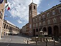
 Panorama of Fabriano |
||

Fabriano is a city in the Italian province of Ancona , Marche . The 325 m. ü. City located above sea level has 30,167 inhabitants (as of December 31, 2019) and an area of 269.61 km². Fabriano is the seat of the Bishop of Fabriano-Matelica .
geography
The city is a member of the Comunità Montana dell'Esino Frasassi and the Parco Gola della Rossa e di Frasassi . The districts ( località e frazioni ) are particularly numerous : Albacina, Argignano, Attiggio, Bassano, Bastia, Belvedere, Borgo Tufico, Ca 'Maiano, Cacciano, Campodiegoli, Campodonico, Cancelli, Cantia, Castelletta, Ciaramella, Coccore, Collamato, Collegiglioni, Collepaganello, Cortina San Venanzio, Cupo, Grotte, Marischio, Melano, Molinaccio, Montefiascone, Morentella, Moscano, Nebbiano, Paterno, Pecorile, Poggio San Romualdo, Precicchie, Rocchetta, Rucce, San Donato, San Giovanni, San Michele, Sant'Elia , Serradica, Trocchetti, Valgiubola, Vallemontagnana, Valleremita, Vallina, Varano, Viacce, Vigne. The lowest point of the municipality is 164 m, the highest at 1,410 m.
The neighboring municipalities are Cerreto d'Esi , Costacciaro ( PG ), Esanatoglia ( MC ), Fiuminata ( MC ), Fossato di Vico ( PG ), Genga , Gualdo Tadino ( PG ), Matelica ( MC ), Nocera Umbra ( PG ), Poggio San Vicino ( MC ), Sassoferrato , Serra San Quirico and Sigillo ( PG ).
history
In Fabriano, then part of the Papal States, the first paper mill on European soil was founded in 1276 .
After Italy entered the war in June 1940, the fascist regime set up an internment camp ( campo di concentramento ) in Fabriano . It was located in the Collegio Gentile , a religious house on Via Cavour. The inmates belonged to two categories: initially only “dangerous Italians”, later increasingly “ex-Yugoslavs”. Most internees left the camp between July 25 and September 8, 1943, but the camp reopened during the RSI . On February 19, 1944, 120 inmates were handed over to the German occupation troops and transferred to the Calvari di Chiavari camp.
Attractions
The Pinakothek and the Paper and Filigree Museum are well worth seeing .
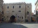
Palazzo del Podestà
Palazzo Vescovile (Bishop's Palace)

Loggiato San Francesco

The "Bruno Molajoli" art gallery

Museo della carta e della filigrana

In the museum

.jpg)
.jpg)


economy
Fabriano is one of the oldest paper manufacturing centers in Europe (since the middle of the 13th century) and is still the seat of important paper mills today.
In the municipality there are approved vineyards for the production of the famous white wine Verdicchio di Matelica .
sons and daughters of the town
- Gentile da Fabriano (≈1370 / 85–1427), painter of the early Renaissance
- Francesco Stelluti (1577–1652), naturalist
- Giovanni Maria Zonghi (1847–1941), Archbishop, President of the Pontifical Diplomatic Academy
- Giuseppe Mazzoli (1886–1945), archbishop and diplomat
- Venantino Venantini (1930-2018), actor
- Primo Zamparini (* 1939), boxer, silver medalist in the bantamweight 1960
- Eva Mei (* 1967), soprano
- Luca Riccitelli (* 1971), automobile racing driver
literature
- Benedikt Loderer : Stadtwanderers Merkbuch. Definition of "urban space" using the example of Fabriano . Callwey, Munich, 1987. ISBN 3-7667-0865-1 . Analysis of urban structures in the city of Fabriano.
Web links
- Entry at Comuni italiani Italian
- Entry in Italia in dettaglio in Italian and English
- Page of the paper museum in Italian and English
Individual evidence
- ↑ Statistiche demografiche ISTAT. Monthly population statistics of the Istituto Nazionale di Statistica , as of December 31 of 2019.
- ^ Dietrich Rauchberger: Johannes Leo der Afrikaner. His description of the area between the Nile and Niger . Harrassowitz Verlag. Wiesbaden 1999. p. 6. ISBN 3-447-04172-2 .
- ↑ Carlo Spartaco Capogreco, I Campi del duce. L'internamento civile nell'Italia fascista (1940-1943) , Torino 2004 (Einaudi), pp. 187-188

Agugliano | Ancona | Arcevia | Barbara | Belvedere Ostrense | Camerano | Camerata Picena | Castelbellino | Castelfidardo | Castelleone di Suasa | Castelplanio | Cerreto d'Esi | Chiaravalle | Corinaldo | Cupramontana | Fabriano | Falconara Marittima | Filottrano | Genga | Jesi | Loreto | Maiolati Spontini | Mergo | Monsano | Monte Roberto | Monte San Vito | Montecarotto | Montemarciano | Morro d'Alba | Numana | Offagna | Osimo | Ostra | Ostra Vetere | Poggio San Marcello | Polverigi | Rosora | San Marcello | San Paolo di Jesi | Santa Maria Nuova | Sassoferrato | Senigallia | Serra San Quirico | Serra de 'Conti | Sirolo | Staffolo | Trecastelli