Frederick County, Maryland
| administration | |
|---|---|
| US state : | Maryland |
| Administrative headquarters : | Frederick (Maryland) |
| Address of the administrative headquarters: |
Frederick County Courthouse Frederick, MD 21702 |
| Foundation : | 1748 |
| Made up from: |
Prince George's County Baltimore County |
| Demographics | |
| Residents : | 233,385 (2010) |
| Population density : | 136 inhabitants / km 2 |
| geography | |
| Total area : | 1728 km² |
| Water surface : | 12 km² |
| map | |
| Website : www.frederickcountymd.gov | |
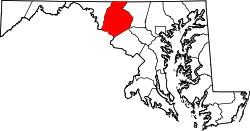
The Frederick County is a county in the US -amerikanischen State Maryland . In 2010 , the county had 233,385 residents and a population density of 136 people per square kilometer. The county seat is Frederick .
Frederick County is part of the metropolitan area around the US capital Washington .
geography
The county covers an area of 1,728 square kilometers; of which twelve square kilometers (0.67 percent) are water. To the north, the Mason-Dixon Line forms the border with Pennsylvania ; the Potomac River in the south is also the border with Virginia . Frederick County is located in the transition area between the Piedmont and the Appalachians . The county's two towering mountain ranges, Catoctin Mountain and South Mountain - the ridge line of the latter forms part of the western county boundary - are an extension of the Blue Ridge Mountains and run roughly north-south.
The county is traversed in a northeast-southwest direction by the Monocacy River coming from Pennsylvania , on the right bank of which the administrative center Frederick is also located.
Frederick County is bordered by the following counties in Maryland, Pennsylvania, and Virginia:
|
Franklin County, Pennsylvania |
Adams County, Pennsylvania |
|
| Washington County |

|
Carroll County |
|
Loudoun County, Virginia |
Montgomery County | Howard County |
history

| Population development | |||
|---|---|---|---|
| Census | Residents | ± in% | |
| 1790 | 30,791 | - | |
| 1800 | 31,523 | 2.4% | |
| 1810 | 34,437 | 9.2% | |
| 1820 | 40,459 | 17.5% | |
| 1830 | 45,789 | 13.2% | |
| 1840 | 36,405 | -20.5% | |
| 1850 | 40,987 | 12.6% | |
| 1860 | 46,591 | 13.7% | |
| 1870 | 47,572 | 2.1% | |
| 1880 | 50,482 | 6.1% | |
| 1890 | 49,512 | -1.9% | |
| 1900 | 51,920 | 4.9% | |
| 1910 | 52,673 | 1.5% | |
| 1920 | 52,541 | -0.3% | |
| 1930 | 54,440 | 3.6% | |
| 1940 | 57,312 | 5.3% | |
| 1950 | 62,287 | 8.7% | |
| 1960 | 71,930 | 15.5% | |
| 1970 | 84,927 | 18.1% | |
| 1980 | 114,792 | 35.2% | |
| 1990 | 150.208 | 30.9% | |
| 2000 | 195.277 | 30% | |
| 2010 | 233,385 | 19.5% | |
| before 1900 1900–1990 2000–2010 | |||
Frederick County was formed in 1746 from parts of Prince George's County and Baltimore County. It was named after Frederick Calvert, 6th Baron Baltimore (1731–1771), the last Baron Baltimore .
The county was originally much larger than it is today. In 1776 Washington and Montgomery Counties were spun off. In 1837, part of Frederick County was spun off and combined with part of neighboring Baltimore County to form the newly formed Carroll County.
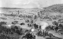
Due to their historical significance, two sites have the status of a National Historic Landmark , the Monocacy National Battlefield and the historic Schifferstadt house . 92 buildings and sites in the county are listed on the National Register of Historic Places (as of November 13, 2017).
Notoriety
The county's largest employers are the military research facilities in Fort Detrick , including the United States Army Medical Research Institute of Infectious Diseases bioweapons research center .
It was made famous by the film Blair Witch Project , which is set near the small town of Burkittsville in southwest Frederick County.
The Naval Support Facility Thurmont , better known as Camp David , is located in northern Frederick County.
Demographic data
According to the 2010 census , Frederick County had 233,385 people in 83,455 households. The population density was 136 inhabitants per square kilometer. Statistically, 2.68 people lived in each of the 83,455 households.
The racial the population was composed of 81.5 percent white, 8.6 percent African American, 0.3 percent Native American, 3.8 percent Asian and other ethnic groups; 2.8 percent were descended from two or more races. Hispanic or Latino of any race was 7.3 percent of the population.
25.3 percent of the population were under 18 years old, 63.6 percent were between 18 and 64 and 11.1 percent were 65 years or older. 50.8 percent of the population was female.
The median income for a household was 81,686 USD . The per capita income was $ 35,172. 4.8 percent of the population lived below the poverty line.
Known residents
- Thomas Johnson , lived there from 1760
- Isaac Shelby (December 11, 1750 - July 18, 1826), 5th Governor of the US state of Kentucky .
Places in Frederick County
Census-designated places (CDP)
other unincorporated communities
1 - partially in Carroll , Howard and Montgomery Counties
structure
Frederick County is divided into 26 numbered districts:
| District | Population (2010) | FIPS |
|---|---|---|
| District 1, Buckeystown | 10,218 | 24-90040 |
| District 2, Frederick | 72.111 | 24-90132 |
| District 3, Middletown | 10,025 | 24-90224 |
| District 4, Creagerstown | 1247 | 24-90316 |
| District 5, Emmitsburg | 6674 | 24-90408 |
| District 6, Catoctin | 2107 | 24-90500 |
| District 7, Urbana | 15,071 | 24-90592 |
| District 8, Liberty | 2460 | 24-90684 |
| District 9, New Market | 27,147 | 24-90776 |
| District 10, Hauvers | 2339 | 24-90868 |
| District 11, Woodsboro | 3400 | 24-90956 |
| District 12, Petersville | 3299 | 24-91048 |
| District 13, Mount Pleasant | 5953 | 24-91140 |
| District 14, Jefferson | 4795 | 24-91232 |
| District 15, Thurmont | 8943 | 24-91324 |
| District 16, Jackson | 4208 | 24-91416 |
| District 17, Johnsville | 2212 | 24-91508 |
| District 18, Woodville | 9628 | 24-91600 |
| District 19, Linganore | 1755 | 24-91692 |
| District 20, Lewistown | 3115 | 24-91784 |
| District 21, Tuscarora | 9961 | 24-91876 |
| District 22, Burkittsville | 1553 | 24-91968 |
| District 23, Ballenger | 5544 | 24-92060 |
| District 24, Braddock | 5548 | 24-92152 |
| District 25, Brunswick | 4763 | 24-92244 |
| District 26, Walkersville | 9309 | 24-92336 |
Individual evidence
- ↑ GNIS-ID: 1711211. Retrieved on February 22, 2011 (English).
- ↑ a b c U.S. Census Bureau, State & County QuickFacts - Frederick County, MD ( July 10, 2011 memento on WebCite ) Retrieved May 20, 2012
- ^ National Association of Counties.Retrieved May 20, 2012
- ^ University of Virginia Library - Historical Census Browser. Retrieved July 15, 2011
- ↑ United States Census.gov.Retrieved July 15, 2011
- ↑ Listing of National Historic Landmarks by State: Maryland . National Park Service , accessed November 13, 2017.
- ↑ Search mask database in the National Register Information System. National Park Service , accessed November 13, 2017.
- ↑ ( page no longer available , search web archives: Missouri Census Data Center - Maryland ) Retrieved May 20, 2012
literature
- John R. Holt: Historic Frederick. A condensed history of Frederick City and County and the personages that have made them famous. Marken & Bielfeld, Frederick, Maryland 1949. (Previous edition 1932.)
- WR Quynn: Bicentennial history of Frederick City & County, Maryland. Bicentennial Committee of the Frederick Chamber of Commerce, [Frederick? Md.] 1975.
- Margaret Denton: Frederick County German heritage. Diversions Pub., Frederick, MD 2007. ISBN 0-9743715-8-0 .
Web links
Coordinates: 39 ° 28 ′ N , 77 ° 24 ′ W


