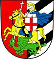
Jiříkov u Rýmařova
| Jiříkov | ||||
|---|---|---|---|---|
|
||||
| Basic data | ||||
| State : |
|
|||
| Region : | Moravskoslezský kraj | |||
| District : | Bruntál | |||
| Area : | 3529,6093 ha | |||
| Geographic location : | 49 ° 51 ' N , 17 ° 17' E | |||
| Height: | 600 m nm | |||
| Residents : | 270 (Jan. 1, 2019) | |||
| Postal code : | 792 01 | |||
| License plate : | MO | |||
| traffic | ||||
| Street: | Rýmařov - Paseka | |||
| structure | ||||
| Status: | local community | |||
| Districts: | 5 | |||
| administration | ||||
| Mayor : | Bohumil Hrnčíř (as of 2015) | |||
| Address: | Jiříkov 85 793 51 Břidličná |
|||
| Municipality number: | 597457 | |||
| Website : | obce.rymarovsko.cz/jirikov | |||
Jiříkov (German Girsig ) is a municipality in the Czech Republic . It is nine kilometers south of Rýmařov and belongs to the Okres Bruntál .
geography
The forest hoof village Jiříkov extends in the Lower Jeseníky on the upper reaches of the brook Jiříkovský potok; The Teplička rises north-east of the village . To the north rise the Jiříkovský vrch (669 m nm) and the Návrší (709 m nm), in the east the Obecní kopec (651 m nm), southeast the Hony (637 m nm), in the south the Jiříkov (617 m nm), southwest of the Vápenný vrch (628 m nm), in the west the Veselka (571 m nm) and the Těchanovský vrch (598 m nm) and northwest of the Sovinec (616 m nm).
Neighboring towns are Hutov, Skály, Strálecká Myslivna, Rýmařov and Ondřejov in the north, Stránske, Vajglov and Kněžpole in the Northeast, Veveří in the east, Krahulčí the southeast, Huzová , Mutkov and Pasecký Žleb in the south, Karlov , Křížov, Sovinec , Valšův Důl and Křivá in the southwest, Těchanov and Ruda in the west and Mirotínek , Rešov and Horní Město in the northwest.
history
Jiříkov was laid out in the course of the state colonization under the Olomouc bishop Bruno von Schauenburg and was first mentioned in writing in 1264. Since 1494 the village belonged to the rule Eulenberg . In 1578 the mining entrepreneur Lorenz Eder von Sstiawnicz ( Vavřinec Eder z Štiavnic ) acquired the rule. In 1592 Eder's son-in-law Jan d. Ä. Kobylka von Kobylí ruled Eulenberg. Because of his participation in the uprising of the estates , Kobylka lost his property to Karl von Liechtenstein after the battle of the White Mountain . This handed over the rule to the German Order in 1623 . Giersig remained submissive to Eulenberg until the middle of the 19th century . After the abolition of patrimonial formed Giersig / Jiříkov in 1849 with the hamlet Hutdörfel / Hutov a municipality in the judicial district of Roman town. In 1930 there were 333 people in Girsig , and in 1939 there were 372.
Girsig belonged to the German district of Römerstadt from 1938 to 1945 . After the war, Jiříkov came back to Czechoslovakia and the German population was expelled . In the second half of the 20th century, most of Jiříkov's houses were demolished; New buildings were built in the upper village. The Hutov settlement was completely abandoned. After the Okres Rýmařov was abolished, the municipality was assigned to the Okres Bruntál in 1960. On July 1, 1979 Sovinec (with Křížov) was incorporated. On January 1, 1980, Kněžpole and Těchanov were incorporated.
Community structure
The municipality Jiříkov consists of the districts and cadastral districts Jiříkov ( Girsig ), Kněžpole ( Herzogsdorf ), Křížov ( cross ), Sovinec ( Eulenberg ) and Těchanov ( Zechan ). To Jiříkov also includes the settlement Valšův Dul, the monolayer Strálecká Myslivna and the deserted village Hutov ( Hutdörfel ).
Attractions
- Church of Archangel Michael in Jiříkov, the renaissance building built in 1605 was redesigned in 1787 in baroque style. Today the deconsecrated and dilapidated church is owned by Jiří Halouzka and is part of the grandfather gallery.
- The grandfather gallery "U Halouzků" in Jiříkov, the exhibition of Christmas cribs from Moravian carvers opened by the carver Jiří Halouzka in 2008 in a former farm has now grown to an area of 8 hectares. The exhibits include a 10.4 m high figure "Vládce Jeseníku" ( Hruby ) having a weight of 15 t, the largest Christmas crib with more than 250-life figures as well as a fabricated from 24 Linde strains replica of the wood image "father Hruby and kingdom", which was originally in the old Altvaterturm .
- Sovinec Castle ( Eulenburg )
- Church of St. Augustine in Sovinec
- Church of St. John the Baptist in Kněžpole
- Church of St. Simon and Judas in Těchanov
- Chapel of St. Franz Xavier in Křížov
- Ruins of the Church of St. Anna in Hutov
- Strálek castle ruins
Web links
Individual evidence
- ↑ http://www.uir.cz/obec/597457/Jirikov
- ↑ Český statistický úřad - The population of the Czech municipalities as of January 1, 2019 (PDF; 7.4 MiB)
- ↑ Michael Rademacher: German administrative history from the unification of the empire in 1871 to the reunification in 1990. District Römerstadt (Czech. Rymarov). (Online material for the dissertation, Osnabrück 2006).
- ↑ http://www.uir.cz/casti-obce-obec/597457/Obec-Jirikov
- ↑ http://www.uir.cz/katastralni-uzemi-obec/597457/Obec-Jirikov
- ↑ Archived copy ( memento of the original from December 24, 2015 in the Internet Archive ) Info: The archive link was inserted automatically and has not yet been checked. Please check the original and archive link according to the instructions and then remove this notice.


