Město Albrechtice
| Město Albrechtice | ||||
|---|---|---|---|---|
|
||||
| Basic data | ||||
| State : |
|
|||
| Historical part of the country : | Silesia | |||
| Region : | Moravskoslezský kraj | |||
| District : | Bruntál | |||
| Area : | 6527 ha | |||
| Geographic location : | 50 ° 10 ′ N , 17 ° 35 ′ E | |||
| Height: | 350 m nm | |||
| Residents : | 3,529 (Jan 1, 2019) | |||
| Postal code : | 793 73 - 793 95 | |||
| traffic | ||||
| Railway connection: | Krnov – Głuchołazy | |||
| structure | ||||
| Status: | city | |||
| Districts: | 10 | |||
| administration | ||||
| Mayor : | Jana Murová (as of 2020) | |||
| Address: | Nám. ČSA 10 793 95 Město Albrechtice |
|||
| Municipality number: | 597635 | |||
| Website : | www.mesto-albrechtice.cz | |||
Město Albrechtice (German Olbersdorf ) is a town in the Czech Moravskoslezský kraj ( Moravian-Silesian Region ) in Okres Bruntál ( Freudenthal district ).
Geographical location
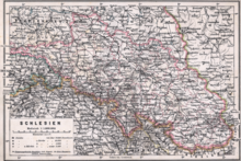
The city is located in the Sudetes , about 20 km southwest of Leobschütz and 37 km northwest of Opava , at an altitude of 350 m above sea level. M. in the Olbersdorf depression (Albrechtická kotlina) of the Zuckmanteler Uplands ( Zlatohorská vrchovina, Oppagebirge) on both sides of the Goldoppa , which forms the border to the Polish Voivodeship of Lower Silesia below the city . Neighboring towns are Rudíkovy in the north, Biskupice in the northeast, Opavice and the Polish Opawica in the southeast, Žáry and Burkvíz in the south and Hynčice in the west. The cadastral area is 6,527 ha.
history

Albirchtisdorf was first mentioned in 1377 when the Duchy of Opava was divided. In 1390 Jobst von Moravia became the owner of the Olbersdorf estate, followed by the Knights of Stosch in 1420 and the Makrota in 1492. The old fortress was destroyed in 1474 by the troops of King Matthias Corvinus . In 1492 Adolf Makrota had Olbersdorf elevated to the status of town by Vladislav II and given various privileges. In 1503 the Lords von Füllstein acquired the property, which was confiscated after the Battle of the White Mountain . In 1623 the Jesuits in Neisse received Olbersdorf. 1716 raised Charles VI. Olbersdorf to a free rule.
After most of Silesia was ceded to Prussia in 1742, the city remained with Austrian Silesia . The border that emerged directly in front of the city severely hampered its further development. In 1745 the Neisser Jesuits handed Olbersdorf over to the Jesuits in Opava ; In 1773 their goods were transferred to the Imperial Court Chamber.
In 1813, a heavy flood from the Goldoppa flooded the city in such a way that its residents fled to the higher-lying neighboring villages of Burgwiese and Oberschaar. In 1824 Karl Traugott Skrbenský from Hřiště to Hoschialkowitz ( Hošťálkovice ) became the new landlord, who sold the property to the Troppauer merchants Vincenz Keil and Vincenz Tlachov just a year later. In 1837 they built a sheet metal rolling mill near the city, which became the largest employer in the region. In the 1890s the plant was relocated to Oderberg , where it merged with the United Ironworks and Wire Works . As a result of the loss of jobs, the population fell by 15 percent.
Around 1850 Paul Primavesi built a linen spinning mill, which in its heyday was among the 10 largest spinning mills in the monarchy. The plant also supported the construction of the railway from Jägerndorf to Bad Ziegenhals , which gave Olbersdorf a rail connection. After the majority takeover of the company by Otto Primavesi, the plant became part of the bankruptcy, caused by excessive support for the Wiener Werkstätte.
By the Munich Agreement , Olbersdorf was assigned to the German Reich in 1938; until 1945 Olbersdorf belonged to the district of Jägerndorf in the administrative district of Troppau in the Reichsgau Sudetenland . After the Second World War , Olbersdorf came back to Czechoslovakia. The predominantly German-speaking population was expelled ; only a few spinning masters had to stay. The plant later produced incandescent lamps. After the Velvet Revolution , the unprofitable factory was closed.
Today the region is one of the areas with high unemployment.
Demographics
| year | Residents | Remarks |
|---|---|---|
| 1834 | 714 | German Catholic residents |
| 1900 | 1,028 | (as a community 2,376) German residents |
| 1930 | 2,843 | |
| 1939 | 2,582 |
Buildings
Community structure
The city of Město Albrechtice includes the districts Burkvíz ("Burgwiese"), Česká Ves ("Neudörfel"), Dlouhá Voda ("Langwasser"), Hynčice ("Heinzendorf"), Linhartovy ("Geppersdorf"), Opavice ("Tropplowitz") , Piskořov ("Peischdorf"), Valštejn ("Wallstein") and Žáry ("Oberschaar") as well as the hamlets of Biskupice ("Bischofswalde"), Láč ("Latsch"), Malý Valštejn ("Klein Wallstein"), Velký Valštejn ( "Groß Wallstein") and Ztracená Voda ("Lost Water").
Town twinning
-
 Biała , Poland
 -
 Głubczyce , Poland
 -
 Komprachcice , Poland
 -
 Lubrza , Poland
 -
 Precenicco , Italy
 -
 Prudnik , Poland
Mayor of the city of Olbersdorf
- 1885 to 1892 Karl Escher
- 1892 to 1898 Albert Tittel
- 1898 to 1899 Rudolf Koloczek
- 1899 to 1902 Xaver Bank
- 1902 to 1918 Adolf Koppitz
- 1918 to 1919 Gustav Stölzel
- 1919 to 1928 Paul Primavesi
- 1928 to 1932 Friedrich Hauke, businessman
- 1932 to 1932 Rudolf Koppitz
- 1932 to 1932 Karl Groß
- 1932 to 1933 Ferdinand Zopp
- 1933 to 1938 Ludwig Richter
- 1938 to 1944 Karl Groß, businessman
- 1944 to 1945 Rudolf Koppitz
- 2005 to 2007 Petr Šolc
- since 2007 Luděk Volek
sons and daughters of the town
- Leopold von Sedlnitzky (1787–1871), Prince-Bishop of Breslau, born in Geppersdorf
- Albert Adam (1824–1894), painter, born in Heinzendorf
- Leo Schubert (1885–1968), Sudeten German mayor and member of parliament
- Alois Fietz (1890–1968), German archeobotanist
- František Gel (1901–1972), Czech journalist
- Lola Chlud (1905-2000), German actress
- Dietfried Krömer (1938–2006), German classical philologist
- Miloslav Gajdoš (* 1948), double bass player, music teacher and composer
- Loukas Vyntra (* 1981), Greek football player
literature
- Faustin Ens : The Oppaland, or the Troppauer Kreis, according to its historical, natural history, civil and local characteristics . Volume 4: Descriptions of the principalities of Jägerndorf and Neisse, Austrian Antheils and the Moravian enclaves in the Troppauer district , Vienna 1837, pp. 86–88.
- Heinrich Schulig: A home book for the districts Jägerndorf and Olbersdorf . Published by the Jägerndorfer District Teachers' Association. Adolf Drechsler, Troppau 1923.
- Jaromír Balla: Město Albrechtice a okolí . 2010.
Web links
Individual evidence
- ↑ Český statistický úřad - The population of the Czech municipalities as of January 1, 2019 (PDF; 7.4 MiB)
- ↑ Faustin Ens : The Oppaland or the Opava district, according to its historical, natural history, civic and local peculiarities . Volume 4: Description of the locations of the principalities of Jägerndorf and Neisse, Austrian Antheils and the Moravian enclaves in the Troppauer district , Vienna 1837, pp. 86-88.
- ^ Meyer's Large Conversational Lexicon . 6th edition, Volume 15, Leipzig and Vienna 1908, p. 22
- ^ A b Michael Rademacher: German administrative history from the unification of the empire in 1871 to the reunification in 1990. Jägerndorf district. (Online material for the dissertation, Osnabrück 2006).


