Lower Diemeltal nature reserve
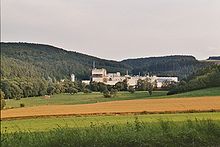
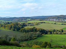
The nature reserve Unteres Diemeltal with a size of 164.57 ha is located between Bredelar and Marsberg in the urban area of Marsberg in the Hochsauerlandkreis . The nature reserve (NSG) was designated as a NSG in 2008 with the Marsberg landscape plan. The NSG represents a part of the Fauna-Flora-Habitat-Area (FFH) water system Diemel and Hoppecke (Natura 2000-Nr. DE-4617-302) in the European protected area system according to Natura 2000 with a size of 588 ha.
Adjacent areas
In the northwest, the NSG borders the Bredelarer Kammer / Fürstenberger Wald conservation area as far as Niedermarsberg . The Momecketal nature reserve only slips in between for a short distance . Then follows the nature reserve Diemeltalflanken to the east around Niedermarsberg . This LSG ends in the east at Diemel. Now follows the eastern part of the landscape protection area Schweingründchen / Berghagen / Unter der Königsseite towards the southwest. In part, this landscape protection area Schweingründchen / Berghagen / Unter der Königsseite is only as wide as the embankment of the Upper Ruhr Valley Railway there . Only separated by this embankment is the Hagen / Königsseite nature reserve in the east and the Auf der Wiemecke nature reserve in the southeast . The LSG Schweingründchen / Berghagen / Unter der Königsseite far west to the area west of the Diemeltalbrücke of the K 65 . To the west, the landscape protection area Bredelarer Kammer / Fürstenberger Wald connects to the site of the Wepa paper factory branch . Now, to the north, the western part of the landscape protection area Schweingründchen / Berghagen / Unter der Königsseite borders. Another part of the landscape protection area Bredelarer Kammer / Fürstenberger Wald follows . In the Hoppecketal, the NSG borders the Lange Wiese nature reserve to the west .
description
The NSG is part of the Diemel and Hoppecke with the floodplain . The floodplain is used as grassland. The whole NSG is cut through only by one street, the K 5.
Protection purpose of the nature reserve
The NSG was identified:
- For the maintenance and further development of a large, contiguous, scenic flood plain with the local communities of the floodplain grassland;
- For the protection and optimization of near-natural water bodies and small structures (trees, wet and dry biotopes);
- As a habitat for endangered animal and plant species;
- To safeguard the relics of industrial and settlement history that are interesting from a regional perspective;
- To preserve the large-scale character of the landscape as well as the relative undisturbedness of the river section from construction or use-related interventions in the landscape situation;
- To ensure the coherence and implementation of the European "Natura 2000" system of protected areas.
See also
literature
- Hochsauerlandkreis - Lower Landscape Authority: Marsberg landscape plan (PDF; 1.4 MB). Meschede 2008, pp. 50-51 + 204-213.
Web links
- "Unteres Diemeltal" nature reserve in the specialist information system of the State Office for Nature, Environment and Consumer Protection in North Rhine-Westphalia
- Nature reserve Unteres Diemeltal with two other NSG's under the name Diemeltal and Königsseite on the side of natural treasures of South Westphalia
Coordinates: 51 ° 25 ′ 31 ″ N , 8 ° 48 ′ 48 ″ E


