
Niederbergkirchen
| coat of arms | Germany map | |
|---|---|---|

|
Coordinates: 48 ° 19 ′ N , 12 ° 30 ′ E |
|
| Basic data | ||
| State : | Bavaria | |
| Administrative region : | Upper Bavaria | |
| County : | Mühldorf am Inn | |
| Management Community : | Rohrbach | |
| Height : | 489 m above sea level NHN | |
| Area : | 24.7 km 2 | |
| Residents: | 1229 (Dec. 31, 2019) | |
| Population density : | 50 inhabitants per km 2 | |
| Postal code : | 84494 | |
| Primaries : | 08639, 08635, 08631, 08637 | |
| License plate : | MÜ, VIB , WS | |
| Community key : | 09 1 83 130 | |
| LOCODE : | DE NBE | |
| Community structure: | 52 districts | |
| Association administration address: | Rohrbach 20 84513 Erharting, Germany |
|
| Website : | ||
| Mayor : | Werner Biedermann jun. ( CSU / Niederbergk Citizen List ) | |
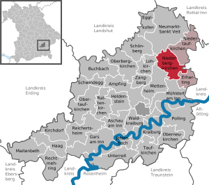
| Location of the community Niederbergkirchen in the district of Mühldorf am Inn | ||
  |
||

Niederbergkirchen is a municipality in the Upper Bavarian district of Mühldorf am Inn and a member of the Rohrbach administrative community .
geography
Geographical location
The completely rural municipality of Niederbergkirchen is located in the region of southeast Upper Bavaria in the tertiary hill country between the valley lowlands of Rott and Isen around nine kilometers north of the district town of Mühldorf and seven kilometers south of Neumarkt-Sankt Veit .
Community structure
The community Niederbergkirchen has 52 districts:
|
There are the districts Niederbergkirchen and Oberhofen.
history
Until the church is planted
Niederbergkirchen was first mentioned in a document in the Notitia Arnonis of the Salzburg Archbishop Arno in 788 AD. The Cistercian monastery in Raitenhaslach was the largest landowner in the community until secularization . The place belonged to the Landshut Rent Office and the Neumarkt Regional Court of the Electorate of Bavaria . In the course of the administrative reforms in Bavaria , the municipality of Niederbergkirchen was created with the municipal edict of 1818 .
Incorporations
On May 1, 1978, the previously independent municipality of Oberhofen was incorporated.
Population development
Between 1988 and 2018 the municipality grew from 1,103 to 1,219 by 116 inhabitants or 10.5%.
- 1961: 1146 inhabitants
- 1970: 1051 inhabitants
- 1987: 1099 inhabitants
- 1991: 1144 inhabitants
- 1995: 1152 inhabitants
- 2000: 1170 inhabitants
- 2005: 1247 inhabitants
- 2010: 1222 inhabitants
- 2015: 1203 inhabitants
politics
Mayor is Werner Biedermann (CSU / Niederbergkirchener Bürgerliste).
badges and flags
Blazon : “Divided; Above in black a sloping bar made of silver and red, below in two rows of clouds of silver and blue. ”The red, white and blue municipal flag approved in 1985 is not used.
Culture and sights
building
The Catholic parish church of St. Blasius was rebuilt in the late Gothic style between 1467 and 1484 as the successor to a Romanesque building . After the baroque renovation from 1715 to 1732, the church was redesigned (regotified) in the neo-Gothic style from 1883 to 1893 . The neighboring rectory shows a baroque design.
Natural monuments
- Oak with a chest height circumference of 6.50 m (2015).
Soil monuments
See: List of ground monuments in Niederbergkirchen
Economy and education

In 2013 there were 104 jobs subject to social insurance contributions in the municipality, eight in agriculture and forestry, 69 in manufacturing and ten in the service sector. 449 residents had an employment relationship subject to social security contributions. The number of out-commuters thus outnumbered 345 people.
1798 hectares of the municipal area were used for agriculture, that is 72.8%. In 2010, 50 farms were counted.
There is a day-care center for children in the municipality with 28 places; in 2014 it had 34 children. There is also a primary school with four classes and 72 students in the 2017/18 school year.
Personalities
- Alois Wiesböck (* 1950), long track world champion 1979
Individual evidence
- ↑ "Data 2" sheet, Statistical Report A1200C 202041 Population of the municipalities, districts and administrative districts 1st quarter 2020 (population based on the 2011 census) ( help ).
- ↑ http://www.bayerische-landesbibliothek-online.de/orte/ortssuche_action.html ? Anzeige=voll&modus=automat&tempus=+20120104/224014&attr=OBJ&val= 409
- ^ Federal Statistical Office (ed.): Historical municipality directory for the Federal Republic of Germany. Name, border and key number changes in municipalities, counties and administrative districts from May 27, 1970 to December 31, 1982 . W. Kohlhammer GmbH, Stuttgart / Mainz 1983, ISBN 3-17-003263-1 , p. 583 .
- ↑ Entry on Niederbergkirchen on the Kommunalflaggen.eu page
- ^ Entry in the directory of monumental oaks . Retrieved January 10, 2017
Web links
- Entry on the coat of arms of Niederbergkirchen in the database of the House of Bavarian History

Ampfing |
Aschau am Inn |
Buchbach |
Egglkofen |
Erharting |
Gars am Inn |
Hague in Upper Bavaria |
Hero's Stone |
Jettenbach |
Kirchdorf |
Kraiburg am Inn |
Lohkirchen |
Maitenbeth |
Mettenheim |
Mühldorf am Inn |
Neumarkt-Sankt Veit |
Niederbergkirchen |
Niedertaufkirchen |
Oberbergkirchen |
Oberneukirchen |
Obertaufkirchen |
Polling |
Rat churches |
Right more |
Reichertsheim |
Schoenberg |
Schwindegg |
Taufkirchen |
Unterreit |
Waldkraiburg |
Zangberg
Unregulated areas in the district of Mühldorf a.Inn
Mühldorfer Hart