
Waldkraiburg
| coat of arms | Germany map | |
|---|---|---|

|
Coordinates: 48 ° 13 ' N , 12 ° 24' E |
|
| Basic data | ||
| State : | Bavaria | |
| Administrative region : | Upper Bavaria | |
| County : | Mühldorf am Inn | |
| Height : | 436 m above sea level NHN | |
| Area : | 21.55 km 2 | |
| Residents: | 23,392 (Dec. 31, 2019) | |
| Population density : | 1085 inhabitants per km 2 | |
| Postal code : | 84478 | |
| Area code : | 08638 | |
| License plate : | MÜ, VIB , WS | |
| Community key : | 09 1 83 148 | |
| City structure: | 18 districts | |
City administration address : |
Stadtplatz 26 84478 Waldkraiburg |
|
| Website : | ||
| Mayor : | Robert Pötzsch (UWG) | |
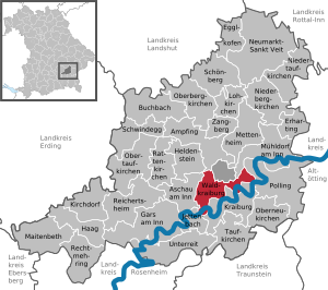
| Location of the town of Waldkraiburg in the Mühldorf am Inn district | ||
  |
||


Waldkraiburg is the largest city in the Upper Bavarian district of Mühldorf am Inn . With 23,392 inhabitants (as of December 31, 2019), Waldkraiburg is the second largest city in the planning region of southeast Upper Bavaria after Rosenheim (63,551 inhabitants - also as of December 31, 2019) and one of 13 so-called efficient municipalities in Bavaria. Waldkraiburg is part of the Inn-Salzach tourist region .
geography
Geographical location
Waldkraiburg is located in the Bavarian foothills of the Alps , about ten kilometers southwest of the district town of Mühldorf on the Munich - Salzburg and Landshut - Rosenheim axes .
The town of Waldkraiburg is bordered by the municipality-free area of Mühldorfer Harts and the municipality of Ampfing in the north, the district town of Mühldorf in the northeast, the municipality of Polling in the east and Markt Kraiburg am Inn in the south . The municipality of Jettenbach is located in the southwest of Waldkraiburg and the municipality of Aschau am Inn in the west . In the north-west, Waldkraiburg also shares a short piece of municipal boundary with Heldenstein .
City structure
The municipality of Waldkraiburg has 18 districts:
|
history
19th and 20th centuries
Waldkraiburg is one of five Bavarian expellee towns and was only created after the Second World War .
In the Mühldorfer Hart forest area southwest of Mühldorf am Inn , a train station for Kraiburg am Inn, about three kilometers south of the railway line on the opposite side of the Inn, was built when the Rosenheim – Mühldorf railway was built in 1876 .
Due to the secluded location, camouflaged by the forest, with nevertheless favorable transport connections, the armaments company Deutsche Sprengchemie GmbH (DSC) began building the so-called Kraiburg plant in 1938 . From 1940 onwards, Pol powder (powder without solvents) was mainly produced there. 2500 workers, most of them forced laborers , were employed in the factory, which was spread over around 500 individual camouflaged bunkers , until the end of the war in 1945 . Another armaments industry plant had existed in the neighboring town of Aschau am Inn since 1938 and produced cellulose nitrate, an important raw material for the Kraiburg plant.
After 1946, displaced people from Eastern and Southeastern Europe settled in the spacious, now abandoned and partially destroyed factory premises and built businesses and houses. In the beginning there was the refugee camp Pürten , which consisted of barracks ; after the expulsion from the Egerland , rail transports brought many Sudeten Germans there. The first companies to be founded included a glassworks and glass processing plants in which skilled workers from northern Bohemia used their knowledge.
On April 1, 1950, the industrial estate became an independent community with the name Waldkraiburg. For this purpose, the communities of Aschau bei Kraiburg (now Aschau am Inn), Fraham, Heldenstein and Pürten ceded parts of the area to Waldkraiburg. Furthermore, part of the community-free area Mühldorfer Hart came to the new community. The growth in the following years was so enormous that Waldkraiburg was elevated to a town as early as 1960.
Under Mayor Hubert Rösler (1950–1965), 2815 residential units were built (1607 of them in social housing and 1208 privately financed). It was possible to establish a large number of businesses. While the turnover of the workplaces in Waldkraiburg amounted to 25 million DM in 1950, this rose to 200 million DM by 1960. In 1954 the Eichendorff School was built as a primary school with 8 classes as the first school in the town and in 1956 it was expanded to 12 classes. In 1957 the second school building with 17 classes, auditorium and gymnasium and in 1963 the third school building with 10 classes and the second gymnasium were built. In 1955 a middle school was added. Two kindergartens, a sports stadium with a soccer field and athletics facilities (1952), an outdoor pool with a 2800 m² pool (1951) and the forest cemetery with 5.5 hectares (1950) were built during his tenure as well as the fire station , the Red Cross rescue station and two old people's homes. The development of the place under Hubert Rösler can also be seen in the municipal income, which rose from 122,016.46 in 1950 to 5,514,649.25 DM in 1963.
In 1995 Waldkraiburg was the organizer of the Small State Horticultural Show in Bavaria.
Incorporations
As part of the municipal reform , the previously independent municipality of Pürten was incorporated on January 1, 1974, and parts of the dissolved municipality of Fraham on July 1, 1976.
population

On June 31, 2013, 23,903 people lived in the city of Waldkraiburg, 51.17% of them female.
The first strong increase in population in the area of today's Waldkraiburg occurred between 1940 and the end of the war in the course of the settlement of the armaments industry in Mühldorfer Hart . During this time, the population of around 1400 has more than doubled. After the Second World War , displaced persons from Eastern and Southeastern Europe settled here , especially from the Sudetenland . In 1950 the independent community of Waldkraiburg was created with 1912 inhabitants. In 1960, well over 8,000 people lived in Waldkraiburg, which led to it being granted city rights . The city experienced steady population growth until the 1980s. Only since the mid-1990s has the population stagnated with a slight tendency to decrease.
Between 1988 and 2018 the population grew or stagnated from 23,177 to 23,442 by 265 inhabitants or 1.1%.
politics
mayor
The full-time first mayor of the city of Waldkraiburg has been Robert Pötzsch (UWG Waldkraiburg) since May 1, 2014 . His four predecessors since the municipality was founded were Hubert Rösler (1950–1966), Josef Kriegisch (1966–1984), Jochen Fischer (1984–2002) and Siegfried Klika (2002–2014).
City council
The city council for the 2014-2020 electoral term is composed as follows:
| CSU | UWG 1 | SPD | total |
| 12 | 12 | 6th | 30th |
1 UWG Waldkraiburg
Town twinning
Waldkraiburg has been twinned with the French city of Sartrouville since 1997 .
Culture and sights
- Since its establishment in 1989, the House of Culture has been both a cultural and social meeting point for the town of Waldkraiburg. The museum departments City History, Glass Museum and Adlergebirgsheimatstube are well worth seeing .
- The youngest museum in town, Bunker 29 , is located in an original building of the powder factory from 1940 on Schweidnitzer Weg. It offers visitors a sensual experience in several ways: seeing, hearing and smelling are the unusual ways of communicating it.
- Designed as a circular route, the path of history leads past buildings and places that played an important role in the history of the city as a powder factory or as a settlement for displaced persons. 18 stations contain pictures and texts with a lot of information about the respective location. The path of history is signposted with yellow and blue signs and floor markings. Station 4 is designed as the Bunker 29 industrial museum .
- The Roman Catholic parish church of Christ the King ( Patron's Day is the last Sunday of the church year). It is a church building in the shape of an octagon , completed in 1964 ; The architect was Franz Xaver Gärtner (* 1925 near Neumarkt / Opf .; † 1989 in Neumarkt / Opf.), Student of the architect Sep Ruf . Gärtner's first independent church building is based on the model of Sep Ruf's church in Munich-Bogenhausen. The church is illuminated through stained glass windows and through a window in the zenith of the ceiling. Most of the furnishings come from the two artists Josef Henselmann and Hubert Elsässer . The church is open during the day.
- The Evangelical Lutheran parish church Martin Luther is a church building completed in 1964; The architect was Gustav Gsaenger (* 1900 in Munich-Obermenzing; † 1989 in Munich), one of the most important architects for Protestant church architecture in Germany in the 20th century. The Waldkraiburg Church follows the model of the St. Matthew Church of the Bavarian State Church in Munich (1955), the furnishings came largely from the workshop of the Waldkraiburg siblings Brunotte, the altarpiece is by Angela Gsaenger. There is a Steinmeyer organ in the church. The church is open during the day.
- The Roman Catholic parish and pilgrimage church of the Assumption is located in the district of Pürten
- The route of the Stadtparkeisenbahn of the Kleinbahnfreunde Waldkraiburg has a circuit length of about 500 meters and gauges of 5 and 7 1/4 inches. The smallest radius is 9 meters.
- The curate church of St. Martin in Ebing (rococo pulpit), the branch church of St. Erasmus (valuable wall and ceiling paintings) and the parish church of Maria Schutzfrau Bayern (furniture by sculptor Friedrich Koller, * 1939) in Waldkraiburg-Süd are worth seeing.
See also the list of architectural monuments in Waldkraiburg
Economy and Infrastructure
In Waldkraiburg there are chemical companies, mechanical engineering companies, and the plastics and rubber processing industry. Haldenwanger , MD Elektronik and Kraiburg Holding are based in Waldkraiburg. The city is part of the Bavarian Chemical Triangle .
traffic
Waldkraiburg is located to the south or east of the federal highway 12 and has been connected to the A 94 via junction 18 since the completion of the A 94 on December 4, 2012. The state roads St 2352 and St 2091 cross the city in an east-west and north-south direction as other important regional connecting roads .
Furthermore, with the railway stop on the Rosenheim – Mühldorf railway line, which opened on May 28, 1994, the city again has a connection to the railway network and is served by regional trains of the Südostbayernbahn . Until then, this function was fulfilled by the train station, which was less convenient for Waldkraiburg and originally built for the town of Kraiburg. There are also three city bus routes that run every hour, Monday to Friday, at 23 stops during the day.
There is also a connection to the district town of Mühldorf am Inn and the neighboring communities of Aschau am Inn and Ampfing with the district bus routes 30, 31 and 7548.
Educational institutions
In Waldkraiburg there are a total of six kindergartens (four Catholic, two Protestant) available to young families. There are also two day nurseries and two day care centers. There are also four primary schools, two secondary schools (Diesel Hauptschule, Hauptschule on Franz-Liszt-Straße), a Realschule (Staatliche Realschule Waldkraiburg), a grammar school and a special education center. Afternoon care is also located in the House of Youth. The city also maintains a singing and music school in the House of Culture and the city library in the House of Books. An adult education center is available for adult education.
Personalities
- Peter Maffay (* 1949) singer and music producer, grew up in Waldkraiburg.
- Wolfgang Nadvornik (born January 19, 1970 in Altötting ), sports journalist and television presenter.
- Hubert Rösler (born February 27, 1900 in Hlinay , Bohemia; † December 14, 1981 in Waldkraiburg), first mayor of Waldkraiburg
- Emilie Schindler's (1907–2001) grave is in Waldkraiburg. Oskar Schindler's wife was named Righteous Among the Nations by Yad Vashem .
- Willi Schneider (born March 12, 1963 in Mediaș , Romania), skeleton pilot and coach of the Canadian national team
- Ferdinand Staeger (born March 3, 1880 in Trebitsch , Moravia; † September 11, 1976 in Waldkraiburg), painter and graphic artist , who is also known as an illustrator and draftsman for tapestries and lace ceilings .
- Christoph Ullmann (* 1983 in Altötting), national ice hockey player and captain of Adler Mannheim , grew up in Waldkraiburg and learned the sport at the EHC Waldkraiburg
Web links
- City of Waldkraiburg
- Text with photo about the old train station in Waldkraiburg
- Entry on the coat of arms of Waldkraiburg in the database of the House of Bavarian History
Individual evidence
- ↑ "Data 2" sheet, Statistical Report A1200C 202041 Population of the municipalities, districts and administrative districts 1st quarter 2020 (population based on the 2011 census) ( help ).
- ↑ http://www.bayerische-landesbibliothek-online.de/orte/ortssuche_action.html ? Anzeige=voll&modus=automat&tempus=+20120105/185555&attr=OBJ&val= 422
- ^ Wilhelm Volkert (ed.): Handbook of Bavarian offices, communities and courts 1799–1980 . CH Beck, Munich 1983, ISBN 3-406-09669-7 , p. 525 .
- ^ Otto Schütz: The new cities and communities in Bavaria; 1967, pp. 59-71
- ^ Federal Statistical Office (ed.): Historical municipality directory for the Federal Republic of Germany. Name, border and key number changes in municipalities, counties and administrative districts from May 27, 1970 to December 31, 1982 . W. Kohlhammer, Stuttgart / Mainz 1983, ISBN 3-17-003263-1 , p. 582 and 583 .
- ↑ Waldkraiburg city bus

Ampfing |
Aschau am Inn |
Buchbach |
Egglkofen |
Erharting |
Gars am Inn |
Hague in Upper Bavaria |
Hero's Stone |
Jettenbach |
Kirchdorf |
Kraiburg am Inn |
Lohkirchen |
Maitenbeth |
Mettenheim |
Mühldorf am Inn |
Neumarkt-Sankt Veit |
Niederbergkirchen |
Niedertaufkirchen |
Oberbergkirchen |
Oberneukirchen |
Obertaufkirchen |
Polling |
Rat churches |
Right more |
Reichertsheim |
Schoenberg |
Schwindegg |
Taufkirchen |
Unterreit |
Waldkraiburg |
Zangberg
Unregulated areas in the district of Mühldorf a.Inn
Mühldorfer Hart